Hiking Around Las Vegas, Mojave National Preserve
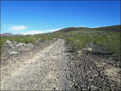
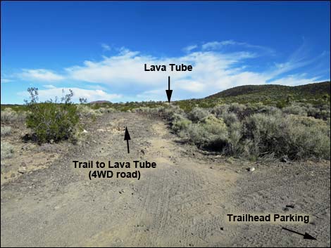 2WD Parking and Trailhead (view NNE) |
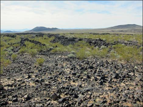
Overview Lava tubes are formed when the surface of a stream of lava cools to form a hard crust, but the lava below the surface stays hot and continues flowing (similar to a frozen-over river with water flowing beneath the crust of ice). When this happens, molten lava, which stays hot because it is insulated by the crust, can flow out from under the crust, leaving behind an empty tube. Once formed, fresh lava from new eruptions can flow down the tube, each leaving a fresh coat of lava plastered to the sides of the tube. Lava tubes have a habit of partially collapsing and forming holes in the ceiling. Fresh lava flowing on the surface can fall into the holes, and the holes can become plugged up or the lava can flow down the wall and into the tube. Evidence of these events is recorded in the roof and walls of this lava tube. Link to map. |
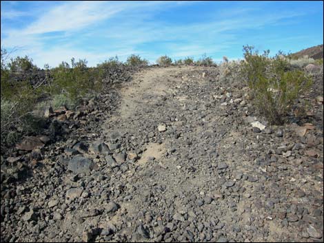
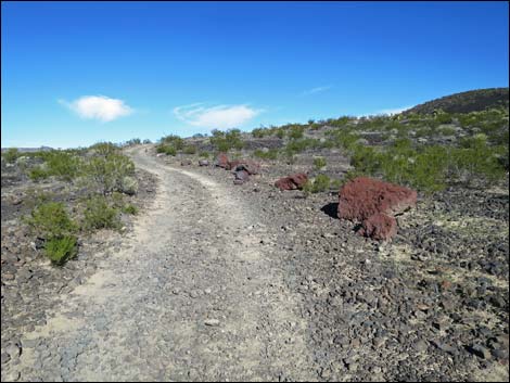
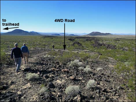
 4WD road and trail (view NE) |
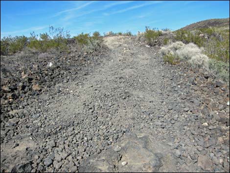
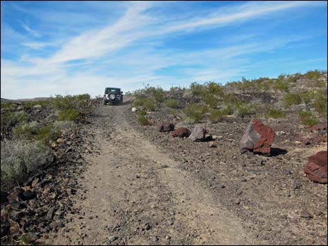
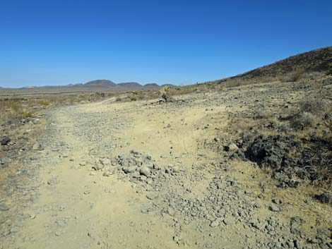
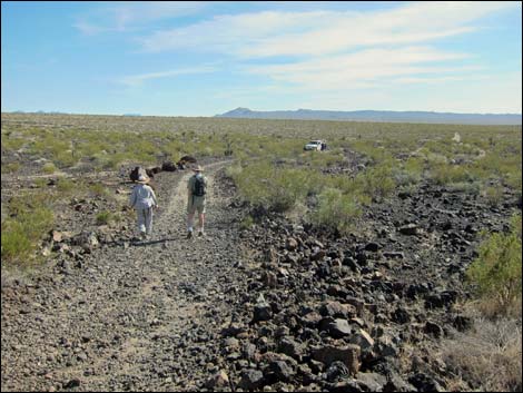
The Lava Tube adventure starts from the pavement rather than from the end of the road. The 4.8-mile, graded dirt Aiken Mine Road should be passable to all vehicles, but it is sandy in places and subject to washouts, so drive carefully and use your own good judgment about the road conditions. Stop to move rocks out of the road if necessary. From the trailhead at the end of the 2WD road, the 1/4-mile hike follows a 4WD road for a few hundred yards, runs a short distance up a hillside, and then drops into a lava tube. This is an underground adventure, so bring flashlights and be careful. Some people bring hardhats. |
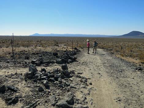
 Worst part of 4WD road (view NE) |
Watch Out Other than the standard warnings about hiking in the desert, ... going into holes in the ground is inherently dangerous. Take extra lights, wear a hard hat, and don't get hurt because underground rescues are very difficult. Review the standard warnings about going into caves. Taking all of this into account, this lava tube is pretty safe because it is short and there are holes in the roof that let in some light. There probably is too much light for bats here, but bees have nested in the mouth of the tube. Lava tubes are the kind of place where Hanta virus might be a problem, so don't stir up too much dust. I've been exposed to Hanta virus many times, and I haven't gotten sick or died, but don't tempt fate: if you develop flu-like symptoms soon after leaving a dusty cave, seek medical attention and tell the doctor that you may have been exposed to Hanta virus. While hiking, please respect the land and the other people out there, and try to Leave No Trace of your passage. Also, even though this is a short hike, it is in a remote area, so be sure to at least have the 10 Essentials in your car. |
 4WD road and trail (view NE) |
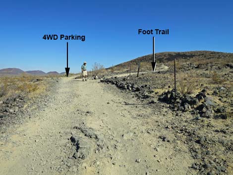
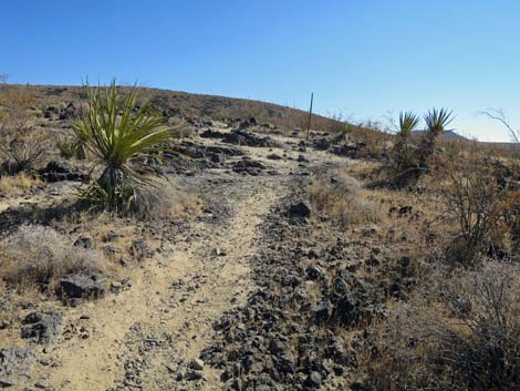
Getting to the Trailhead This hike is located in Mojave National Preserve, about 2 hours south of Las Vegas. From town, drive out to the Mojave National Preserve Visitor Center at Kelso Depot. From the Visitor Center, drive north and west 14.9 miles on Kelbaker Road to Aiken Mine Road. Alternatively, from Las Vegas, drive south on Interstate-15 for about 85 miles to Baker. Exit the interstate onto Kelbaker Road (Highway 127) and drive southeast 19.7 miles to Aiken Mine Road. The turn is unmarked, but watch for a large parking area on the side of the road. Turn northeast onto Aiken Mine Road and drive 4.8 miles to the 2WD trailhead. For details, see Aiken Mine Road. In a 2WD vehicle, park here; this is the trailhead. In a 4WD vehicle, continue up the very rough road. After about 0.18 miles, the trail turns right (Wpt. 02) and starts up the hillside. The 4WD parking area is about 20 yards farther up the road on the right. |
 4WD road and trail (view NE) |
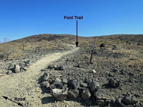
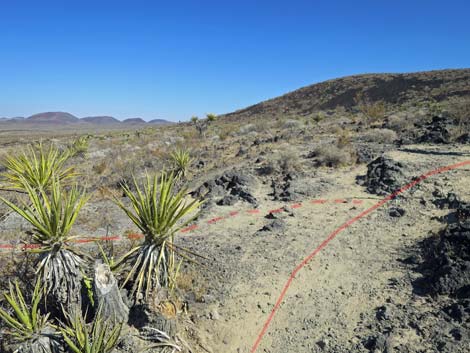
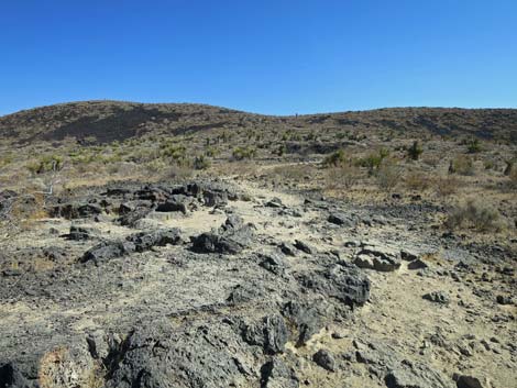
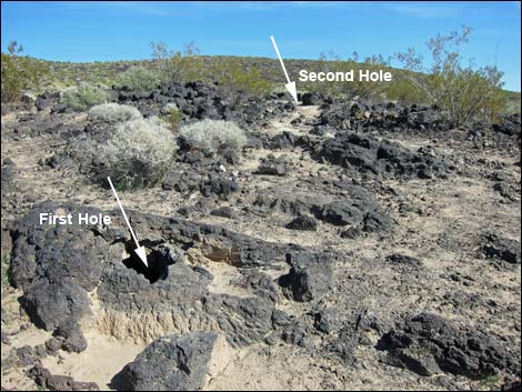
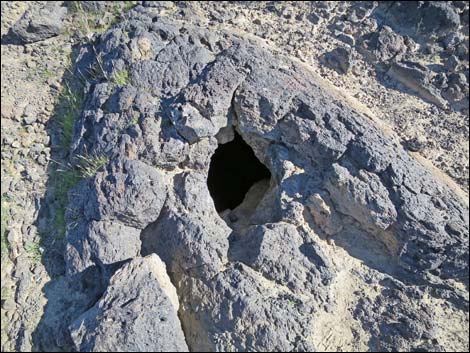
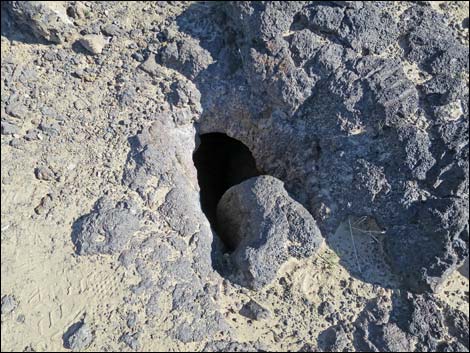
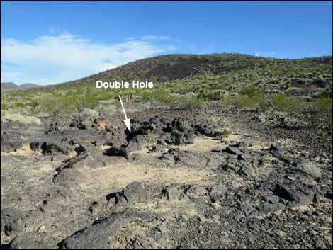
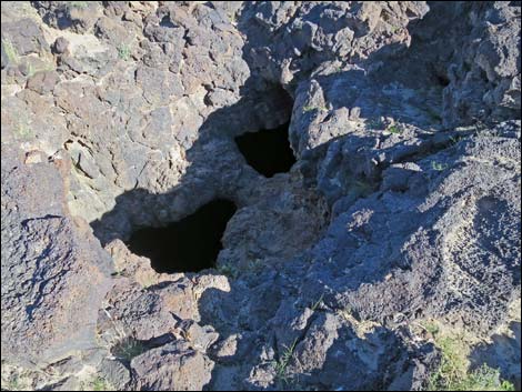
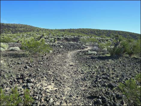
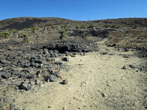
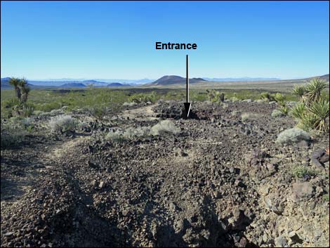
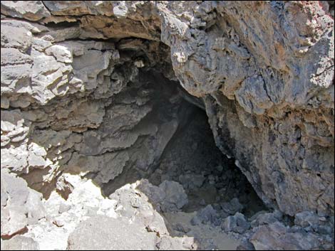
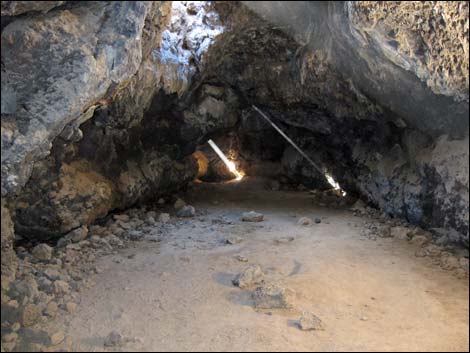
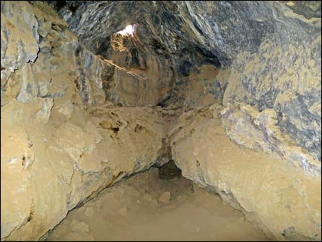
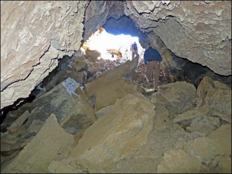
The Hike From the 2WD trailhead (Table 1, Waypoint 01), the hike runs northeast up the 4WD road. At about 0.18 miles out, a foot trail (Wpt. 02) branches off to the right and starts up the hillside. Before starting up the foot trail, hikers should turn around and look west across the road. A rocky ditch can be seen running down the gentle hillside; this is a collapsed lava tube. In fact, this is a continuation of the lava tube that hikers will eventually drop into. Continuing, the foot trail runs northeast and up the gentle hillside. The trail, only about 100 yards long, is marked with metal T-posts, and the white dirt on the trail contrasts with the black volcanic rocks (so please stay on the trail). The trail runs parallel to, and just to the right of, the lava tube. Along the way, the trail passes three holes in the top of the lava tube. Keep an eye out to the left for the first (a single hole; Wpt. 03) and the nearby second. Both of these are small openings. The third (a double hole; Wpt. 04) is a bit farther up the trail and big enough to fall into. |
 4WD road and trail (view NE) |
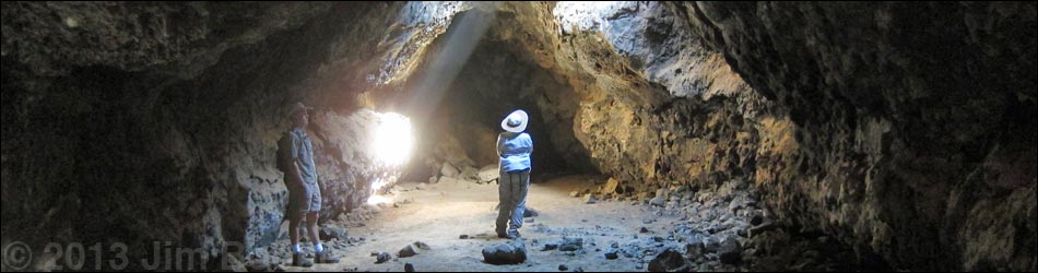
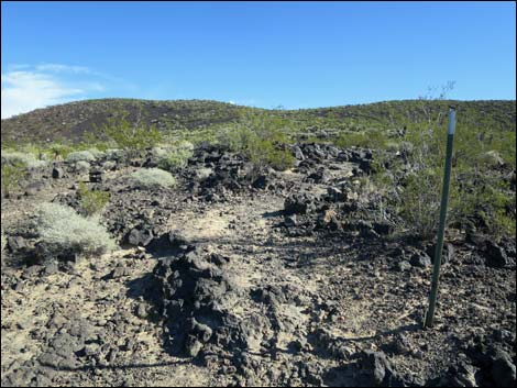
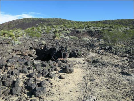
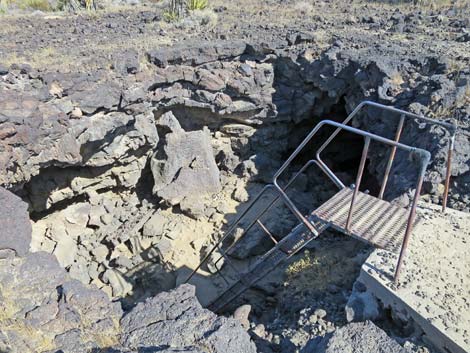
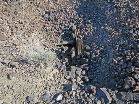
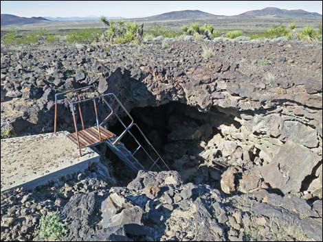
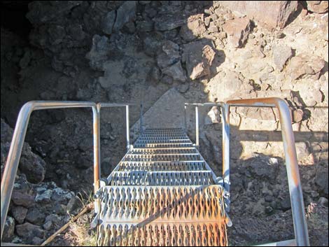
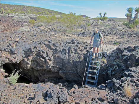
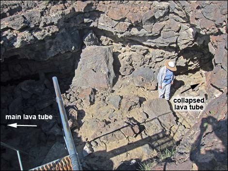
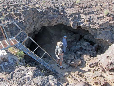
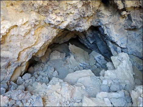
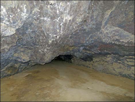
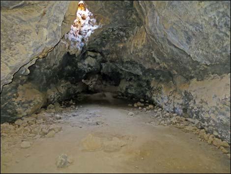
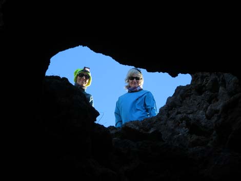
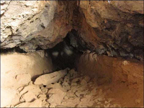
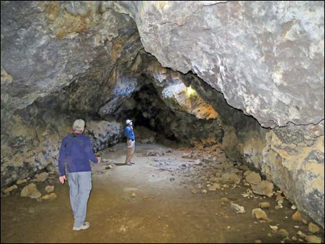
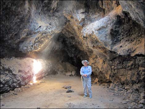
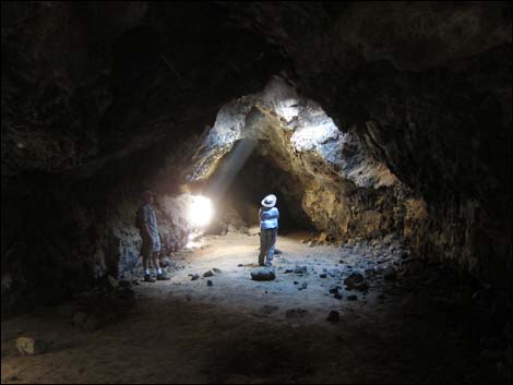
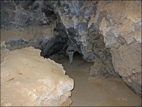
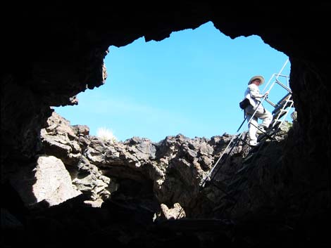
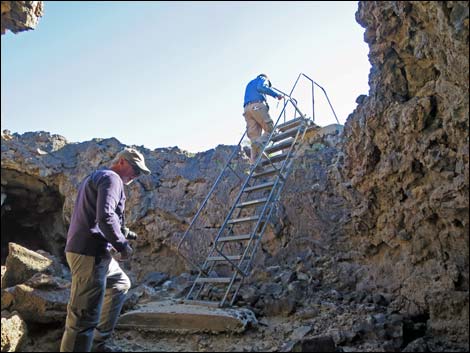
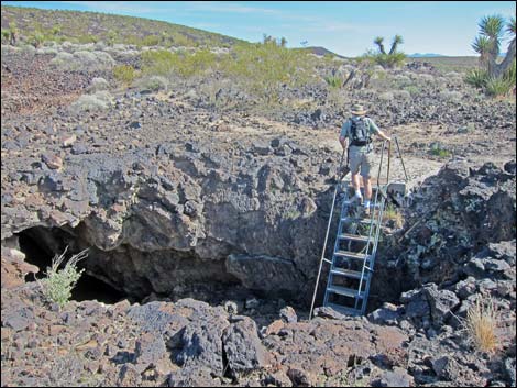
The next hole is the lava tube entrance, which is a large round hole with sturdy metal stairs leading down in. Several yards beyond the main entrance, there is a rock-filled depression with some wooden posts in the bottom. This is another hole in the roof of the lava tube and used to serve as the second entrance, but it seems to have been filled in. Some timbers, used to keep the entrance open like a mine shaft, can be seen sticking out of the rubble. Back at the main entrance, the ladder leads down into the hole. From there, hikers scramble down into the lava tube (back towards the road) and enjoy the dark coolness. After scrambling past the loose rubble from the roof collapse, the floor of the tube is smooth and covered with a fine, dry dusty mud. Hikers then crawl under a low spot to get into the main cavern where the ceiling is about 15 feet high. |
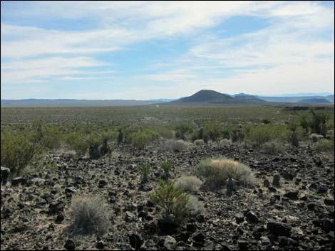
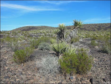 Grand scenery along the trail (view NE) |
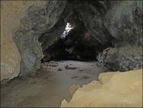
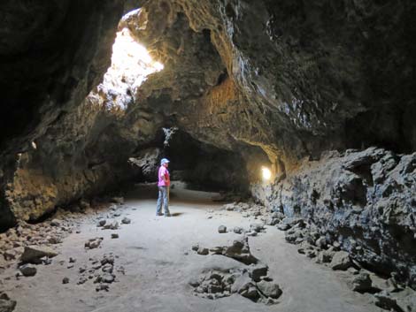
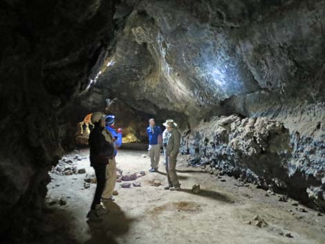
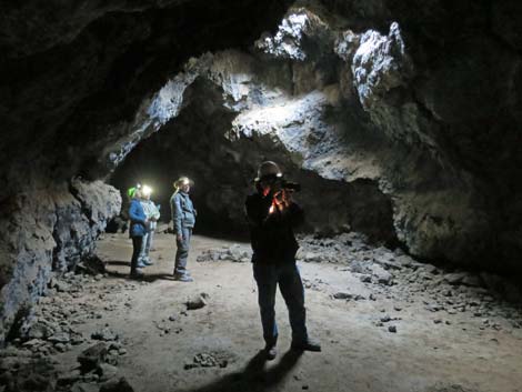
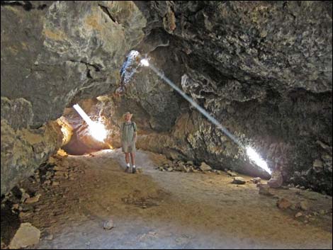
In the dark, watch your head as the ceiling always seems to sneak up and smack you when you aren't paying attention. Also watch your step because there are a few rocks on the otherwise smooth floor that will catch your toe while you are looking up in the dark. The lava tube is actually fairly short (about 150 feet long), taking only a minute or two to reach the far end. However, I suspect that few people would want to spend only 2-3 minutes inside the tube before leaving. Inside the lava tube, watch for signs of animal use. Packrats, mice, bats, and birds all use the cave and have left marks. Look in the cracks for bits of vegetation that these creatures hauled into the cave for food or bedding material. |
 Approaching where trail leaves road (view NE) |
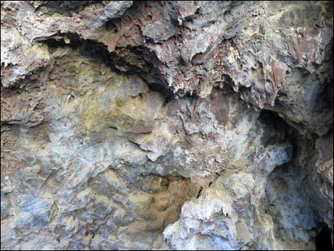
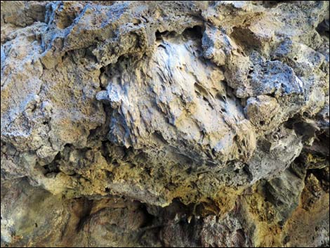
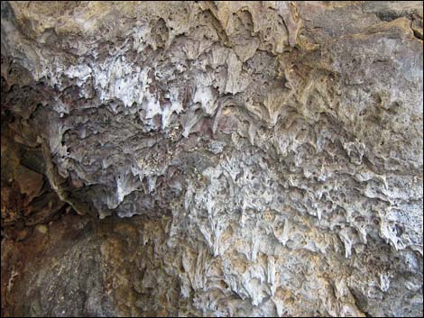
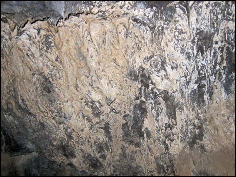
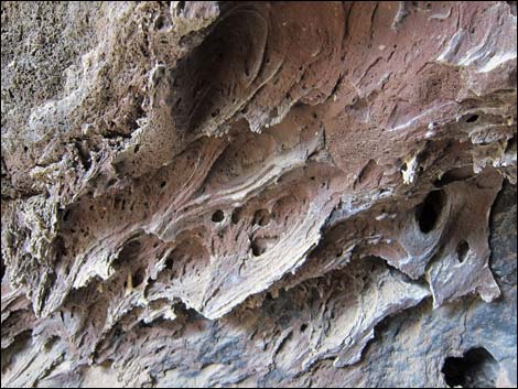
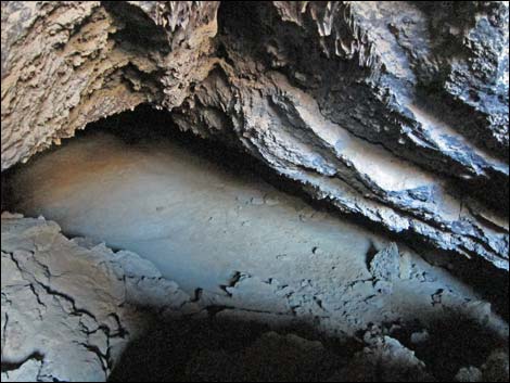
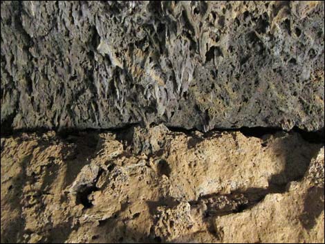
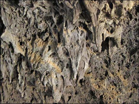
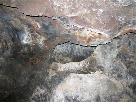
There are some nice packrat middens inside the tube, and these guys left many calling cards on the ledges. This is the kind of place where Hanta virus might be a problem, so don't stir up too much dust. I even found a sleeping woodpecker (Northern Flicker) in a little hole in the ceiling near the entrance. I guess that's what you use when there are no trees for nest holes. Inside the lava tube, also watch for evidence of multiple lava flows. There are places where hikers can clearly see layers of "fresh" lava on the lower walls of the tube and places where fresh lava was splattered against the ceiling. In other places, notice where holes in the ceiling allowed fresh lava to flow in, sometimes plugging the hole. At the entrance, the results of successive lava flows can be seen as each left thin layers of lava on the surface above the tube. |
 Trail leaves road (view NE) |
 4WD road and 4WD parking just past the trail (view NE) |
 Foot trail leading away from the 4WD trailhead |
 Foot trail from 4WD trailhead joins regular trail at T-post |
 Foot trail leading from the 4WD trailhead joining regular trail |
 Trail at T-post trail marker |
 Combined trail continues up the hillside |
 First small hole in the ground (view NE) |
 First small hole in the top of the lava tube (view NE) |
 Second small hole in the top of the lava tube (view NE) |
 Approaching paired holes in the ground (view NE) |
 Paired holes in the ground (view NE) |
 Trail beyond the holes (view NE) |
 Approaching the main entrance (view E) |
 Approaching the main entrance (view E) |
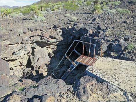 Ladder at main entrance (view NE) |
 Ladder at main entrance (view NE) |
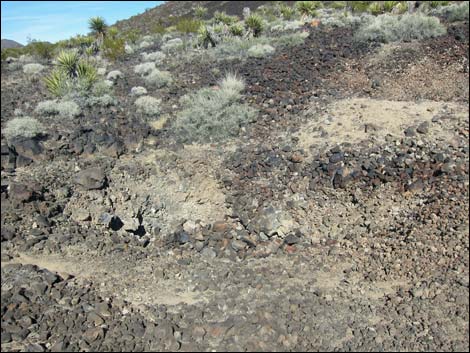 Beyond main entrance, another hole |
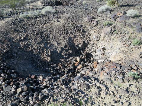 Farther hole "caved" in |
 Timbers that once held hole open |
 Turning back towards the main entrance (view W) |
 Back to the main entrance (view W) |
 Ladder |
 Hiker starting down ladder |
 Hiker in lava tube below ladder |
 To the right, collapsed lava tube |
 To the right, cave is filled in |
 Hikers in lava tube below ladder |
 To the left, looking down into open lava tube |
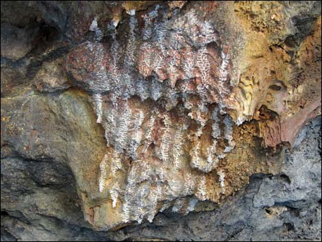
 Lava drips on the ceiling |
 Lava drips and inclusions on the ceiling |
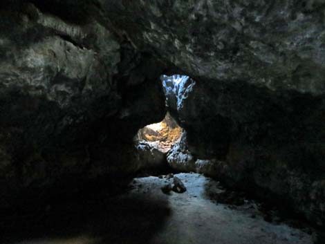
 Wax from bee hive inside opening |
 Lava drips on the ceiling |
 Lava drips on the wall |
 Lava drips on the ceiling |
 Looking down into open lava tube |
 Approaching low ceiling |
 Entering main cavern |
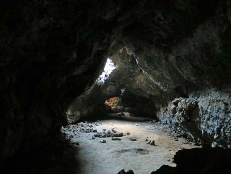
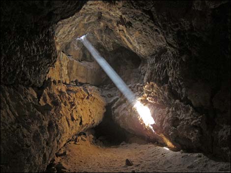
 High ceiling and shafts of light from holes in the ceiling |
 Main cavern |
 |
 |
 |
 |
 Inside the lava tube |
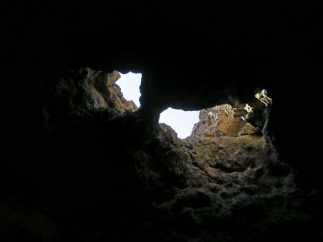 Paired holes seen from inside lava tube |
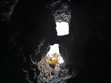 Paired holes seen from inside lava tube |
 Paired holes seen from inside lava tube |
 Layers of lava flows |
 Layers of lava flows |
 |
 |
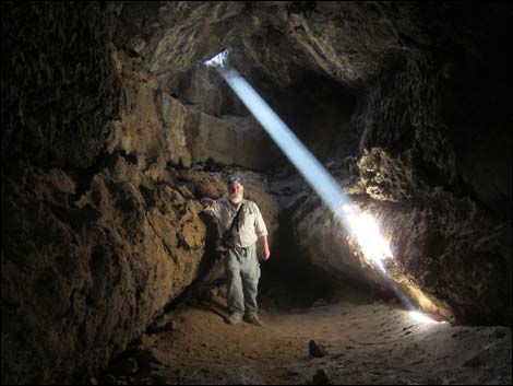 Playing with the shaft of light |
 Owl roost in the ceiling |
 End of the lava tube |
 Far end of the lava tube pinches out |
 |
 |
 Hikers beginning to exit the lava tube |
 Hiker exiting the main cavern |
 Hiker past the low ceiling and in entrance hole |
 Hikers climbing the rubble pile |
 Hiker climbing out the ladder |
 Hiker on the ladder |
 Hiker climbing out of the lava tube entrance |
 Back to grand scenery in the vast brightness of the desert |
 Returning towards the 4WD road |
 Hikers back on the 4WD road |
 Collapsed lava tube below 4WD road |
 Returning towards the trailhead |
Table 1. Hiking Coordinates Based on GPS Data (NAD27; UTM Zone 11S). Download Hiking GPS Waypoints (*.gpx) file.
| Wpt. | Location | UTM Easting | UTM Northing | Elevation (ft) | Point-to-Point Distance (mi) | Cumulative Distance (mi) | Verified |
|---|---|---|---|---|---|---|---|
| 01 | Trailhead | 613562 | 3897276 | 3,525 | 0.00 | 0.00 | GPS |
| 02 | Trail Departs Road | 613627 | 3897524 | 3,569 | 0.18 | 0.18 | GPS |
| 03 | First Hole in the Ground | 613649 | 3897546 | 3,585 | 0.02 | 0.20 | GPS |
| 04 | Second Hole in the Ground | 613667 | 3897551 | 3,594 | 0.01 | 0.21 | GPS |
| 05 | Lava Tube Entrance | 613708 | 3897557 | 3,598 | 0.03 | 0.24 | GPS |
| 06 | Collapsed Lava Tube | 613731 | 3897565 | 3,603 | 0.02 | 0.26 | GPS |
| 01 | Trailhead | 613562 | 3897276 | 3,525 | 0.26 | 0.52 | GPS |
Happy Hiking! All distances, elevations, and other facts are approximate.
![]() ; Last updated 240328
; Last updated 240328
| Hiking Around Mojave Preserve | Hiking Around Las Vegas | Glossary | Copyright, Conditions, Disclaimer | Home |