Hiking Around Las Vegas, Mojave National Preserve
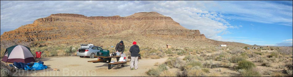
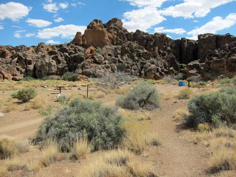
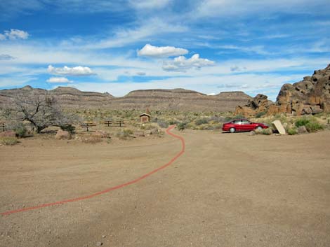
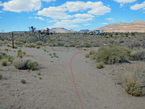
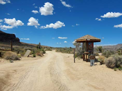
 Campground Kiosk (view N) |
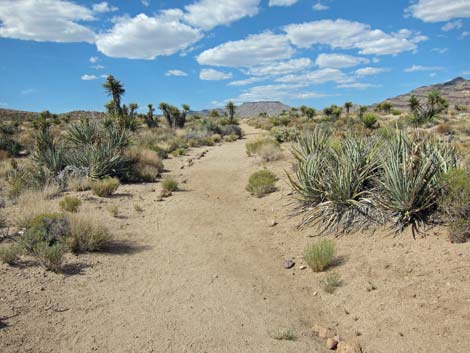
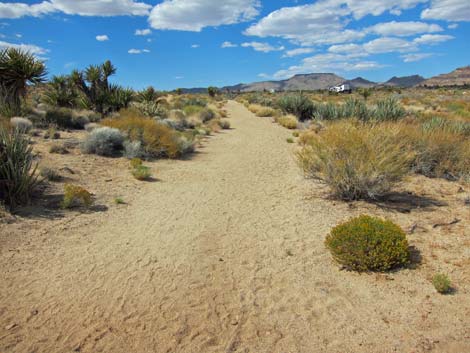
Overview This loop trail links together trails and dirt roads to make a nice 1.7-miles loop through the campground that has grand views from up on the flanks of Barber Peak and runs through an area thick with several species of cactus and some unusually tall Mojave Yucca. The trail is a bit rocky in places, but it is easy to follow and well marked. There are several places to start this loop (campground, visitor center, picnic area), and it can be walked in either direction, but for simplicity, the description starts at the campground kiosk. Link to map. |
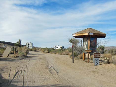
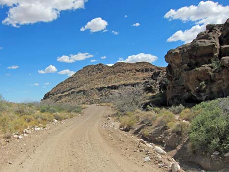
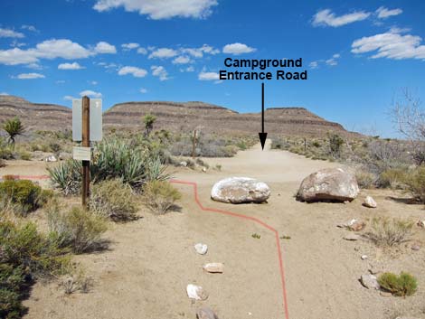
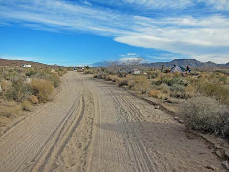 Campground road (view N) |
Watch Out Other than the standard warnings about hiking in the desert, ... this hike is about as safe as it gets, plus hikers are almost always in sight of the campground. In the "cactus garden," be careful of spines, and always keep an eye out for snakes in the desert and wild Winnebagos in the campground. While hiking, please respect the land and the other people out there, and try to Leave No Trace of your passage. Also, even though this hike is short, be sure to bring what you need of the 10 Essentials. |
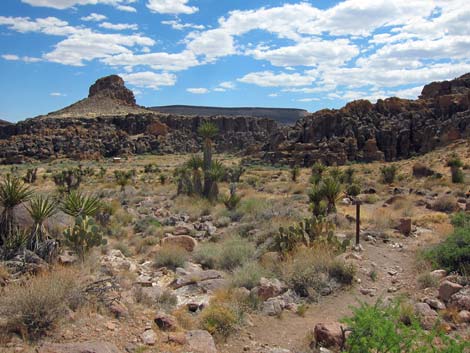
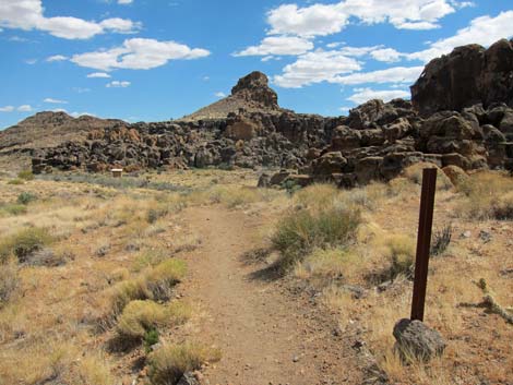
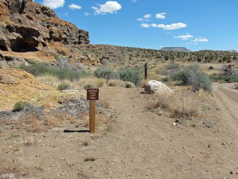
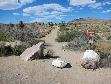
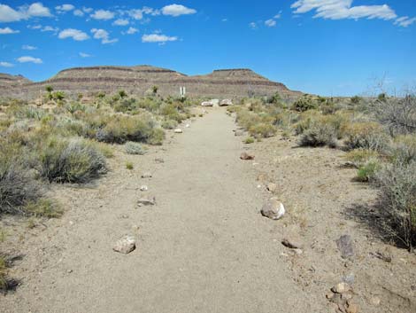
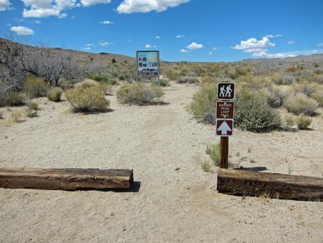 Barber Peak Loop Trail spur trailhead (view N) |
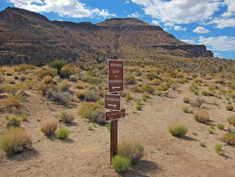
Getting to the Trailhead This hike is located in Mojave National Preserve, about 2 hours south of Las Vegas. From town, drive out to Hole-in-the-Wall Visitor Center, which is about 85 miles south of town. For hikers not using the campground, park here at the Visitor Center; this is a good trailhead. Alternatively, hikers can continue to the end of Hole-in-the-Wall Road and park at Rings Trailhead. For hikers using the campground, from the Visitor Center, drive north for a minute or so on Black Canyon Road, pull into the campground, and select your campsite. Park here; this is the trailhead. To start the hike, walk to the far end of the campground to the Hole-in-the-Wall Campground Trailhead. |
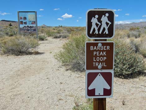 Barber Peak Loop Trail trailhead sign (view N) |
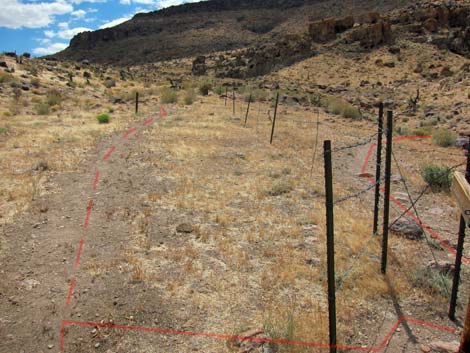
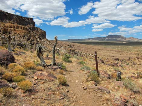
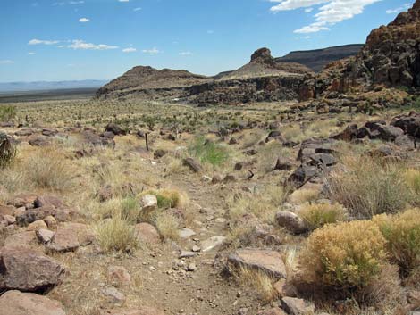
The Hike From the Hole-in-the-Wall Campground kiosk (Table 2; Waypoint 01), the loop runs north on campground roads to the north end of the campground where a spur of the Barber Peak Loop Trail begins (Wpt. 02). Following this trail, the loop continues north to a barbed-wire fence. Following the fence west, the loop climbs the hillside to a trail junction (Wpt. 03) with the main Barber Peak Loop Trail. The loop does not go through the gate, but rather continues along the south side of the fence as it climbs higher onto the flanks of Barber Peak. |
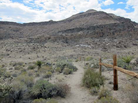 Trail follows barbed-wire fence (view W) |
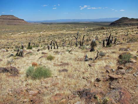
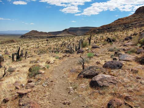
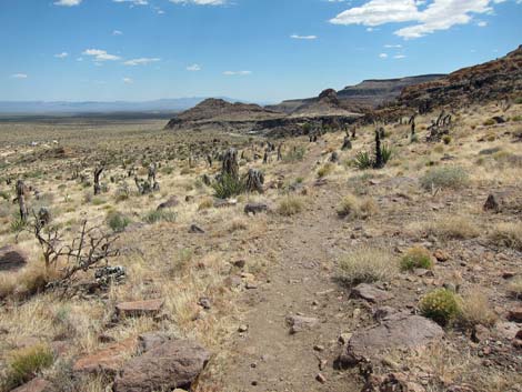
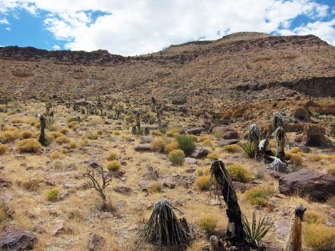
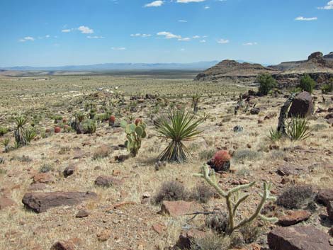
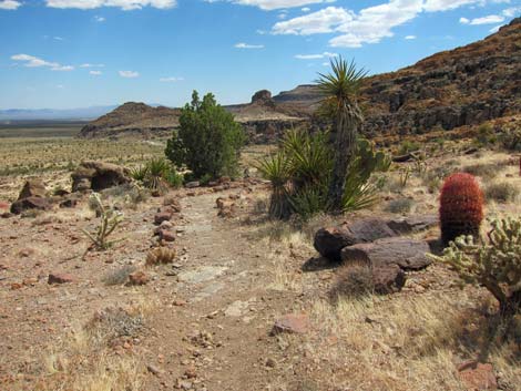
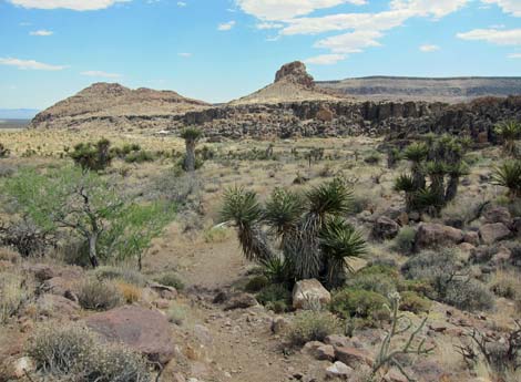
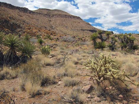
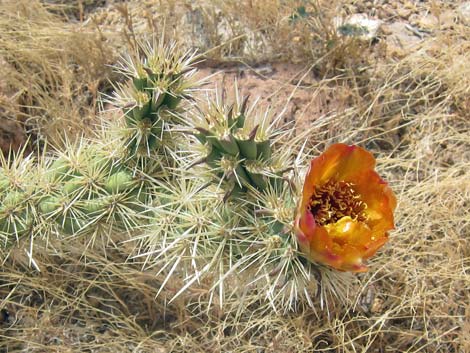
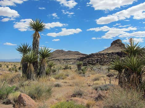
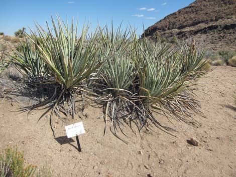
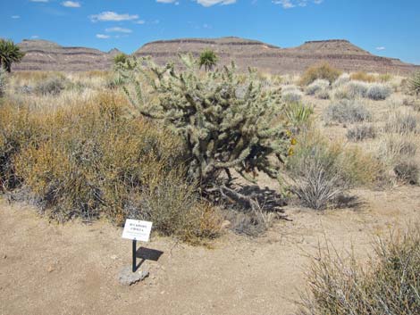
The trail bends to the south and the grade eases as the loop reaches a highpoint (Wpt. 04) overlooking the campground and the surrounding landscape. This area was burned in the 2005 Hackberry Fire, but shrubs (Matchweed, Littleleaf Ratany, Eastern Mojave Buckwheat), bunchgrasses (Big Galleta Grass), and annual forbs (i.e., desert wildflowers) are returning; even some Mojave Yucca are resprouting. With little vegetation, the views up and down the valley are grand, and the shimmering roof of the visitor center, at the end of the loop, is visible. The trail continues south, more-or-less on the contour, but descending gently across the hillside. The trail eventually exits the fire zone, and here the vegetation is thick and diverse. Among other species, most of the cactus species in the area can be seen along this section of trail (California Barrel Cactus, Engelmann's Hedgehog Cactus, Buckhorn Cholla, Silver Cholla, Pancake Pricklypear, and Grizzlybear Pricklypear). There are also some unusually tall Mojave Yucca and a few California Juniper. |
 At gate, trail follows barbed-wire fence (view W) |
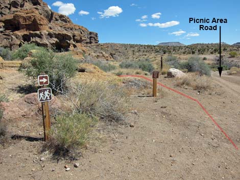
About 200 yards before reaching the picnic area, the trail drops out of the richly vegetated area into what looks like a very old burn. Few shrubs have come back, but the bunchgrasses are doing well. Passing the picnic area, the trail hugs the cliffs until emerging onto the road at the Rings Trail trailhead (Wpt. 05). Following the road downhill to the visitor center, the loop turns off the road to the left onto the Nature Trail (Wpt. 06). Several species of shrubs and cactus are identified along the trail, giving hikers a chance to learn the names of species seen on the hillside above. The Nature Trail runs north to a sign, then turns right and runs out to the campground road (Wpt. 07). Turning left, the loop is closed in a few yards when hikers reach the kiosk (Wpt. 01). |
 Climbing onto the flank of Barber Peak (view SE to campground) |
 Trail on the flank of Barber Peak (view S) |
 High on the flank of Barber Peak (view SE to visitor center) |
 High on the flank of Barber Peak (view N) |
 High on the flank of Barber Peak (view NW towards summit) |
 Exiting the burn area (view SE) |
 Juniper tree, Mojave Yucca, and Barrel Cactus (view SE) |
 Trail descends toward Hole in the Wall (view SE) |
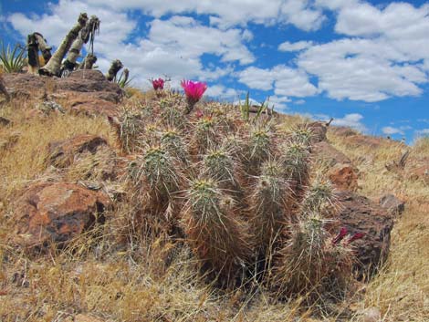 Engelmann's Hedgehog Cactus on hillside |
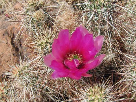 Engelmann's Hedgehog Cactus flower |
 Catclaw Acacia and stout Mojave Yucca |
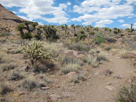 Buckhorn Cholla along trail (view NW) |
 Mojave Yucca and Buckhorn Cholla below Barber Peak (view NW) |
 Buckhorn Cholla with flower |
 Trail descends the hillside (view S towards Banshee Peak) |
 Unusually tall Mojave Yucca |
 Entering old burn near picnic area (view S) |
 Trail arrives at picnic area |
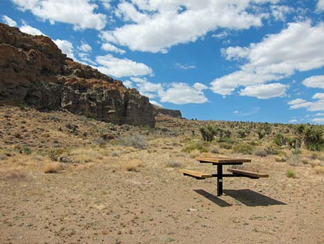 A good picnic table for a cold, winter day (view N) |
 Barber Peak Trailhead at Rings Trailhead parking area (view NE) |
 Barber Peak Trailhead at Rings Trailhead parking area (view NE) |
 Loop follows picnic area road towards visitor center (view E) |
 Loop follows road towards visitor center (view E) |
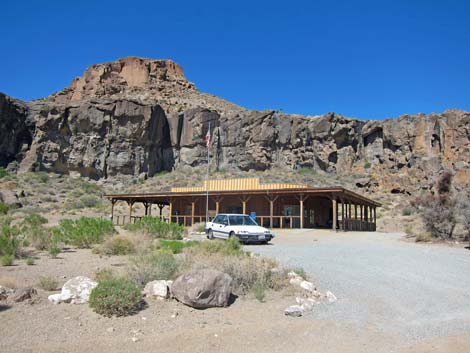 Hole in the Wall Visitor Center (view SW) |
 Hole in the Wall Nature Trail (view N towards campground) |
 Hole in the Wall Nature Trail (view N towards campground) |
 Banana Yucca (aka Blue Yucca) identified along Nature Trail (view E) |
 Buckhorn Cholla identified along Nature Trail (view E) |
 Hole in the Wall Nature Trail (view N towards campground) |
 Nature Trail turns right (view N into campground) |
 Nature Trail directional sign (view NW) |
 Nature Trail runs out to Campground Road (view E) |
 Loop turns left onto Campground Road (view E) |
 Loop returns to the campground kiosk (view N) |
Table 1. Hiking Coordinates Based on GPS Data (NAD27; UTM Zone 11S). Download Hiking GPS Waypoints (*.gpx) file.
| Wpt. | Location | UTM Easting | UTM Northing | Elevation (ft) | Point-to-Point Distance (mi) | Cumulative Distance (mi) | Verified |
|---|---|---|---|---|---|---|---|
| 01 | Trailhead | 646595 | 3879135 | 4,281 | 0.00 | 0.00 | GPS |
| 02 | North Trailhead | 646536 | 3879679 | 4,391 | 0.35 | 0.35 | GPS |
| 03 | Gate at Trail Junction | 646315 | 3879772 | 4,423 | 0.19 | 0.54 | GPS |
| 04 | Highpoint | 646194 | 3879596 | 4,489 | 0.16 | 0.70 | GPS |
| 05 | Rings Trailhead | 646180 | 3878907 | 4,252 | 0.53 | 1.23 | GPS |
| 06 | Nature Trail Trailhead | 646429 | 3878754 | 4,268 | 0.21 | 1.44 | GPS |
| 07 | Nature Trail End | 646588 | 3879060 | 4,268 | 0.25 | 1.69 | GPS |
| 01 | Trailhead | 646595 | 3879135 | 4,281 | 0.04 | 1.73 | GPS |
Happy Hiking! All distances, elevations, and other facts are approximate.
![]() ; Last updated 240328
; Last updated 240328
| Hiking Around Mojave Preserve | Hiking Around Las Vegas | Glossary | Copyright, Conditions, Disclaimer | Home |