Hiking Around Las Vegas, Lake Mead National Recreation Area
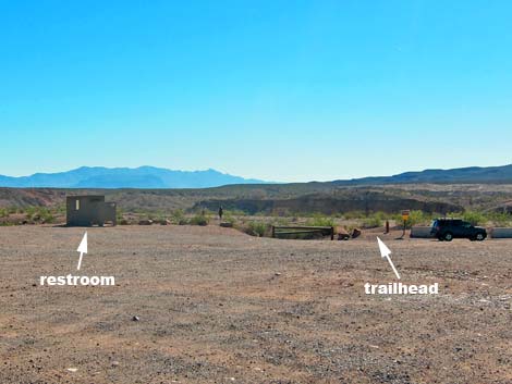 Wetlands Trail trailhead parking (view E) |
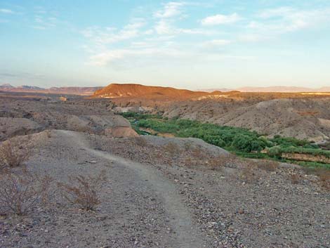
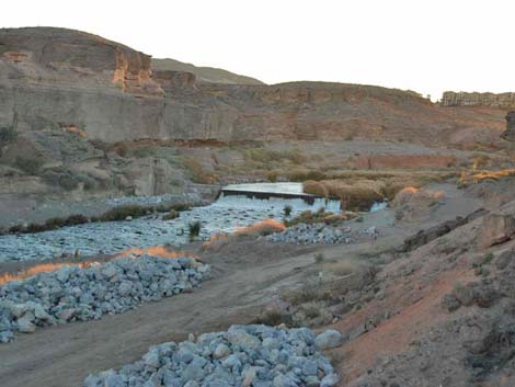
Overview At the lower end of Las Vegas Wash, where the river of runoff from the Las Vegas Valley flows into Lake Mead, there is a deep, narrow, steep-walled canyon with water and vegetation. The vegetation (e.g., mesquite, saltcedar, saltbush, and cattail) and water create a riparian corridor that attracts birds and other wildlife from miles around. A short loop-trail runs down to the stream and back. The water isn't safe for swimming or drinking (it is, after all, urban runoff and water released from sewage treatment plants), but it does attract wildlife, and as one hiker said, this is about the only place in southern Nevada where you can enjoy the sounds of running water. Visitors can enjoy the sights and sounds of the wash without hiking down the trail. From the trailhead, just walk south to the edge of the bluffs and look down into the wash. The Park Service is rehabilitating and re-vegetating the area using native vegetation, so this should be an interesting place to hike and watch the progress. Link to map. |
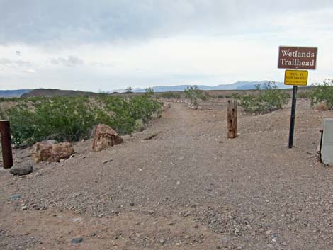 Wetlands Trailhead sign (view E) |
Watch Out Other than the standard warnings about hiking in the desert, ...this is a safe hike, but don't get in the water here because it is urban runoff contaminated with who knows what. The edge of the bluffs overlooking the wash provide an elevated observation platform for listening to the water and watching for wildlife, but watch your footing out on the edge. Also, part of the trail runs steeply along the top of narrow dirt ridges, so watch your step along there too. While hiking, please respect the land and the other people out there, and try to Leave No Trace of your passage. Also, this is a short hike, so just bring what you need of the 10 Essentials. Getting to the Trailhead This hike is located along Northshore Road in Lake Mead National Recreation Area, about 30 minutes east of Las Vegas. |
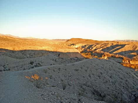
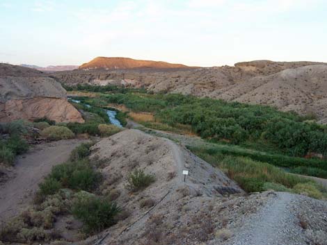
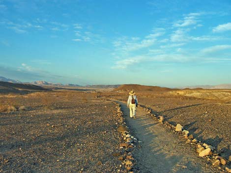 "Wetlands" Trail feels like the wrong place, ... |
From town, drive out to Lake Mead, then drive north on Northshore Road for about 1.2 miles to the Mile 1.2 (Wetlands) Trailhead. Park here; this is the trailhead. The Hike From the trailhead (Table 1, Waypoint 01), the trail runs eastward across the top of the bluffs on sparsely vegetated desert pavement. Watch for the burrows of kangaroo rats around the shrubs and imagine what it must be like for these little seed-eating rodents to live out here (at least they don't need to drink the water!). The trail runs out onto a narrow peninsula that eventually narrows to the width of a trail (Wpt. 02). The trail continues down the narrow ridge towards the bottom of the wash. |
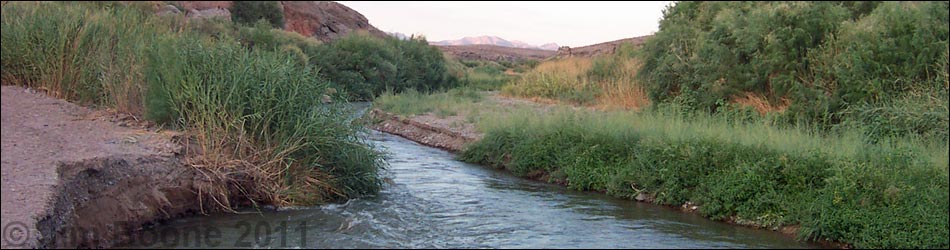
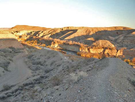
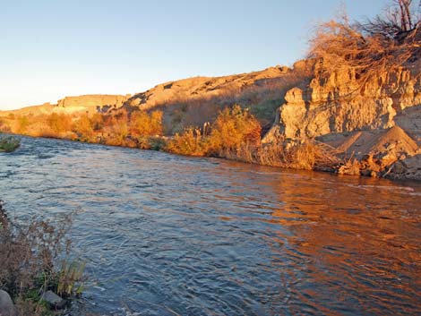
 ... but the bluffs reveal the stream (view NE) |
Just before the end of the ridge, the trail switchbacks down the north side of the ridge into the bottom of a broad side-wash (Wpt. 03). In the side wash, the main trail runs upstream (northeast) to return to the trail-end (Wpt. 05). However, before departing the area, an alternate trail runs down the wash for about 1 minute to the edge of Las Vegas Wash (Wpt. 04). From there, enjoy the sights and sounds of water flowing in the desert and walk up along the stream. Hikers and walk up and down the stream some distance before canyon walls pinch off further access. To return to the trailhead, walk back up the side-wash. At the base of the switchbacks on the main trail (Wpt. 03), rejoin the main trail and hike upstream following the wash and trail back to the parking area (Wpt. 05). The entire trail is well marked. |
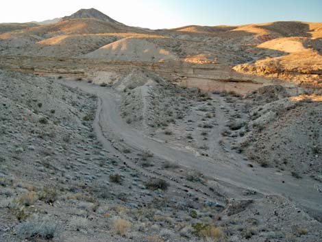
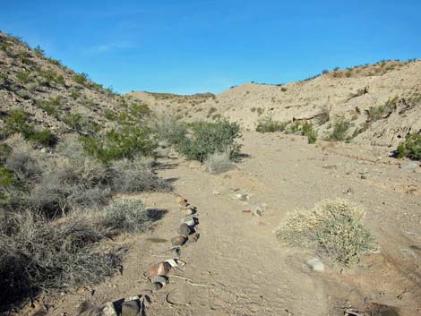
 The trail runs down this narrow ridge (view NE) |
 The trail runs down this narrow ridge (view E) |
 The trail runs down this narrow ridge (view E) |
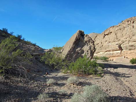
 Exit wash (view NW from narrow ridge) |
 The trail runs down this narrow ridge (view NE) |
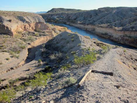
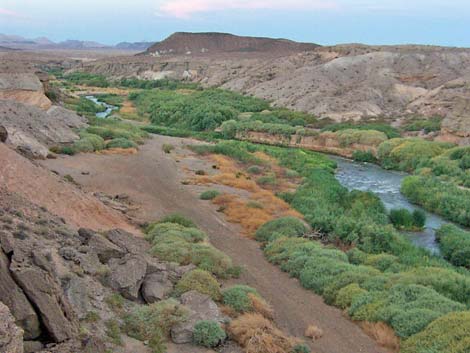 Las Vegas Wash (view NE from atop cliffs) |
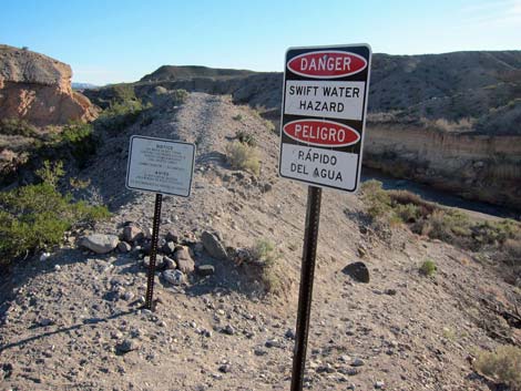 Warning signs |
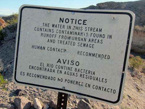 Warning signs |
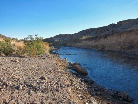 Edge of the stream |
 Las Vegas Wash (view SW) |
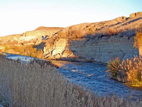 Las Vegas Wash (view NE) |
 Las Vegas Wash (view NE) |
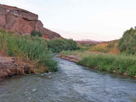 Running water in southern Nevada -- what a sight! (view NE) |
 Continuing on the loop and heading back out (view NW) |
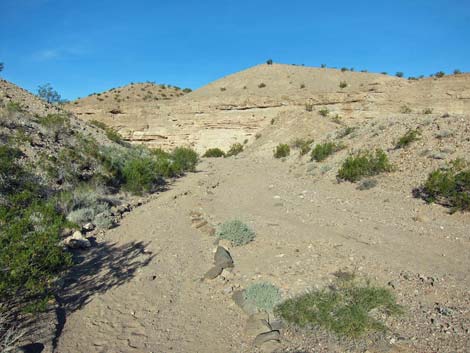 Trail in exit wash (view NW) |
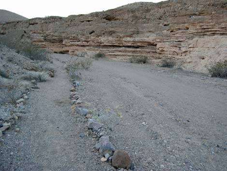 Trail in exit wash (view NW) |
 |
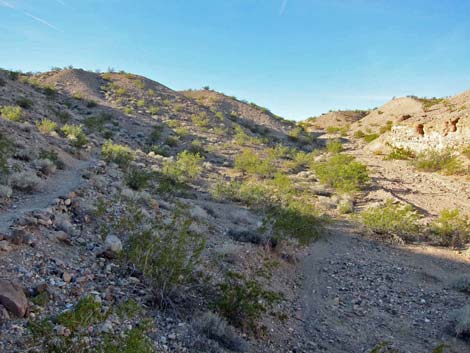 |
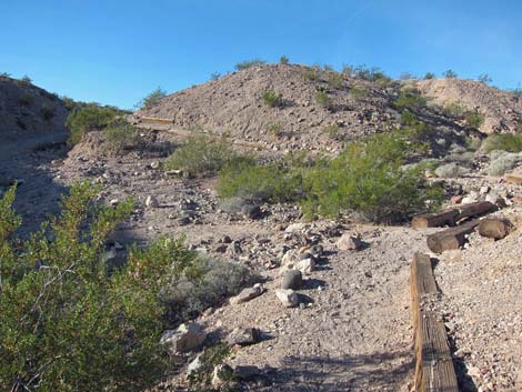 Built trail climbs hillside (view W) |
 Built trail climbs hillside towards the trailhead (view W) |
Table 1. Hiking Coordinates Based on GPS Data (NAD27; UTM Zone 11S). Download Hiking GPS Waypoints (*.gpx) file.
| Wpt. | Location | UTM Easting | UTM Northing | Elevation (ft) | Point-to-Point Distance (mi) | Cumulative Distance (mi) | Verified |
|---|---|---|---|---|---|---|---|
| 01 | Trailhead | 688818 | 3999614 | 1,370 | 0.00 | 0.00 | GPS |
| 02 | Narrow Peninsula | 689158 | 3999727 | 1,320 | 0.23 | 0.23 | GPS |
| 03 | Base of Switchbacks | 689268 | 3999734 | 1,270 | 0.10 | 0.33 | GPS |
| 04 | Edge of Creek | 689364 | 3999721 | 1,220 | 100 yards | . | GPS |
| 03 | Base of Switchbacks | 689268 | 3999734 | 1,270 | 100 yards | . | GPS |
| 05 | Trail-end | 688820 | 3999642 | 1,370 | 0.35 | 0.68 | GPS |
Happy Hiking! All distances, elevations, and other facts are approximate.
![]() ; Last updated 240328
; Last updated 240328
| Hiking Around Lake Mead | Hiking Around Las Vegas | Glossary | Copyright, Conditions, Disclaimer | Home |