Backroads Around Las Vegas, Lake Mead National Recreation Area
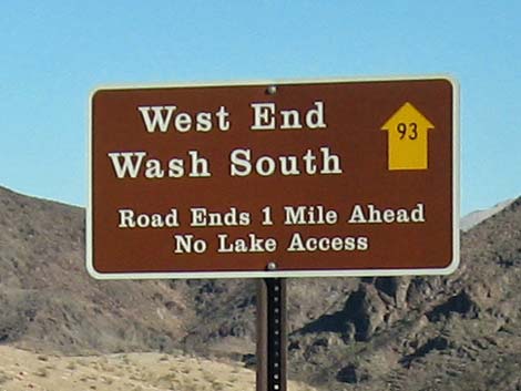 West End Wash South Road (Road 93) sign (view S) |
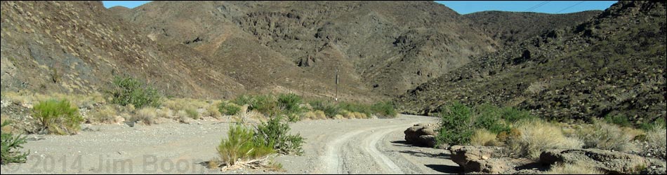
Overview West End Wash South Road is a sandy two-track road that follows a broad wash as it runs south from Northshore Road towards Lake Mead. The road never gets to the lake, as it is blocked a pour-over about 1.2 miles out. This road runs through spectacular country with high mountains and a deep sandy wash, but it doesn't really go anywhere other than for a nice off-road drive, although hikers could continue down about 2 miles to Callville Bay Marina. Driving this wash requires a 4WD vehicle because of deep, soft sand. Link to map. |
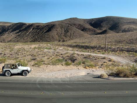 Northshore Rd at West End South Rd (view S) |
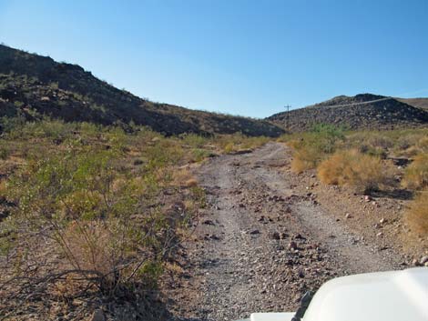
Watch Out Other than the standard warnings about hiking in the desert, ...this road is safe, but it is not maintained and suitable only for 4WD vehicles because of deep, soft sand. In my jeep, I usually stay in 2WD until I get stuck, and in case -- I did. While out, please respect the land and the other people out there, and try to Leave No Trace of your passage. Even though this road is short, be sure to bring what you need of the 10 Essentials. Getting to the Roadhead This road is located along Northshore Road in Lake Mead National Recreation Area, about 40 minutes northeast of Las Vegas. From town, drive out to Lake Mead and then to about Mile 12.6 on Northshore Road. As Northshore Road winds down a hill, West End Wash South Road starts to the right (south). There is no highway sign, but watch for telephone wires crossing the road. |
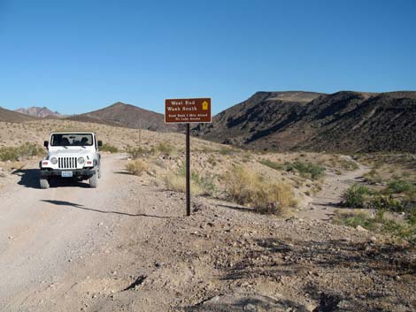 West End Wash South Road (Road 93) sign (view S) |
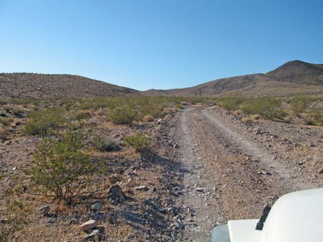
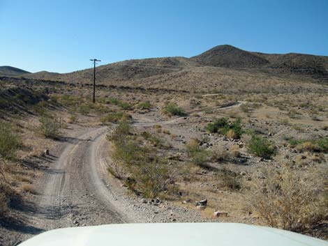
The Road From the pavement (Table 1, Site 1410), West End Wash South Road turns south to wind through a gully and then continues of firm dirt following telephone poles. At about 0.4 miles out, the road forks. The left drops directly into the wash, while the right stays on firm ground until it too drops into the wash (Site 1413). Now in the wash, tire tracks lead downstream until a layer of rocks lying across the wash forms a pour-over (Site 1414). The legal road ends here, but some rock-hopper jeeps continue farther. Returning back up the road, the sandy wash bends to the right as the road bends left. Tire tracks run up the wash to the Northshore Road bridge, but that is not the legal road. |
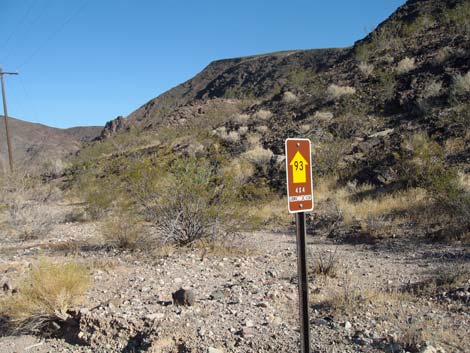 Approved road sign (view SE) |
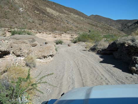 Nearing West End Wash (view SE) |
 Entering West End Wash (view SE) |
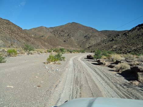 West End Wash (view SE) |
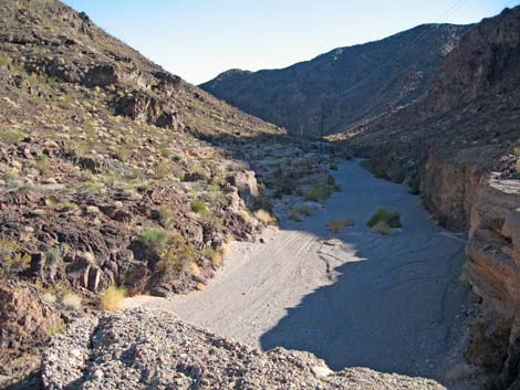 Road ends atop a pour-over (view S) |
 More to come ... |
Returning back up West End Wash South Road
 Firm ground after climbing out of the sandy wash (view NW) |
 Firm ground after climbing out of the sandy wash (view NW) |
 Approaching Northshore Road (view NW) |
More to come ... |
Table 1. Backroad Coordinates Based on GPS Data (NAD27; UTM Zone 11S). Download Roadway GPS Waypoints (*.gpx) file.
| Site | Location | UTM Easting | UTM Northing | Latitude (N) | Longitude (W) | Elevation (ft) | Verified |
|---|---|---|---|---|---|---|---|
| 1410 | Northshore Rd at West End Rd South | 702911 | 4006767 | 36.18627 | 114.74353 | 1,737 | GPS |
| 1413 | West End Rd South Fork | 703744 | 4006168 | 36.18070 | 114.73443 | 1,595 | GPS |
| 1414 | West End Rd South End | 704294 | 4005717 | 36.17651 | 114.72845 | 1,527 | GPS |
Happy Hiking! All distances, elevations, and other facts are approximate.
![]() ; Last updated 240326
; Last updated 240326
| Backroads Around Lake Mead | Hiking Around Las Vegas | Glossary | Copyright, Conditions, Disclaimer | Home |