(aka Wilderness Access Road)
Backroads Around Las Vegas, Lake Mead NRA, Mount Wilson Wilderness Area
 |
Overview Missouri Spring Road (Road 130) is a 2WD-HC backcountry road off Temple Bar Road south of Hoover Dam in Arizona. The road follows the track of an historic mining road for 2.5 miles through the wild backcountry of Lake Mead National Recreation Area to the edge of the Mount Wilson Wilderness Area near the base of Wilson Ridge. Early on, the road runs through the Creosote-Bursage habitat type where shrub diversity is low, but spring wildflowers can be diverse and numerous. Farther out, the road climbs into the Mojave Desert Scrub habitat type. Here, Mojave Yucca joins the shrubs, cactus are fairly common, and spring wildflowers can be quite good. The road ends at the Missouri Spring Trailhead, which provides hiker access to Missouri Spring Guzzler, the summit of Mount Wilson, and a couple of springs. Link to map. |
 |
Watch Out Other than the standard warnings about driving in the desert, ...this is a bumpy but easy drive. The road is firm with few rocks and few wash-outs, and it should be passable in a 2WD-HC vehicles. Farther out, the road becomes rougher, but the roadbed remains firm and suitable for 2WD-HC vehicles. Check with NPS rangers on road conditions before driving into the backcountry. Maps of approved backcountry roads are available online and at the Alan Bible Visitor Center. While out, please respect the land and the other people out there, and try to Leave No Trace of your passage. Also, even though this road is short, be sure to bring what you need of the 10 Essentials. |
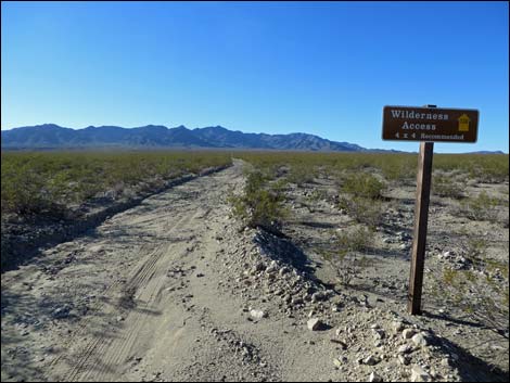 |
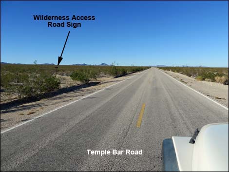
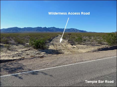
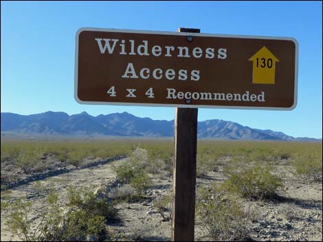
Getting to the Roadhead This road is located in Lake Mead National Recreation Area, about 1-1/4 hours southeast of Las Vegas. From town, drive south on Highway 93 to Boulder City, then continue south across the bridge into Arizona. About 17.5 miles south of the bridge, turn left onto Temple Bar Road (Table 1, Site 1399). Drive northeast and north 10.8 miles to Missouri Spring Road (Site 1402), a dirt road on the left marked only with a "Wilderness Access" sign. At the roadhead, watch for a brown backcountry road sign giving the name of the road and a numbered yellow arrow. Approved roads are signed with yellow arrows and the road number. Driving on roads or trails not marked with a yellow arrow is prohibited. Driving off roads, in washes, or cross-country damages the fragile desert soil and is prohibited by National Park Service regulations. |
 |
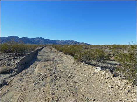
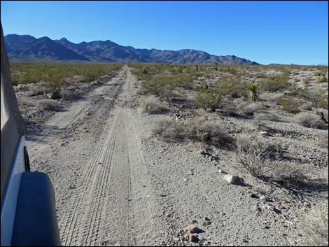
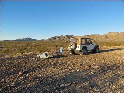
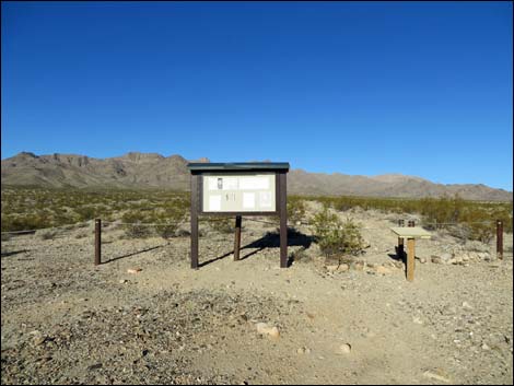
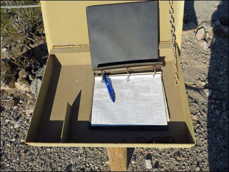
The Road From Temple Bar Road (Table 1, Site 1402), the dirt Missouri Spring Road runs northwest and fairly straight as it gradually climbs the bajada. At about 0.5 miles out, the road crosses a powerline road, continuing straight to the northwest. There are a few rocks and minor washouts, but the road is fairly straight and smooth. At about 2 miles out, the road crosses a cattle guard to pass through a barbed-wire fence and enters an area where the left edge of the road is bordered with carsonite wilderness area signs. At about 2.5 miles out, the road arrives at the trailhead parking area (Site 1402), which is marked off with post-and-cable fencing. There is an information kiosk and sign-in register, but no other structures or facilities. There is space to camp, but no flat places for a comfortable tent. |
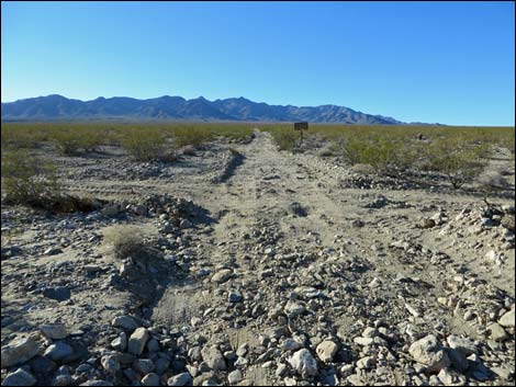 Approaching the Powerline Road |
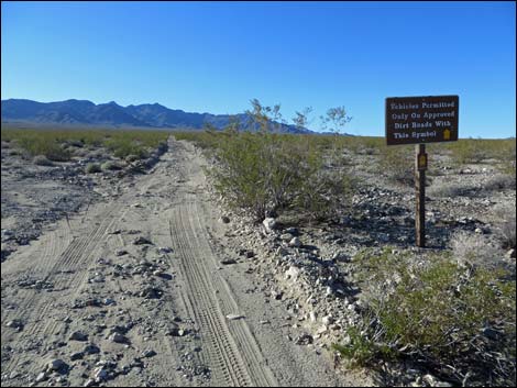 Road sign |
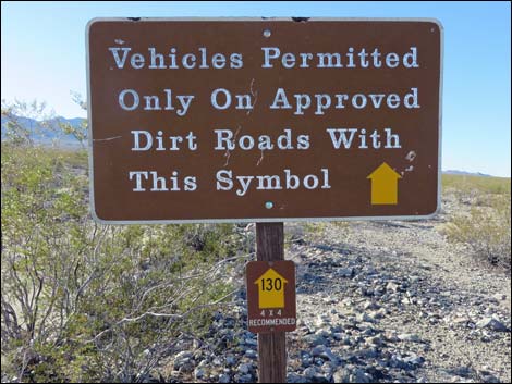 Road signs (note yellow arrow with 130) |
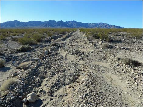 The road gets a bit washed out |
 |
 |
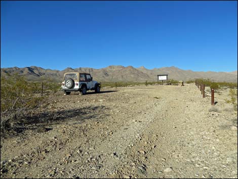 Entering the trailhead parking area |
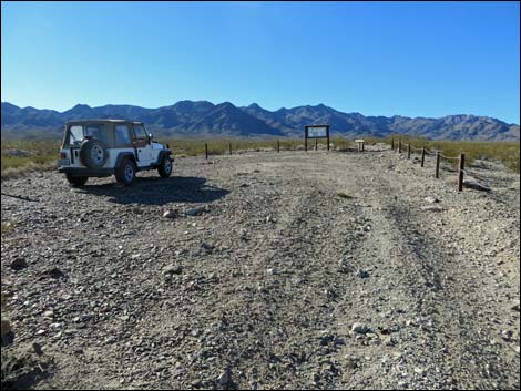 Trailhead parking area |
 |
 |
 |
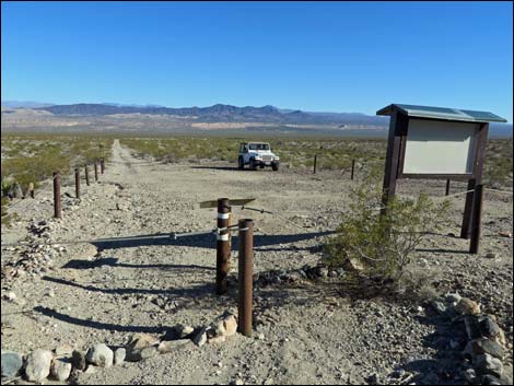 |
Table 1. Highway Coordinates Based on GPS Data (NAD27; UTM Zone 11S). Download Highway GPS Waypoints (*.gpx) file.
| Site | Location | UTM Easting | UTM Northing | Latitude (N) | Longitude (W) | Elevation (ft) | Verified |
|---|---|---|---|---|---|---|---|
| 1399 | Hwy 93 at Temple Bar Rd | 721223 | 3966541 | 35.81991 | 114.55130 | 2,297 | Yes |
| 1402 | Temple Bar Rd at Missouri Spring Rd | 725592 | 3982964 | 35.96684 | 114.49833 | 1,637 | Yes |
| 1403 | Missouri Spring Rd End | 721973 | 3984483 | 35.98136 | 114.53800 | 2,364 | Yes |
Happy Hiking! All distances, elevations, and other facts are approximate.
![]() ; Last updated 240326
; Last updated 240326
| Backroads Around Lake Mead | Hiking Around Las Vegas | Glossary | Copyright, Conditions, Disclaimer | Home |