Backroads Around Las Vegas, Lake Mead National Recreation Area

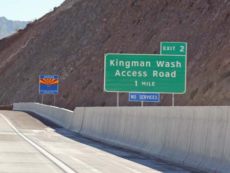
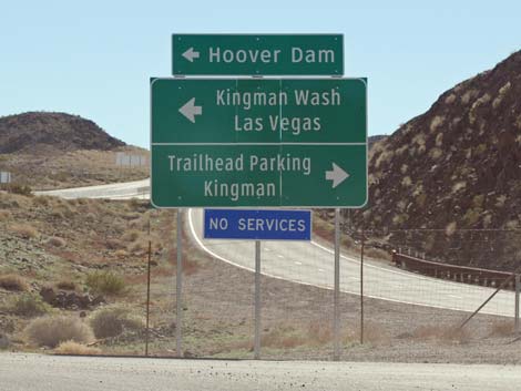
 Kingman Wash Road sign |
Overview Kingman Wash Road (NPS Road 70) is a maintained backcountry road off Highway 93 south of Hoover Dam in Arizona. The road runs for about 3.6 miles over hills and down washes through the wild backcountry of Lake Mead National Recreation Area to the colorful Paint Pots area at the shore of Lake Mead. The road usually is suitable for carefully driven sedans, but a 2WD-HC vehicle would be safer, and one part of the road is a bit steep. This road provides vehicle access to the shore of Lake Mead and three other backcountry roads, including Fortification Hill Road and the hike to the summit of Fortification Hill. Link to map. |
 Highway sign entering Arizona (view E) |
Watch Out Other than the standard warnings about hiking in the desert, ...this road is pretty safe, but it can be bumpy and always be careful on blind corners. One part is rather steep, but it is passable in 2WD vehicles. Check with NPS rangers on road conditions before driving into the backcountry. Maps of approved backcountry roads are available online and at the Alan Bible Visitor Center. While out, please respect the land and the other people out there, and try to Leave No Trace of your passage. Also, even though this road is short, be sure to bring what you need of the 10 Essentials. |
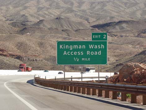 |
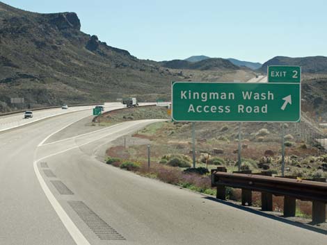
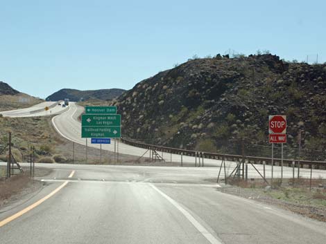
Getting to the Roadhead This road is located in Lake Mead National Recreation Area, about 40 minutes southeast of Las Vegas. From town, drive out towards Hoover Dam, then continue south on Hwy 93 into Arizona for about 2 miles to Exit 2, Kingman Wash Road. Exit the highway, turn left and drive under the highway. Kingman Wash Road starts on the east side of the interchange. |
 |
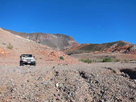
The Road From the pavement (Table 1, Site 0793), the road passes road and information signs, and then it goes onto the dirt. At about 0.25 miles out, the road passes the official "designated road" sign, then continues to wind up into the hills. The road generally climbs for about 0.9 miles to an intersection (Site 1421) with Kingman Wash South Mine Road (NPS Rd 70A), then runs over low hills to an intersection (Site 1422) with Kingman Wash North Mine Road (NPS Rd 70B). |
 |
The road then descends (sometimes steeply) to an intersection (Site 1423) with Fortification Hill Road (NPS Rd 70C). Two vault toilets mark the intersection, and Fortification Hill towers above the toilets. When the lake level is high, this is about the edge of Lake Mead, but the water is so low that drivers must continue another 0.3 miles to the lakeshore and the end of the road. |
 |
 Edge of the pavement at Kingman Wash Road |
 Sign at the edge of the pavement |
 Posted Regulations at the edge of the pavement |
 Official Kingman Wash Road sign |
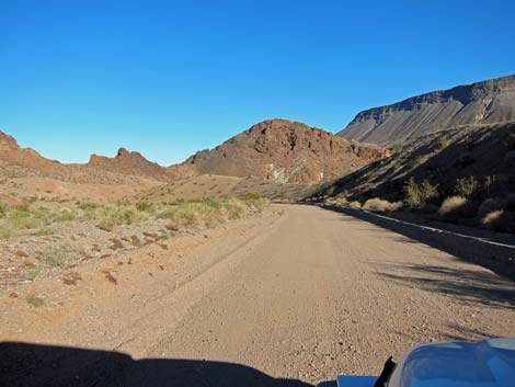
 Climbing towards Fortification Hill |
 Side Road: Kingman Wash South Mine Road sign |
 Side Road: Kingman Wash South Mine Road |
 Running over low hills |
 Side Road: Kingman Wash North Mine Road sign |
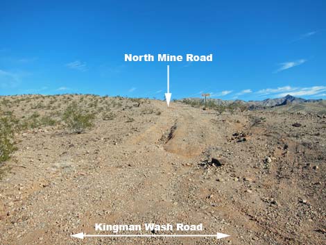 Side Road: Kingman Wash North Mine Road |
 Descending towards the colorful Paint Pots area |
 Fortification Hill |
 Descending towards the colorful Paint Pots area |
 Close to the end of the road |
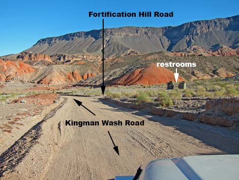 Approaching restrooms and turn to Fortification Hill Road |
 Restrooms at roads junction |
 Lake Mead at the Paint Pots |
 Rising water flooded this campfire ring |
 Scenery above the Paint Pots |
 Scenery above the Paint Pots |
 Driving out, stay right at the restrooms to exit the area |
Table 1. Highway Coordinates Based on GPS Data (NAD27; UTM Zone 11S). Download Highway GPS Waypoints (*.gpx) file.
| Site | Location | UTM Easting | UTM Northing | Latitude (N) | Longitude (W) | Elevation (ft) | Verified |
|---|---|---|---|---|---|---|---|
| 1423 | Kingman Wash Rd at Fortification Hill Rd | 706784 | 3989853 | 36.03307 | 114.70494 | 1,197 | GPS |
| 1422 | Kingman Rd @ Kingman North Mine Rd | 706663 | 3988023 | 36.01661 | 114.70676 | 1,630 | GPS |
| 1421 | Kingman Wash Rd at Kingman South Mine Rd | 706471 | 3987080 | 36.00816 | 114.70914 | 1,624 | GPS |
| 0794 | Paint Pots Cove (Lake Mead shoreline) | 706568 | 3990199 | 36.03623 | 114.70724 | 1,214 | Yes |
| 0793 | Hwy 93 at Kingman Wash Rd | 705370 | 3986367 | 36.00197 | 114.72153 | 1,465 | Yes |
Happy Hiking! All distances, elevations, and other facts are approximate.
![]() ; Last updated 240326
; Last updated 240326
| Backroads Around Lake Mead | Hiking Around Las Vegas | Glossary | Copyright, Conditions, Disclaimer | Home |