Backroads Around Las Vegas, Lake Mead National Recreation Area
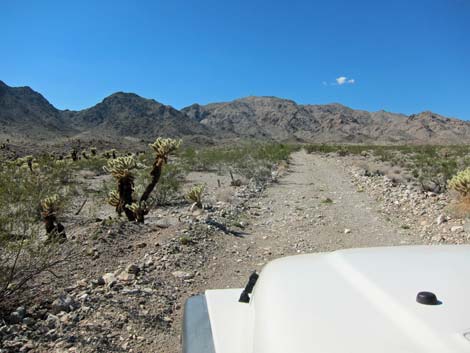
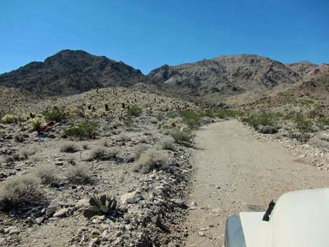
 Rockefeller Mine Rd at Dupont Mine Rd (view NW) |
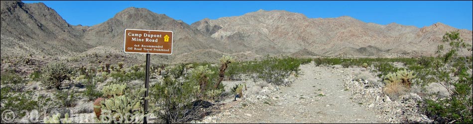
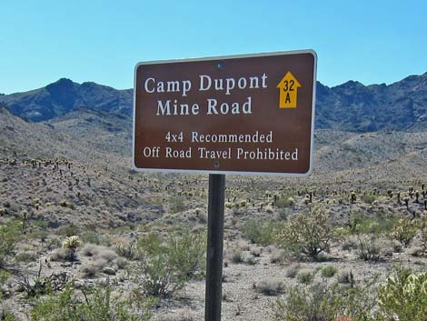
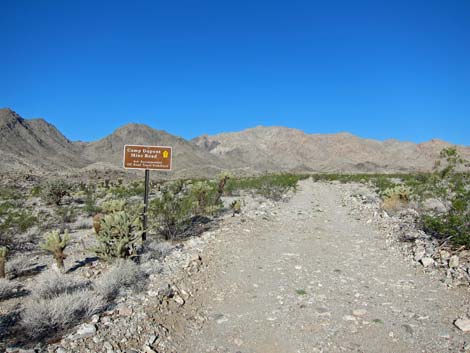
Overview Camp Dupont Mine Road (NPS Road 32A) is a dirt road that runs 0.74 miles from Rockefeller Mine Road northwest into the Rockefeller Mine area, just outside the Ireteba Peaks Wilderness Area, and a bit north and west of Dupont Mountain. The road provides sightseeing, hiking, hunting, and camping opportunities in this wild and remote part of Lake Mead National Recreation Area. It also provides access to a mine site 0.33 miles beyond the end of the official road. The road is in fairly good condition, but sandy in places. Assuming good weather, the road is suitable for experienced drivers of 2WD high-clearance vehicles, but soft patches of sand make 4WD a safer bet. Link to map. |
 4-way intersection (view NW) |
Watch Out Other than the standard warnings about the desert ... Camp Dupont Mine Road generally is a good road, but it runs out into wild and remote country. There are no services or developments of any kind. Cell phones don't work. Bring water and food, a good spare tire, a shovel, tools, a tow rope, bailing wire, and anything you might need to survive a night stuck out in the desert. The road runs out to a mining area. Some of the mines have been gated or closed, but remember, while holes in the ground are inherently interesting, it is never safe to enter mines. Stay Out -- Stay Alive! While out and about, please respect the land and the other people out there, and try to Leave No Trace of your passage. This road runs towards the edge of Wilderness, so pay particular attention to respecting the land. Be sure to bring the 10 Essentials. All motor vehicles, including ATVs, must be street legal. |
 |
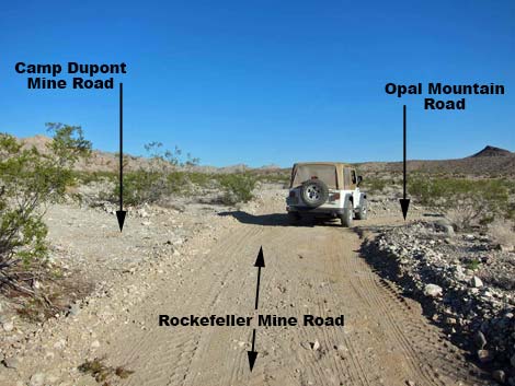
Getting to the Roadhead This road is located in Lake Mead National Recreation Area, about 1-1/2 hours south of Las Vegas and just east of Searchlight. From town, drive south on Highway 95 to Searchlight (Table 1, Site 0927). In downtown Searchlight, turn left onto Cottonwood Cove Road and drive east for 7.8 miles) to Rockefeller Mine Road (Site 1320) on the left. Drive generally northward on Rockefeller Mine Road for 9.7 miles to a 4-way intersection (Site 1323). At this intersection, turn left onto Camp Dupont Mine Road; Rockefeller Mine Road continues straight to the edge of the Ireteba Peaks Wilderness Area, and Opal Mountain Road goes right and runs down to Lake Mojave. |
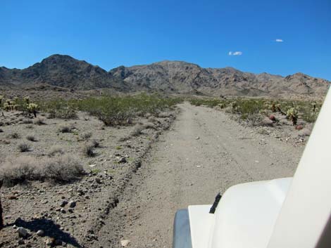
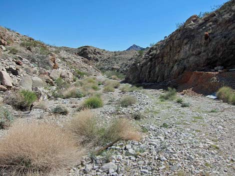
 Dupont Mine Rd (view NW) |
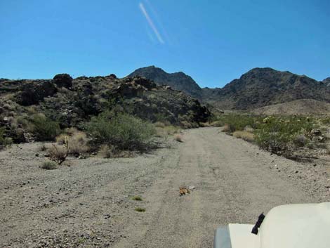
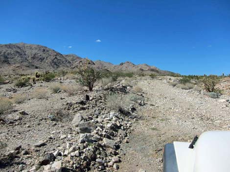
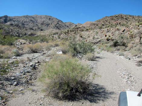
The Road From 4-way intersection (Site 1323), Camp Dupont Mine Road turns left and runs northwest towards mountains in the distance, mountains that are in the Ireteba Peaks Wilderness Area. The road runs uphill and generally is in good shape, but it has not been graded recently and there are patches of fairly deep sand. The road runs northwest on firm ground for about 0.30 miles, then turns more to the west and runs up a sandy wash. Passing prospects, the road bends to the right, leaves the wash, and runs out over a low ridge. The road then drops into another wash at 0.74 miles out (Site 1361). At this point, the road is actually a few yards onto private property, although it appears not to be posted and there are no NPS signs or barricades. |
 Dupont Mine Rd (view NW) |
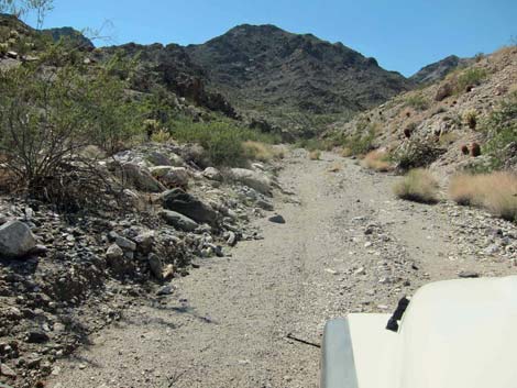
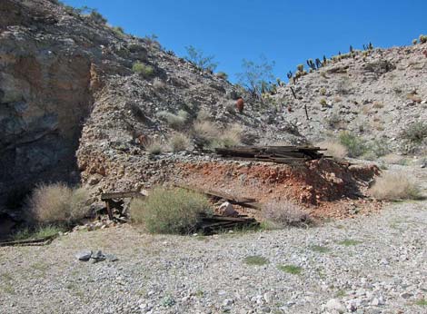
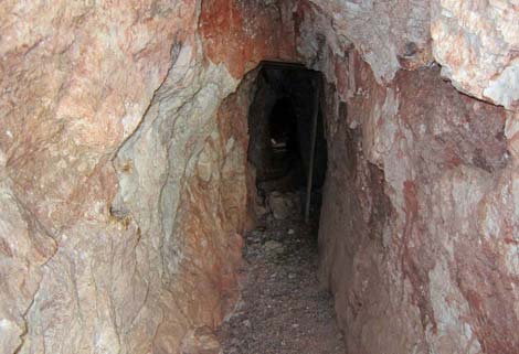
Across the wash, the private road continues up the hillside to the north heading towards the Rockefeller Mine, proper, with several tailings piles that can be seen from the wash. The road looks rough and unused, and presumably the mine owners don't want it used by the public. In contrast to the unused road up the hillside, it appears that the main road (perhaps it should be a footpath) continues up the wash and quickly (about 0.14 miles out) exits the National Recreation Area onto BLM land, and in another 0.09 miles, exits the private property. Whether a legal road or a foot trail, tire tracks in the wash run 0.33 miles to an old mine and several prospects (Site 1362). The canyon above the mine pinches off, apparently blocking vehicle traffic. At the mine site, the main adit is grated, allowing bats to use the mine without letting curious humans endanger themselves. A loading dock outside the main adit still supports human weight, and boards and junk of various sorts litter the ground. |
 Dupont Mine Rd in sandy wash (view W) |
 Dupont Mine Rd exiting sandy wash (view W) |
 Road running over low ridge toward the next wash (view NW) |
 In wash beyond the road (view W) |
 Well used vehicle route in the wash (view W) |
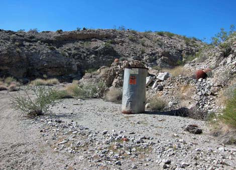 Old water tank along wash just before mine (view W) |
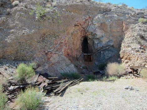 Mine site with loading dock and debris (view W) |
 Mine site just right of adit with debris (view NW) |
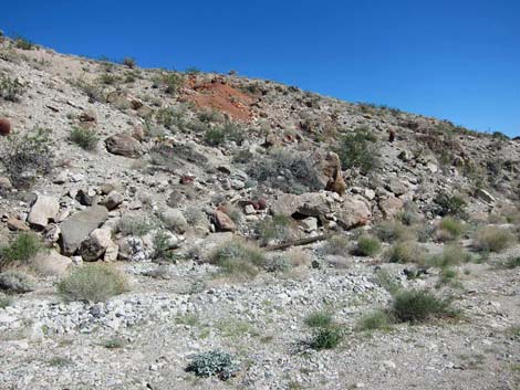
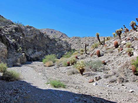 Scenic canyon beyond the mine (view NW) |
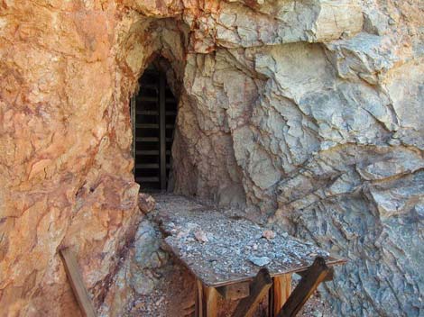 Adit with loading dock |
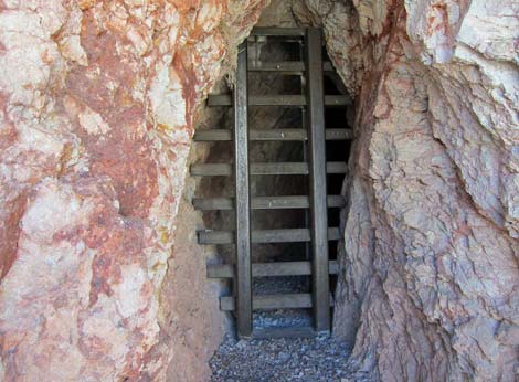 Metal grate allows bats and snakes to pass freely |
 Inside the mine (view through the grate) |
 Prospect on hillside across the wash (view E) |
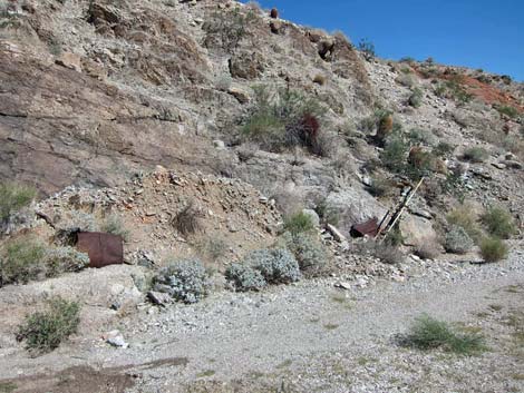 Debris across the wash (view W) |
 Downstream view from just above the mine (view SE) |
 More to come ... |
Table 1. Highway Coordinates Based on GPS Data (NAD27; UTM Zone 11S). Download Highway GPS Waypoints (*.gpx) file.
| Site | Location | UTM Easting | UTM Northing | Latitude (N) | Longitude (W) | Elevation (ft) | Verified |
|---|---|---|---|---|---|---|---|
| 0927 | Hwy 95 at Hwy 164, Searchlight | 688813 | 3926424 | 35.46519 | 114.91921 | 3,500 | Yes |
| 1320 | Cottonwood Cove Rd at Rockefeller Mine Road | 701103 | 3928204 | 35.47882 | 114.78341 | 1,982 | GPS |
| 1323 | Rockefeller Mine Road at Opal Mtn Rd | 702755 | 3937877 | 35.56564 | 114.76280 | 1,768 | GPS |
| 1361 | Camp Dupont Mine Road at Wash | 701700 | 3938148 | 35.56830 | 114.77437 | 1,956 | GPS |
| 1362 | Camp Dupont Mine Road at Dupont Mine | 701307 | 3938280 | 35.56957 | 114.77867 | 2,031 | GPS |
Happy Hiking! All distances, elevations, and other facts are approximate.
![]() ; Last updated 240326
; Last updated 240326
| Hiking Around Lake Mead | Backroads | Glossary | Copyright, Conditions, Disclaimer | Home |