Backroads Around Las Vegas, Lake Mead National Recreation Area
 Callville Wash South Road |
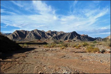
Text and photos with help from Mark Petterson, Henderson Overview The Callville Wash South Road is a backcountry road that follows the bed of Callville Wash from Northshore Road south into the wild backcountry of Lake Mead National Recreation Area. About 5 miles long and ending on the shore of Lake Mead, this road leads through a rugged desert landscape with colorful sandstone bluffs, imposing black volcanic mountains, and fascinating geologic features, then ends across the water from Callville Bay. There are no structures or services of any kind along this road. Presented here is a complete description of the road. For photos of the return, click here. Link to map. |
 |
Watch Out Other than the standard warnings about hiking in the desert, ... the route is fairly safe, but one section is quite rough and should only be driven in a 4WD vehicle. In January 2013, I drove it both ways using 2WD in my jeep (just barely coming out), but it would be a strong display of irresponsibility to drive this road in a 2WD-HC vehicle. While out, please respect the land and the other people out there, and try to Leave No Trace of your passage. Also, even though this road is short, be sure to bring what you need of the 10 Essentials. Be aware of the weather report and stay out of this area if rain is expected, as you don’t want to get caught in a flash flood. Also, the road marks the western boundary of the Pinto Valley Wilderness Area, so pay particular attention to respecting the land. |
 |
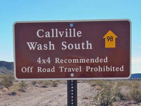
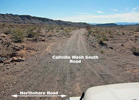
At the turnoff, watch for a brown backcountry road sign giving the name of the road or a post with a numbered yellow arrow. Approved roads are signed with yellow arrows. The black number in the center of the arrow designates the road number. Driving on roads or trails not marked with the yellow arrow is prohibited. Driving off roads, in washes, or cross country damages the fragile desert soil and is prohibited by National Park Service regulations. Please check with local rangers on the road conditions before driving into the backcountry. Maps of approved backcountry roads are available online and at the Alan Bible Visitor Center. |
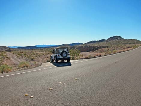 |
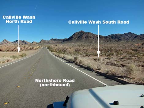
Getting to the Roadhead This road is located along Northshore Road in Lake Mead National Recreation Area, about 45 minutes northeast of Las Vegas. From town, drive out to Lake Mead, then drive north on Northshore Road for about 16 miles to the Anniversary Narrows Trailhead. Callville Wash South Road is almost directly across the pavement from the Anniversary Narrows Trailhead. |
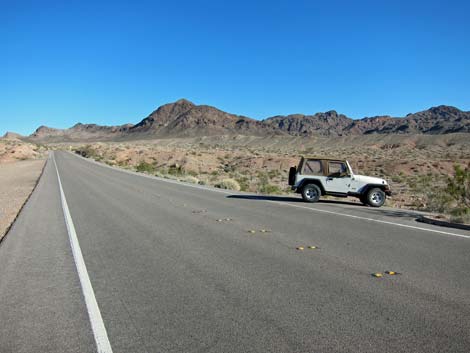
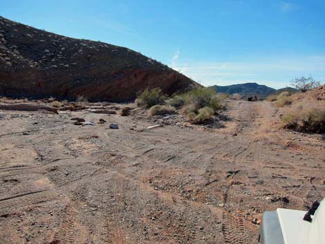
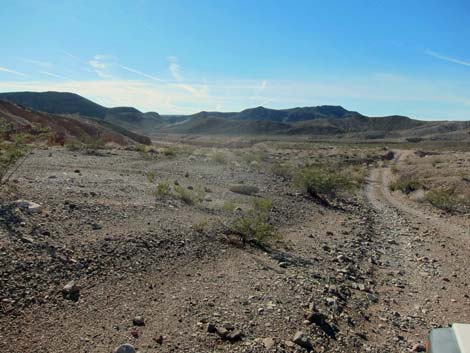
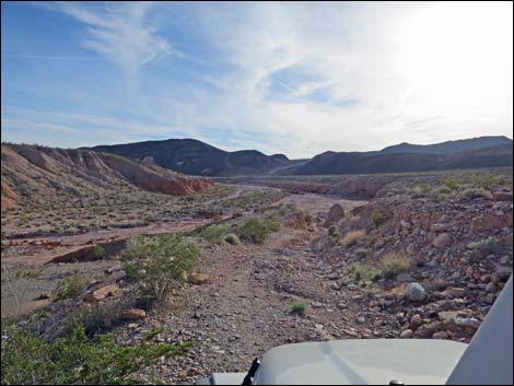
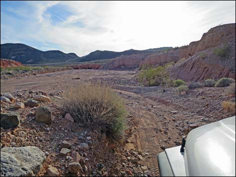
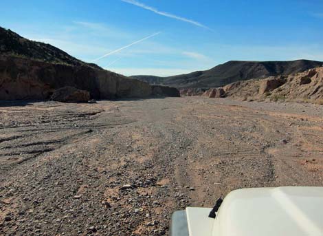
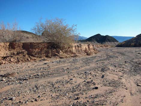
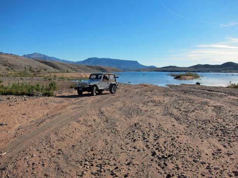
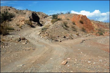
 Departing the pavement (view S; Wpt. 1241) |
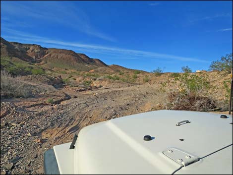
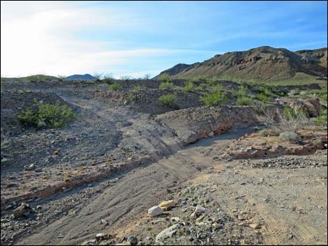
The Road From the pavement (Table 1, Site 1241), the approved road runs south across desert soils on the east side of the wash. It is also possible, however, to immediately turn right parallel to the pavement and drive directly into the wash. Continuing straight, the dirt road runs out into the wash in about 300 yards (Site 1242). In another 120 yards (Site 1243), the approved road exits the wash to the left, and although signed, the turn is not obvious. In 2013, most drivers continued down the wash, but depending on the state of recent flash flooding and shifting gravels, this section of wash can be rocky and difficult to traverse due to many rock fins. Continuing down the approved road, the road runs south parallel to the wash. The road bends hard to the right and enters the wash (0.5 miles out; Site 1244) at a point where the wash is bending hard to the left. Here, the road crosses the wash and climbs onto desert soil to avoid boulders and other obstructions in the wash just around the corner. |
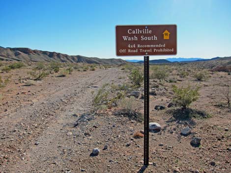 Callville Wash South sign |
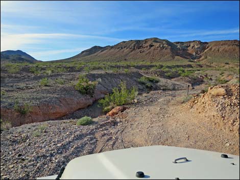
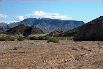
The road runs west across firm desert soils for about 300 yards, then re-enters the wash (0.7 miles out; Site 1245) at the confluence of Callville Wash (on the left) and Lovell Wash (on the right). Below the confluence, the broad wash runs south, but begins to narrow, and in about 550 yards, the road leaves the wash (1.0 miles out; Site 1246) and climbs onto high ground on the west side of the canyon to avoid rocks and pour-overs in the wash below. The road parallels the wash for about 400 yards, in places with nice views to the left of badlands with banded layers of red, white, orange, and pink (MP Photo 01). Then suddenly, the road makes a sharp turn to the right and goes around a tight hairpin curve to the left as it runs across a steep side canyon. Beyond the hair-pin, the road drops steeply through a very rough notch and emerges into the wash again (1.5 miles out; Site 1247). |
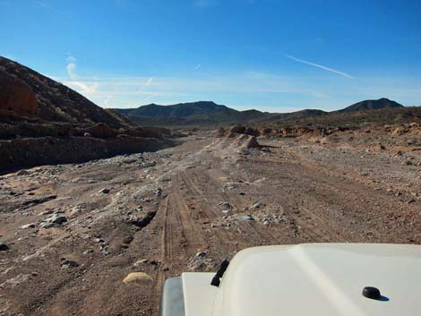
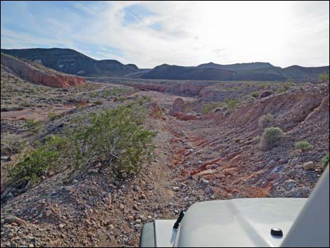
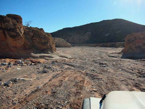
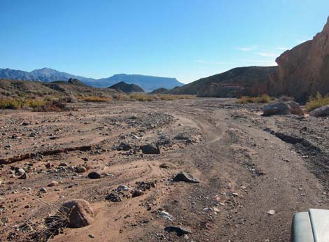
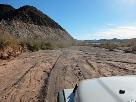
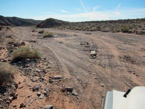 Road enters the wash (view SW; Wpt. 1242) |
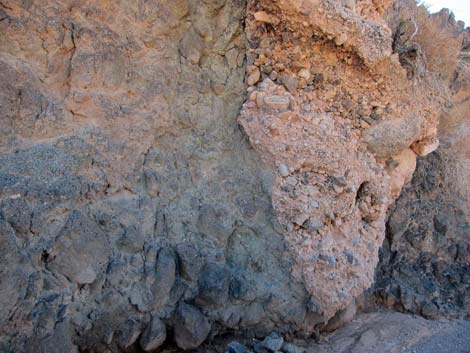
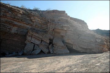
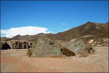
Beyond the rough notch, the difficult driving is over, and the road continues down the usually wide wash. However, about 150 yards after reentering the wash, it is useful to stay on the right (west) side of the wash to avoid having to back out to avoid another rough patch. The wash takes a broad bend to the left and a geologic phenomenon appears ahead on the right – pinkish orange mudstone mounds have been exposed on the flank of a black volcanic mountain (MP Photo 02). On the left, the rugged crags of the Black Mountains (MP Photo 03) can also be seen. A short distance ahead, a layered cliff face on the left side of the wash has collapsed, with the layered pieces visible like a jigsaw puzzle (MP Photo 04). The canyon curves to the right, then the left, and eventually the "bathtub ring" marking the high-water level of Lake Mead becomes visible, as does the hulking black mass of Fortification Hill looming off across the lake (MP Photo 05). |
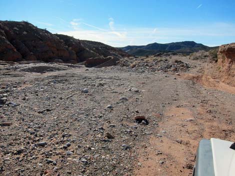
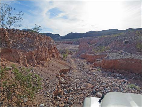
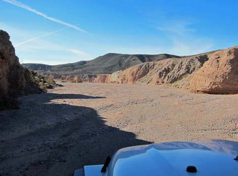
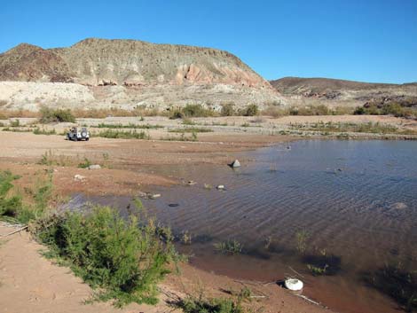
 Road crosses or departs the wash, depending on the route taken (view SW; Wpt. 1244) |
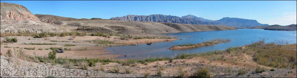
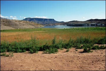
The road eventually runs out onto the shore (4.7 miles out; Wpt. 1426) of Lake Mead, depending, of course on current water levels. In Fall 2009, the lakeshore was very sandy and dense brush (saltcedar) prevented easy access to the water (MP Photo 06), but in the winter of 2013, the water level was higher and the edge of the water was muddy and free of shrubs (they were flooded). Return the way you came. On the way back, notice an outcrop of green volcanic ash in the middle of the wash (MP Photo 07). Past there, watch for the road exiting the wash to the left (MP Photo 08), which leads through the notch and to the hairpin curve. When that road drops back into the wash, carefully follow the tire tracks back to Northshore Road. It is easy to miss the turnoff to the last section of road that leads to pavement. Just before the last turnoff, look north and enjoy the view of scenic hills (MP Photo 09). |
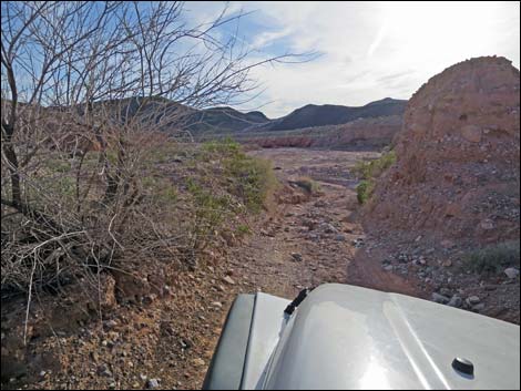
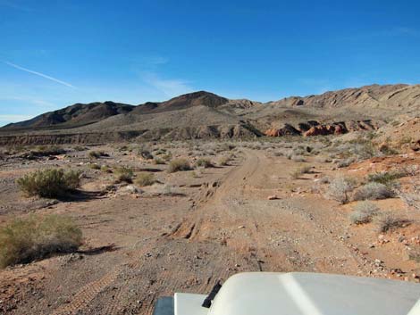 On desert soils heading for Lovell Wash (view W) |
 Exposed bedrock in the wash (view SW) |
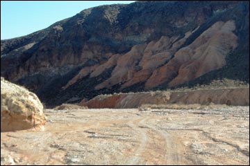
 Road departing wash to avoid narrows (view SW; Wpt. 1246) |
 Avoiding the narrows (view SW) |
 Hair-pin turn (rough) |
 Approaching sharp left to cross gully |
 Crossing the gully |
 Approaching steep and rough road returning towards wash |
 Steep and rough road returning towards wash (Wpt. 1247) |
 Steep and rough descent through notch |
 Steep and rough descent through notch |
 Dropping back into the main wash |
 Pinch point between rock outcrops |
 Jumble of geology (view W) |
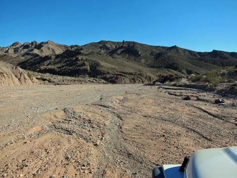 Broad, smooth wash |
 Smooth and firm surface (note lack of tire tracks) |
 Smooth and firm surface (note lack of tire tracks) |
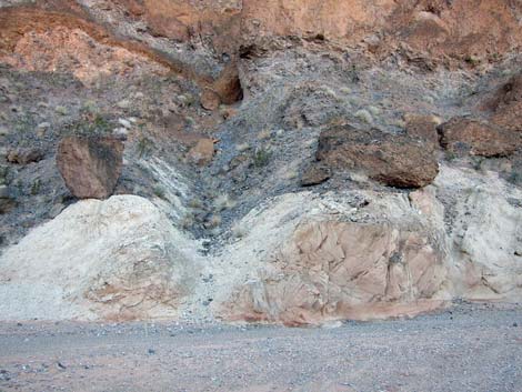
 Interesting geology |
 Not-so-smooth, but firm surface (view S) |
 Old high-water level (view S) |
 Bathtub ring is high overhead (view S) |
 Lakeshore (Jan 2013) |
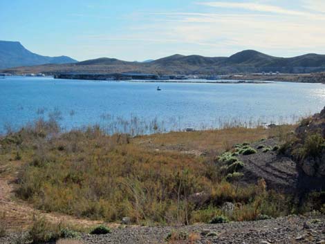 Callville Marina in the distance (Jan 2013) |
 Lakeshore (Jan 2013; Wpt. 1426) |
Returning Back up the Road
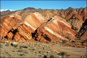 MP Photo 01: Badlands with banded layers |
 MP Photo 02: Flank of a black volcanic mountain |
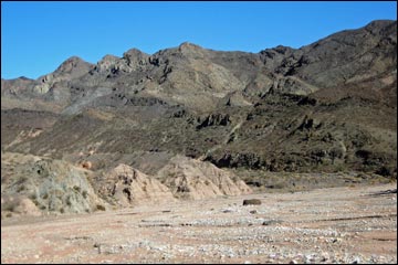 MP Photo 03: Rugged crags of the Black Mountains |
 MP Photo 04: Layered jigsaw puzzle |
 MP Photo 05: Fortification Hill in the distance |
 MP Photo 06: Callville Bay Marina (Fall, 2009) |
 MP Photo 07: Green volcanic rocks |
 MP Photo 08: Exit route through notch |
 MP Photo 09: Scenic hills north of Northshore Road |
 more to come ... |
Table 2. Hiking Coordinates (NAD27; UTM Zone 11S). Download Highway GPS Waypoints (*.gpx) file.
| Site | Location | UTM Easting | UTM Northing | Latitude (N) | Longitude (W) | Elevation (ft) | Verified |
|---|---|---|---|---|---|---|---|
| 1241 | Northshore Rd at Callville South Rd | 707924 | 4007994 | 36.19625 | 114.68750 | 1,657 | GPS |
| 1242 | Callville Wash S, Enter Wash | 707828 | 4007764 | 36.19420 | 114.68863 | 1,641 | GPS |
| 1243 | Callville Wash S, Exit Wash | 707838 | 4007654 | 36.19321 | 114.68856 | 1,629 | GPS |
| 1244 | Callville Wash S, Cross Wash | 707793 | 4007261 | 36.18968 | 114.68916 | 1,624 | GPS |
| 1245 | Callville Wash S, Enter Wash | 707495 | 4007234 | 36.18950 | 114.69247 | 1,608 | GPS |
| 1246 | Callville Wash S, Exit Wash | 707228 | 4006872 | 36.18630 | 114.69554 | 1,558 | GPS |
| 1247 | Callville Wash S, Enter Wash | 706773 | 4006564 | 36.18362 | 114.70068 | 1,575 | GPS |
| 1426 | Callville Wash S, Shoreline (Jan 2013) | 706017 | 4002766 | 36.14957 | 114.71007 | 1,280 | GPS |
Happy Hiking! All distances, elevations, and other facts are approximate.
![]() ; Last updated 240326
; Last updated 240326
| Backroads Around Lake Mead | Hiking Around Las Vegas | Glossary | Copyright, Conditions, Disclaimer | Home |