Backroads Around Las Vegas, Lake Mead National Recreation Area
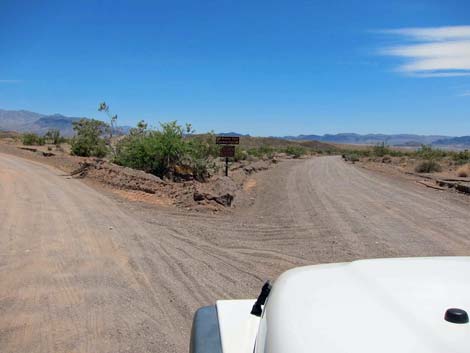
 Northshore Road at Boxcar-Crawdad Road |
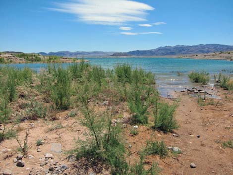
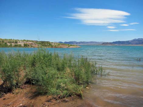
Overview Boxcar Cove Road runs from Northshore Road down to the edge of Lake Mead at Boxcar Cove. This is a maintained backcountry road, but with limited budgets for work crews, the sand in the wash gets a bit soft down towards the lake and there is evidence that drivers sometimes get stuck in the sand. The road, about 2.75 miles long, runs through dry, rolling hills covered with creosote bush and then turns down a sparsely-vegetated wash. Except one outhouse, there are no structures or services along the road. Despite changing water levels, boaters can find places to launch their craft, fishermen can find places to cast, and campers can find places to pitch tents. Link to map. |
 |
Watch Out Other than the standard warnings about hiking in the desert, ...this is an easy drive. Although people in sedans make it to the lake, there are sandy spots where people get stuck. The area is heavily used, so drivers stuck in the sand likely would soon find a passing truck willing to pull them out. While out, please respect the land and the other people out there, and try to Leave No Trace of your passage. Also, even though this road is short, be sure to bring what you need of the 10 Essentials. Be aware of the weather report and stay out of this area if rain is expected; you don’t want to get caught in a flash flood. |
 Fork in the road (0.50 miles out) |
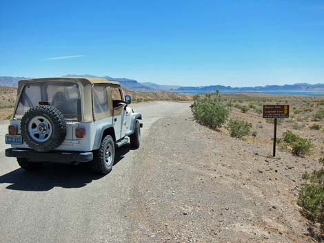
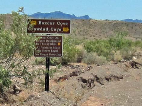
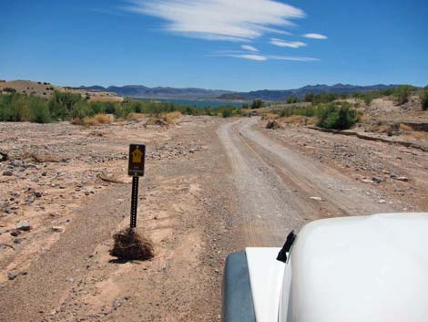
Getting to the Roadhead This road is located along Northshore Road in Lake Mead National Recreation Area, about 40 minutes east of Las Vegas via Lake Mead Blvd. From town, drive out to Lake Mead, and then out Northshore Road to mile marker 8.9 (Table 1, Site 1161). Boxcar Cove Road turns right and runs south towards the lake. At the turnoff, watch for a brown backcountry road sign giving the name of the road and a numbered yellow arrow. Approved roads in the National Recreation Area are signed with yellow arrows. The black number in the center of the arrow designates the road number. Driving on roads or trails not marked with the yellow arrow is prohibited. Driving off roads, in washes, or cross country damages the fragile desert soil and is prohibited by National Park Service regulations. Maps of approved backcountry roads are available online and at the Alan Bible Visitor Center. Despite these regulations, it appears that Park Rangers don't enforce driving laws below the old high-water lake level. |
 Fork in the road -- sign is missing, but still true (0.55 miles out) |
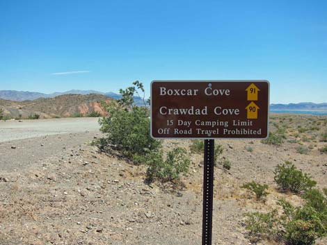
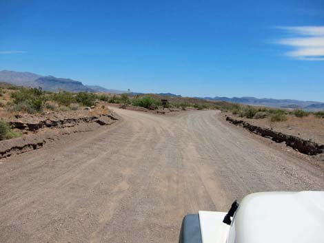
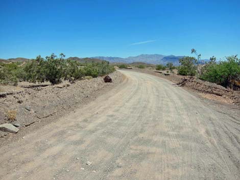
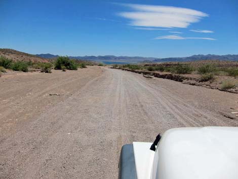
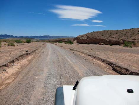
The Road From the pavement (Site 1161), the road runs south, passing a bank of trash dumpsters off to the left in a large pullout. There are no other trash cans in the area. At about 0.55 miles out, the road forks (Site 1162). Boxcar Road turns to the left, while the road to Crawdad Cove stays to the right. Staying to the left, the road runs out over the hills on a firm road that can be a bit washboarded. At about 1 mile out, the road drops into Boxcar Wash. The road in the wash is smoother, but parts are softer sand. Closer to the lake, the road firms up. |
 Fork in the road -- sign is missing, but still true (0.56 miles out) |
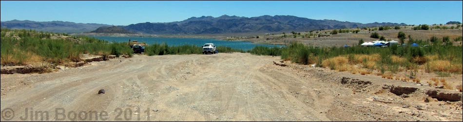
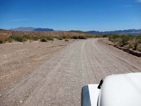
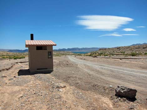
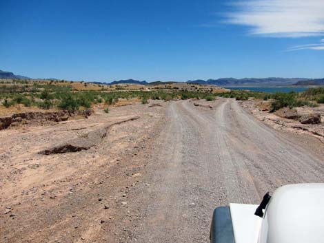
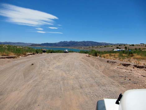
At about 2 miles out, the road passes an outhouse. This is the only restroom facility in the area. Unfortunately, with the lake level so low, this is a long way from the water. At the outhouse, side roads to the left begin to diverge. The main road generally stays to the right, but in the wash, it looks like "main" roads change. At about 2.8 miles out, the main road reaches the edge of the lake. A number of roads spread out, with some side roads continuing most of a mile farther out to points sticking into the lake with boat launch site, camp sites, and fishing holes. |
 Boxcar to the left (0.56 miles out) |
 Road drops into Boxcar Wash (1.04 miles out) |
 Boxcar Wash (1.08 miles out) |
 Boxcar Wash (1.53 miles out) |
 Boxcar Wash (2.03 miles out) |
 Boxcar Wash (2.41 miles out). To the left is better |
 Boxcar Wash (2.52 miles out on the fork to the right) |
 Boxcar Cove (2.74 miles out) |
 Boxcar Cove (2.80 miles out) |
 Boxcar Cove (2.80 miles out) |
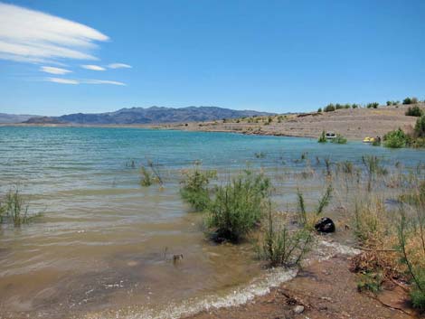 Boxcar Cove (2.80 miles out) |
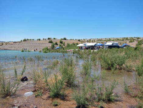 Boxcar Cove (2.80 miles out) |
Table 2. Backroad Coordinates based on GPS data (NAD27; UTM Zone 11S). Download Highway GPS Waypoints (*.gpx) file.
| Site # | Location | UTM Easting | UTM Northing | Latitude (N) | Longitude (W) | Elevation (ft) | Verified |
|---|---|---|---|---|---|---|---|
| 1161 | Northshore at Boxcar-Crawdad Rd | 698550 | 4003410 | 36.15693 | 114.79285 | 1,491 | GPS |
| 1162 | Boxcar Rd -- Crawdad Rd Fork | 698859 | 4002636 | 36.14989 | 114.78961 | 1,424 | GPS |
| 1163 | Boxcar Cove Rd at Lake Mead | 699474 | 3999336 | 36.12003 | 114.78362 | 1,117 | GPS |
Happy Hiking! All distances, elevations, and other facts are approximate.
![]() ; Last updated 240326
; Last updated 240326
| Backroads Around Lake Mead | Hiking Around Las Vegas | Glossary | Copyright, Conditions, Disclaimer | Home |