Backroads Around Las Vegas, Lake Mead National Recreation Area
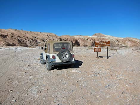
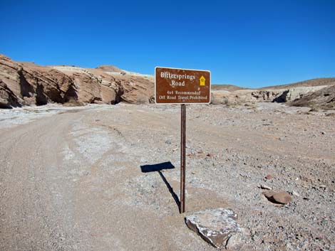
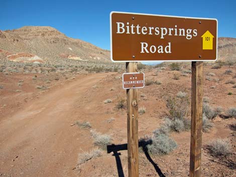 Bittersprings Road sign (NPS Rd 101; view N) |
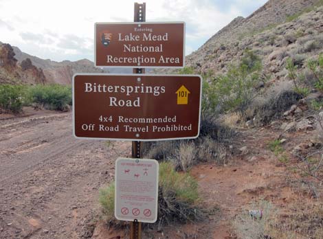
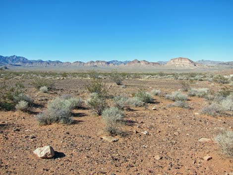
Overview Bittersprings Road (NPS Rd 101), not to be confused with the Bitter Spring Trail (a BLM backcountry byway) is a 6.4-mile backcountry road that runs north from Northshore Road to Bitter Spring, then continues northeast following Echo Wash back to Northshore Road. The road traverses grand scenery, but Echo Wash is full of deep sand that requires 4WD. Bittersprings Road provides access to Bitter Spring Backcountry Byway, Bitter Spring (an interesting birdwatching site), Bittersprings Campground and other backcountry campsites, miles of BLM backroads, and various hiking routes. Link to map. |
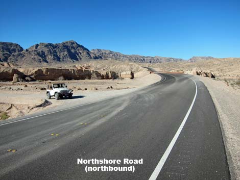
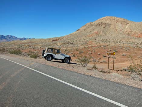
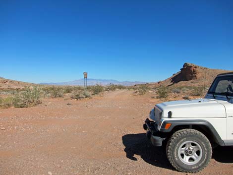
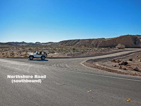
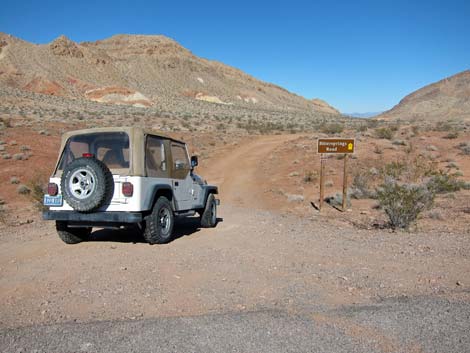 Northshore Road at Bittersprings Road (view N) |
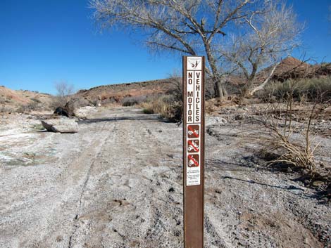
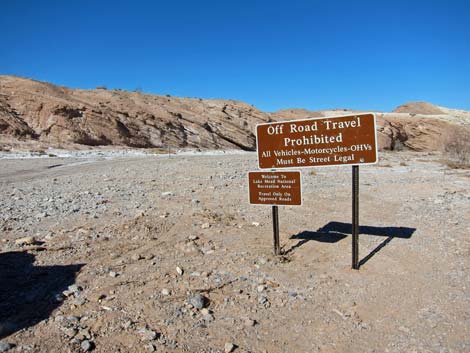
Watch Out Other than the standard warnings about driving in the desert, ...this is a fairly safe drive, especially the first 2.4 miles to Bitter Spring. Continuing down Echo Wash, while safe and easy, requires 4WD to navigate deep, soft sand. While out, please respect the land and the other people out there, and try to Leave No Trace of your passage. This road is fairly remote, so be sure to bring the 10 Essentials. Please stay on the road at the spring and don't drive up the water course as it makes it harder for land managers to reestablish native vegetation (part of a saltcedar removal project). |
 Bittersprings Campground in wash (view N) |
Getting to the Roadhead This road is located along Northshore Road in Lake Mead National Recreation Area, about 50 minutes east of Las Vegas. From town, drive out to Lake Mead. From the intersection of Lakeshore Road and Northshore Road, drive north on Northshore Road for about 25.9 miles. Shortly before the mile marker 26, watch for the sign and turn left onto Bittersprings Road (google map). From the other direction, Bittersprings Road departs Northshore Rd at Mile 33.3 (0.3 miles before mile marker 33). |
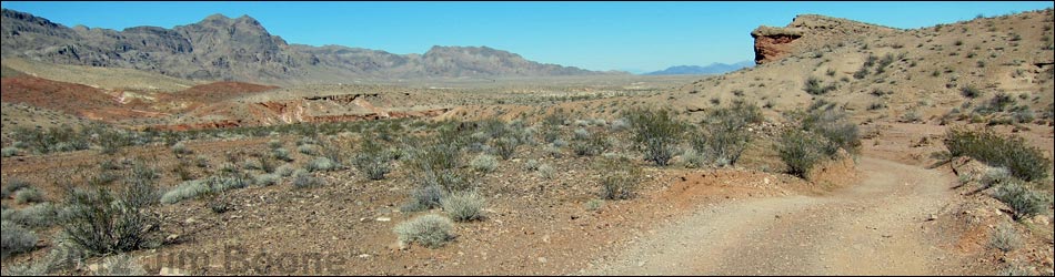
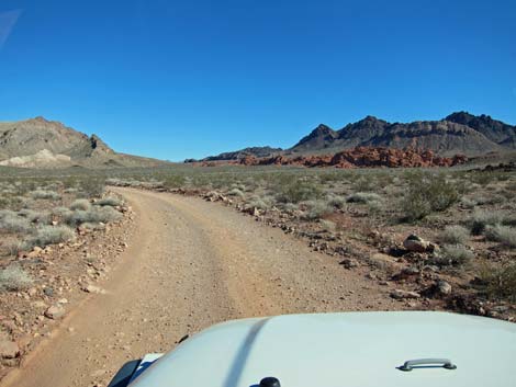
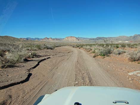
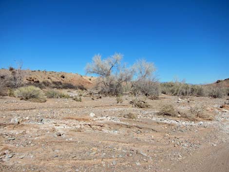
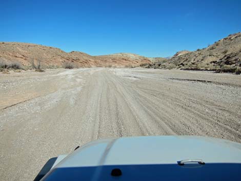
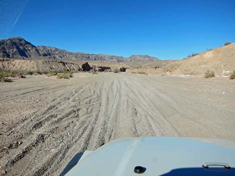
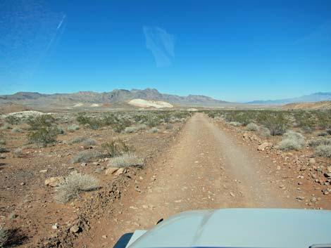 Bittersprings Road descending the bajada (view N) |
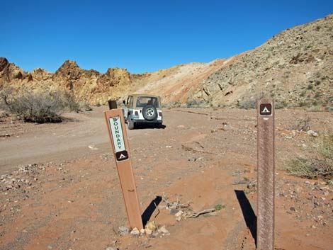
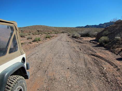
The Road From the pavement (Table 1, Site 0656), the graded road runs northeast and then north as it descends gently through rolling hills. The road surface here is firm dirt, and the Park Service maintains it from time to time. The road eventually follows washes descending towards a gap in Echo Hills. At about 0.7 miles out, as the road enters the gap, notice symbol signs for the designated Bittersprings Campground (Site 1382). In general, camping along roads is illegal at Lake Mead. This, however, is one of a few primitive campgrounds in the park where people can get away from developments and camp in the desert (away from the lake) legally and for free. |
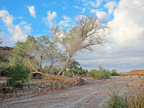 Cottonwood Tree at Bitter Spring (view W) |
Bittersprings Campground is nothing special, just a wide area in a wash with a few boundary signs. Parking is available for several vehicles, but it would be crowded with more than two quiet groups. This is a flashflood zone, so don't camp here if thunderstorms threaten. Beyond Bittersprings Campground, the road continues down the wash through the gap. Shortly, the road passes Lake Mead NRA boundary signs (Site 1383) and runs out onto BLM land. The road then curves away from the cliffs and heads north down the bajada. About 0.5 miles onto BLM land, the road passes a well-used traditional campsite (Site 1384) on the left. |
 Bittersprings Road in sandy Echo Wash (view NE) |
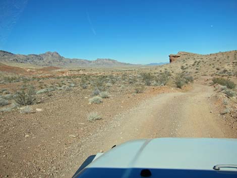
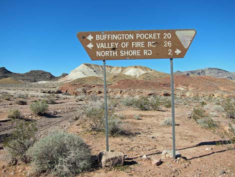
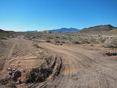
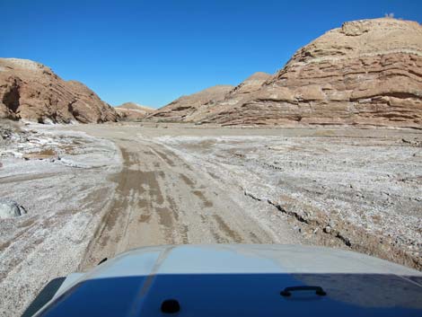
Running down the bajada, the road eventually reaches a signed road intersection (Site 0658; 3.3 miles out). Here, the Bitter Spring Backcountry Byway runs left (also straight ahead), and Bittersprings Road continues to the right. Turning right, the road runs out about 0.25 miles and drops into the sandy wash. For drivers in 2WD vehicles wishing to visit the spring, park on firm ground before dropping into the wash, and then walk the last few minutes to the spring. Continuing down the wash, the road quickly passes cottonwood trees that mark the upstream end of the spring area (Site 0658; 3.9 miles out), and in a few hundred yards, all signs of water in the desert are gone. |
 Bittersprings Road at Northshore Road (view N) |
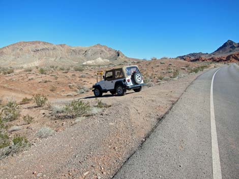
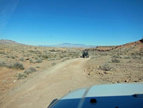
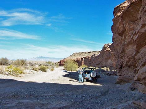
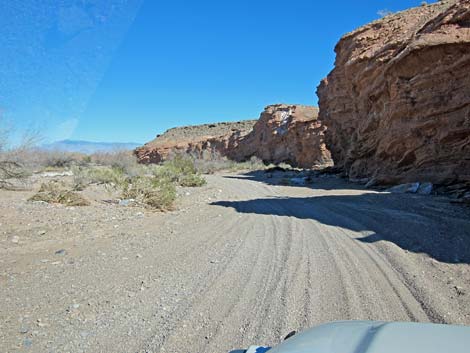
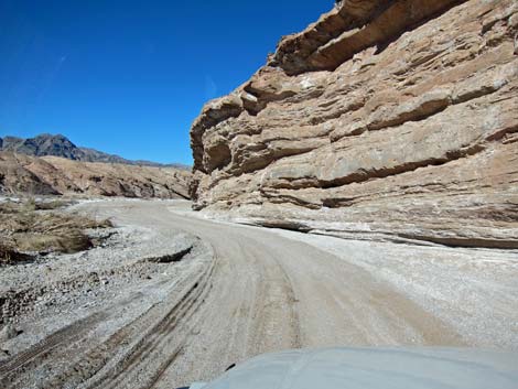
Following the wash, the road runs in a shallow canyon with scenic, vertical walls. Parts of the canyon are narrower than others, but none qualify as "narrows." At about 5.2 miles out, the road reaches another set of Lake Mead NRA boundary signs (Site 1386) as it re-enters the National Recreation Area. Continuing downstream, the road eventually parallels Northshore Road as that road drops towards Echo Wash. Just upstream from the Northshore Road bridge over Echo Wash, Bitterspring Road reaches a spur road to the right (Site 1385) that leads out to the pavement (Site 0660). Although the wash continues, Bitterspring Road turns right and ends. A road continues down Echo Wash, but now takes the name Echo Wash Road. |
 Northshore Road at Bittersprings Road (view E) |
 Northshore Road at Bittersprings Road (view W) |
 Bittersprings Road (view NE) |
Bittersprings Camp (view N) |
 Bittersprings Camp (view N) |
 Boundary signs (view SE; looking back) |
 Bittersprings Road on bajada (view NE) |
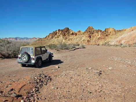
 Traditional camp on BLM land (view NW) |
Bittersprings Road on bajada (view NE) |
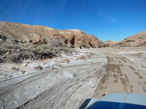
 Bittersprings Road approaching Echo Wash (view NE) |
 Bittersprings Road at Bitter Spring Trail (view NW) |
 Bittersprings Road at Bitter Spring Trail (view NE) |
 Bittersprings Road at Bitter Spring Trail (view SW) |
 Bittersprings Road at Bitter Spring Trail (view SE) |
 Bittersprings Road approaching Bitter Spring (view NE) |
 Bittersprings Road at Bitter Spring (view N) |
 Bitter Spring: don't drive in the spring (view E) |
 Bitter Spring parking in the shade (view NE) |
 Bittersprings Road in Echo Wash (view NE) |
 Bittersprings Road in Echo Wash (view NE) |
 Bittersprings Road in Echo Wash (view NE) |
 Bittersprings Road in Echo Wash (view NE) |
 Bittersprings Road in Echo Wash (view NE) |
 Bittersprings Road at Lake Mead NRA boundary (view NE) |
 Lake Mead NRA boundary signs |
 Lake Mead NRA boundary sign |
Bittersprings Road in Echo Wash (view NE) |
 Bittersprings Road in Echo Wash (view NE) |
 Bittersprings Road at Northshore Road (view W) |
Bittersprings Road at Northshore Road (view N) |
Table 1. Highway Coordinates Based on GPS Data (NAD27; UTM Zone 11S). Download Highway GPS Waypoints (*.gpx) file.
| Site | Location | UTM Easting | UTM Northing | Latitude (N) | Longitude (W) | Elevation (ft) | Verified |
|---|---|---|---|---|---|---|---|
| 0656 | Northshore Rd at Bitter Spr Rd | 721481 | 4013565 | 36.24343 | 114.53528 | 2,139 | Yes |
| 0657 | Bitter Spring Rd at Echo Wash Rd | 723000 | 4017961 | 36.28267 | 114.51713 | 1,673 | Yes |
| 0658 | Bitter Spring | 723366 | 4018239 | 36.28509 | 114.51299 | 1,670 | Yes |
| 0660 | Northshore Rd at Echo Wash Rd | 725514 | 4020768 | 36.30737 | 114.48835 | 1,444 | Yes |
| 1382 | Bitterspring Campground | 722065 | 4014369 | 36.25054 | 114.52856 | 1,999 | GPS |
| 1383 | Echo Wash at Lake Mead Boundary | 721806 | 4014481 | 36.25161 | 114.53141 | 1,992 | GPS |
| 1384 | BLM campsite | 721761 | 4015275 | 36.25877 | 114.53168 | 1,890 | GPS |
| 1385 | Bitterspring Rd at Echo Wash Rd | 725413 | 4020780 | 36.30751 | 114.48947 | 1,431 | GPS |
| 1386 | Bittersprings Rd at Lake Mead Boundary | 724845 | 4019373 | 36.29496 | 114.49621 | 1,565 | GPS |
Happy Hiking! All distances, elevations, and other facts are approximate.
![]() ; Last updated 240326
; Last updated 240326
| Backroads | Hiking Around Las Vegas | Glossary | Copyright, Conditions, Disclaimer | Home |