Hiking Around Las Vegas, Lake Mead National Recreation Area
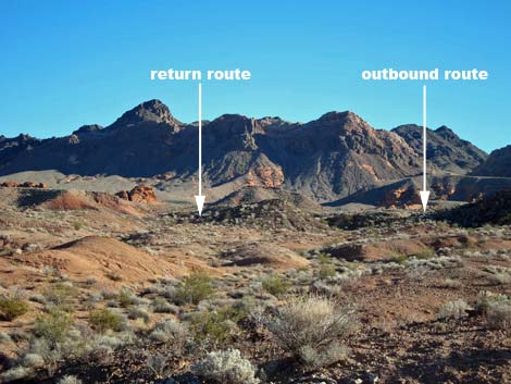
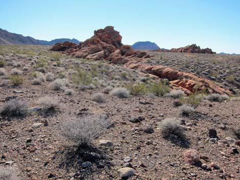
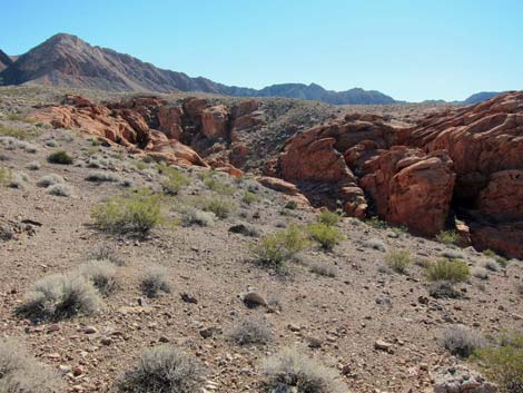
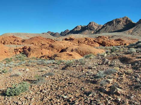
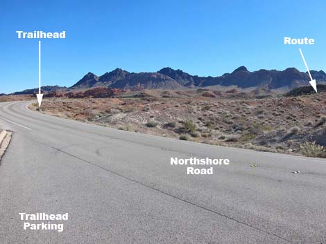 Mile 25.8 Trailhead and direction of travel (view SW) |
Overview This 3-3/4-mile route runs south from the highway to make a scenic loop through a large area of red sandstone outcrops, squeezes through a slot canyon, and climbs to overlooks with views into Pinto Valley, the namesake for the Pinto Valley Wilderness Area, from vantage points atop red sandstone crags. This route requires considerable 2nd-class route finding and a bit of 3rd-class scrambling in the sandstone where the "landmarks" all look alike. Hikers can simply wander into and out of this area, but following any described path is only possible by going with a guide or by following GPS waypoints. Therefore, this route is described as an orienteering course where hikers follow GPS waypoints rather than landmarks. Be sure to print out the map, grab a compass, and load up the GPS before heading out on this hike.Link to map. |
 |
Watch Out Other than the standard warnings about hiking in the desert, ...this is an off-trail route that leads into rugged territory. While the rocks are inviting, always watch your step and be extra careful when high enough to fall and get hurt. Lost hikers need only walk downhill to find the pavement. While hiking, please respect the land and the other people out there, and try to Leave No Trace of your passage. Also, be sure to bring the 10 Essentials. Cell phones do not work. This hike goes into the Pinto Valley Wilderness Area, so pay particular attention to respecting the land. |
 |
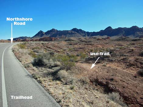
Getting to the Trailhead This hike is located along Northshore Road in Lake Mead National Recreation Area, about 1 hour northeast of Las Vegas. From town, drive out to Lake Mead. From the intersection of Lakeshore Road and Northshore Road, drive north on Northshore Road for 25.8 miles to the Mile 25.8 Trailhead, which is on the north side of the road. Park here, this is the trailhead. The Hike From the parking area, the hike crosses the road and runs 80 yards east on the pavement to the trailhead (Table 1, Waypoint 01) on the south side of the highway. Watch for a faint use-trail that runs off a low ridge and down into a wash, then angles southeast and away from the pavement. |
 |
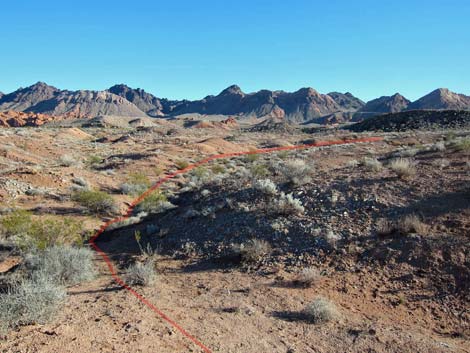
In the wash, or following an intermittent use-trail, the route runs up the wash through low red mudstone hills. The route splits (Wpt. 02) to begin the loop, although the left (return route) is hard to see. Stay to the right as the use-trail leaves the wash runs up a low ridge, eventually climbing over the higher ridgeline above and out onto gray limestone soils (Wpt. 03) and continues south towards a red sandstone crag. At the east edge of the crag (Wpt. 04), scramble through a cleft in the crag and out the other side. Beneath the northwest face of the crag, notice an eye in the rock through which the sky can be seen. Leaving the sandstone crag (Wpt. 05), the route runs southwest across gravel soils and eventually drops into the bottom of a canyon (Wpt. 06) where the walls are towering red sandstone crags. In the wash, the route runs generally southeast, eventually climbing out of the canyon (Wpt. 07) and regaining the gray desert flats beyond (Wpt. 08). |
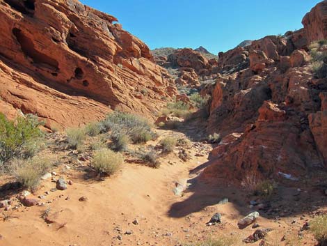
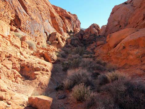
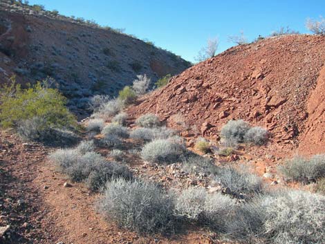
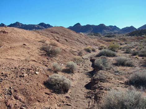 Wash leading away from the trailhead |
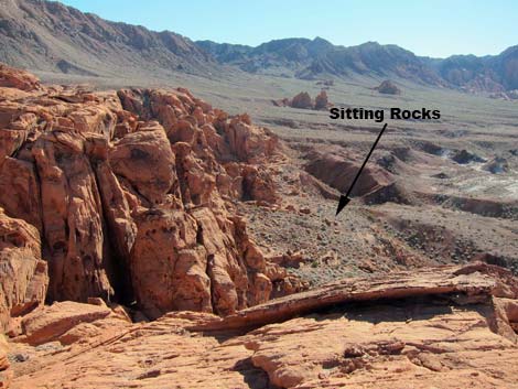
The route continues southwest, eventually arriving at a rocky overlook (Wpt. 09) where the land ahead falls away and provides grand views into Pinto Valley. Dropping off the overlook to the northwest, the route circles around to the head of a steep chute (Wpt. 10), then drops between towering sandstone walls onto a broad platform with scattered flat-topped boulders (Wpt. 11) seemingly intended for sitting and enjoying the view. From the sitting rocks, the route continues southeast along the base of the cliffs that tower above. Generally staying high, the route passes the mouth of a box canyon (Wpt. 12), then continues south, still staying high along the base of the cliffs to a corner (Wpt. 13). The route turns the corner (Wpt. 13) and climbs northeast towards a low saddle upon which sits an enormous boulder (Wpt. 14). Passing the boulder, a broad hidden canyon is revealed. |
 |
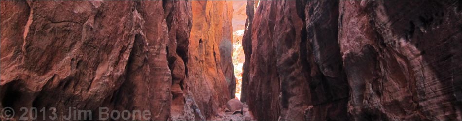
Continuing into the canyon, the route runs northeast and passes great examples of "Indian marbles," small round sandstone balls formed when water moves through the solid sandstone and minerals (probably iron) precipitate around a nucleus and glue together the grains of sand. During surface erosion, the concretions erode more slowly than the surrounding rock, resulting in marbles that will be a hiking hazard farther along the route. The route runs through the hidden valley, then bends to the left into a narrower slot canyon. When the canyon appears to end (Wpt. 15), the route turns hard to the right and scrambles up a 3rd-class pour-over, which actually still is the main wash. Above the pour-over, the route enters a long, narrow canyon running southeast that eventually opens into a broad area drained by a sandy wash (Wpt. 16). The route follows the wash down through deep and very tight narrows (take you pack off tight; Wpt. 17) before emerging into the sunshine at the far end (Wpt. 18). Be sure to examine the varnished wall adjacent to the exit slot. |
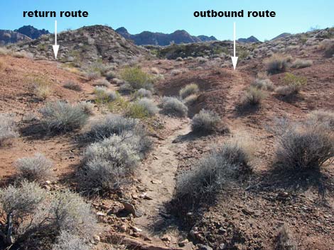 The route splits to start the loop (Wpt. 02) |
From the exit, the route runs onto the sandstone heading south until arriving at a highpoint on gray gravel soils (Wpt. 19). The route then begins heading south and east, generally staying on desert soils and avoiding the red sandstone. Looking over the hillside, it becomes apparent that there are pour-overs and water pockets in the canyon below that would have blocked the route (Wpt. 20). Staying more-or-less on gray gravel soils, the route continues southeast and climbs onto a highpoint (Wpt. 21) overlooking the entire sandstone area as it spreads out to the north. This is essentially the south-most point on the route. Beyond the overlook, the route descends to the northeast, finds a gully (Wpt. 22), and drops through it heading north. Before long, a gap (Wpt. 23) in the right sandstone wall permits passage to the northeast. Running through the gap, the route heads out onto gray desert soils and skirts around the south side of the sandstone (Wpt. 24; Wpt. 25) before crossing a wash and climbing onto a low dirt saddle (Wpt. 26). Crossing over the saddle and following down between sandstone crags provides easy access to the desert flats below. |
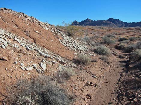
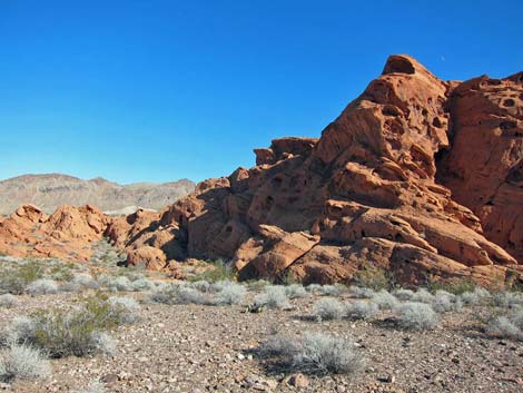
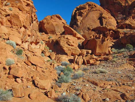
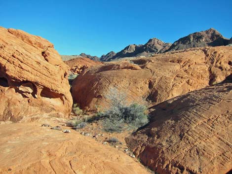
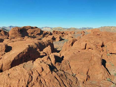
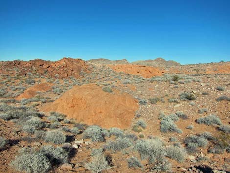
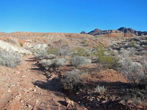
 Approaching the first sandstone outcrop |
Continuing generally northwest, the route turns up a side canyon (Wpt. 27) and begins running northeast across desert flats on a use-trail. The use-trail eventually runs up the edge of a canyon (Wpt. 28), then descends to the south before curving back around to the northeast and dropping into a major wash (Wpt. 29). This wash is followed almost back to the trailhead, but a pour-over (Wpt. 30) must be passed on the left. Beyond the pour-over, the route drops immediately back into the wash, but it might be easier to just stay above the wash until the low ridge runs naturally back into the wash. Continuing down the canyon, the wash eventually makes a hard bend to the left, cutting through white and yellow mudstones. On turning the corner, a bank of red mudstones lies ahead (Wpt. 31). At that point, the route exits the wash to the left, climbs over a low saddle, and rejoins the original route (Wpt. 02) in a small wash. The wash flows north and back to the trailhead (Wpt. 01). |
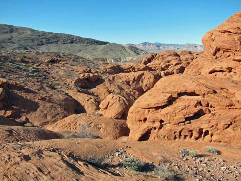
 Northeast face of the first outcrop |
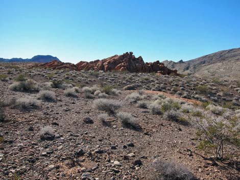
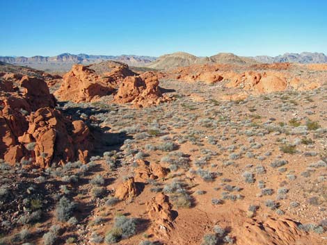
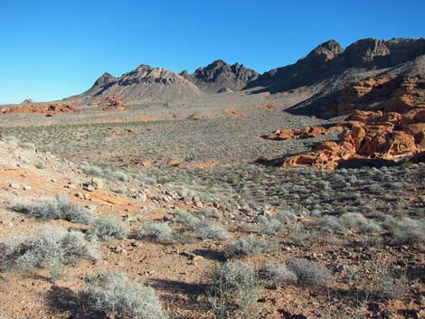
 Looking back at the first outcrop |
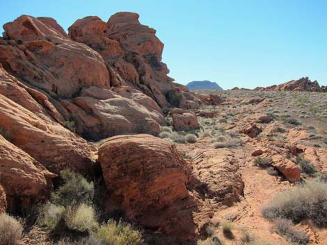
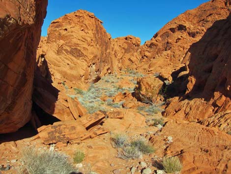
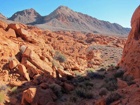
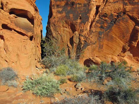
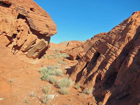
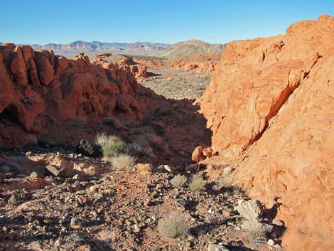
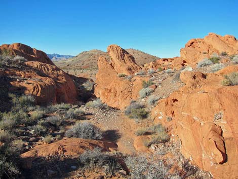
 Approaching the second sandstone outcrop ... |
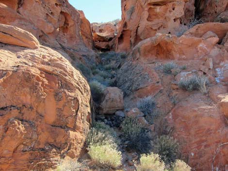
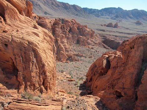
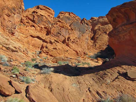
 which turns out to be a sandstone canyon |
 Wash in the sandstone canyon (Wpt. 06) |
 Exit from the sandstone canyon (Wpt. 07) |
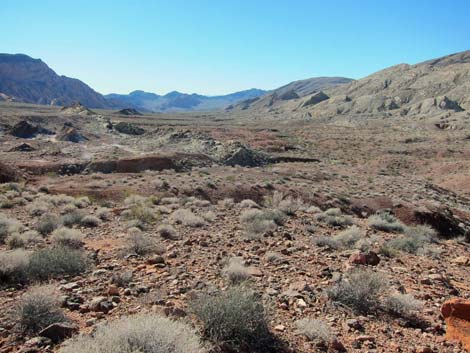
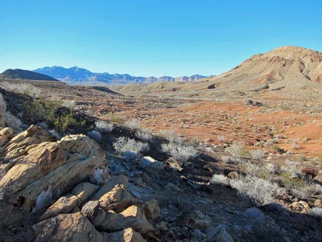
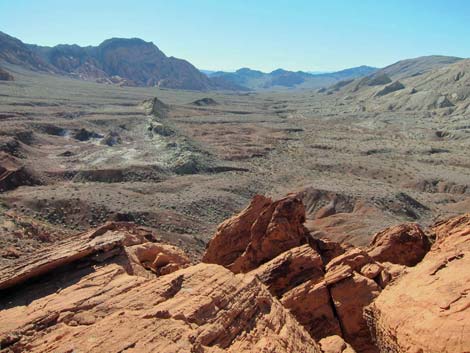 Pinto Valley overlook (Wpt. 09; view into Pinto Valley) |
 Pinto Valley overlook (Wpt. 09; view of route) |
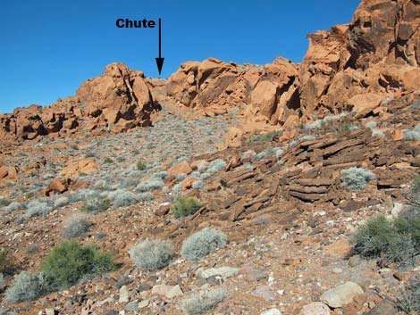
 Steep descent chute (Wpt. 10) |
 Near sitting rocks (Wpt. 11; view back up route) |
 Sitting rocks (Wpt. 11; view into Pinto Valley) |
 Colorful crags |
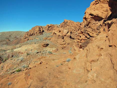
 View ahead |
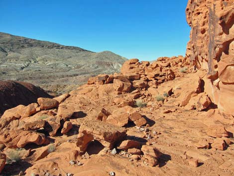
 Looking back |
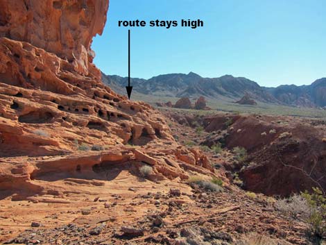
 Looking back (route stays against cliffs) |
 Corner (Wpt. 13), looking towards saddle |
 Hidden Valley (Wpt. 14) |
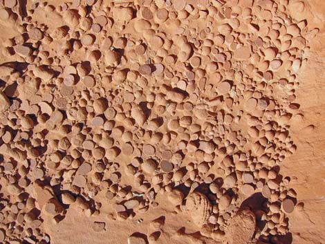 Indian marbles |
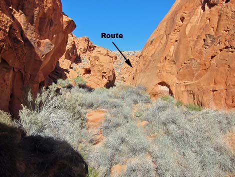 Route appears to exit canyon ahead, but turns right at Wpt. 15 |
 Long, narrow canyon |
 Emerging onto open area (approaching Wpt. 16) |
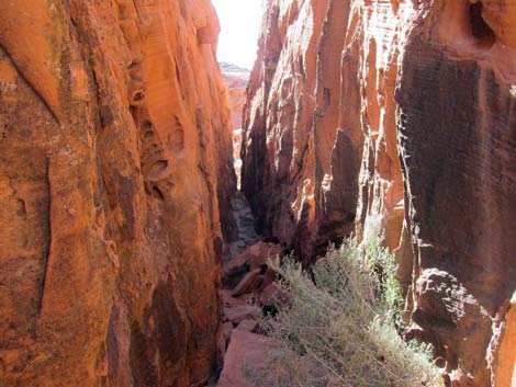 Entering narrow slot (Wpt. 17) |
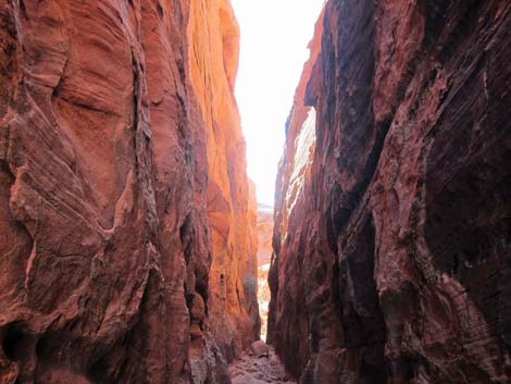 Narrow slot (Wpt. 17) |
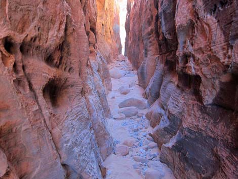 Narrow slot (Wpt. 17) |
 Exit from narrow slot (Wpt. 18) |
 Crossing sandstone |
 Looking back |
 Skirting the sandstone (Wpt. 20) |
 Southern overlook (Wpt. 21; view north) |
 Gap (Wpt. 23) in the sandstone permitting passage to the NE |
 View N from a highpoint |
 Atop low saddle (Wpt 26; view north) |
 Crossing desert soils (near to Wpt. 27) |
 Top of slope (Wpt. 28) |
 Main wash (view N) |
 Main wash (view N) |
 Main wash (view E; approaching exit, Wpt. 31) |
 View from a highpoint looking towards trailhead |
Table 2. Hiking Coordinates Based on GPS Data (NAD27; UTM Zone 11S). Download Hiking GPS Waypoints (*.gpx) file.
| Wpt. | Location | UTM Easting | UTM Northing | Elevation (ft) | Point-to-Point Distance (mi) | Cumulative Distance (mi) | Verified |
|---|---|---|---|---|---|---|---|
| 01 | Trailhead | 721398 | 4013553 | 2,116 | 0.00 | 0.00 | Yes |
| 02 | Start of Loop | 721540 | 4013343 | 2,136 | 0.22 | 0.22 | GPS |
| 03 | Desert Flats | 721526 | 4013215 | 2,170 | 0.09 | 0.31 | GPS |
| 04 | Near Edge of Sandstone | 721482 | 4012922 | 2,254 | 0.22 | 0.53 | GPS |
| 05 | Far Edge of Sandstone | 721409 | 4012834 | 2,259 | 0.09 | 0.62 | GPS |
| 06 | Bottom of Canyon | 721357 | 4012676 | 2,230 | 0.12 | 0.74 | GPS |
| 07 | Climb out of Canyon | 721451 | 4012524 | 2,288 | 0.15 | 0.89 | GPS |
| 08 | Desert Flats | 721413 | 4012529 | 2,310 | 0.03 | 0.92 | GPS |
| 09 | Pinto Valley Overlook | 721290 | 4012375 | 2,318 | 0.15 | 1.07 | GPS |
| 10 | Top of Chute | 721265 | 4012394 | 2,305 | 0.03 | 1.10 | GPS |
| 11 | Sitting Rocks | 721291 | 4012246 | 2,195 | 0.12 | 1.22 | GPS |
| 12 | Box Canyon | 721321 | 4012196 | 2,166 | 0.04 | 1.26 | GPS |
| 13 | Corner | 721330 | 4012086 | 2,180 | 0.09 | 1.35 | GPS |
| 14 | Enormous Boulder | 721372 | 4012101 | 2,205 | 0.03 | 1.38 | GPS |
| 15 | Base of Pour-Over | 721495 | 4012374 | 2,251 | 0.22 | 1.60 | GPS |
| 16 | Wash | 721569 | 4012212 | 2,288 | 0.15 | 1.75 | GPS |
| 17 | Slot | 721517 | 4012145 | 2,282 | 0.06 | 1.81 | GPS |
| 18 | End of Slot | 721480 | 4012109 | 2,259 | 0.03 | 1.84 | GPS |
| 19 | Highpoint | 721476 | 4012059 | 2,298 | 0.04 | 1.88 | GPS |
| 20 | Edge of Outcrop | 721524 | 4012014 | 2,320 | 0.06 | 1.94 | GPS |
| 21 | Highpoint Overlook | 721639 | 4011967 | 2,358 | 0.10 | 2.04 | GPS |
| 22 | Top of Gully | 721675 | 4011984 | 2,346 | 0.04 | 2.08 | GPS |
| 23 | Gap | 721648 | 4012065 | 2,331 | 0.07 | 2.15 | GPS |
| 24 | Edge of Sandstone | 721759 | 4012154 | 2,379 | 0.10 | 2.25 | GPS |
| 25 | Edge of Sandstone | 721843 | 4012161 | 2,342 | 0.07 | 2.32 | GPS |
| 26 | Low Saddle above Gully | 721872 | 4012216 | 2,352 | 0.04 | 2.36 | GPS |
| 27 | Side Canyon | 721803 | 4012401 | 2,325 | 0.13 | 2.49 | GPS |
| 28 | Edge of Canyon | 721928 | 4012490 | 2,338 | 0.11 | 2.60 | GPS |
| 29 | Wash | 722059 | 4012554 | 2,277 | 0.12 | 2.72 | GPS |
| 30 | Pour-Over | 721951 | 4012766 | 2,227 | 0.17 | 2.89 | GPS |
| 31 | Exit Wash | 721645 | 4013334 | 2,144 | 0.56 | 3.45 | GPS |
| 02 | Start of Loop | 721540 | 4013343 | 2,136 | 0.07 | 3.52 | GPS |
| 01 | Trailhead | 721398 | 4013553 | 2,116 | 0.22 | 3.74 | GPS |
Happy Hiking! All distances, elevations, and other facts are approximate.
![]() ; Last updated 240326
; Last updated 240326
| Hiking Around Lake Mead | Hiking Around Las Vegas | Glossary | Copyright, Conditions, Disclaimer | Home |