Hiking Around Las Vegas, Lake Mead National Recreation Area
 |
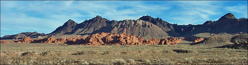
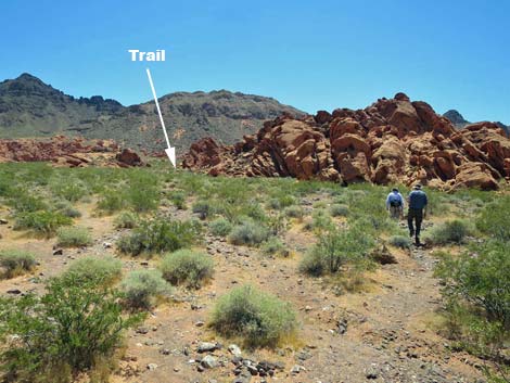
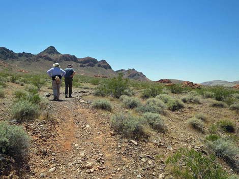
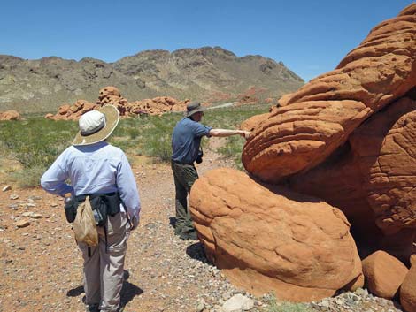
Overview This 0.5-mile trail runs south from the Redstone Picnic Area to make a scenic loop around a large, red sandstone crag before returning to the picnic area. Signs at the trailhead provide information about the local geology. This is a nice, scenic little nature trail. The outbound trail seems to wash out during flashfloods, but when the trail is hard to find, keep an eye on the left side of the big sandstone crag that lies south of the trailhead. In addition to the trail, the piles of red sandstone provide a great place for families to scramble and climb around on the rocks. Even for those who don't walk the loop trail, this is a fun little area. Link to map. |
 |
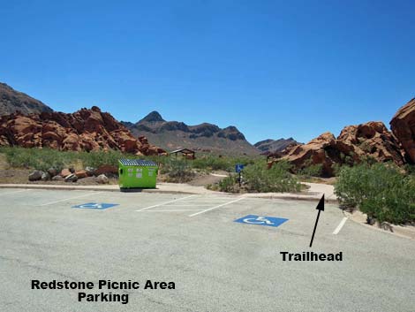
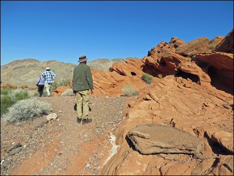
Watch Out Other than the standard warnings about hiking in the desert, ...this is a safe trail if you stay on the trail. The rocks are inviting, so if you climb on the outcrops, watch your step and watch your kids. While hiking, please respect the land and the other people out there, and try to Leave No Trace of your passage. Also, even though this hike is short, be sure to bring what you need of the 10 Essentials. Getting to the Trailhead This hike is located along Northshore Road in Lake Mead National Recreation Area, about 1 hour northeast of Las Vegas. From town, drive out to Lake Mead, then drive north on Northshore Road for about 27.0 miles to the Mile 27.0 (Redstone) Trailhead. Park here; this is the trailhead. |
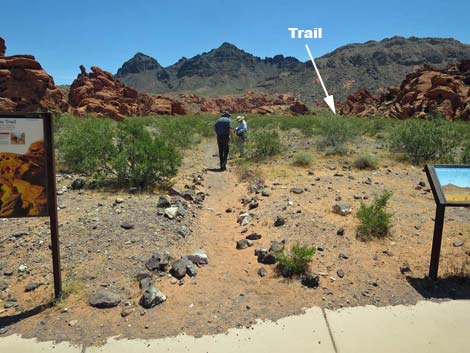 |
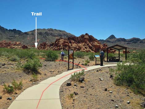
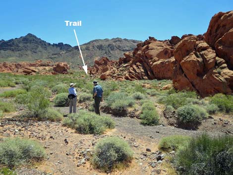
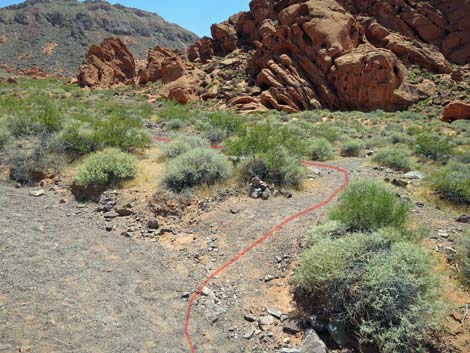
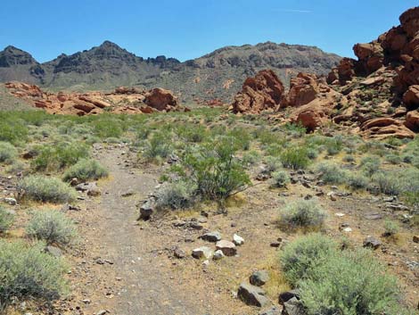
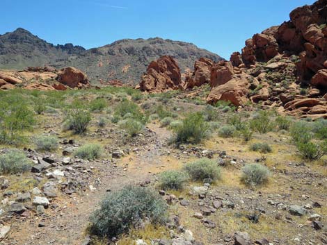
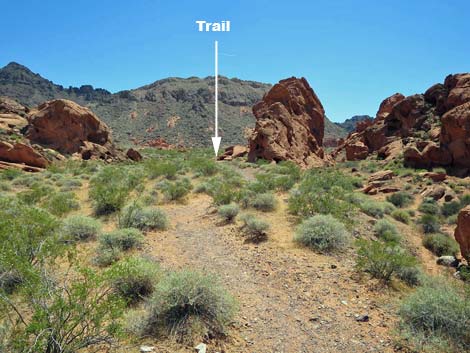
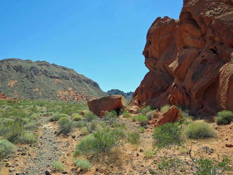
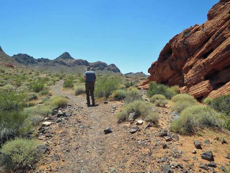
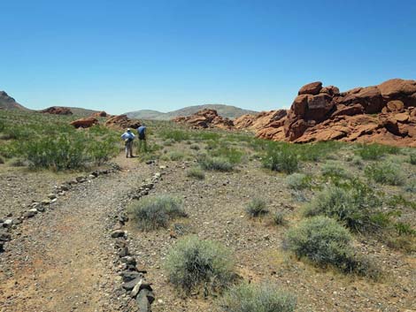
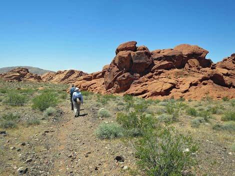
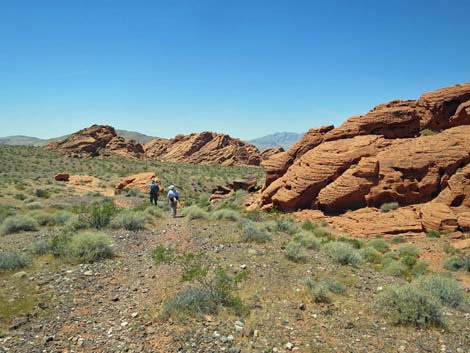
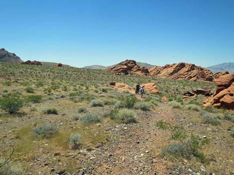
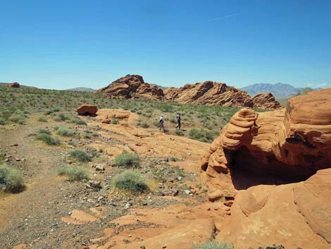
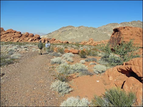
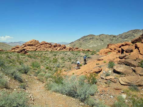
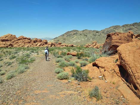
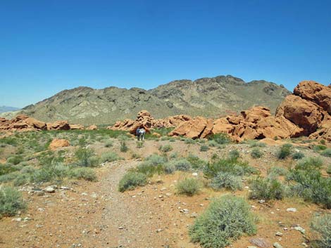
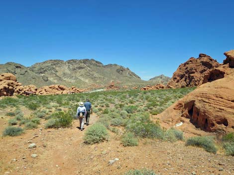
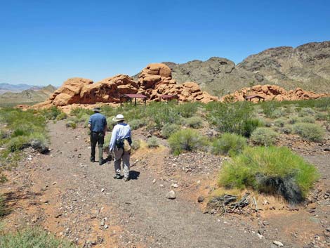
The Hike From the trailhead (Table 1, Waypoint 01), a concrete trail runs around the left side of a sandstone crag into the picnic area. A few yards out the trail, two information signs border the start of the trail, which runs south into the desert. Initially, the trail is well-maintained, but soon it runs into an area that seems to frequently flashflood, washing out the trail. Even so, the walking is easy walking and barely more than level. With or without a constructed trail, hikers should continue south-southeast towards the east (left) side of a large red sandstone outcrop (Wpt. 02). Continuing towards the left side of the crag, hikers will eventually cross the wash-out area and find the trail again. The trail runs around the east side of the outcrop to the southeast corner (Wpt. 03), loops around the back to the southwest (Wpt. 04) and northwest (Wpt.05) corners, and returns through the picnic area to the trailhead (Wpt. 01). |
 |
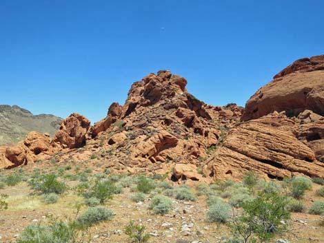
This is a scenic area where the bright red sandstone outcrops contrast with the gray limestone mountains. There are several other outcrops in the area, and the views in all directions are spectacular. Although this trail is short, and I wouldn't go out there just to hike it, trail is well worth a visit if you are out at the lake for some other reason. For example, this would be a good place to stop with out-of-town visitors who don't have the time to take a longer hike. For those fortunate enough to visit after a windstorm, the sand along the trail will have been smoothed out by the wind, and there will be many animal tracks in the soft, smooth sand. There should be many tracks from kangaroo rats, pocket mice, lizards, beetles, and perhaps a snake. Watch for marks left by these animals as they went about their daily (or nightly) activities. Kangaroo rats have long tails and hop like kangaroos, so they leave paired footprints on each side of a tail mark. You can tell how fast they were moving by the distance between the foot marks. |
 |
Lizards walk on all four feet, so they leave tail tracks with lots of footprints scattered along the tail mark. Beetles leave all sorts of footprints, usually some regular pattern of closely spaced marks; these often look mechanical. Snake tracks, and you rarely see these, look like a wide, smooth, flat, continuous depression in the sand with little mounds of sand pushed up where the snake pushed against the ground while moving along. Count yourself among the lucky if you see a snake track. |
 |
 |
 |
 |
 |
 |
 |
 |
 |
 |
 |
 |
 |
 |
 |
 |
 |
 |
 |
 |
 |
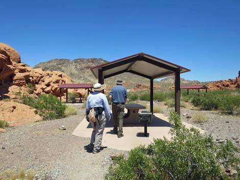 |
Table 1. Hiking Coordinates Based on GPS Data (NAD27; UTM Zone 11S). Download Hiking GPS Waypoints (*.gpx) file.
| Wpt. | Location | Easting | Northing | Elevation (ft) | Point-to-Point Distance (mi) | Cumulative Distance (mi) | Verified |
|---|---|---|---|---|---|---|---|
| 01 | Trailhead | 723297 | 4013463 | 2,238 | 0.00 | 0.00 | GPS |
| 02 | East corner | 723420 | 4013237 | 2,299 | 0.16 | 0.16 | GPS |
| 03 | Southeast corner | 723402 | 4013164 | 2,323 | 0.05 | 0.21 | GPS |
| 04 | Southwest corner | 723246 | 4013129 | 2,300 | 0.10 | 0.31 | GPS |
| 05 | West edge | 723225 | 4013298 | 2,275 | 0.11 | 0.41 | GPS |
| 01 | Trailhead | 723297 | 4013463 | 2,238 | 0.11 | 0.52 | GPS |
Happy Hiking! All distances, elevations, and other facts are approximate.
![]() ; Last updated 240326
; Last updated 240326
| Hiking Around Lake Mead | Hiking Around Las Vegas | Glossary | Copyright, Conditions, Disclaimer | Home |