Hiking Around Las Vegas, Hiking Lake Mead NRA, Hiking Wilderness Areas
 |
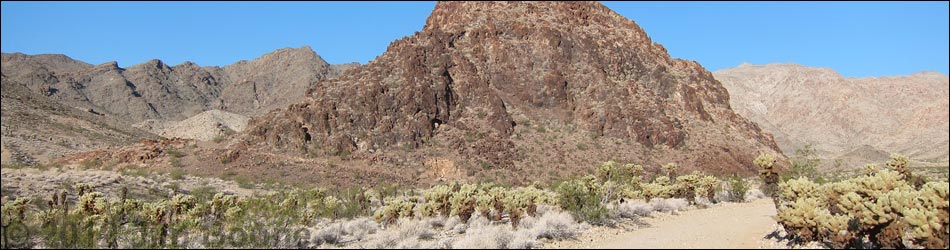
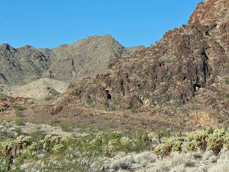
Overview This point of interest along Rockefeller Mine Road provides visitors with a site to stop, get out of the vehicle, stretch the legs, and recall a time when men, with hopes for a better life just like ours, toiled in the desert trying to dig gold, copper, and silver from these hard-rock mountains. Mining activity here probably dates from about 1910-1920. This point of interest offers great solitude, grand scenery, and the chance to visit an historic mining area. Link to map. |
 |
Watch Out Other than the standard warnings about hiking in the desert, ...the area near the road is fairly safe, but other prospects and mines in the area are not. While holes in the ground are inherently interesting, old mines are never safe -- Stay Out, Stay Alive! Remember that this area is remote, and visitors are far from help, so be careful. Access to this area requires a high-clearance vehicle. While out and about, please respect the land and the other people out there, and try to Leave No Trace of your passage. This site is near Wilderness, so pay particular attention to respecting the land. If visitors wander from the road, nobody will find you, so be sure to bring the 10 Essentials. Cell phones don't work. |
 Adit and cement wall |
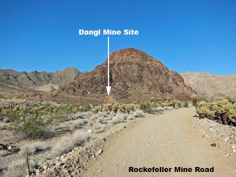
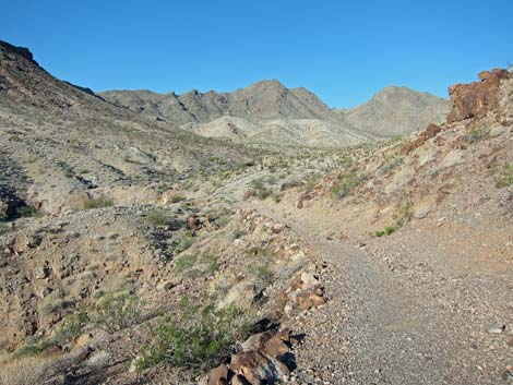
Getting to the Site This point of interest is located in Lake Mead National Recreation Area, about 2 hours south of Las Vegas, east of Searchlight. From town, drive south on Highway 95 to Searchlight (Table 1, Site 0927). In downtown Searchlight, turn left onto Cottonwood Cove Road and drive east for 7.8 miles) to Rockefeller Mine Road (Site 1320) on the left. Drive generally northward on Rockefeller Mine Road for 9.55 miles to a pullout on the left (southwest) side of the road (Site 1356) at the base of a rocky hill. Park here; this is the site. If drivers miss the site, the signed intersection (Site 1323) of Rockefeller Mine Road with Camp Dupont Mine Road and Opal Mountain Road is about 0.1 miles farther up the road. |
 |
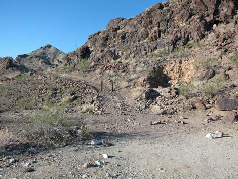
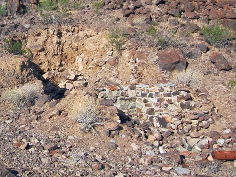
The Site Near the Rockefeller Mine Road, the site includes an old adit, now collapsed, with a cement wall that perhaps was a loading dock where ore could be loaded directly onto trucks. Among the rubble in the collapsed adit are pieces of stove pipe, perhaps indicating that the mine was deep enough to require a ventilation system. Assorted rusty cans, an old muffler, and various other worthless (but nonetheless historic) junk litters the site. Farther from the Rockefeller Mine Road, numerous prospects and mines punctuate the landscape. The Dangle Mine Road, formerly designated at NPS Road 32B, is now closed to vehicles, but it leads around the mountain to more mine sites. |
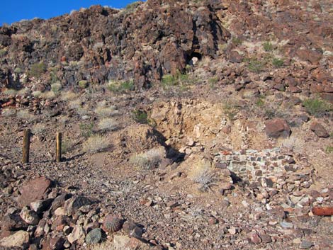 Collapsed adit near the main road |
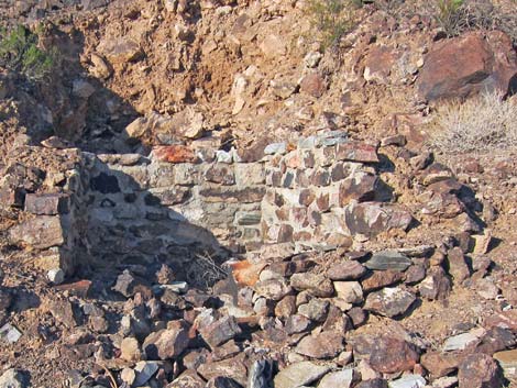 Collapsed adit and cemented walls |
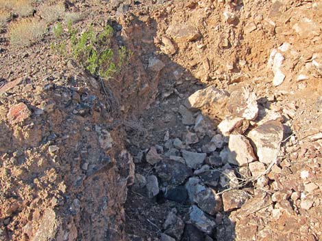 Collapsed adit |
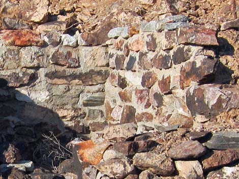 Cement wall |
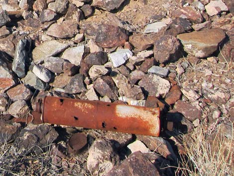 Rusting muffler and bits of junk |
 Old road leading to somewhere interesting |
Table 1. Highway Coordinates Based on GPS Data (NAD27; UTM Zone 11S). Download Highway GPS Waypoints (*.gpx) file.
| Site | Location | UTM Easting | UTM Northing | Latitude (N) | Longitude (W) | Elevation (ft) | Verified |
|---|---|---|---|---|---|---|---|
| 0927 | Hwy 95 at Hwy 164, Searchlight | 688813 | 3926424 | 35.46519 | 114.91921 | 3,500 | Yes |
| 1320 | Cottonwood Cove Rd at Rockefeller Mine Road | 701103 | 3928204 | 35.47882 | 114.78341 | 1,982 | GPS |
| 1323 | Rockefeller Mine Road at Opal Mtn Rd | 702755 | 3937877 | 35.56564 | 114.76280 | 1,768 | GPS |
| 1356 | Rockefeller Mine Road at Dangl Mine Rd | 702852 | 3937748 | 35.56446 | 114.76177 | 1,711 | GPS |
Happy Hiking! All distances, elevations, and other facts are approximate.
![]() ; Last updated 240326
; Last updated 240326
| Hiking Wilderness | Hiking Lake Mead | Hiking | Glossary | Copyright, Conditions, Disclaimer | Home |