Hiking Around Las Vegas, Lake Mead National Recreation Area, Bootleg Canyon
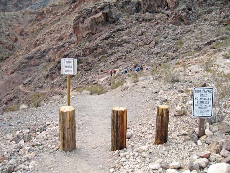
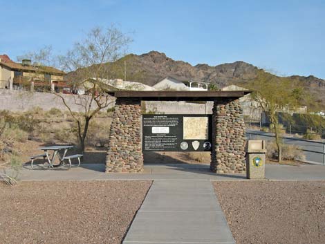 Trailhead kiosk (view northwest) |
Overview This great trail is located in the Bootleg Canyon Area of Boulder City, just outside the border of Lake Mead NRA, and was originally built by the Civilian Conservation Corps in the 1930s. The trail fell into disrepair, but Boulder City and partners found funding to restore the trail. Hikers now have a nice, paved parking lot and a maintained trail. From the trailhead, within the urban area, the trail leads out of town and up a steep, rocky canyon (following a nice trail with switchbacks) to the crest of the ridge at the saddle between Black and Red mountains. From there, maintained trails lead to overlooks on both mountains, plus a parking lot on the backside of Red Mountain, which opens other hiking possibilities. Link to map or elevation profile. |
 Start of the trail (view northwest) |
Watch Out Other than the standard warnings about hiking in the desert, ...this is a fairly safe hike. There are some places where a hiker could stumble off the trail near the crest of the mountains, but there are no unusual hazards on this trail. This trail is part of the Bootleg Canyon Bicycle Trail System, so be sure to watch for bikers careening down the trail. While hiking, please respect the land and the other people out there, and try to Leave No Trace of your passage. Also, this hike is fairly short, so just bring what you need of the 10 Essentials. Getting to the Trailhead This hike is located along Highway 93 in Boulder City, just west of the Lake Mead National Recreation Area Visitor Center, about 45 minutes southeast of Las Vegas. |
 Passing flood basin (view northwest) |
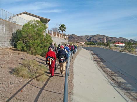
From Las Vegas, drive out to Boulder City and the Bootleg Canyon Area. From the stoplight (Table 1, Site 0802) and left turn on Highway 93 near downtown, turn left and continue eastbound on Highway 93 for 0.7 miles. Watch for a trailhead sign and left turn (Site 1016) onto a short access road that leads to a parking lot with spaces for 25 vehicles. This is the Highway 93 trailhead. Park here; this is the trailhead. The Hike From the trailhead (Table 2, Waypoint 1), the trail runs past the kiosk and picnic table going northwest between a cement-lined flood control channel and a wall at the edge of a housing development. At the edge of the housing development, the trail bends to the left and runs more-or-less west past a flood control retention basin, then continues northwest into the desert heading towards the canyon that separates Red and Black mountains. |
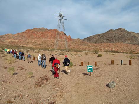
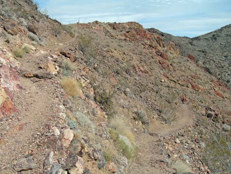
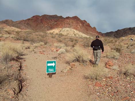 Trail junction (view northwest) |
The trail runs under high-tension powerlines and crosses the dirt powerline road (Wpt. 02), continuing ahead in the same direction. Just across the road, a sign reads: River Mountains Hiking Trail, No Bicycles. Up to about this point, the trail has been running through disturbed areas on the periphery of town where the vegetation is sparse Mojave Desert Scrub dominated by creosote bush, white bursage, and some cheesebush in washes. But beyond this point, the vegetation becomes more diverse and more typical of undisturbed desert areas. Desert senna, right at the northern limit of the species distribution is common here, and indigo bush, beavertail cactus, and silver cholla are also common. From the road crossing (Wpt. 03), the trail continues northwest, running up into low foothills and passing through a shallow canyon. The vegetation becomes more diverse, with a few desert fir and Mojave pineapple cactus adding to the mix of species on the hillsides. The trail eventually intersects an old road or broad bike trail (Wpt. 04). |
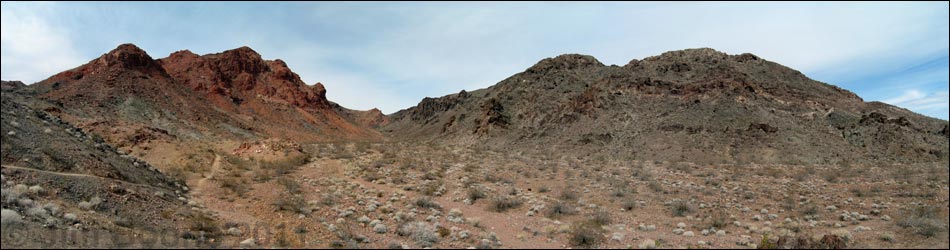
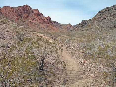 Starting into main canyon (view northwest) |
In the main canyon, the trail runs on a bench on the west side of the wash where the footing is solid, and the trail is well defined. The trail runs straight up the bench near the bottom of the canyon (Wpt. 06), then begins switch-backing up the hillside. The trail runs up three long switchbacks (4 turns), then makes a long run up the canyon. In the head of the canyon, the trail begins a long series of switchbacks (8-9 turns, depending on how you count them), and crests out at a saddle on the ridge between Red and Black mountains (Wpt. 07). |
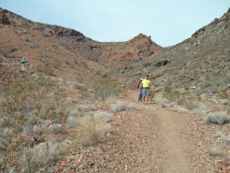 Hikers coming down from the end of switchbacks |
At the crest (Wpt. 07), the River Mountain "Foot" Trail intersects the start of two other trails (3-way intersection): the Red Mountain Trail and the Black Mountain Trail. To the left, the Red Mountain Trail runs west and up to a parking lot and Red Mountain Overlook. To the right, the Black Mountain Trail runs east and down, then up to Black Mountain Overlook. From this point, hikers can turn around and hike back down or continue on one of the other trails. Either way, the crest is a nice place to stop, relax, and enjoy the scenery. Views down the canyon give a great feeling of accomplishment and a nice overview of Boulder City. |
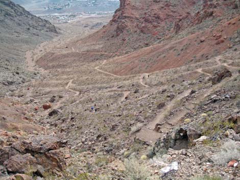 Switchbacks in canyon (view southeast) |
 Near top of switchbacks (view north) |
 Top of River Mt. Foot Trail (view SW) |
 More to come ... |
Table 1. Highway Coordinates (NAD27; UTM Zone 11S). Download Highway GPS Waypoints (*.gpx) file.
| Site # | Location | Latitude (N) | Longitude (W) | UTM Easting | UTM Northing | Elevation (feet) | Verified |
|---|---|---|---|---|---|---|---|
| 0802 | Hwy 93 at Stoplight | 35.97418 | 114.84526 | 694284 | 3983031 | 2,460 | Yes |
| 1016 | Trailhead Access | 35.98371 | 114.84151 | 694599 | 3984096 | 2,423 | GPS |
Table 2. Hiking Coordinates Based on GPS Data (NAD27, UTM Zone 11S). Download Hiking GPS Waypoints (*.gpx) file.
| Wpt. | Location | Easting | Northing | Elevation (ft) | Point-to-Point Distance (mi) | Cumulative Distance (mi) | Verified |
|---|---|---|---|---|---|---|---|
| 01 | Trailhead | 694549 | 3984193 | 2,423 | 0.00 | 0.00 | GPS |
| 02 | Powerline Road | 694230 | 3984450 | 2,509 | 0.33 | 0.33 | GPS |
| 03 | Trail Intersection | 694082 | 3984491 | 2,545 | 0.10 | 0.43 | GPS |
| 04 | Trail Intersection | 693806 | 3984753 | 2,674 | 0.29 | 0.72 | GPS |
| 05 | Bottom of Canyon | 693883 | 3985077 | 2,657 | 0.28 | 1.00 | GPS |
| 06 | Bottom of Switchbacks | 693283 | 3985610 | 2,931 | 0.54 | 1.54 | GPS |
| 07 | Top of Canyon | 692969 | 3985836 | 3,295 | 0.69 | 2.23 | GPS |
Happy Hiking! All distances, elevations, and other facts are approximate.
![]() ; Last updated 240326
; Last updated 240326
| Hiking Around Lake Mead | Hiking Around Las Vegas | Glossary | Copyright, Conditions, Disclaimer | Home |