Hiking Around Las Vegas, Gold Butte National Monument
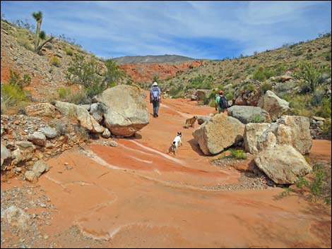
 Trailhead Parking at Whitney Pocket (view N) Trailhead Parking at Whitney Pocket (view N) |
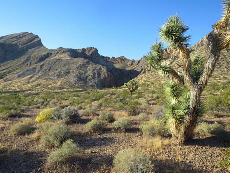
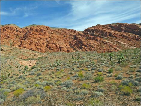
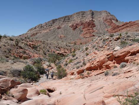
Overview Whitney Wash is an interesting hike into a broad amphitheater that hides striking red sandstone cliffs over-topped by towering limestone cliffs. As described, the hike is short, only 3 round-trip miles to a low knob with grand views all around and a sandstone cascade, but hikers are free to explore farther up the canyon and scramble on the scenic canyon walls. There are some old prospects in the canyon, but it appears someone bulldozed a road and then stopped working. Otherwise, the area is unblemished with relatively lush vegetation. This is a convenient hike because it is easily accessible from Whitney Pocket, a popular camping and picnic area in Gold Butte National Monument, that is accessible in 2WD vehicles. Link to map. |
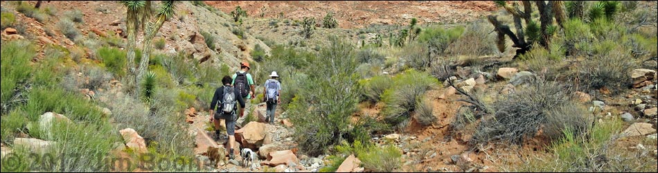
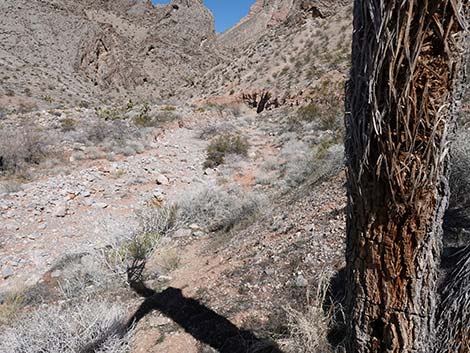
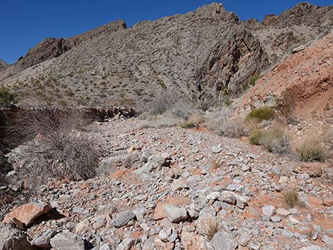
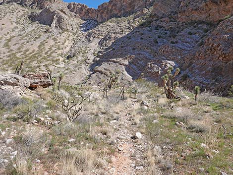
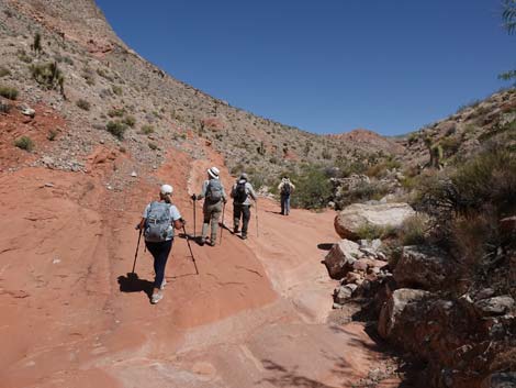
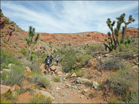
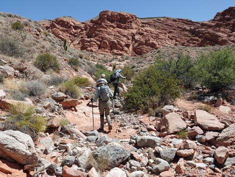
 Crossing rolling terrain heading towards canyon (view N) |
Watch Out Other than the standard warnings about hiking in the desert, ... this is a relatively safe hike for those who stay in the bottom of the wash. This is, however, a wild and remote area without services of any kind (no restrooms, no water, no gas, no food). Bring what you need to survive. Be prepared and be self-reliant. Someone will find you eventually if you stay on a main road, but be prepared to survive alone for a day or two. Cell phones don't work in the canyon. This canyon flash flooded during the summer of 2017, and it seems that all of the sand and gravel washed away, leaving many large, loose rocks boulders in the wash. The hike is now harder on the ankles and knees than it used to be. While visiting Whitney Wash, please respect the land and the other people out there, and try to Leave No Trace of your passage. Also, this is a remote area, so be sure to bring the 10 Essentials. |
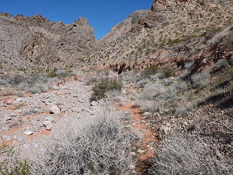
 Crossing rolling terrain heading towards canyon (view N) |
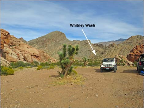
Getting to the Trailhead Whitney Wash is located above Whitney Pocket out in Gold Butte National Monument at the northeast end of Lake Mead, about 2 hours northeast of Las Vegas in a wild, remote, and scenic area. From town, drive out to Gold Butte National Monument. Drive east on Interstate-15 to Highway 170. Take Exit 112 south towards Riverside and Bunkerville. Drive south and cross the Virgin River, then quickly turn right onto the paved Gold Butte Road. Follow the pavement (there are no paved side roads) for 21 miles until it ends at Whitney Pocket. Continue south on the unpaved Gold Butte Road for about 120 yards to Whitney Pass Road, a graded road to the left. Turn left onto Whitney Pass Road and drive east 0.4 miles to a left turn into an undeveloped camping area. Drive to the far end of the camp area. Park here; this is the trailhead. |
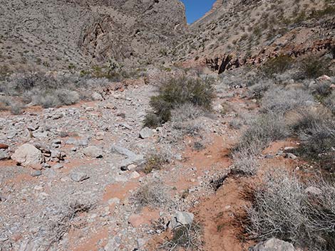
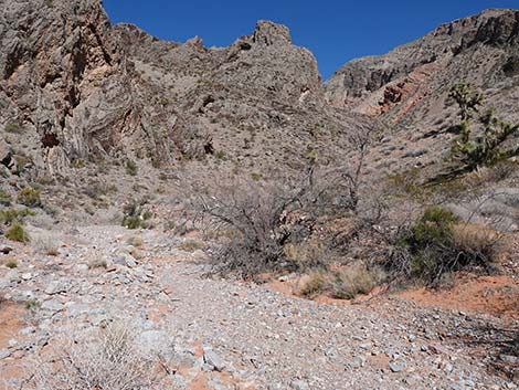
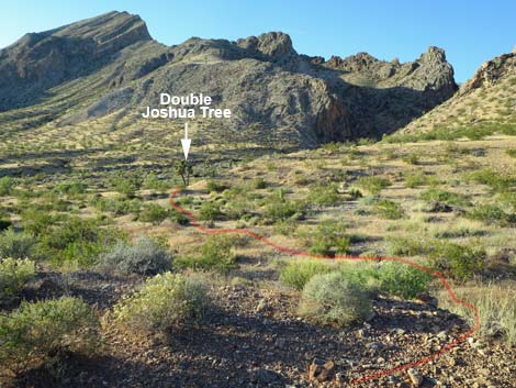 Crossing rolling terrain towards Double Joshua Tree (view N) |
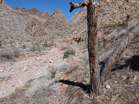
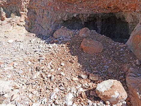
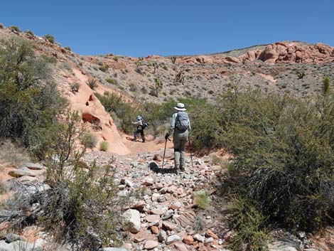
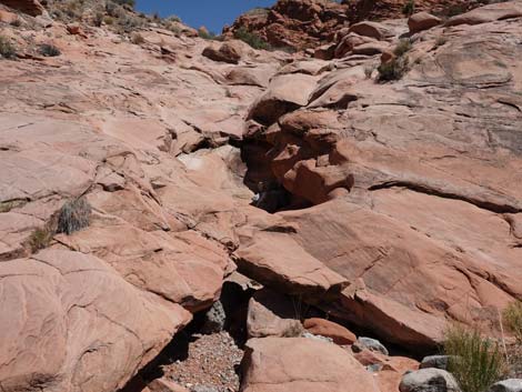
Whitney Wash From the trailhead (Table 1, Wpt. 01), the route heads north across rolling terrain, dropping into washes and climbing over low ridges aiming towards the cleft in the mountains that can be seen ahead in the middle distance (about 1/4 miles out). Walking across the rolling terrain, an old animal trail becomes visible on the right leading into the canyon. It they want, hikers can climb high enough to use this animal trail, but it is easier to stay low and reach the wash near a prominent double-Joshua tree (Wpt. 02; note that one side of the tree is dying in 2023) a few yards downhill from the animal trail. Descending a use-trail into the wash, the route turns upstream and passes a shallow cave in the canyon wall on the right. The cave exposes curious purple and green muds that perhaps were formed from volcanic ash. This cave is missed if hikers use the animal trail to access the wash bottom. The roof of the cave partially collapsed in 2020; perhaps the upper trail will collapse too. |
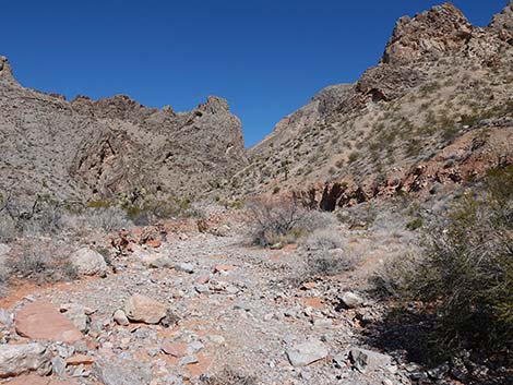
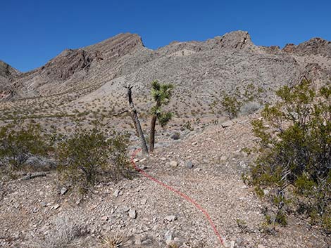 Approaching the Double Joshua Tree (view N) |
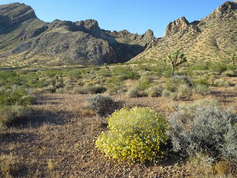
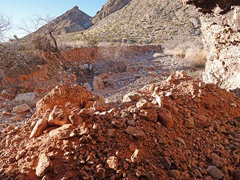
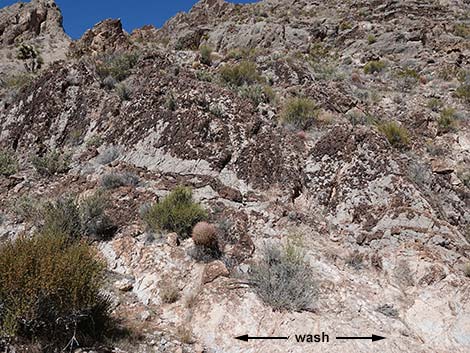
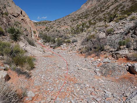
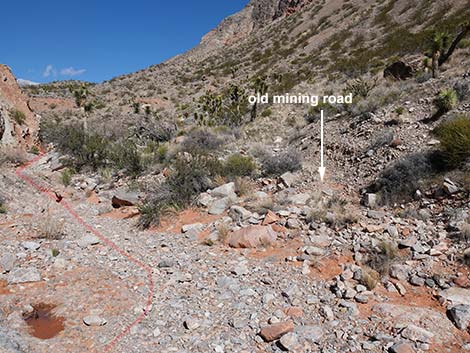
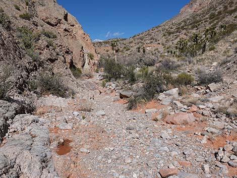
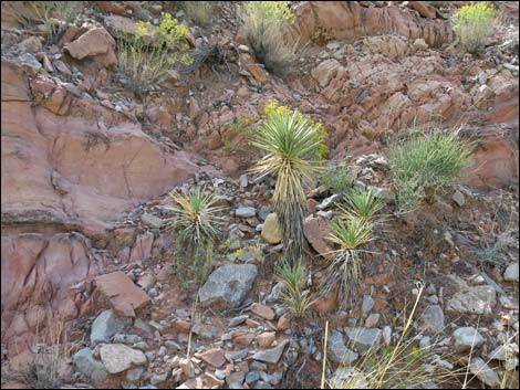
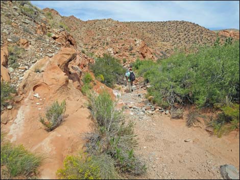
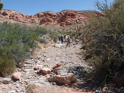
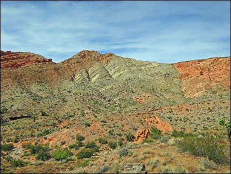
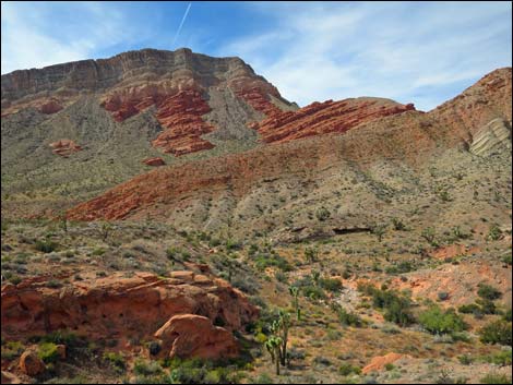
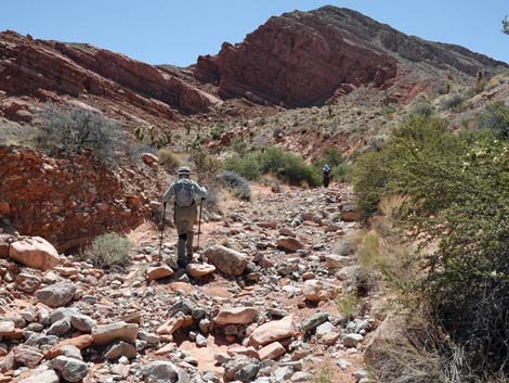
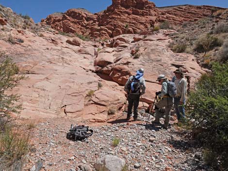
In the wash, the route heads upstream (northeast) through a bit of narrows. A bit farther up, the east wall is a thick deposit if gypsum. Just as the east (right) wall begins to lay back, an old mining road cuts up the hillside (Wpt. 03). This is not a better way to go; hikers should stay in the wash bottom. Continuing upstream, the canyon opens into a broad amphitheater. The canyon bottom remains fairly narrow while rocky slopes sweep high to limestone cliffs. Gray limestone gravels fill the wash and in places contrast with red sandstone and conglomerates, and more gypsum is exposed on the west (left) wall. Sponge fossils and horn corals are easily seen in the limestone along the wash, and even brachiopods and crinoids can be seen. Vegetation in the canyon bottom is relatively lush and diverse. On the hillsides, the vegetation is typical for this elevation: creosote bush and white bursage, sprinkled with cactus (e.g., buckhorn cholla and California barrel cactus) and Joshua trees. |
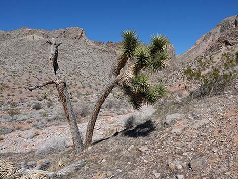 The Double Joshua Tree has seen better days (view N) |
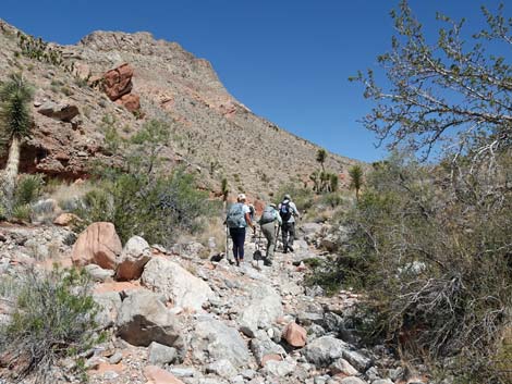
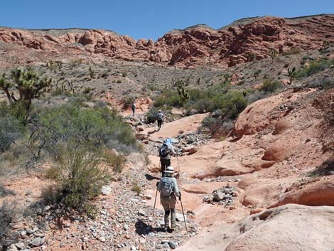
Vegetation along the wash, however, is much more diverse and includes a few species usually found at higher elevations. Species typical of this elevation include desert willow, catclaw acacia, matchweed, brittlebush, turpentinebroom, and bunchgrasses, while cliffrose, skunkbush sumac and shrub live oak at usually found higher in the mountains. Continuing up the wash, hikers can go as far as they want, but at about 1.3 miles out (Wpt. 04), there is a good place to exit the wash to the east and climb onto a low knoll (Wpt. 05) with grand views of the towering limestone and sandstone cliffs of the broad amphitheater. This is a good lunch spot. Hikers can also continue a bit farther up the wash to see a natural bridge at the bottom of a red-sandstone cascade (Wpt. 06). When ready, return to the trailhead (Wpt. 01) by following your footprints back down the wash and across the rolling terrain. Past the cave, watch for the use-trail that exits the wash to the left. |
 Route cuts down across slope into wash (view NE) |
 Route cuts down across slope into wash (view NE) |
 Route cuts down across slope into wash (view NE) |
 Route cuts down across slope into wash (view NE) |
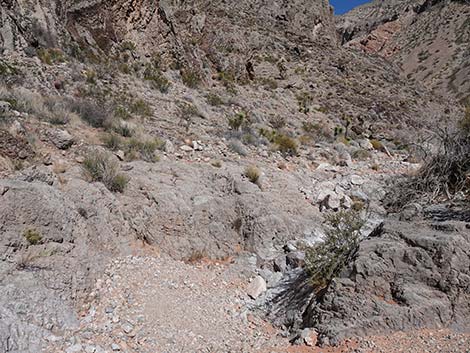
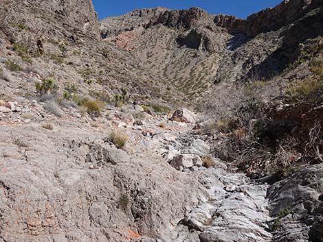
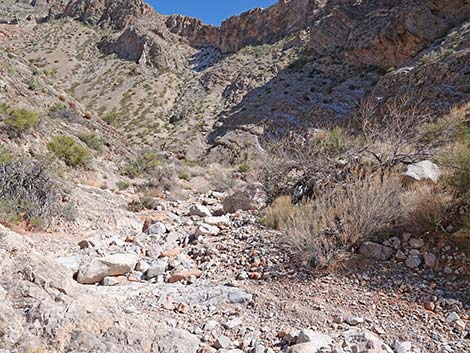
 Route now stays in wash and heads up the canyon (view NE) |
 Route stays in wash (view NE) |
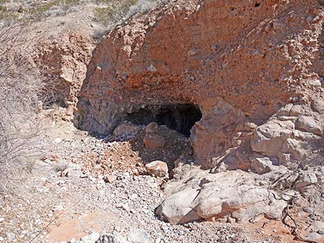 Approaching a curious wash-out cave (view NE) |
 Curious wash-out cave; the front edge has recently collapsed |
 Inside the curious wash-out cave (view NW) |
 Route continues up the wash (view N) |
 Route continues up the wash (view N) |
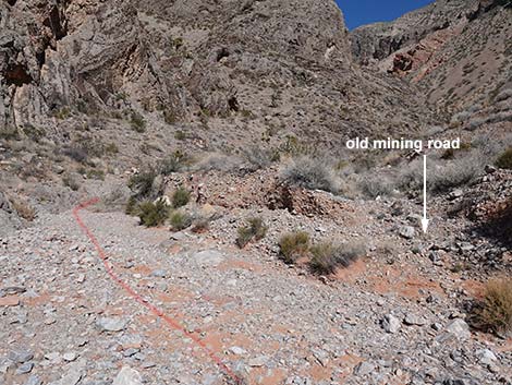 Hikers can use the old mining road (view N) |
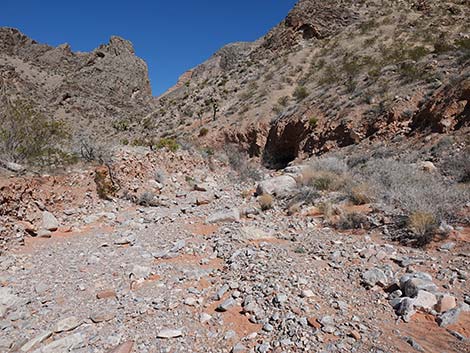
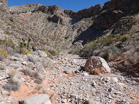
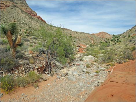
 Entering the canyon (view NE) |
 The route generally follows the bottom of the canyon (view E) |
 Route continues up the wash (view NE) |
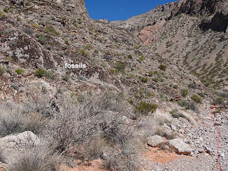 Limestone outcrop with Paleozoic trace fossils (view E) |
 Limestone outcrop with Paleozoic trace fossils (view N from wash) |
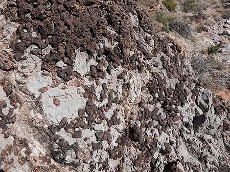 Paleozoic trace fossils |
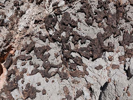 Paleozoic trace fossils: sponges or animal burrows |
 Route continues up the rocky wash (view N) |
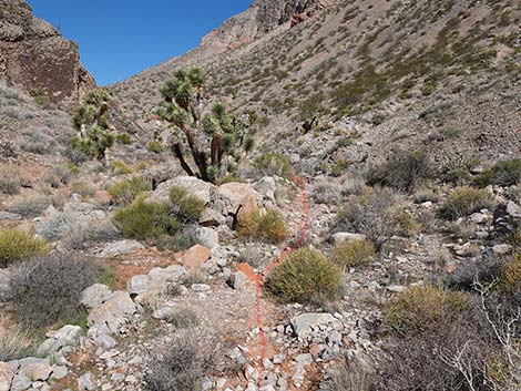
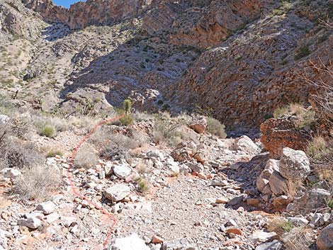 Hikers can exit the wash bottom to the left (view NE) |
 Animal trail on the bench (view NE) |
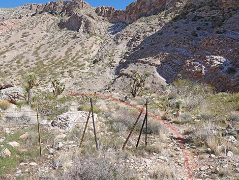 Animal trail passes historical cattle fencing (view NE) |
 Route continues along the animal trail (view NE) |
 Animal trail ends and route returns to wash bottom (view NE) |
 Route continues up the wash bottom (view N) |
 Hikers shouldn't follow the old mining road (view NNE) |
 Route continues up the wash (view N) |
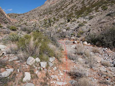
 It is best to stay in the wash bottom (view NW) |
 Young Joshua tress growing along the wash (view W) |
 Hikers crossing red-sandstone slickrock (view N) |
 The canyon opens a bit (view NW) |
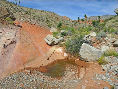 Water pocket in the wash (view N) |
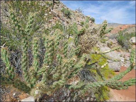 Buckhorn Cholla with Cactus Wren nest (view N) |
 The wash runs over more red-sandstone slickrock (view N) |
 Rocky outcrops along the wash (view N) |
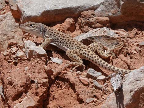 The locals are watching (Leopard Lizard; view W) |
 The canyon opens again (view N) |
 Hikers continuing up the wash (view NE) |
 Hikers approaching exiting to Lunch Knob (view NE) |
Detour to Lunch Knob
 Grand view atop lunch knob (view NW across Whitney Wash) |
 Grand view atop lunch knob (view E) |
 Grand view atop lunch knob (view W along Whitney Wash) |
 More to come ... |
Continuing to the Sandstone Cascade
 Hikers continuing up the wash (view N) |
 The wash winds around (view SE) |
 Hikers finding shade where they can (view SE) |
 Hikers continuing up the wash (view NE) |
 Hikers at base of sandstone cascade (view NE) |
 Small natural bridge in the sandstone (view NE) |
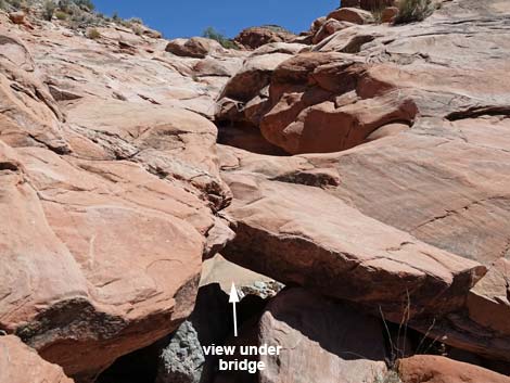 Small natural bridge in the sandstone (view NE) |
 Atop sandstone cascade, looking back down the canyon (view SW) |
Table 1. Highway Coordinates Based on GPS Data (NAD27; UTM Zone 11S). Download Highway GPS Waypoints (*.gpx) file.
| Wpt. | Location | UTM Easting | UTM Northing | Elevation (ft) | Point-to-Point Distance (mi) | Cumulative Distance (mi) |
|---|---|---|---|---|---|---|
| 01 | Trailhead Parking | 756746 | 4045757 | 2,991 | 0.00 | 0.00 |
| 02 | Enter Whitney Wash | 756674 | 4046053 | 2,940 | 0.21 | 0.21 |
| 03 | Route Stays in Wash | 756841 | 4046220 | 2,981 | 0.21 | 0.42 |
| 04 | Exit Wash to Knoll | 756917 | 4047377 | 3,139 | 0.87 | 1.29 |
| 05 | Knoll | 756965 | 4047370 | 3,190 | 0.04 | 1.33 |
| 04 | Return to Wash | 756917 | 4047377 | 3,139 | 0.04 | 1.37 |
| 06 | Base of Sandstone Cascade | 757047 | 4047441 | 3,310 | 0.13 | 1.50 |
| 01 | Trailhead Parking | 756746 | 4045757 | 2,991 | 1.50 | 3.01 |
Happy Hiking! All distances, elevations, and other facts are approximate.
![]() ; Last updated 240326
; Last updated 240326
| Hiking Around Gold Butte | Hiking Around Las Vegas | Glossary | Copyright, Conditions, Disclaimer | Home |