Hiking Around Las Vegas, Gold Butte National Monument
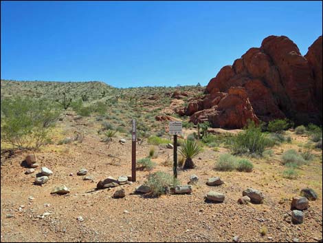
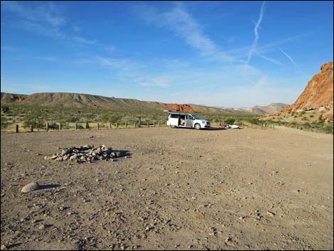 First Rock Campsite #1 Trailhead Parking (view SW) |
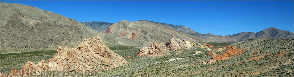
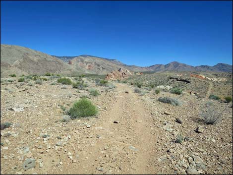
Overview The Whitney Pocket Overlook route (via Raven Ridge) starts in the First Rock Camp area and runs 3.2 miles (round trip) following gravel roads across the desert. There is no trail up the steep side of Raven Ridge, but once atop Raven Ridge, the views are surprisingly grand for a relatively low ridge. On Raven Ridge, an old road runs at mostly easy grades, past several nice overlooks to end at an overlook with great views east over the Whitney Pocket area. From the overlook, the route returns over the same route with a variation that makes a partial loop and shortens the return hike. Returning directly from the top of Raven Ridge is not a better route back to the trailhead. This route traverses Mojave Desert Scrub vegetation, passes Native American campsites and ancient rock art, and provides fairly easy access to hilltops with surprisingly grand views. Link to hiking map. |
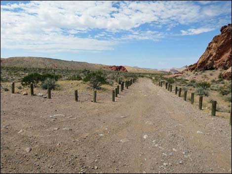 Trail starts on First Rock Campground Road (view SW) |
Watch Out Other than the standard warnings about hiking in the desert, ...this is a fairly safe hike in a wild and remote place. I encountered no unusual hazards, but be careful when hiking near edges where hikers could fall to their death -- and remember -- cliff edges can crumble. This is wild and remote country without services of any kind (no restrooms, no water, no gas, no food). Bring what you need to survive. Be prepared and be self-reliant. It is a big place, but someone will eventually find you if you stay on a main road, but be prepared to survive alone for a day or two, or even longer on side roads. While hiking, please respect the land and the other people out there, and try to Leave No Trace of your passage. Also, this is a remote hike, so be sure to bring the 10 Essentials. |
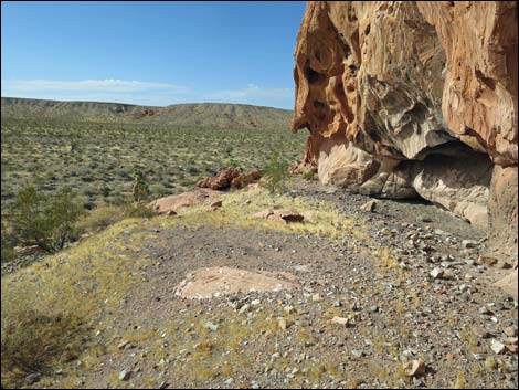
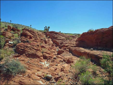
 Ancient kitchens along the road (view SW) |
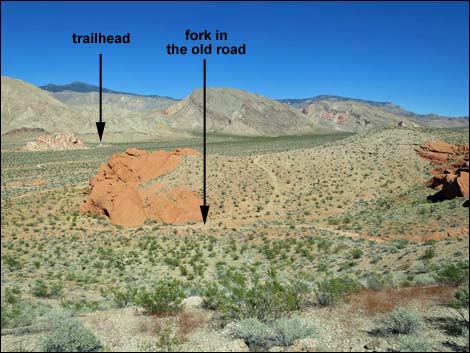
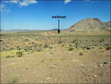
Getting to the Trailhead Raven Ridge is located out in Gold Butte National Monument at the northeast end of Lake Mead, about 2 hours northeast of Las Vegas in a wild, remote, and scenic area. From town, drive out to Gold Butte National Monument. From the start of Gold Butte Road, drive south 19.9 miles to First Rock Campground Road, which is about 1.2 miles before the pavement ends at Whitney Pocket. Turn right into First Rock Campground and drive southwest about 200 yards to the first campsite (inside the large parking corral). Park here, this is the trailhead. Be courteous if campers are already setup here. |
 Upper campsite and kitchen area (view SW) Upper campsite and kitchen area (view SW) |
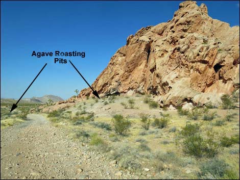
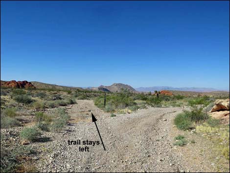
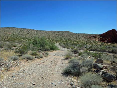
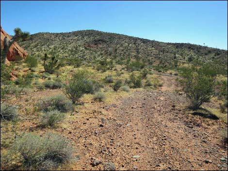
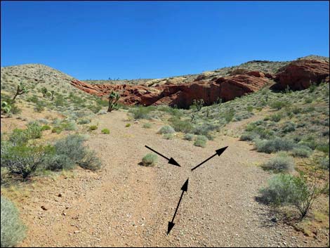
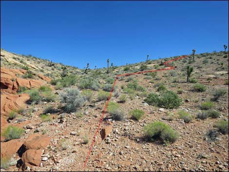
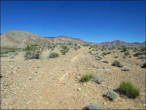
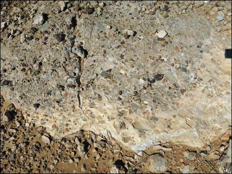
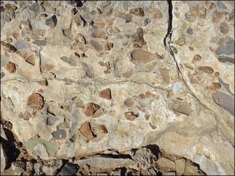
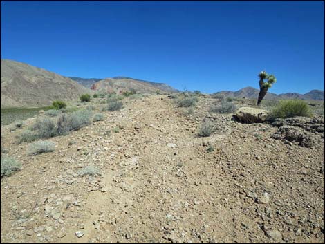
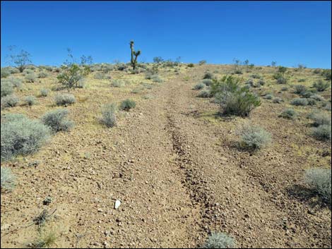
The Hike From the trailhead (Table 1, Waypoint 01), the route runs southwest following First Rock Campground Road out of the parking corral. The road starts out along the base of a sandstone crag. At the base of the vertical cliffs, notice darkened earth. This is an ancient Native American kitchen (agave roasting pit), and the darkness in the soil is soot and ash from the ancient fires. Except for the limestone cobbles, this site is so degraded that it is hard to recognize, but along the left side of the road, there is a smaller, nicely preserved agave roasting pit that still shows the circular structure with a pit in the middle. Fortunately, the road grader only nicked the edge of this archeological site. Continuing, First Rock Campground Road forks (Wpt. 02). The campground road stays right to three more campsites, but the hike takes the left fork and starts out across the desert heading towards a sandstone crag some 0.4 air-miles south-southwest. |
 Lower campsite and kitchen area (view SW) |
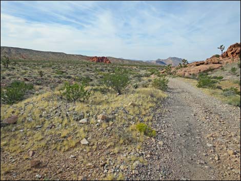
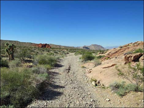
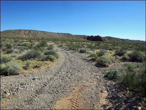
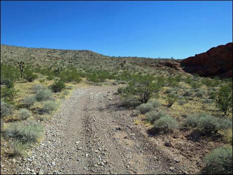
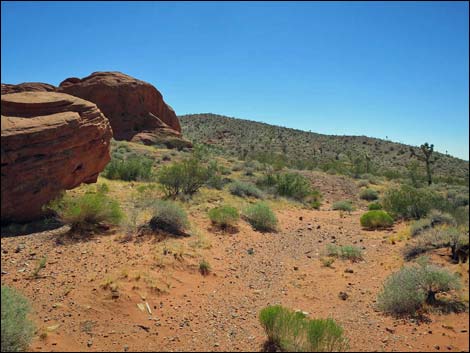
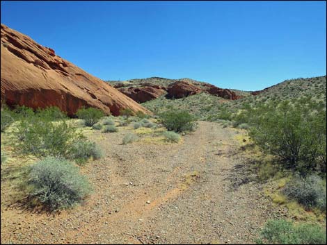
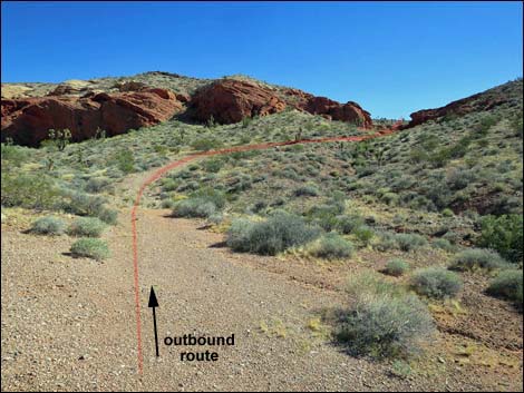
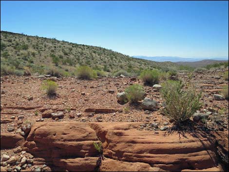
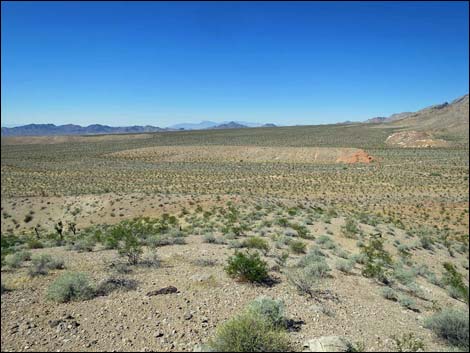
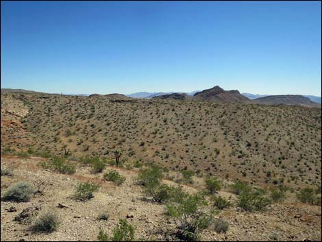
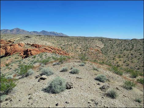
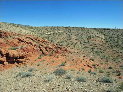
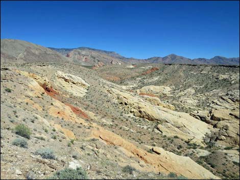
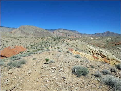
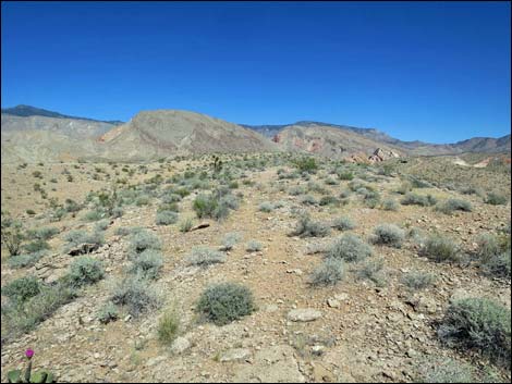
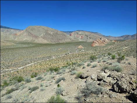
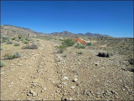
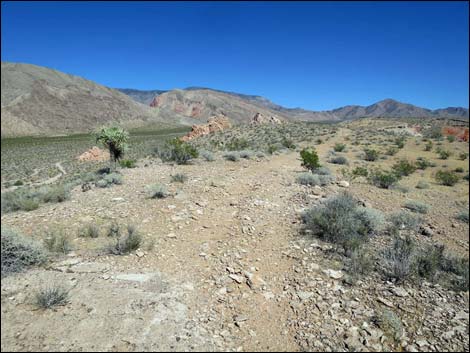
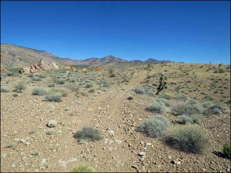
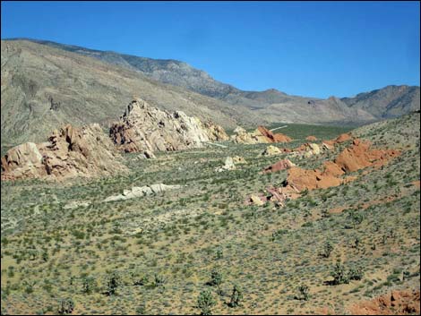
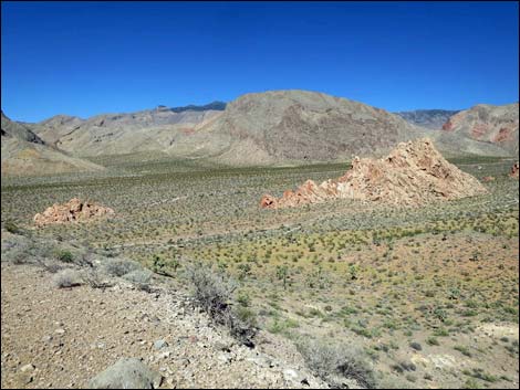
The span between the two crags is a broad, braided wash where rainwater and snow melt from the adjacent mountains is funneled into this 0.4-mile-wide area and sometimes flash floods cross the road. As a result of relatively more moisture in the soil here, the area supports a fairly robust and diverse mix of Mojave Desert shrubs. Creosote Bush, White Bursage, and Joshua Trees are common, as are Mormon Tea (aka Nevada Jointfir), Matchweed, and Indigo Bush (Fremont's Dalea). Where the route crosses the main wash, Desert Willow, Catclaw Acacia, and Mojave Rabbitbrush are common. The broad wash also harbors a remarkable covering of biological soil crust. Keep this relatively lush and diverse vegetation in mind when hiking on the dry ridgeline ahead. The road generally runs southwest across the broad wash, but it winds a bit back and forth, crosses the main wash, and then bends due west heading towards the red sandstone outcrop. In morning light, the east face of the outcrop is very bright. Before getting to the outcrop, an old, closed road forks to the left (notice Restoration-in-Progress signs) and another road forks to the right (Wpt. 03). |
 Lower campsite and kitchen area (view E) |
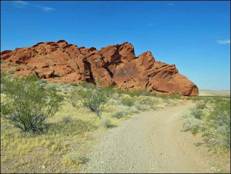
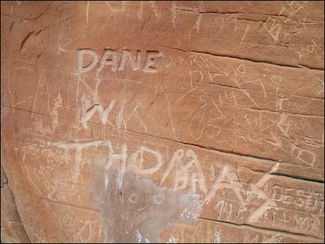
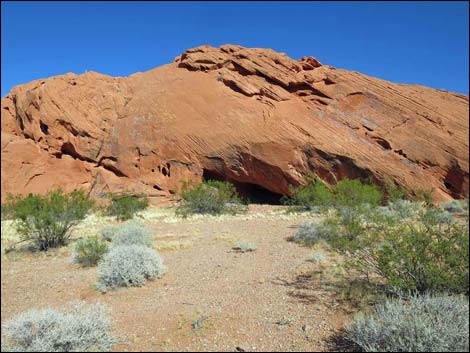
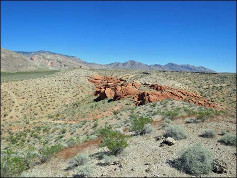
The route stays straight and passes the south edge of the sandstone outcrop. At the point of rock (Wpt. 04), it is disturbing to notice the years of graffiti where, since at least the 1930s, modern people have carved names and dates in the sandstone. The graffiti continues to the left (on the east-facing side) for several yards, and there are even bullet holes and shotgun-pellet holes in the rock (I can hear them saying: yep, aren't I special, I can shoot the rock wall with a shotgun!). Eventually, the graffiti runs out, and towards the center and south side of the wall, there are some much nicer carvings on the rock. During spring, the bird nesting season, keep an eye out for young in the Common Raven nest atop the wall. If nestlings are present, don't stay too long because the parents won't come feed their kids if humans are nearby. There is also a Mexican Free-tailed Bat colony in one of the deep cracks in the rock face. Watch (or smell) for their droppings at the base of wall. |
 The campground road continues along the crag (view SW) |
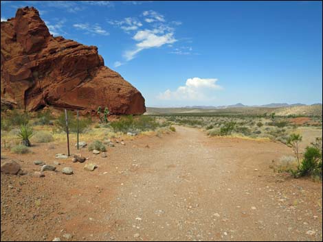
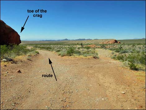
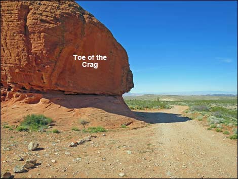
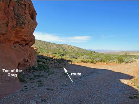
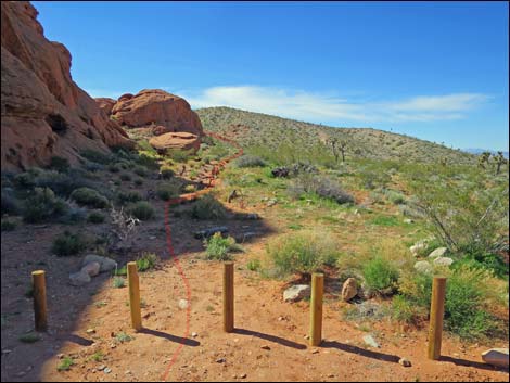
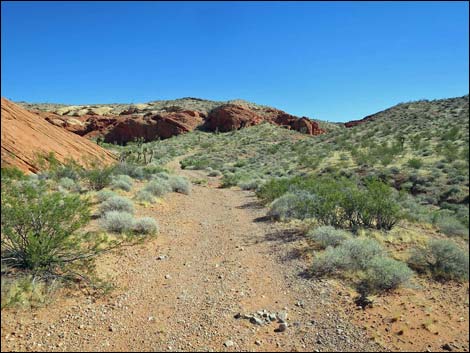
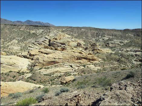
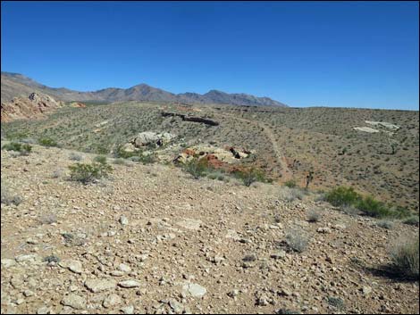
At the toe of the crag (Wpt. 04), the route wraps around the corner to head southwest. Staying along the rock wall, notice the nice examples of cross-bedding in the sandstone. Here, you can see evidence of the original sand dunes that eventually solidified to form the sandstone. Only a few yards past the toe of the crag, it becomes apparent that the route continues on an old, closed road. The old road angles away from the sandstone crag, then joins another old road (an old triangle intersection) and heads southeast. Notice on the left that there is a shallow cave at the base of the rock wall: this is another ancient campsite. The old road continues, now climbing gently, and passes the edge of more sandstone crags. At the far edge of this wall, the old road forks (Wpt. 05). Here, the route forks. Staying right, the route will eventually return on the left fork. |
 The route departs the campground road (view SW) |
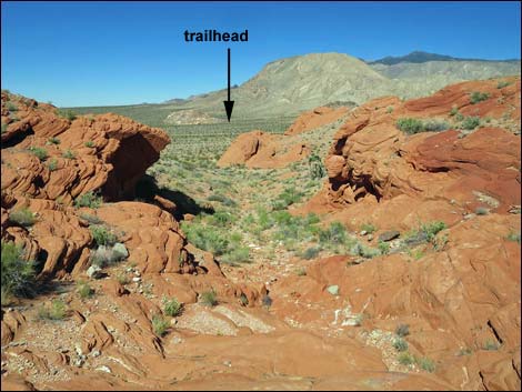
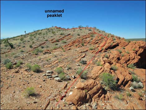
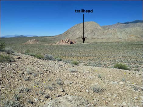
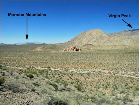
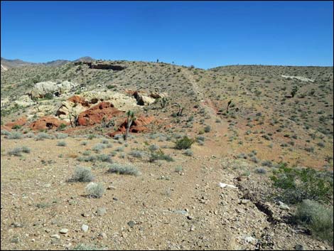
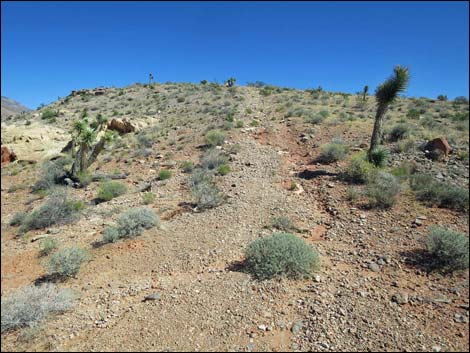
Staying right at the fork (Wpt. 05), the route follows the old road as it becomes steep and heads for a gap in the sandstone crags ahead. Shortly, the old road ends and the route follows the gully upward through the sandstone. Climbing above the red sandstone, the route reaches a low saddle (Wpt. 06). The route continues left, but it adds another scenic overlook to turn right and climb the ridgeline 100 yards northwest to the nearby unnamed peaklet (Wpt. 06a). Atop the peaklet (Wpt. 06a), grand views spread out below in all directions north (from west to east). The trailhead and the route to this point are clearly visible, as is the nearby Virgin Peak and the far off Mormon and Muddy mountains. |
 Crossing broad wash heading towards sandstone crags (view SW) |
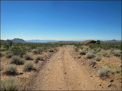
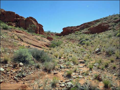
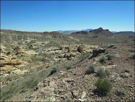
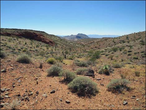
From the unnamed peaklet (Wpt. 06a), the route returns to the low saddle (Wpt. 06) and continues southeast climbing onto the ridgeline to the south. The route joins a faint old road atop the ridge (Wpt. 07) and turns left to head east. However, from this point, it is worth walking a few yards farther south to an overlook at the edge of a deep canyon with grand views south into the eroded sandstone Doodlebug Canyon and points beyond. After partaking of the view, the route continues northeast more-or-less following the ridgeline on the faint old road. There are more great views along this faint road, but eventually the faint road bends off the ridgeline to the left and angles towards a slightly higher ridgeline (Wpt. 08). Here, the faint old road joins a much more obvious old road. This ridge is much more broad, and although there are occasional views into the sandstone canyon, the feeling here is not on-the-edge. There is a layer of eroded caliche along the top of the ridge, and in a few places, it forms small caves that are always worth examining for creatures seeking relief from hot summer sunshine. |
 Winding across the broad wash (view W) |
The broad ridge is followed east-northeast on a gentle incline to near the highpoint on this ridge. At that point, the old road turns abruptly right to head down into a saddle. Before descending, however, there is another nice overlook a couple of yards left of the bend. This overlook provides nice views north, including back to the trailhead. Continuing, the old road drops rather steeply into a saddle (Wpt. 09). Here, this route crosses the Doodlebug Canyon Route, and a faint use-trail leading left and right down off the saddle can be seen. From the saddle (Wpt. 09), this route follows the old road as it climbs rather steeply onto the next ridge to the southeast. Atop this next ridge, the old road bends left to follow the crest of the ridge. Along this section, the ridgeline provides nice views, right into Amber Cat Canyon and left to the north and the trailhead. |
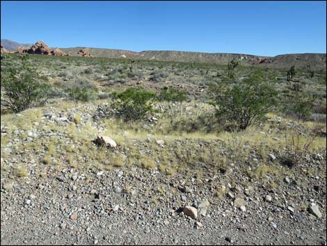
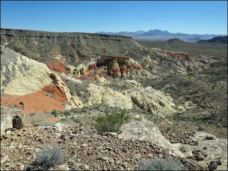
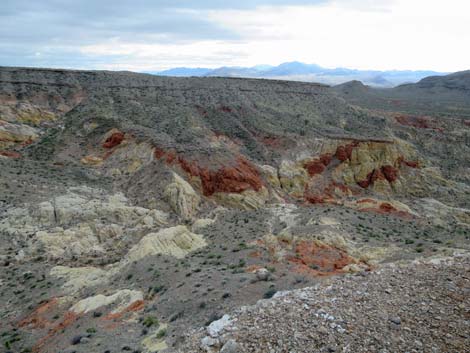
 Remarkable covering of biological soil crust in the broad wash |
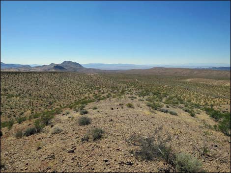
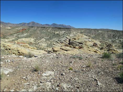
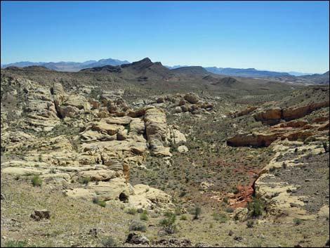
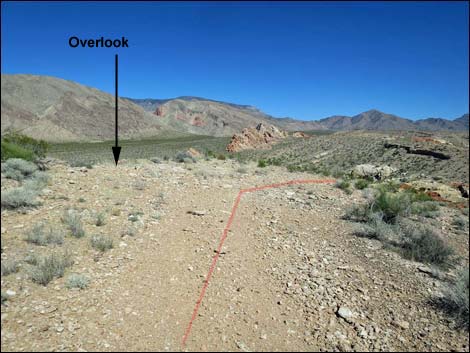
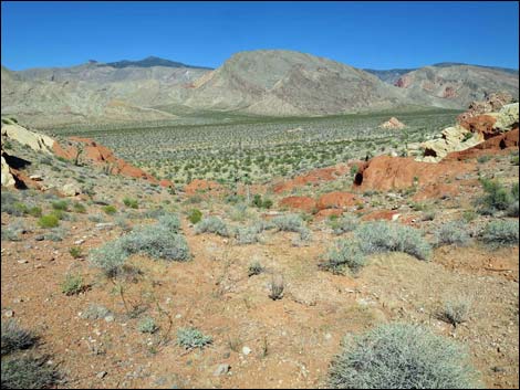
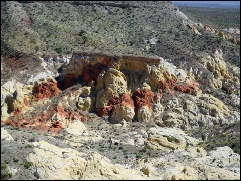
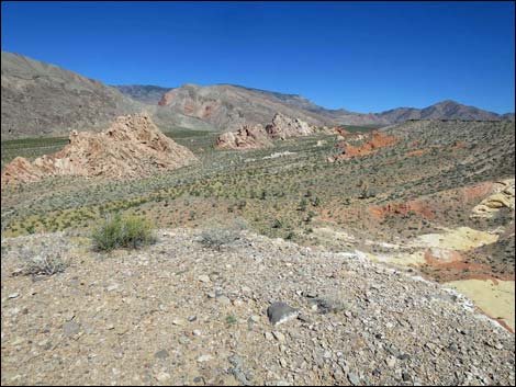
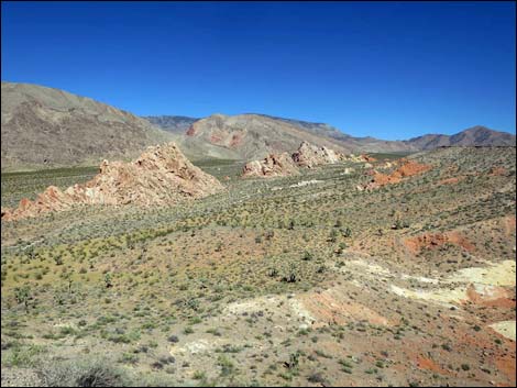
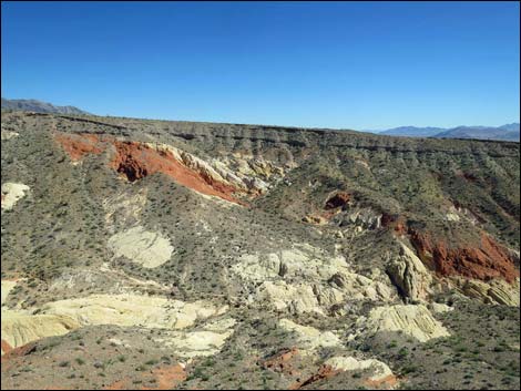
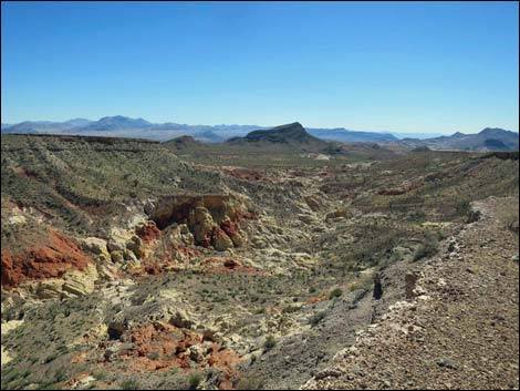
Continuing along the ridgeline, the old road eventually runs out to the end of the ridge and ends with cliffs on all sides (Wpt. 10). Here, the Whitney Pocket Overlook provides grand views east over the red and white sandstone cliffs of Whitney Pocket backed by gray limestone mountains that tower above. To the south, Amber Cat canyon opens below with striking and colorful sandstone set off by gray alluvial materials. Farther out, hikers can see the Tramp and Lime ridge complex, as well as the high peaks just south of Gold Butte Townsite. |
 Crossing the main wash heading towards sandstone crags (view S) |
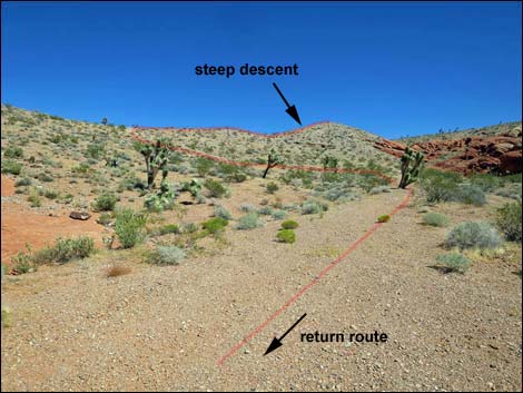
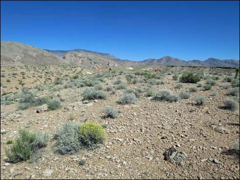
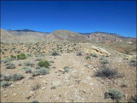
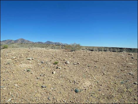
To the north, views stretch across the vast Fisherman's Cove Bajada bordered by the Virgin Ridge complex on the right and bounded by Black Ridge in the distance. In the far distance, hikers can see the Mormon Mountains, which are far to the north of Interstate 15. To the west, the near ground is the ridge system followed during the hike, but in the farther distance, hikers can look across the Virgin River to the Muddy Mountains and even the Sheep Range and Spring Mountains (Mt. Charleston) west of the Las Vegas Valley. Fortunately, none of the Las Vegas buildings are tall enough to be seen from this point. For a description of the descent, see Whitney Pocket Overlook -- The Descent. |
 Crossing broad wash heading towards sandstone crags (view S) |
 Approaching the sandstone crags (view W) |
 Fork in the road (view W; note restoration signs on left) |
 Restoration area signs (view SE) |
 At side road; route stays left past toe of the crag (view W) |
 The toe of the crag is marked with graffiti (view W) |
 Don't be that idiot, ... |
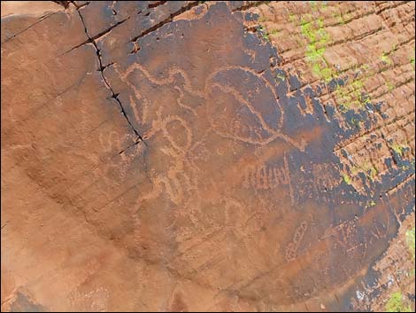 ... and especially don't mark on petroglyphs! |
 Route exits road around the toe of the crag (view W) |
 Route passes through the parking barricade (view SW) |
 The old road soon becomes apparent (view SW) |
 The old road bends left (view SW) |
 The old road follows along the base of the crags (view SW) |
 Ancient campsite in a shallow cave (view E) |
 The old road follows along the base of the crags (view SE) |
 The old road forks past the crags (view SE) |
 The left fork: the route will return this way (view S) |
 The right fork: the uphill route continues this way (view S) |
 The old road ends and the route continues up the gully (view S) |
 Approaching the saddle at the top of the gully (view SW) |
 Arriving at the saddle atop the gully (view W) |
 Looking back down the route (view NNE) |
 Detour to unnamed peaklet (view NW) |
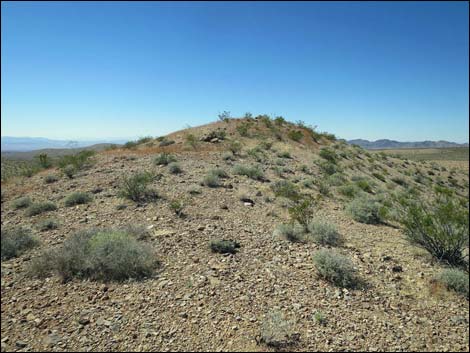 Approaching unnamed peaklet (view NW) |
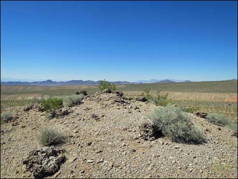 Unnamed peaklet (view NW) |
 Unnamed peaklet (view N towards Mormon Mountains) |
 Unnamed peaklet (view E towards Virgin Ridge) |
 Unnamed peaklet (view S towards Gold Butte Townsite) |
 Unnamed peaklet (view W towards Las Vegas) |
 Unnamed peaklet (view NE towards trailhead and route) |
 Departing the unnamed peaklet (view SE) |
 Descending from unnamed peaklet towards saddle (view SE) |
 Back at the saddle, route climbs side of ridge (view SE) |
 Approaching top of the next ridge with faint old road (view E) |
 Edge of the cliff on other side of the ridge (view SE) |
 Doodlebug Canyon (view E) |
 Doodlebug Canyon (view SE) |
 Doodlebug Canyon (view S) |
 Faint road atop the ridgeline (view NE) |
 Faint road atop the ridgeline (view NE and to both sides) |
 Doodlebug Canyon (view S) |
 Faint road atop the ridgeline (view NE) |
 Faint road merges with main old road (view NE) |
 Main old road runs out on broad ridgeline (view ENE) |
 Main old road approaching dip into saddle (view ENE) |
 Lots of caliche atop the ridge (view down) |
 Details of inclusions in caliche atop the ridge (view down) |
 Main old road approaching overlook (view ENE) |
 Arriving at overlook (view N towards trailhead) |
 Overlook (view N towards trailhead and Mormon Mountains) |
 Overlook (view NE towards Virgin Mountains and Whitney Pocket) |
 Main old road drops steeply into saddle (view SE) |
 Main old road approaching the saddle (view SE) |
 Saddle (view NE towards Virgin Mountains) |
 Saddle (view SW into Doodlebug Canyon) |
 Main old road climbs steeply past the saddle (view SE) |
 Arriving atop the next ridge (view E) |
 Main old road runs out along broad ridgeline (view ENE) |
 Main old road runs along broad ridgeline (view E) |
 Main old road bends right towards higher ridgeline (view SE) |
 Amber Cat Canyon (view S from main old road) |
 Amber Cat Canyon; detail of interesting detached mesa (view S) |
 Climbing towards the higher ridgeline (view SE) |
 Approaching the viewpoint: Whitney Pocket Overlook (view S) |
 Arriving at Whitney Pocket Overlook (view E) |
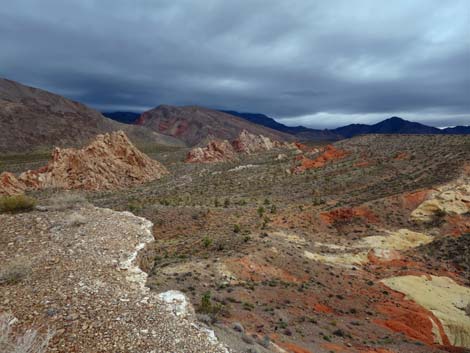 Arriving at Whitney Pocket Overlook (view E on a stormy day) |
 Whitney Pocket Overlook (view E into Whitney Pocket area) |
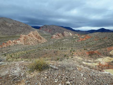 Whitney Pocket Overlook (view E on a stormy day) |
 Overlook (view E into Whitney Pocket area) |
 Overlook (view N towards Virgin Mountains) |
 Overlook (view SE into Amber Cat Canyon) |
 Overlook (view S into Amber Cat Canyon) |
 Overlook (view S into Amber Cat Canyon on a stormy day) |
 Departing Whitney Pocket Overlook (view N towards trailhead) |
Table 1. Hiking Coordinates Based on GPS Data (NAD27; UTM Zone 11S). Download Hiking GPS Waypoints (*.gpx) file.
| Wpt. | Location | UTM Easting | UTM Northing | Elevation (ft) | Point-to-Point Distance (mi) | Cumulative Distance (mi) |
|---|---|---|---|---|---|---|
| 01 | Trailhead | 754397 | 4046065 | 2,769 | 0.00 | 0.00 |
| 02 | Fork in the Road | 754309 | 4045964 | 2,749 | 0.09 | 0.09 |
| 03 | Roads Intersect | 754064 | 4045411 | 2,739 | 0.47 | 0.56 |
| 04 | Road Forks Past Crag | 754006 | 4045408 | 2,740 | 0.03 | 0.59 |
| 05 | Road Forks | 753976 | 4045256 | 2,723 | 0.12 | 0.71 |
| 06 | Lower Ridgeline | 753964 | 4045117 | 2,779 | 0.10 | 0.81 |
| 06a | West Highpoint | 753887 | 4045161 | 2,795 | 0.06 | 0.87 |
| 06 | Lower Ridgeline | 753964 | 4045117 | 2,779 | 0.06 | 0.93 |
| 07 | Upper Ridgeline | 754050 | 4045075 | 2,838 | 0.08 | 1.01 |
| 08 | Old Road | 754296 | 4045247 | 2,894 | 0.19 | 1.20 |
| 09 | Low Saddle | 754502 | 4045234 | 2,858 | 0.14 | 1.34 |
| 10 | Whitney Pocket Overlook | 754983 | 4045244 | 2,998 | 0.32 | 1.66 |
| 09 | Low Saddle | 754502 | 4045234 | 2,858 | 0.31 | 1.97 |
| 08 | Old Road | 754296 | 4045247 | 2,894 | 0.15 | 2.12 |
| 11 | Crest of Ridge | 754077 | 4045294 | 2,789 | 0.15 | 2.27 |
| 11a | Crag Summit | 754036 | 4045372 | 2,805 | 0.06 | 2.33 |
| 11 | Crest of Ridge | 754077 | 4045294 | 2,789 | 0.06 | 2.39 |
| 05 | Road Forks | 753976 | 4045256 | 2,723 | 0.08 | 2.47 |
| 04 | Road Forks Past Crag | 754006 | 4045408 | 2,740 | 0.12 | 2.59 |
| 03 | Roads Intersect | 754064 | 4045411 | 2,739 | 0.04 | 2.63 |
| 02 | Fork in the Road | 754309 | 4045964 | 2,749 | 0.47 | 3.10 |
| 01 | Trailhead | 754397 | 4046065 | 2,769 | 0.08 | 3.18 |
Happy Hiking! All distances, elevations, and other facts are approximate.
![]() ; Last updated 240326
; Last updated 240326
| Hiking Around Gold Butte | Hiking Around Las Vegas | Glossary | Copyright, Conditions, Disclaimer | Home |