Hiking Around Las Vegas, Gold Butte National Monument
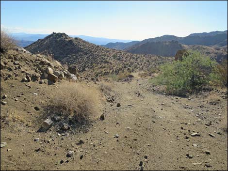
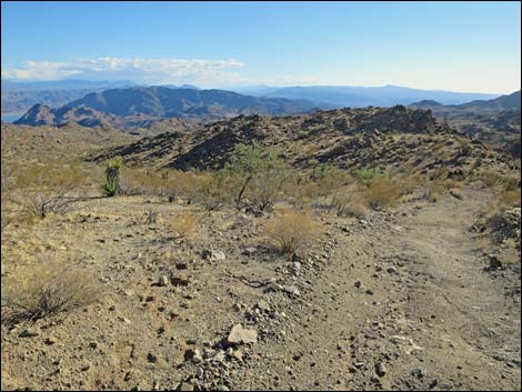
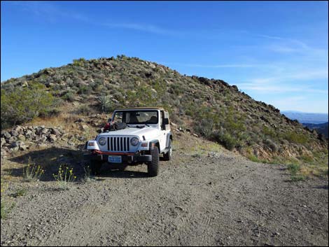 Vehicle turned around and parked atop Scanlon Trailhead (view S) |
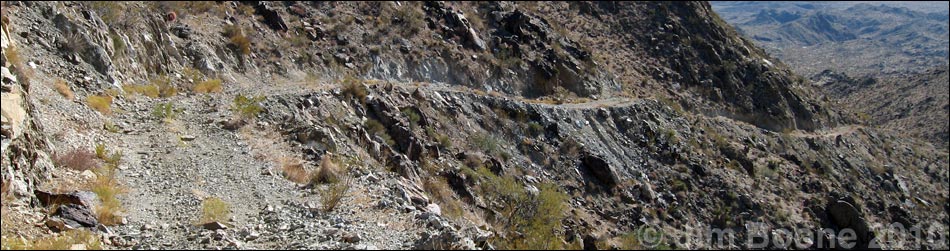
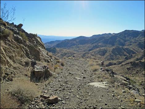
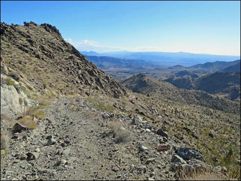
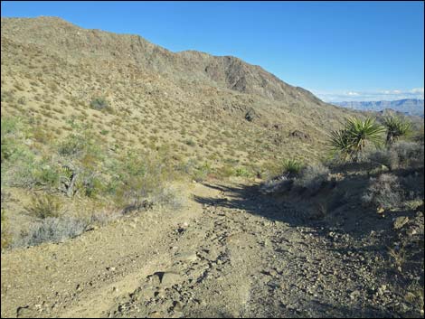
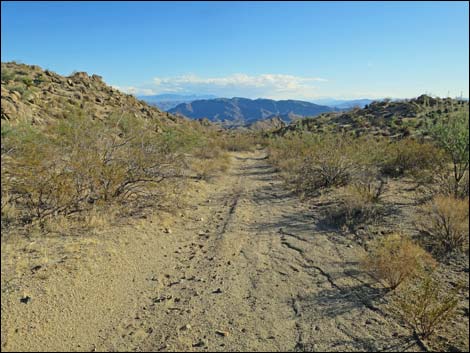
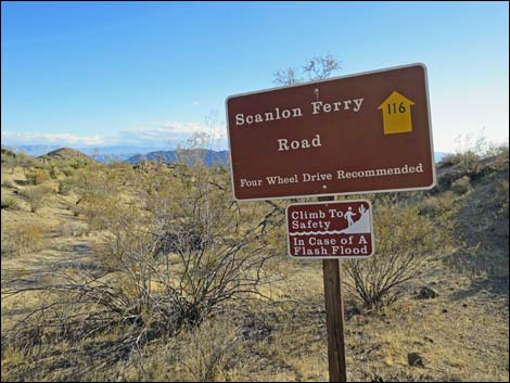
Overview Scanlon Dugway is the steep section of an historic wagon road that connected northern Arizona with southern Nevada, crossing the Colorado River at Scanlon Ferry. The "Dugway" is a section of road "dug out" of the cliffs where it climbs up Gregg Canyon to the high country between Bonelli and Jumbo peaks. The road is narrow, old, and rocky -- these days better left to hikers. The steep part of the Dugway drops 1,040 ft in 1.3 miles -- on average, a very steep roadway grade of 15%. While hiking here, consider what it must have been like to run freight wagons drawn by 6 to 12 mules through this country during the early 1900s. This historic 4-mile (round trip) hike is located about 5.5 hours from Las Vegas. Link to hiking map. Link to photos of returning up the Dugway. |
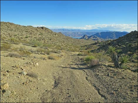
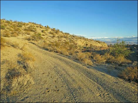
 Scanlon Dugway (view SW from trailhead) |
Watch Out Other than the standard warnings about hiking in the desert, ... this is a safe hike, but the edge of the Dugway drops away steeply, so be careful on the edge. With loose gravel on hard bedrock, it is easy to slip on steeper parts of the Dugway. This is wild and remote country without services of any kind (no restrooms, no water, no gas, no food). Bring what you need to survive. Be prepared and be self-reliant. It is a big place, but someone will eventually find you if you stay on a main road, but be prepared to survive alone for a day or two, or even longer on side roads. Consider signaling the tourist helicopters that traverse the area coming and going from the Grand Canyon. While hiking, please respect the land and the other people out there, and try to Leave No Trace of your passage. Also, even though this hike is short, the area is remote, so be sure to bring the 10 Essentials. |
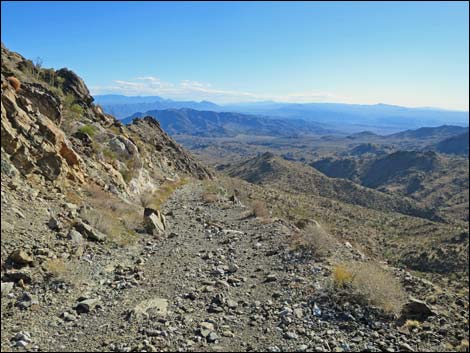
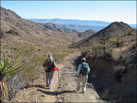
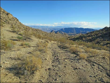
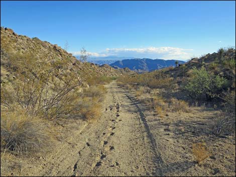
 Hikers starting down Scanlon Dugway (view SW) |
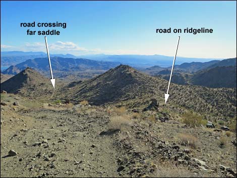
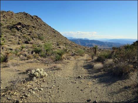
Getting to the Trailhead Scanlon Dugway is located out in Gold Butte National Monument at the northeast end of Lake Mead, about 5.5 hours northeast of Las Vegas in a wild, remote, and scenic area. From town, drive out to Gold Butte National Monument. From Whitney Pocket, continue south on the unpaved Gold Butte Road to Gold Butte Townsite. From the townsite, Scanlon Road is the main road running southwest. Drive south on Scanlon Road 14.6 miles to where the road crests a sharp ridge, which is the top of Scanlon Dugway. Stop on the ridgeline and park here; this is the trailhead. |
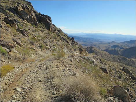
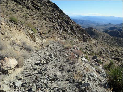
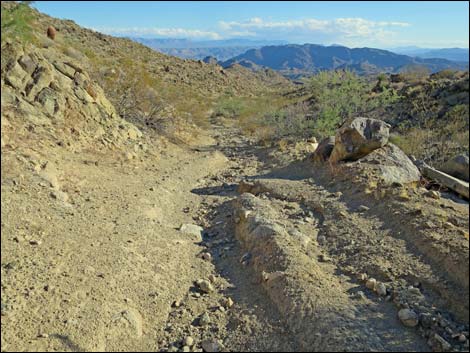
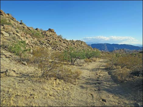
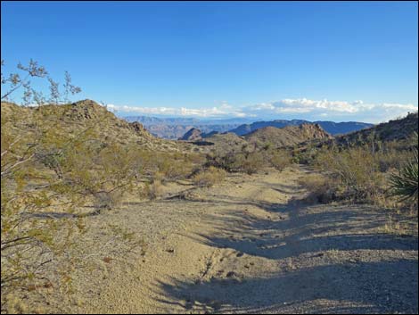
 The first curve (view SW) |
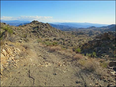
The Hike From the trailhead (Table 1, Waypoint 01), the route runs down onto the steep, narrow Dugway where the old wagon road was carved out of the rocky hillside. From the saddle, the route runs southwest and down to an abrupt and spectacular curve where the road turns sharply to the southeast. At the curve, the extent of the steep road can be seen, and one tries to imagine how a teamster could drive mules down the road without careening out of control and crashing off the cliff. This part of Gold Butte is in the Upper Sonoran (Mojave Desert Scrub) vegetation zone where sparse creosote bush and white bursage dominate the landscape, but many other species of shrubs also are common. Look for mojave yucca, catclaw acacia, and silver cholla that looks a lot like blue diamond cholla. |
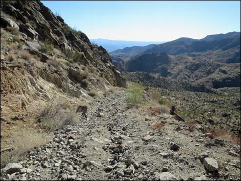
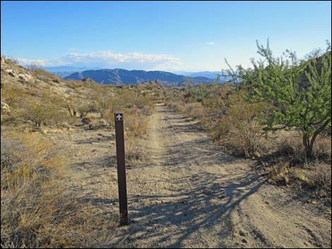
 Around the first corner (view S) |
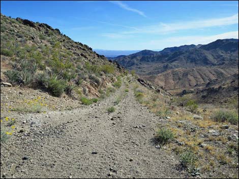
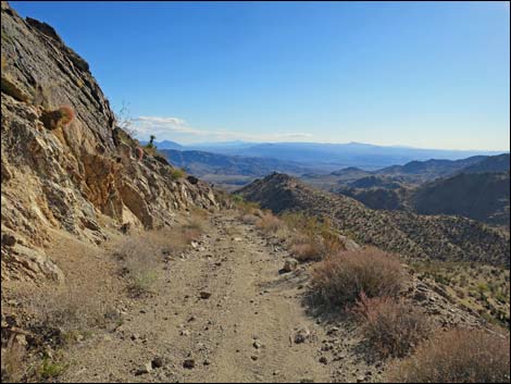
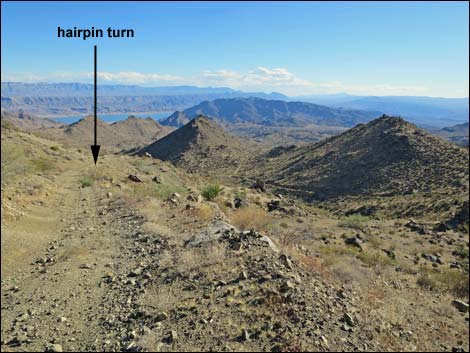
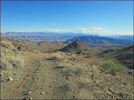
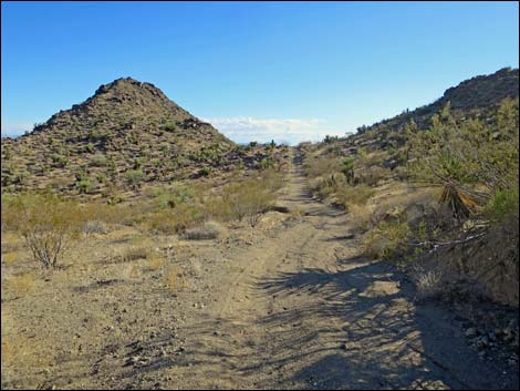
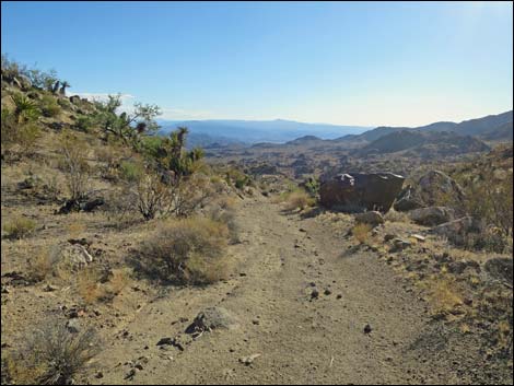
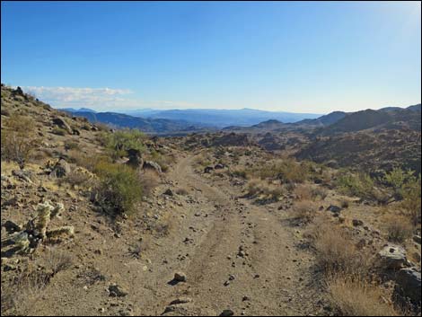
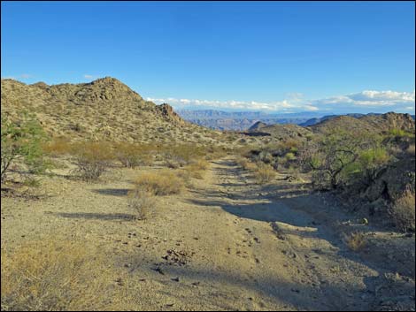
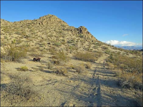
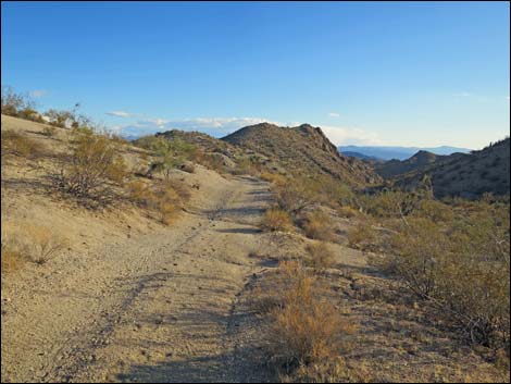
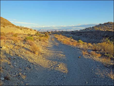
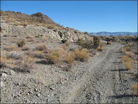
Hiking down the narrow Dugway, the road is in relatively good shape, but many parts are very steep with gravel overlying carved bedrock that makes for serious slipping hazards. About 0.44 miles out, the Dugway makes a hairpin turn (Wpt. 02) to the right that provides grand views out over the Lake Mead region. If you are driving down the Dugway and chicken out, this is the first place to turn around (of course, this is also past the bad parts). Shortly thereafter, an old USGS benchmark (Wpt. 03) set in concrete adorns the edge of the road. As hard as it is to imagine teamsters driving mules up and down the road, imagine what life was like for surveyors hiking across this country in 1935. From the benchmark, the road makes a sharp turn (Wpt. 04) to the left and continues downhill at an easier grade across a less steep hillside. The road runs down, then climbs a short distance onto a saddle, and continues downhill. Eventually the steep part of the road is passed (Wpt. 05) and the old road runs on a sandy, gentler road. |
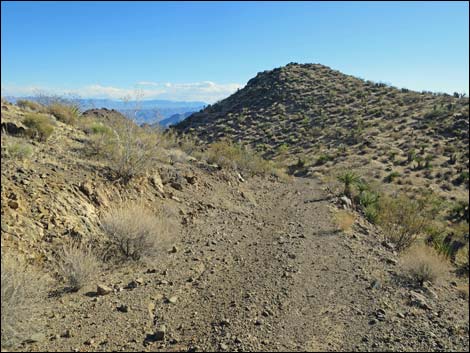
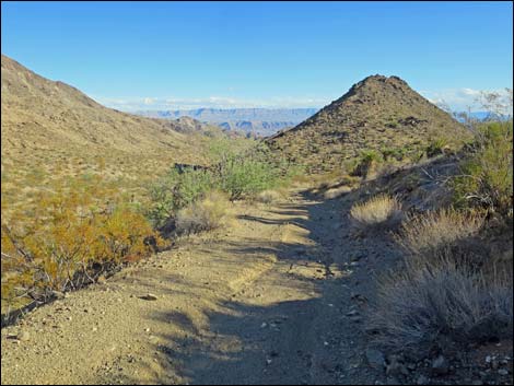
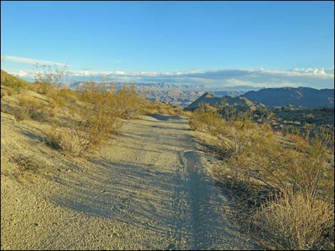
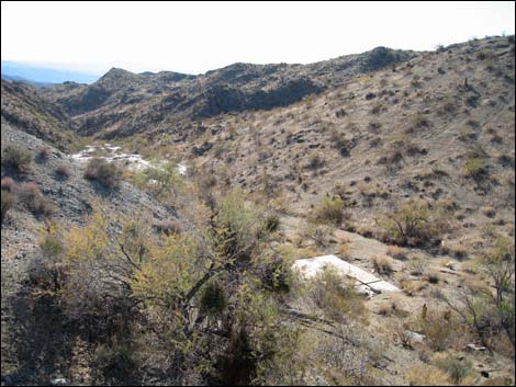
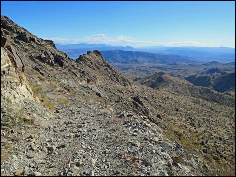 First long view of the Dugway (view S) |
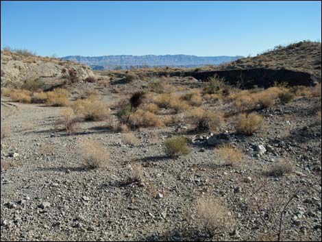
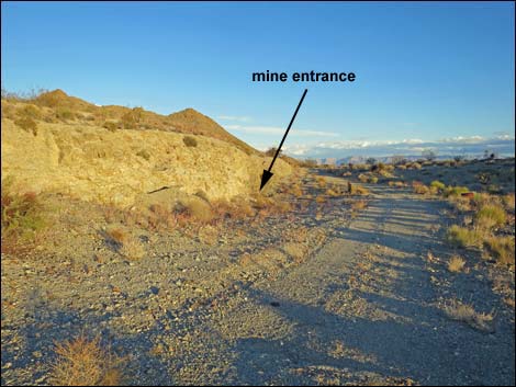
Shortly after the grade eases, signs announce the Lake Mead National Recreation Area boundary (Site 1017), and another 0.44 miles brings one to the north edge of Lakeshore Mine. Most of the mine was a strip mine, but there is at least one adit (horizontal shaft) towards the southeast edge of the stripped area. Timbers hold the opening open, but dirt and gravel have washed in and nearly cover the opening. In the canyon to the west of the mine, old foundations and tailings reveal the former presence of a mill. For hikers, the mine is a good place to turn around and retrace your steps back up the Dugway to the trailhead. The old road continues another 4.5 miles to the edge of Lake Mead, but the road beyond the mine is said to be in worse shape than the Dugway. |
 |
 |
 |
 |
 |
 |
 Approaching the big switchback (view S) |
 Arriving at the big switchback (view S) |
 Below the switchback (view NW) |
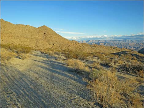
 Road runs along side-ridge (view SW) |
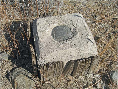 USGS Benchmark placed in 1935; including wooden concrete frame |
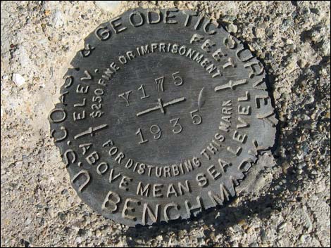 USGS Benchmark placed in 1935 |
 Road runs along side-ridge (view S) |
 Descending off the side-ridge (view SE) |
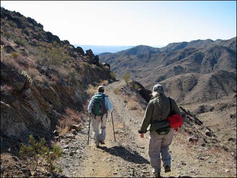
 Hikers on Lower Dugway (view S) |
 Descending towards a low point (view SE) |
 low point before climbing over next low saddle (view S) |
 Atop saddle (note Blue Diamond Cholla on left; view S) |
 |
 |
 |
 |
 |
 |
 Few parts of the road are washed out (view S) |
 Smooth, sandy road (view S) |
 |
 |
 Designated route sign (view S) |
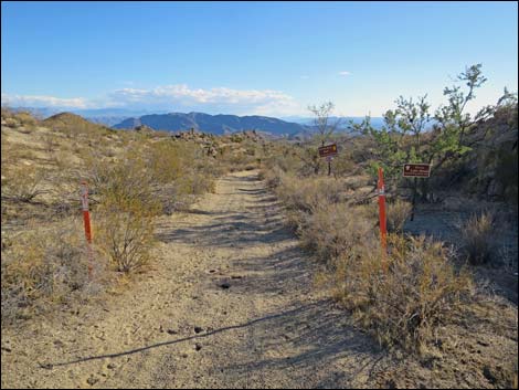 Red carsonite signs mark Lake Mead NRA boundary (view S) |
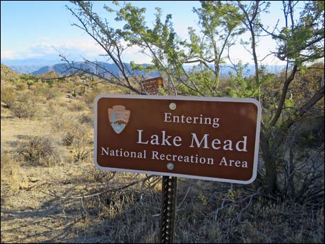 Lake Mead NRA boundary (view S) |
 Lake Mead NRA designated road sign (view S) |
 First mining debris associated with Lakeshore Mine (view S) |
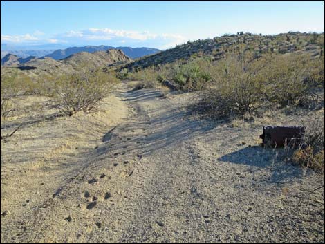
 Little used sandy road (view S) |
 Little used sandy road (except by feral burros; view S) |
 More mining debris on the roadside (view E) |
 Little used sandy road (except by feral burros; view SE) |
 Area scattered with mining debris (view NE) |
 More mining debris on the roadside (view SE) |
 Getting close to Lakeshore Mine (view S) |
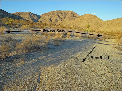
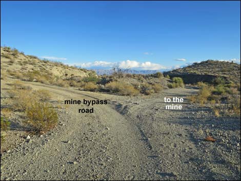 The road forks just before Lakeshore Mine (view SE) |
 Staying left on the main (mine bypass) road (view SE) |
 |
 |
 Mine road returns to the main (mine bypass) road (view SE) |
 Scanlon Road continues towards Lake Mead (view SE) |
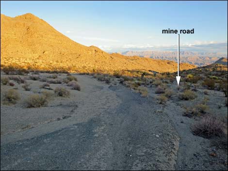
Lakeshore Mine Road
Lakeshore Mine Road stays right (view S) |
 Lakeshore Mine Road (view S) |
 Approaching Lakeshore Mine (view SW) |
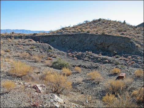 Lakeshore Mine is mostly a strip mine (view SW) |
 Lakeshore Mine Road (view S) |
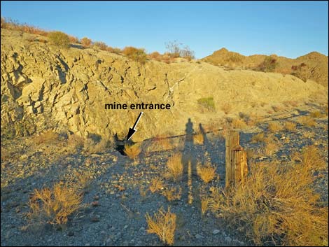 Entrance to short mine adit (view E) |
 Lakeshore Mine Road departing the mine area (view E) |
 Lakeshore Mine Road rejoining the main road (view NE) |
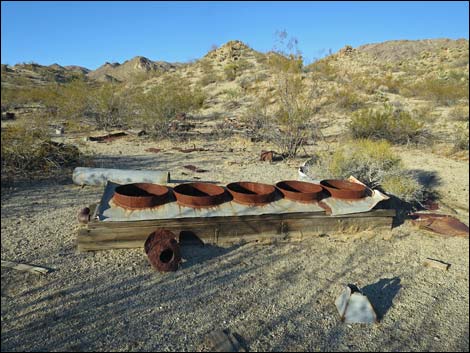
Lakeshore Mine
 Foundation and tailings below the mine (view SW) |
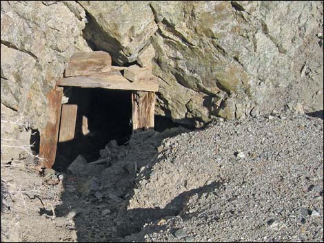 Mine entrance (adit) at Lakeshore Mine (view E) |
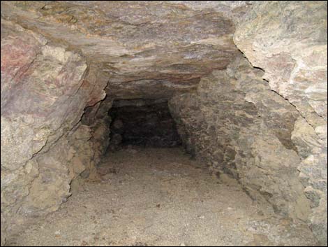 Short adit (view E) |
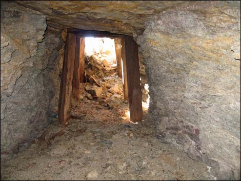 Short adit (view W) |
Table 1. Hiking Coordinates Based on GPS Data (NAD27, UTM Zone 11S). Download Hiking GPS Waypoints (*.gpx) file.
| Wpt | Location | Easting | Northing | Elevation (ft) | Point-to-Point Distance (mi) | Cumulative Distance (mi) | Verified |
|---|---|---|---|---|---|---|---|
| 01 | Trailhead | 751872 | 4005260 | 3968 | 0.00 | 0.00 | GPS |
| 02 | Hairpin Turn | 751940 | 4004654 | 3541 | 0.44 | 0.44 | GPS |
| 03 | USGS Benchmark | 751837 | 4004598 | 3487 | 0.09 | 0.53 | GPS |
| 04 | Wide Turn | 751821 | 4004542 | 3460 | 0.04 | 0.57 | GPS |
| 05 | End of Steep Road | 752154 | 4003613 | 2930 | 0.71 | 1.28 | GPS |
| 06 | Lake Mead NRA Boundary | 752248 | 4003334 | 2840 | 0.19 | 1.47 | GPS |
| 07 | Lakeshore Mine | 752424 | 4002722 | 2646 | 0.44 | 1.91 | GPS |
Happy Hiking! All distances, elevations, and other facts are approximate.
![]() ; Last updated 240326
; Last updated 240326
| Gold Butte | Hiking Around Las Vegas | Glossary | Copyright, Conditions, Disclaimer | Home |