Backroads Around Las Vegas, Gold Butte National Monument
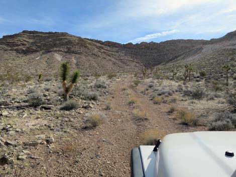
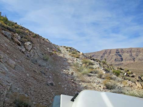
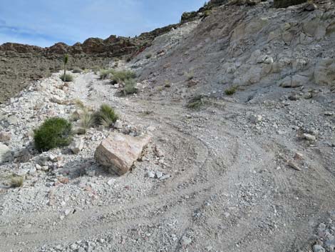
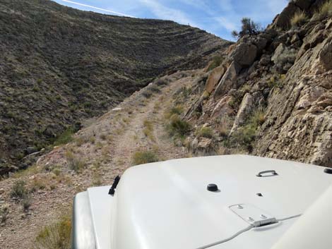
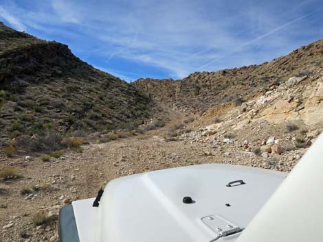
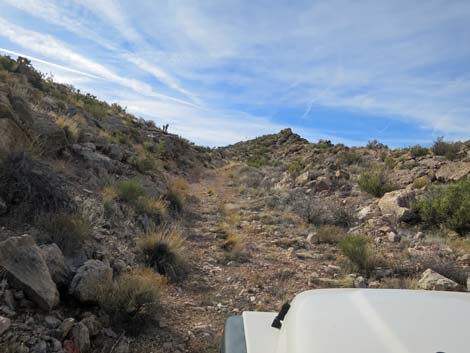
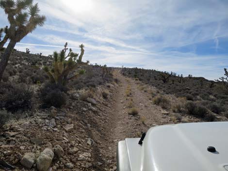
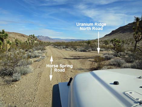 Horse Spring Road at Uranium Ridge North Road (view NE) |
Overview Uranium Ridge is the limestone ridge east of Tramp Ridge. It was prospected (Long Shot Mine) for uranium during 1955, and several roads, surface prospects, and one exploratory adit were constructed. Uranium ore was found in freshwater limestone deposits, and select samples of uranium ore contained as much as 2% U3O8, but it was not in commercial quantities. Visitors to the mine areas should expect a slight increase in their daily radiation dose. Uranium Ridge North Road is a rough side road off the unpaved Gold Butte Road that provides 4WD high-clearance vehicles access to the top of Uranium Ridge from the north. Several prospects can be seen along the road. Other roads climb the ridge from the west and south, but none connect. Views from the top are grand, but the road is rough enough that perhaps it makes a good hike rather than a ride. Link to map. |
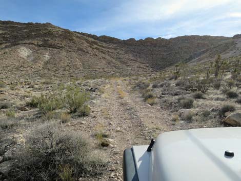
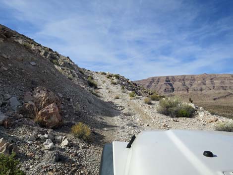
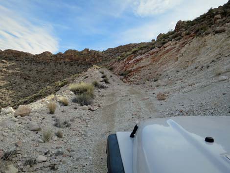
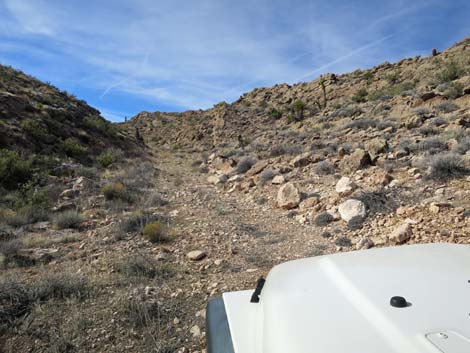
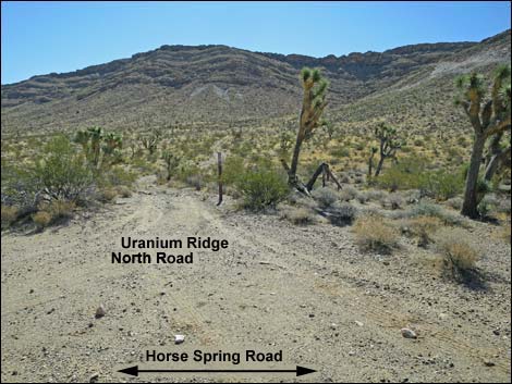 Uranium Ridge North Road (view E from Horse Spring Road) |
Watch Out Other than the standard warnings about being in the desert, ... this is a difficult 4WD road with lots of hazards, including a narrow road, steep cliffs, very tight turns, lots of large rocks in the road, steep sideslopes, and few places to stop or turn around. In addition, visitors to the mine areas should expect a slight increase in their daily radiation dose. This is wild and remote country without services of any kind (no restrooms, no water, no gas, no food). Bring what you need to survive. Be prepared and be self-reliant. It is a big place, but someone will eventually find you if you stay on a main road, but be prepared to walk out from this road because nobody drives it. Cell phones don't work here. While out, please respect the land and the other people out there, and try to Leave No Trace of your passage. Also, this is a remote area, so be sure to bring the 10 Essentials. |
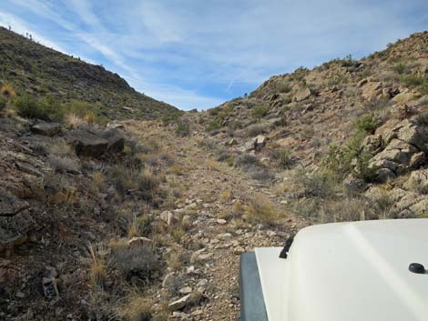
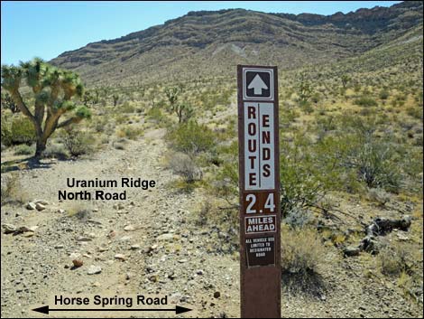 Designated road sign at start of Uranium Ridge Road (view E) |
Getting to the Road Uranium Ridge North Road is located out in Gold Butte National Monument northeast of Lake Mead, most of 3 hours northeast of Las Vegas, on the north end of Uranium Ridge. From Las Vegas, drive out to Gold Butte, then drive south on the paved Gold Butte Road 21 miles to Whitney Pocket. Continue south on the unpaved Gold Butte Road for 15.4 miles to Horse Spring Road, an unmarked, minor road to the left. Turn left and drive east on Horse Spring Road about 100 yards to a T-intersection. At the T-intersection, the ridge straight ahead is Uranium Ridge. Turn left and drive northeast on Horse Spring Road for 1.3 miles to Uranium Ridge North Road, on the right. |
 |
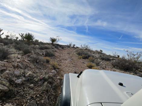
The Road From Horse Spring Road (Table 1, Site 1783), Uranium Ridge North Road runs east towards the steep west face of Uranium Ridge. Note that the east face is no less steep. The narrow road gets steeper as it climbs, then switchbacks up and right to climb back across the hillside. For the faint of heart, there is a small parking spot (or place to turn around) on the left when the road switchbacks right. For hikers, this would be the last good place to park and start walking. Continuing, the narrow road runs west as it climbs steeply across the hillside until suddenly it switchbacks hard to the left. In my jeep, the turn was too tight, but fortunately the front-end bucked a bit on the steep hillside and slid to the left, allowing me to finish the turn. When the road switchbacks left, there is a landing on the right that offers a place to park and probably turn around. |
 |
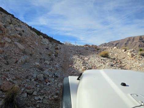
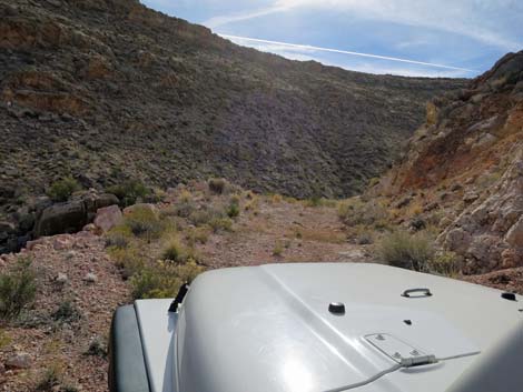
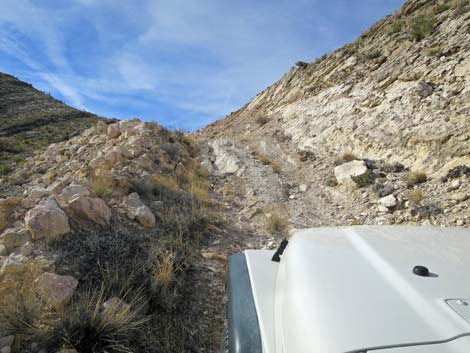
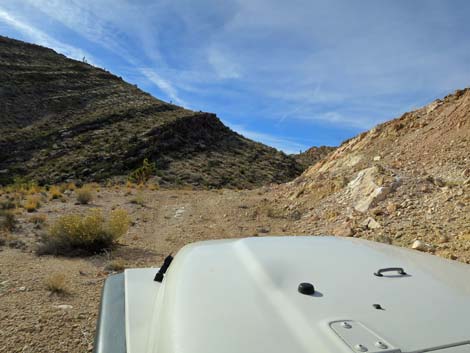
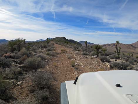
Continuing, the road cuts up and east across the steep hillside until reaching a bit of a landing as the road turns right and starts up into a side canyon that is somewhat hidden from below (or at least not noticed). The road cuts across the side slope through an area that could have been a surface prospect, but now is just a washed out bit of rocky road with a narrow bypass. The road continues up into a steeply V-shaped canyon where drivers, hemmed in between rock walls, have no option but to drive over boulders and whatever else finds itself in the roadway. Climbing out of the narrow canyon, the road continues steeply up and across the west-facing hillside until finally gaining the crest (sigh of relief here). Still heading south, the road runs easily along the crest to a fork (Site 1854) at 1.1 miles out. The better road seems to continue straight along the crest, but this road soon ends. The left continues onto the east-facing slope of the ridge, but I did not drive it. Return over the same road, as this road does not connect with the other two roads on the ridge (photos of the descent). |
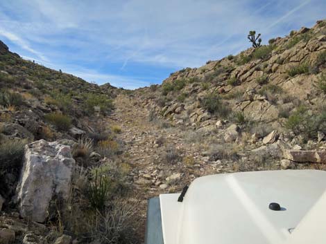
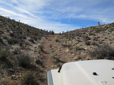
 Lulled into a sense of tranquility, the road climbs gently eastward |
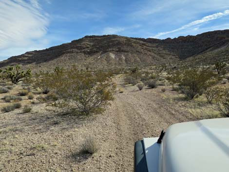
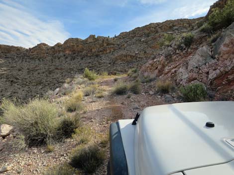
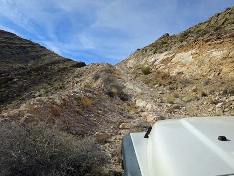
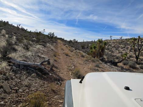
 Approaching the ridge, the road narrows and steepens |
 First swithcback (note parking on the left; view E) |
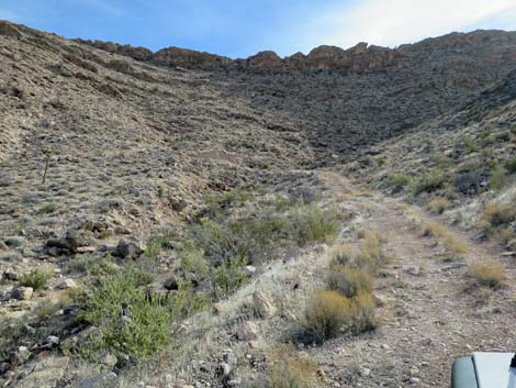
 Climbing across steep hillside (view SW) |
 Climbing across steep hillside (view SW) |
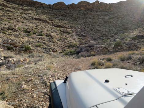
 Approaching second switchback (view SW) |
 Second switchback (view SW; note parking on right) |
 Tight turn at second switchback (view E) |
 |
 |
 Turning into "unnoticed canyon" (view SE) |
 Narrow road heading into "unnoticed canyon" (view SE) |
 Washed out road below prospect (view S) |
 Approaching narrow bypass at a washout (view S) |
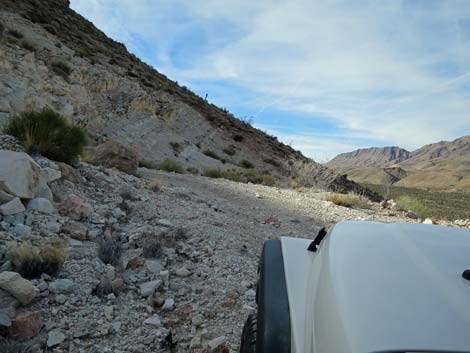
 Passing a broad landing (view S) |
 A bit of easy road (view S) |
 Entering the narrow zone (view S) |
 Rocky road exiting the narrow zone (view S) |
 |
 |
 Climbing out of the canyon (view S) |
 Climbing across steep hillside (view S) |
 |
 |
 Steep hillside approaching the crest of the ridge (view S) |
 Crest of the ridge (view S) |
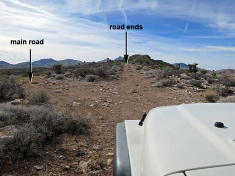 Crest of the ridge at fork (view S) |
 More to come ... |
Table 1. Highway Coordinates Based on GPS Data (NAD27; UTM Zone 11S). Download Highway GPS Waypoints (*.gpx) file.
| Site | Location | UTM Easting | UTM Northing | Latitude (N) | Longitude (W) | Elevation (ft) |
|---|---|---|---|---|---|---|
| 1783 | Horse Spring Road at Uranium Ridge Road | 757299 | 4025689 | 36.34373 | 114.13310 | 2,989 |
| 1854 | Uranium Ridge North Road at Fork | 757314 | 4024365 | 36.33180 | 114.13337 | 3,740 |
Happy Hiking! All distances, elevations, and other facts are approximate.
![]() ; Last updated 170912
; Last updated 170912
| Backroads Around Las Vegas | Hiking Around Las Vegas | Glossary | Copyright, Conditions, Disclaimer | Home |