Backroads Around Las Vegas, Gold Butte National Monument
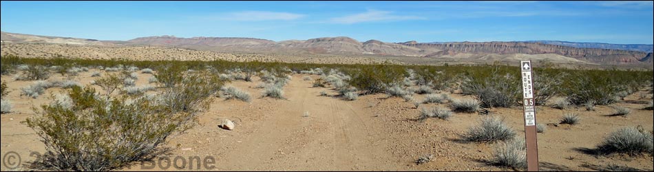
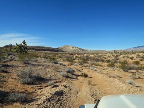
 Greasewood Basin East Road (view NE from St. Thomas Gap Road) |
Overview Greasewood Basin East Road is a 0.6-mile spur road off St. Thomas Gap Road that runs north to an old cattle tank that was created by damming the wash. The dam washed out years ago and the road is blocked by flood channels. Greasewood Basin West Road can be seen across the washout area, but they do not connect. Greasewood Basin East Road runs across open desert country, over a low saddle, and down into a muddy canyon, making the north end of the road questionable for 2WD vehicles. This road provides access to no particular destination, not even a nice campsite, and there is little reason to drive this road. Link to map. |
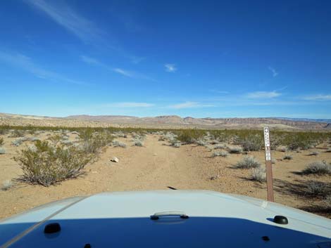
 Designated road sign at start of road (view NE) |
Watch Out Other than the standard warnings about hiking in the desert, ... this road is fairly safe, but it runs into a wild and remote area without services of any kind (no restrooms, no water, no gas, no food). Bring what you need to survive. Be prepared and be self-reliant. Someone will find you eventually if you stay on main roads, but be prepared to survive alone for a day or more on side roads. Cell phones don't work. I drove this road in my jeep using 2WD, but it was reassuring that I could lock in the hubs and continue in 4WD if necessary in the soft dirt near the wash. Road conditions change; use your own good judgment. While out, please respect the land and the other people out there, and try to Leave No Trace of your passage. Also, this is a remote area, so be sure to bring the 10 Essentials. |
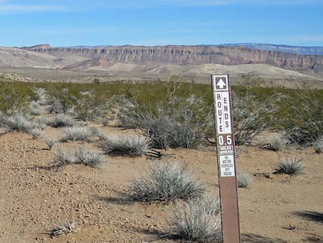
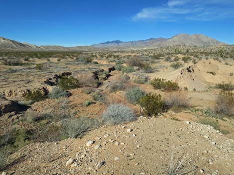
 Approaching Black Wash (view N) |
Getting to the Roadhead Greasewood Basin East Road is located out in Gold Butte National Monument northeast of Lake Mead, about 2-1/4 hours northeast of Las Vegas. From Las Vegas, drive out to Gold Butte. From the end of the pavement at Whitney Pocket, continue south on the unpaved Gold Butte Road for 9.0 miles to a major fork. The intersection is signed, but the southbound sign was knocked down some years ago; only one wooden 4x4 sign post remains. At the fork, the left is St. Thomas Gap Road, which can be confirmed by driving a few yards farther south on Gold Butte Road and looking back at the northbound sign. From Gold Butte Road, drive southeast on St. Thomas Gap Road. The road forks before a steep ridge, and taking the right (more gentle option), travel a total of 2.9 miles to a minor side road forking to the left, which is Greasewood Basin East Road. |
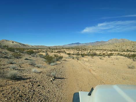
 Descending along Black Wash (view N) |
The Road From St. Thomas Gap Road (Table 1, Site 1846), Greasewood Basin East Road forks left to traverse gentle desert flats. The road runs northeast to cross a low saddle, then descend into Black Wash. Curving left to head upstream above the wash, the road ends (Site 1847) just before the old dam. The dam and road washed out long ago, so drivers cannot continue across the dam to connect with Greasewood Basin West Road. |
 Top of the dam above Black Wash (view NW) |
 More to come ... |
Table 1. Highway Coordinates Based on GPS Data (NAD27; UTM Zone 11S). Download Highway GPS Waypoints (*.gpx) file.
| Site | Location | UTM Easting | UTM Northing | Latitude (N) | Longitude (W) | Elevation (ft) |
|---|---|---|---|---|---|---|
| 1846 | St. Thomas Gap Road at Greasewood Basin East Road | 762009 | 4032380 | 36.40270 | 114.07843 | 2,402 |
| 1847 | Greasewood Basin East Road End | 762229 | 4033098 | 36.40911 | 114.07573 | 2,359 |
Happy Hiking! All distances, elevations, and other facts are approximate.
![]() ; Last updated 240326
; Last updated 240326
| Backroads Around Las Vegas | Hiking Around Las Vegas | Glossary | Copyright, Conditions, Disclaimer | Home |