Backroads Around Las Vegas, Gold Butte
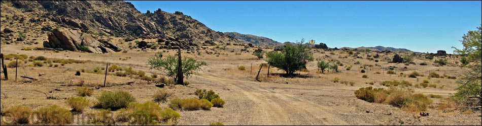
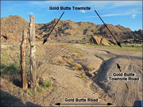
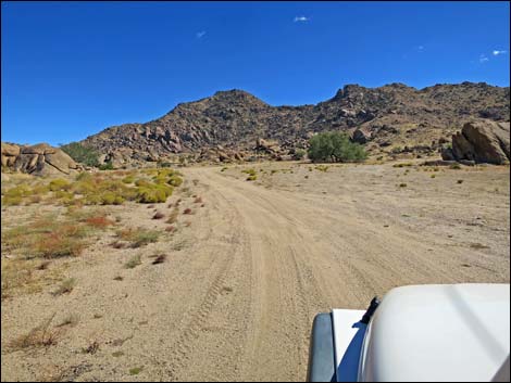
 Gold Butte Road at Gold Butte Townsite Road East (view SW) |
Overview Gold Butte Townsite Road is a short, 1/4-mile-long dirt road that loops off Gold Butte Road, runs up into the Townsite area, loops around and returns to reconnect with Gold Butte Road. This road provides access to the Townsite area where little remains except the graves of two long-time residents, cement foundations, a mine shaft, some junked historic equipment, a few primitive campsites, and a couple of minor roads that lead into the hills around the townsite. Link to map. |
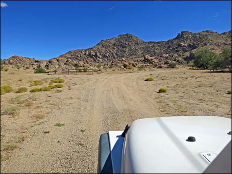
 Gold Butte Townsite Road East approaching GB Townsite (view SW) |
Watch Out Other than the standard warnings about hiking in the desert, ... this area is fairly safe, but be aware that old mines surround the area, there are rusty nails in old boards, and barbed wire presents tripping hazards. This is a wild and remote area without services of any kind (no restrooms, no water, no gas, no food). Bring what you need to survive. Be prepared and be self-reliant. Someone will find you eventually if you stay on a main road, but be prepared to survive alone for a day or two. Cell phones only work along parts of the paved road. While out, please respect the land and the other people out there, and try to Leave No Trace of your passage. Also, this is a remote area, so be sure to bring the 10 Essentials. |
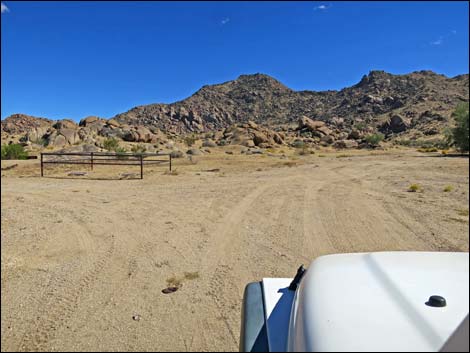
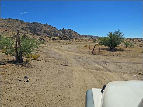 Old fenceline marks entry into Gold Butte Townsite area (view SW) |
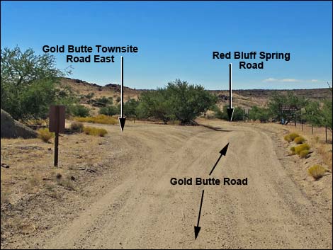
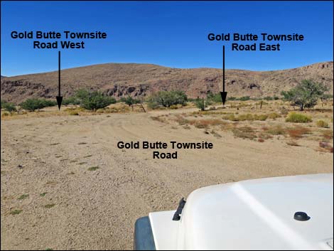
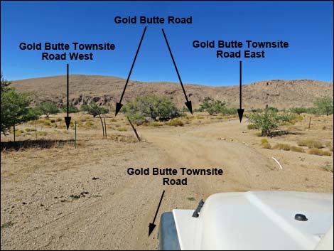
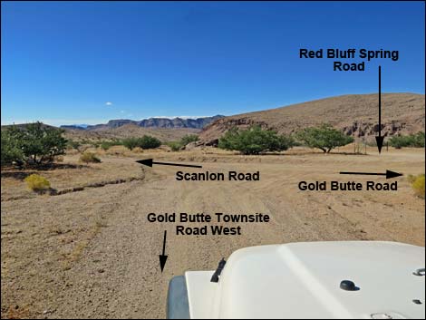
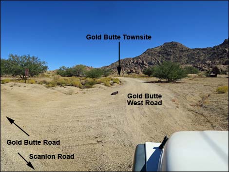
Getting to Gold Butte Townsite Road Gold Butte Townsite Road is located out in Gold Butte northeast of Lake Mead, about 3 hours northeast of Las Vegas in a wild, remote, and scenic area. From town, drive out to Gold Butte. Drive south on the paved Gold Butte Road 21 miles to Whitney Pocket where the pavement ends. Continue south on the scenic unpaved Gold Butte Road for 19.8 miles a cattle guard that marks entry into the Gold Butte Townsite area. Continue on the main road past the cattle guard for another 0.4 miles (20.2 miles total) to the third obvious left turn (Table 1, Site 1648). Notice at this point a road sign for Red Bluff Spring Road on the right. Angle left (southwest) onto Gold Butte Townsite Road East. About 70 yards farther down Gold Butte Road, at the right turn for Red Bluff Spring Road (Site 0806), drivers can also make a hard left turn onto Gold Butte Townsite Road West and head up into the Townsite area. |
 Passing the historic fenceline into Gold Butte Townsite (view S) |
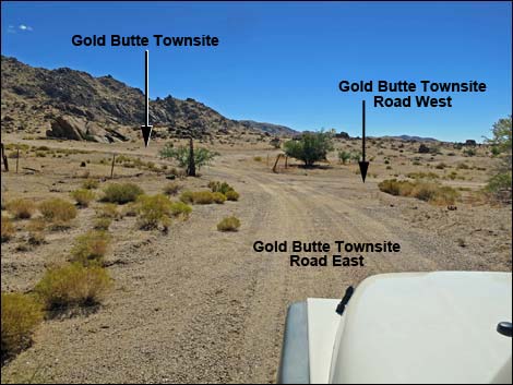
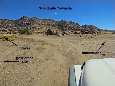
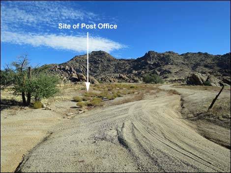
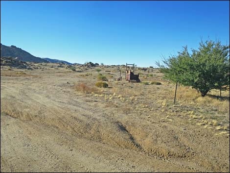
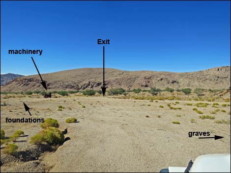
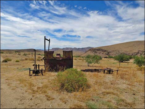
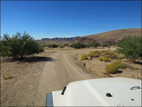
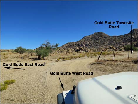
The Road From Gold Butte Road (Site 1648), Gold Butte Townsite Road East runs southwest about 60 yards to where Gold Butte Townsite Road West merges from the right. Together, the roads run south through an historic fenceline into the Gold Butte Townsite area (Site 0460). Immediately, the road opens into a broad, open area spanning some 110 yards. On the left, the road passes the site of the historic post office, and at 70 yards, the graves of Coleman and Garrett. Just past the graves, the road loops right around two large catclaw trees and heads back into the open area. A minor road continues south into the hills to end at a mine site, while another minor road runs southwest. On the right in the open area, the obvious thing is rusting equipment abandoned long ago. Less noticeable are two cement foundations and a grated mine shaft that might have been used for a well. Visitors will find flat spots in the main townsite area to camp. While here, please respect this historic site and distinguish between "historical junk" and "trash" when picking up litter. |
 Entering the Townsite area (view SE) |
 Entering the Townsite area (view SE) |
 Entering the Townsite area (view SW) |
 Staying left in the Townsite area (view SE) |
 Approaching the fenced graveyard (view SE) |
 Graves on the left; continue straight to mine site (view SE) |
Returning to Gold Butte Road
 Re-entering the Gold Butte Townsite area (view NW) |
 Proceeding towards the exit (view NW) |
 Rusting machinery (view NW) |
 Exiting Gold Butte Townsite through historic fenceline (view N) |
 Gold Butte Townsite Road West approaching Gold Butte Road |
 Gold Butte Townsite Road West at Gold Butte Road (view NW) |
 Gold Butte Road at Gold Butte West Road (view E) |
 Gold Butte West Road at Gold Butte East Road (view E) |
Table 1. Highway Coordinates Based on GPS Data (NAD27; UTM Zone 11S). Download Highway GPS Waypoints (*.gpx) file.
| Site | Location | UTM Easting | UTM Northing | Latitude (N) | Longitude (W) | Elevation (ft) | Verified |
|---|---|---|---|---|---|---|---|
| 0460 | Gold Butte Townsite | 751564 | 4018463 | 36.28017 | 114.19926 | 3,749 | Yes |
| 0806 | Gold Butte Rd at Red Bluff Spring Rd | 751471 | 4018545 | 36.28093 | 114.20028 | 3,727 | Yes |
| 1648 | Gold Butte Rd at Gold Butte Townsite Rd East | 751531 | 4018569 | 36.28113 | 114.19960 | 3,727 | Yes |
Happy Hiking! All distances, elevations, and other facts are approximate.
![]() ; Last updated 240326
; Last updated 240326
| Backroads Around Las Vegas | Hiking Around Las Vegas | Glossary | Copyright, Conditions, Disclaimer | Home |