Hiking Around Las Vegas, Gold Butte National Monument
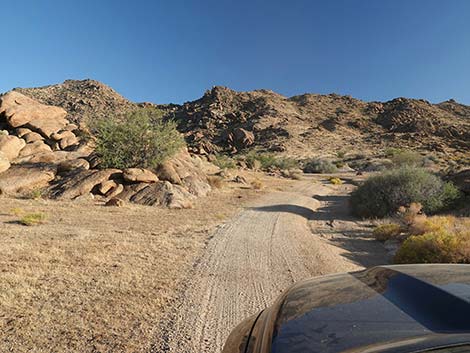
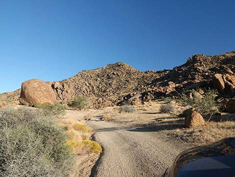
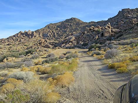
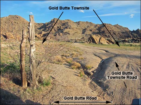 Gold Butte Road at Gold Butte Townsite Road (view S) |
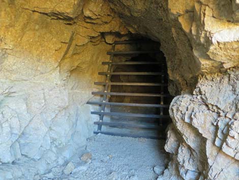
Overview The Gold Butte Townsite Lower Mines are an interesting place to visit and commune with the mining history of this wild and rugged region. In 1905, gold was discovered on Gold Butte Peak, and when the news got out, miners poured into the area. The town of Gold Butte was established in 1906 with a post office, and by 1908 there was a hotel, livery stable, saloon, mercantile, and some 2,000 residents. By 1909, the mines had played out, the post office closed, and the town was abandoned. Art Coleman and Bill Garrett arrived at Gold Butte Town in 1916, after the town had been abandoned, and intermittently worked the mines and ran cattle until 1958 and 1961, respectively. Today the area is littered with evidence of mining, including mine shafts and adits, old equipment, the remains of old mills, can dumps, and cement foundations, but all of the buildings are gone. The mine openings were grated in 2019. Link to map. |
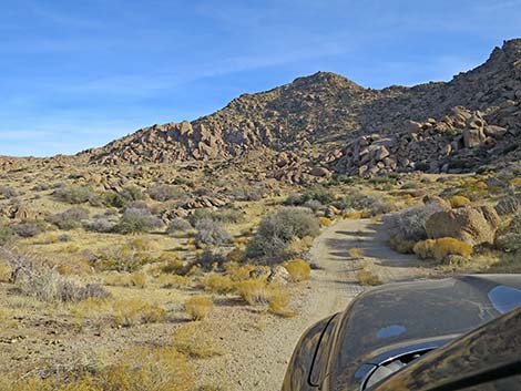
 Gold Butte Townsite Road (view S) |
Watch Out Other than the standard warnings about hiking in the desert, ... this area is fairly safe if you stay out of the mines. Old holes in the ground are never safe to enter, and these were dug over 100 years ago into decomposed granite, which is a bit like stuck-together gravel that is coming apart. Most of the tunnels have already collapsed. Stay out; stay alive. The access road requires at least a 2WD-HC vehicle. This is a wild and remote area without services of any kind (no restrooms, no water, no gas, no food). Bring what you need to survive. Be prepared and be self-reliant. Law enforcement occasionally patrols the area. Someone will find you eventually if you stay on a main road, but be prepared to survive alone for a day or two. Cell phones don't work in this area. While visiting, please respect the land and the other people out there, and try to Leave No Trace of your passage. Also, this is a remote hike, so be sure to bring the 10 Essentials. |
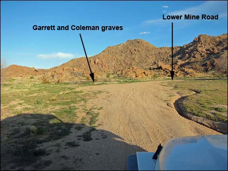
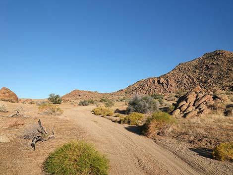
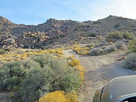
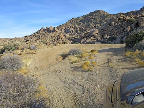
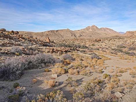
 Gold Butte Lower Mine Road passes the grave sites (view S) |
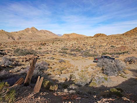
Getting to the GB Townsite Lower Mine Gold Butte Townsite is located out in Gold Butte National Monument at the northeast end of Lake Mead, about 3 hours northeast of Las Vegas in a wild, remote, and scenic area. From town, drive out to Gold Butte, then drive south on the paved Gold Butte Road for 21 miles to Whitney Pocket where the pavement ends. Continue south on the scenic unpaved Gold Butte Road for 19.8 miles; a cattle guard marks entry into the Gold Butte Townsite area. Continuing on GB Road, at about 0.4 miles past the cattle guard (20.2 miles total), Gold Butte Townsite Road East forks left into the Townsite area, proper. Gold Butte Townsite Road East runs through an old fenceline and into Gold Butte Townsite (Site 0460), which is an open area about 110 yards wide. From the fenced grave sites on the left (east) side of the open area, Gold Butte Lower Mine Road continues southeast into the hills. In 0.3 miles, the road forks. The ends of both forks are visible, and there are mines at each end. The mill site is to the right. |
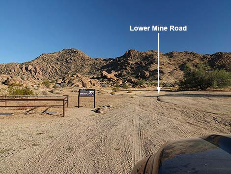
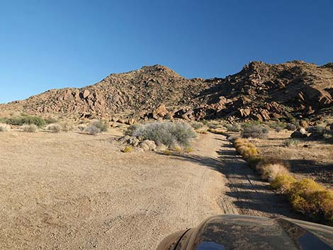
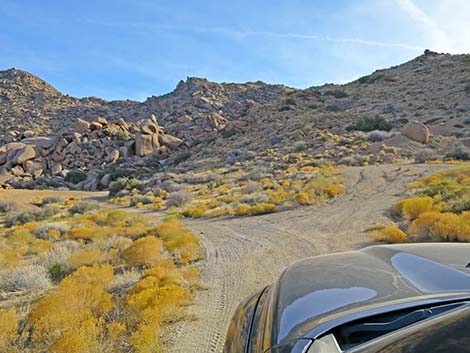
 Lower Mine Road (view S) |
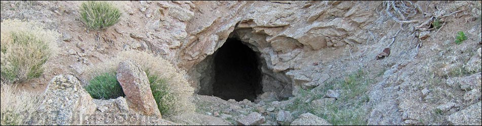
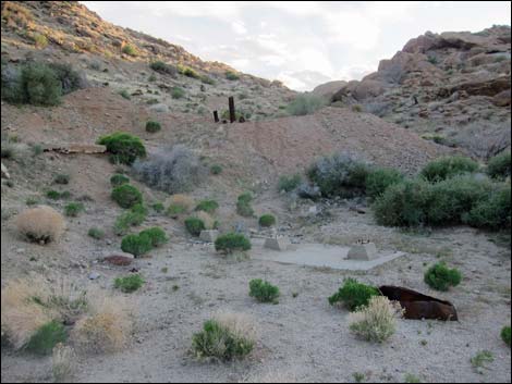
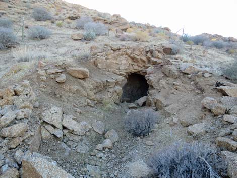
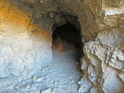
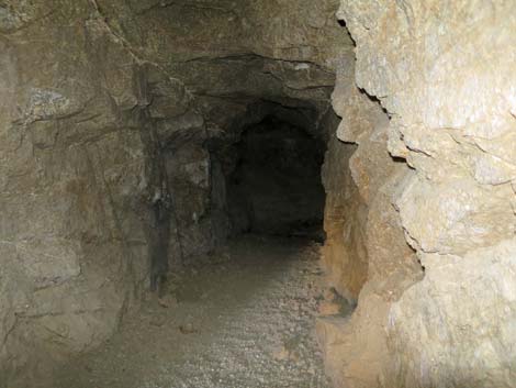
GB Townsite Lower Mines From the fork in the road just before the road ends, the right fork leads 40 yards to an old mill site. The small concrete foundation remains, but everything useful is gone. Only the concrete, a few rusting metal parts, and an old pair of shoes remain. Above the mill site, mine tailings on the hillside reveal the presence of several mine openings. Most are adits (horizontal openings), but there is one shaft (vertical opening). Two of the adits collapsed, one leaving an opening to the surface. The rock here is decomposed granite, so it is not particularly hard, and as the collapsed tunnels reveal, the mines are not safe to enter. One of the adits goes in a short way to a vertical shaft that seems pretty deep. This one has wooden infrastructures, but the floor also seems to be wooden, and nothing in an old mine is more dangerous than a rotten wood floor. Father back, this adit is collapsed to the surface. This mine and the collapsed roof are now grated to prevent human entry. |
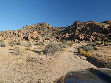
 Lower Mine Road (view SE) |
Another of the adits goes in a short way to a collapse that completely blocks the tunnel. Above the adits, one "shaft" seems to be the collapsed roof of the adit, and the other shaft is shallow. Don't get too close to the edges of the shafts because the rim is collapsing. Also above the mill site, an ATV trail can be seen climbing the steep hillside to a saddle. This road leads to surface prospects, but not to more mines or other items of historical interest. From the fork in the road just before the road ends, the left fork leads to a turn-around loop. From the end of the loop, the fencing around another adit can be seen a few yards off. Upon approaching this mine, it can be seen from the decomposing rocks around the entrance that the rock is not solid, and the mine is not safe to enter. This mine goes back a few yards, bends to the left, and ends. This mine is now grated to prevent human entry. |
 Lower Mine Road (view S) |
 Lower Mine Road (view S) |
 Lower Mine Road (view SE) |
 Lower Mine Road (view SE) |
 Lower Mine Road (view SE) |
 Lower Mine Road forks (view SE) |
 After fork, left to Lower Mine Road turn-around loop (view SE) |
 Lower Mine Road turn-around loop (view SE) |
End of Road to the Right
 Mine and mill site (view SW) |
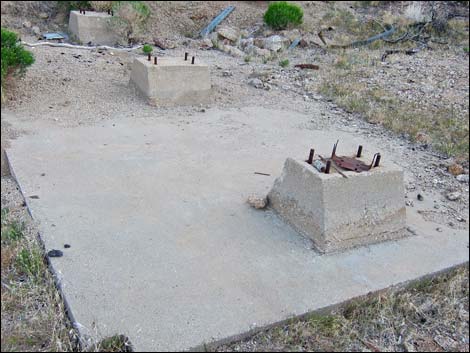 Mill foundation |
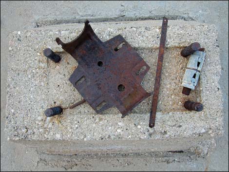 Concrete pedestal with assorted metal debris |
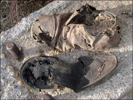 Worn-out shoes |
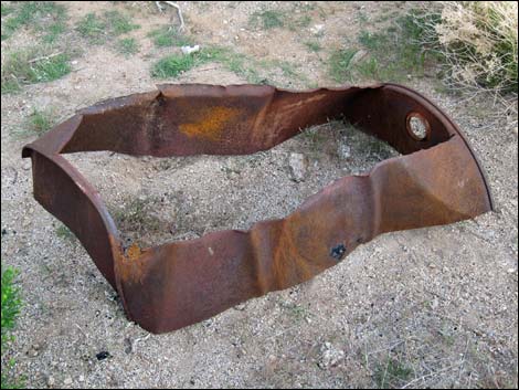 55-gallon drum used as a tub |
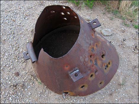 Funnel |
 Mill site (view N from above) |
 Mill site (view NE from above) |
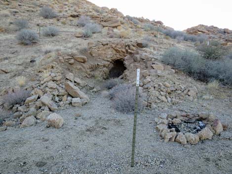
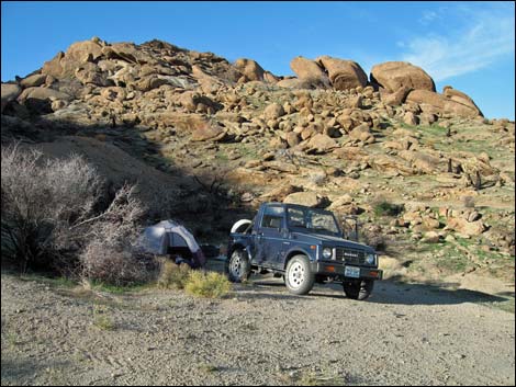 Campsite at old mill site |
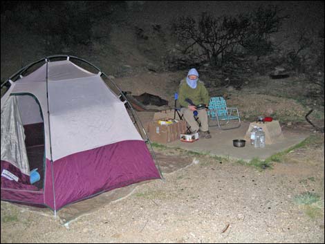 Cold winter campsite at old mill site |
Mine #1
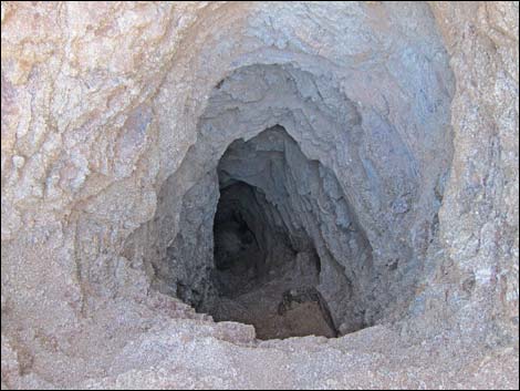
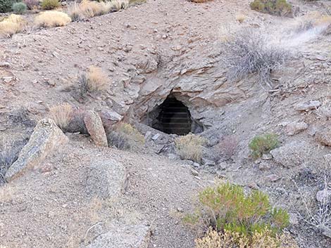 Mine opening (view S) |
 Mine entrance before the grate was installed |
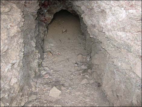 Collapsed tunnel |
 Back of collapsed tunnel |
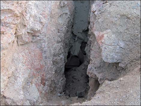
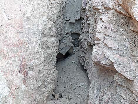
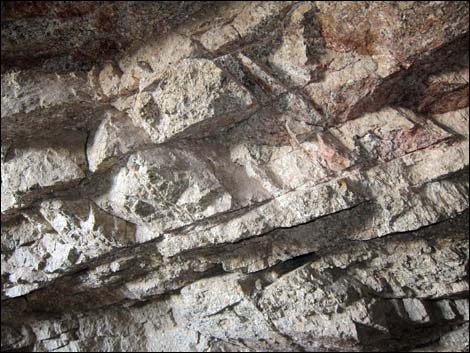 Fractured rock walls inside mine cause mine collapse |
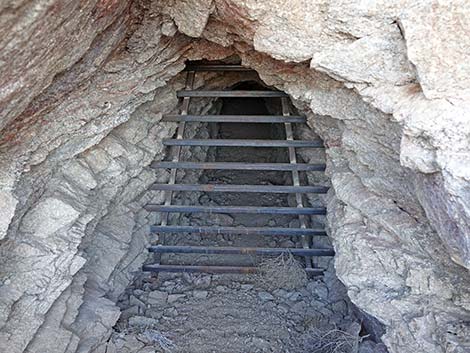 Grate inside the mine entrance |
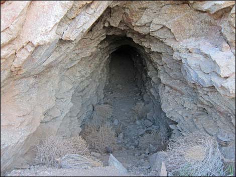
Mine #2
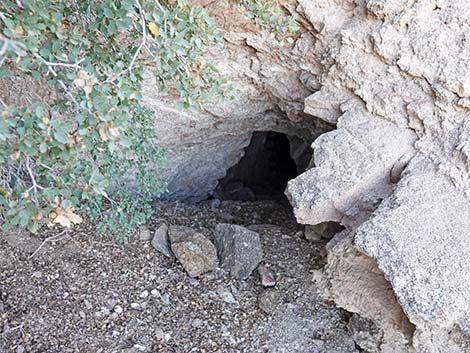 Another mine opening |
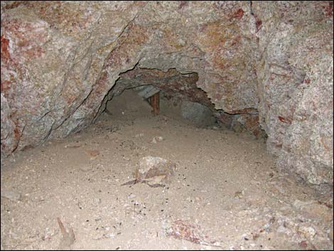
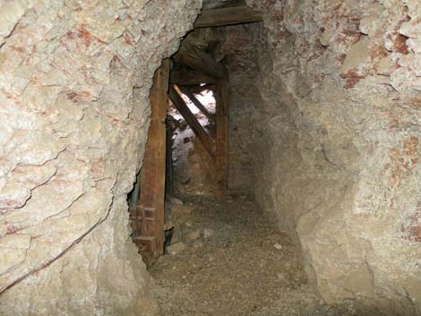
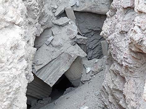
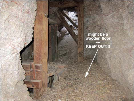 Inside mine -- stay back from wooden floor! |
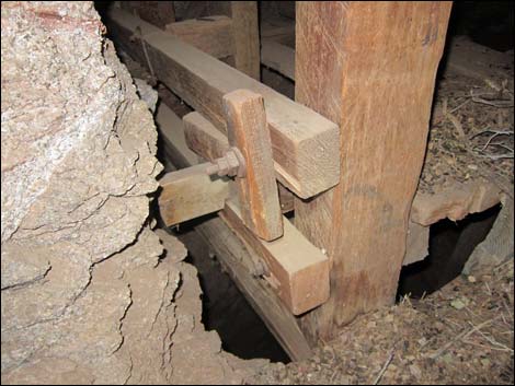 Inside mine - wooden timbers (view down) |
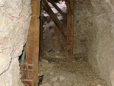
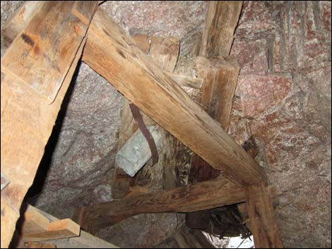 Inside mine - wooden supports and air vent (view up) |
 Inside mine - wooden timbers and air vent (view down) |
 Inside mine - wooden timbers and air vent (view down) |
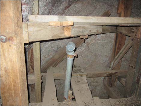
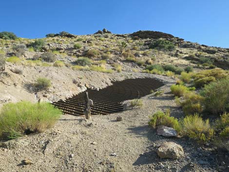
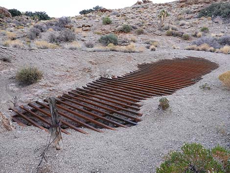
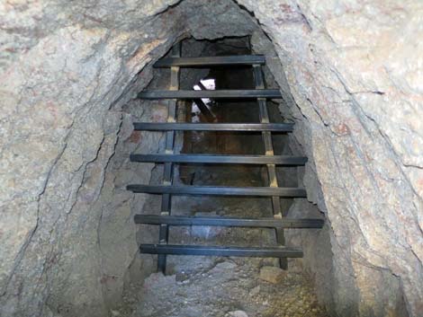 Inside mine - the tunnel is grated before the wooden structures |
 Inside mine - from the grate, wooden structures still visible |
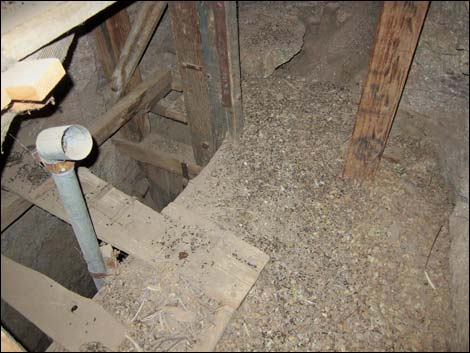
 Inside mine - from the grate, collapsed roof still visible |
 More to come ... |
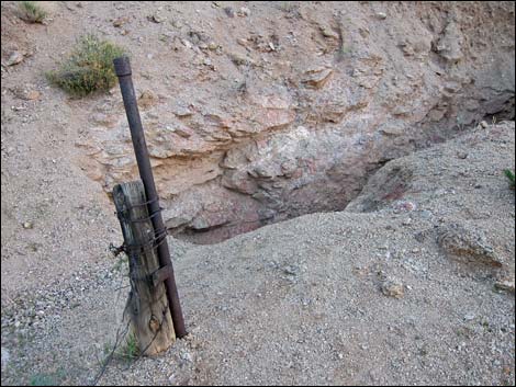 Hillside above mine looking towards collapsed tunnel |
 Hillside above mine looking into collapsed tunnel |
 Hillside above mine looking towards grated collapsed tunnel |
 Grate prevents people falling into collapsed tunnel |
 Inside the collapse |
 Inside the collapse (zoom) |
Mine #3
 Another mine opening - don't fall in! |
More to come ... |
Mine #4 (off the turn-around loop)
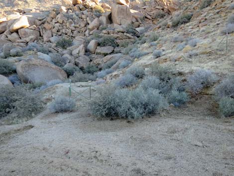 Fencing visible from end of left fork road (view SE) |
 Mine adit (view SW from outside fence); odd place for fire pit |
 Crumbling rock and surface collapse around entrance |
 Adit (view from entrance to bend) |
 Adit (view from bend to end) |
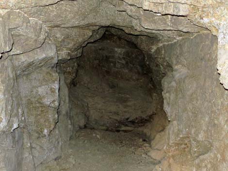 End of the adit; nothing to see here |
 The mine entrance is now grated |
More to come ... |
Table 1. Highway Coordinates Based on GPS Data (NAD27; UTM Zone 11S). Download Highway GPS Waypoints (*.gpx) file.
| Site | Location | UTM Easting | UTM Northing | Latitude (N) | Longitude (W) | Elevation (ft) |
|---|---|---|---|---|---|---|
| 0460 | Gold Butte Townsite | 751564 | 4018463 | 36.28017 | 114.19926 | 3,749 |
| 1850 | Gold Butte Lower Mine Road at Fork | 751912 | 4018179 | 36.27752 | 114.19549 | 3,866 |
Happy Hiking! All distances, elevations, and other facts are approximate.
![]() ; Last updated 240325
; Last updated 240325
| Hiking Around Gold Butte | Hiking Around Las Vegas | Glossary | Copyright, Conditions, Disclaimer | Home |