Hiking Around Las Vegas, Gold Butte National Monument
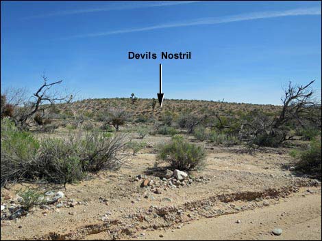
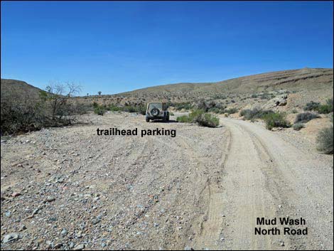 Devils Nostril trailhead parking (view SW) |
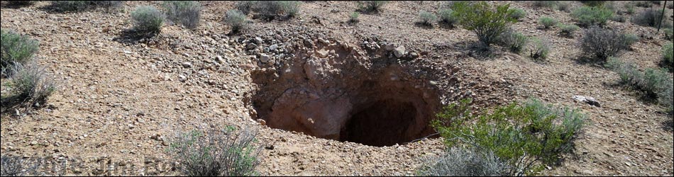
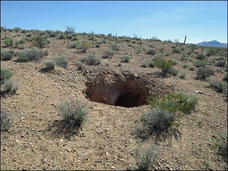
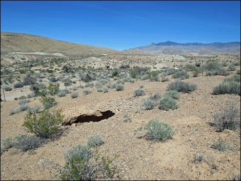
Overview Devils Nostril is an interesting, if somewhat disconcerting, geological feature where apparently the roof of a limestone cave collapsed, leaving a narrow sinkhole in the middle of the open desert. For those who think terra firma is firm, this is an educational place that gives a different point of view. This sinkhole is about 3 air-miles north-northwest of Devils Throat, the much larger and better-known sinkhole in Gold Butte National Monument. As such, the tiny Devils Nostril is a place to stop and visit while driving along Mud Wash North Road, but this is not a destination. Link to map. |
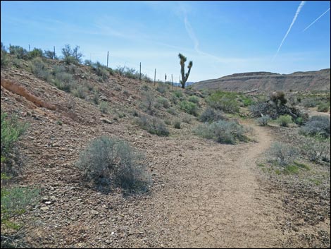
 Short trail to Devils Nostril (view SW) |
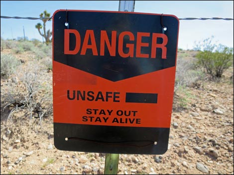
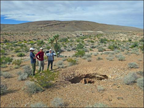
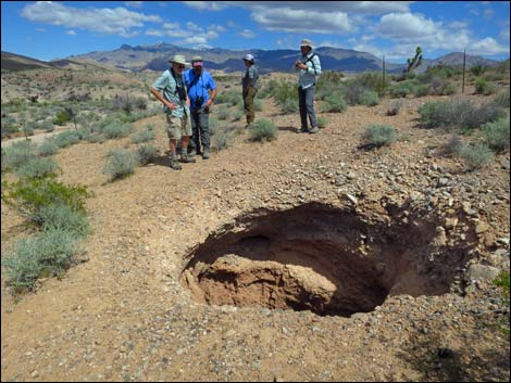
Watch Out Other than the standard warnings about hiking in the desert, ... well, all I can say is don't fall in the hole. A fence surrounds the area, but it is too far back to see into the pit, so everyone steps through the fence and walks up closer. Be careful near the edge because it could collapse, and of course, the entire area could sink into a new hole. This is a wild and remote area without services of any kind (no restrooms, no water, no gas, no food). Bring what you need to survive. Be prepared and be self-reliant. Someone will find you eventually if you stay on a main road, but be prepared to survive alone for a day or two. Cell phones don't work here. While hiking, please respect the land and the other people out there, and try to Leave No Trace of your passage. Also, this is a remote hike, so be sure to bring what you need of the 10 Essentials. |
 Trail to Devils Nostril; notice wire fence (view SW) |
Getting to the Trailhead Devils Nostril is located out in Gold Butte National Monument at the northeast end of Lake Mead, about 2.5 hours northeast of Las Vegas in a wild, remote, and scenic area. From town, drive out to Gold Butte National Monument. From Whitney Pocket, continue south on the unpaved Gold Butte Road for 3.9 miles to Mud Wash North Road, on the right (watch for directional road signs). Turn right onto Mud Wash North Road and drive southwest 1.1 miles to a wide spot in the wash (Table 1, Site 1775). This is just past where the road bends hard to the right and before it bends back hard to the left. Pull over to the left and park here; this is the trailhead. For people who miss the pullout, after making the hard left turn, the fence surrounding the sinkhole is visible on the left. Park along the wash and hike in from there. |
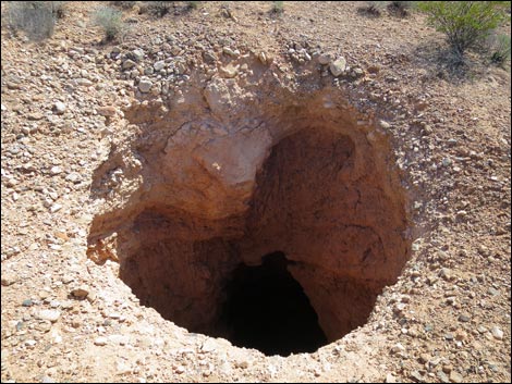
 It is never safe to enter holes in the ground (view SE) |
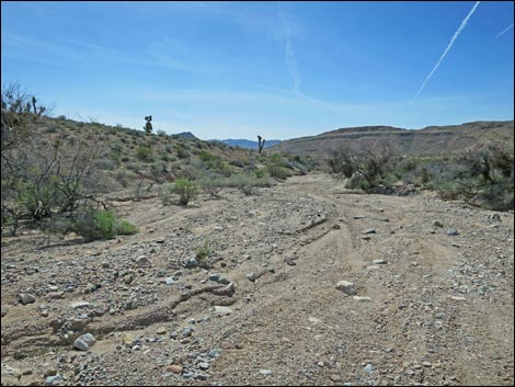
Devils Nostril From the trailhead parking (Table 2, Waypoint 01), the route heads southwest following a side channel of the main wash. About 40 yards out, a trail emerges from the wash and climbs the bank on the left. Walking along the trail, the wire fence surrounding the sinkhole becomes apparent, as does a "danger" sign just ahead. From the sign (about 100 yards out), the fence keeps visitors a "safe" distance from the edge because the entire area could cave in. Staying outside the fence, visitors can look and see the sinkhole, but everyone probably steps through the fence and walks up closer to look down into the abyss (Wpt. 02). This can't be safe, so don't get too close. This isn't a hike, as it is only a minute or two to the sink hole, but looking into the abyss offers an interesting perspective on what otherwise appears to be solid ground. |
 Approaching Devils Nostril (view SE) |
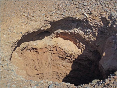 Devils Nostril (view SE) |
 Devils Nostril (view down) |
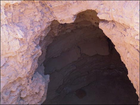 Devils Nostril (view down) |
 Devils Nostril (view N towards trailhead) |
 Don't get too close! (view NW) |
 Don't get too close! (view NW) |
 More to come ... |
 Devils Nostril on hillside (view E from farther down the road) |
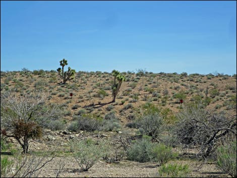 Devils Nostril on hillside (view E from farther down the road; zoom) |
Table 1. Highway Coordinates based on GPS Data (NAD27; UTM Zone 11S). Download Highway GPS Waypoints (gpx) file.
| Site | Location | UTM Easting | UTM Northing | Latitude (N) | Longitude (W) | Elevation (ft) |
|---|---|---|---|---|---|---|
| 1775 | Devils Nostril Sinkhole Trailhead Parking | 753221 | 4039045 | 36.46507 | 114.17414 | 2,314 |
Table 2. Hiking Coordinates Based on GPS Data (NAD27, UTM Zone 11S). Download Hiking GPS Waypoints (*.gpx) file.
| Wpt. | Location | UTM Easting | UTM Northing | Elevation (ft) | Point-to-Point Distance (mi) | Cumulative Distance (mi) |
|---|---|---|---|---|---|---|
| 01 | Devils Nostril Sinkhole Trailhead | 753216 | 4039039 | 2,314 | 0.00 | 0.00 |
| 02 | Devils Nostril Sinkhole | 753188 | 4038970 | 2,322 | 0.05 | 0.05 |
| 01 | Devils Nostril Sinkhole Trailhead | 753216 | 4039039 | 2,314 | 0.05 | 0.11 |
Happy Hiking! All distances, elevations, and other facts are approximate.
![]() ; Last updated 240325
; Last updated 240325
| Hiking Around Gold Butte | Hiking Around Las Vegas | Glossary | Copyright, Conditions, Disclaimer | Home |