Hiking Around Las Vegas, Gold Butte National Monument
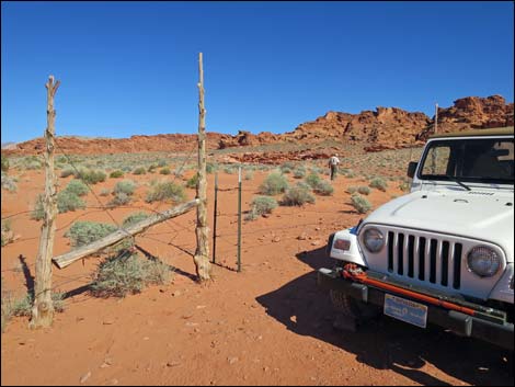
 Man-gate at southern parking area (view E). |
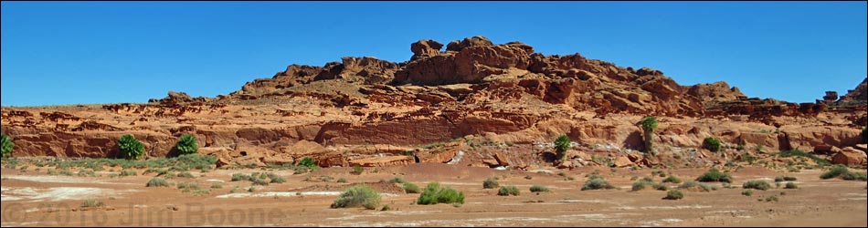
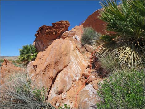
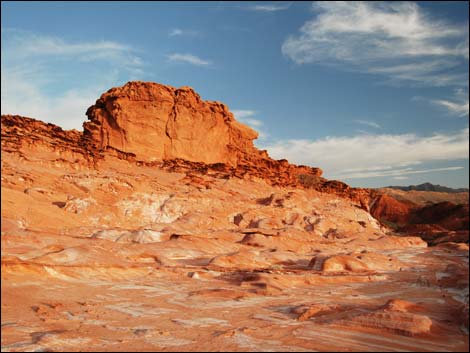
Overview Little Finland (aka Hobgoblin Playground, Lone Palm, and Devils Fire) is a fascinating area where wind and water have sculpted red sandstone rock into fantastical shapes that rival the best of similar areas in the southwestern deserts. There are some nice petroglyphs here too. From the trailhead, a short scramble runs up into Little Finland, which stretches out for about 0.4 miles to the north. Alternatively, hikers can access Little Finland from the north via a sandy hill. Exploration is easy because the area is fairly level. The farther you go and the more you look, the more you find, but this is more of an elfin wonderland than an area of towering pillars. This area is a major attraction for photographers. See some fine photography here, and ordinary photos organized by themes and areas here. Link to area map or hiking map. |
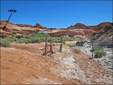
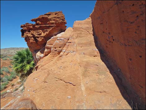
 Short trail leads towards ramp (view E) |
Watch Out Other than the standard warnings about hiking in the desert, ... this is a fairly safe area, but be careful scrambling around the edge of the cliffs, some of which are undercut. This is a wild and remote area without services of any kind (no restrooms, no water, no gas, no food). Bring what you need to survive. Be prepared and be self-reliant. Someone will find you eventually if you stay on a main road, but be prepared to survive alone for a day or two. Cell phones only work along parts of the paved road. While hiking, please respect the land and the other people out there, and try to Leave No Trace of your passage. Also, even though this hike is short, the area is remote, so be sure to bring what you need of the 10 Essentials. Cell phones don't work. |
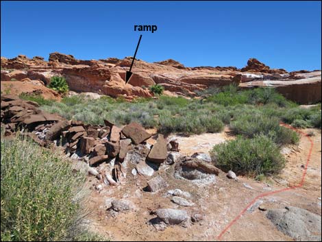
 Short trail runs among bushes to base of cliff (view NE) |
Getting to the Trailhead [Note: This hike is also accessible directly from Mud Wash.] Little Finland is located out in Gold Butte National Monument at the northeast end of Lake Mead, about 3 hrs from Las Vegas in a wild, remote, and scenic area. From town, drive out to Gold Butte National Monument. From Whitney Pocket, continue south on the unpaved Gold Butte Road for 3.9 miles to Mud Wash North Road. Turn right onto Mud Wash North Road and drive southwest (downstream) for 3.2 miles to Mud Wash Road. Stay right onto Mud Wash Road, continuing downstream for another 4.0 miles to Little Finland Road, on the right. Drive east on Little Finland Road, staying right at a fork and then carefully climb a rocky step (not always passable in 2WD). Below the Little Finland cliffs, the road forks three ways. The main road stays right to the southern trailhead. The two lefts, using 4WD, can be used to climb a steep sand hill to the northern trailhead atop the cliffs. This northern trailhead is useful for people with ambulatory difficulties. |
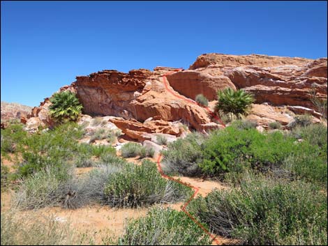
 Base of ramp (view N) |
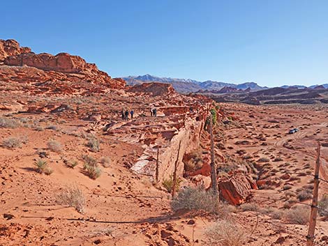
The Hike From the trailhead (Table 2, Waypoint 01), a use-trail runs east about 250 feet to the base of the cliff (Wpt. 02), then turns left to scrambles up a 3rd-class ramp to the top of the cliff (Wpt. 02), which is Little Finland. From atop the cliff, hikers can wander southeast through the elfin wonderland about 0.2 miles (Wpt. 04) or wander north about 0.4 miles (Wpt. 05). Alternatively, a steep, sandy road leads to the top of the cliff at the north end of Little Finland (Wpt. 05). While driving up requires 4WD, walking is easy, and using the trailhead at this end avoids scrambling up the 3rd-class ramp. This is a good place to wander about, sit and think, eat a little lunch, and contemplate the forces of nature (wind and water) that created such a site. |
 Steep part of the ramp (view N) |
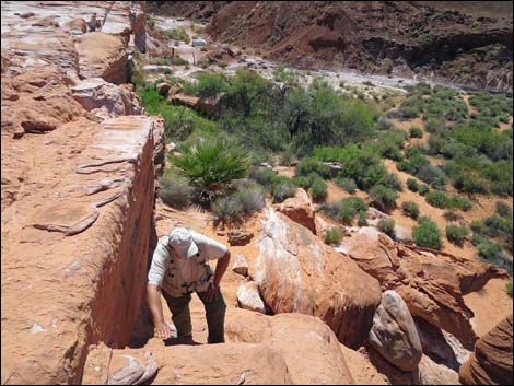 Looking back down at hiker on steep part of the ramp (view S) |
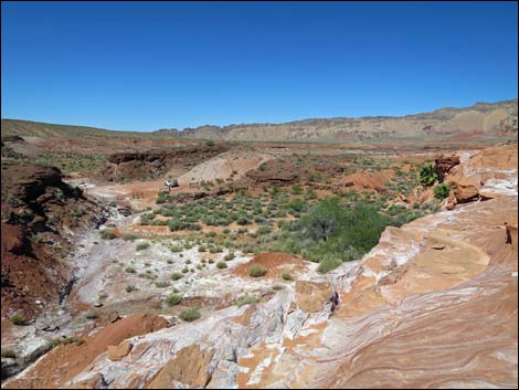 Atop the cliffs, looking back at trailhead (view NW) |
 Atop the cliffs, looking away from the trailhead (view SE) |
Northern Access
 Vehicle at northern trailhead |
 Little Finland (view S from near northern trailhead) |
Table 1. Hiking Coordinates and Distances based on GPS data (NAD27; UTM Zone 11S). Download Hiking GPS Waypoints (*.gpx) file.
| Wpt. | Location | UTM Easting | UTM Northing | Elevation (ft) | Point-to-Point Distance (mi) | Cumulative Distance (mi) | Verified |
|---|---|---|---|---|---|---|---|
| 01 | Trailhead | 749689 | 4037088 | 1838 | 0.00 | 0.00 | GPS |
| 02 | Base of Cliff | 749737 | 4037104 | 1817 | 0.05 | 0.05 | GPS |
| 03 | Top of Cliff | 749736 | 4037121 | 1838 | 0.01 | 0.06 | GPS |
| 04 | South End | 749823 | 4036973 | 1867 | 0.16 | 0.22 | GPS |
| 05 | North End | 749659 | 4037613 | 1850 | .. | .. | GPS |
Happy Hiking! All distances, elevations, and other facts are approximate.
![]() ; Last updated 240325
; Last updated 240325
| Gold Butte | Rock Art | Hiking Around Las Vegas | Glossary | Copyright, Conditions, Disclaimer | Home |