Hiking Around Las Vegas, Gold Butte National Monument
 Fisherman's Cove Road approaching trailhead (view SW) |
Overview Black Ridge Mine is a series of abandoned prospects high on the southern flanks of Black Ridge that in and of themselves are of little interest, but this makes for a nice hike and a good way to experience grand views with relatively little effort. This hike can be done as a 5-mile in-and-out or as a partial loop, and the trailhead is accessible using 2WD vehicles. With few landmarks, this is a good route to practice map-reading and GPS skills. The hike follows washes on a gentle bajada into the foothills, then diverts to a shallow mine shaft. Returning to the wash, an old road is eventually followed onto the hillsides where prospectors drove bulldozers around for awhile, then abandoned the area. The object of the prospecting isn't clear, but there is some suggestion of tiny amounts of copper. Link to map. |
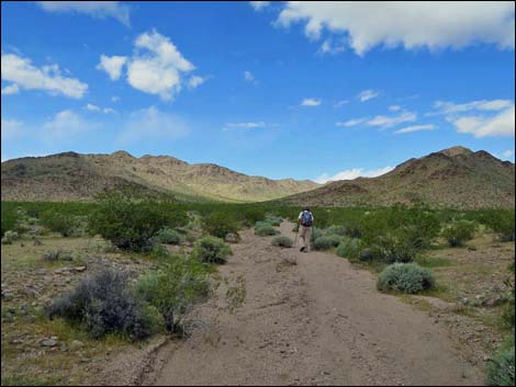
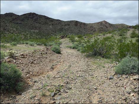
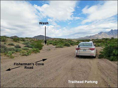 Trailhead parking in wash (view NE) |
Watch Out Other than the standard warnings about hiking in the desert, ... this area is fairly safe, but don't fall down the mine shaft. Otherwise, there are no unusual hazards on this hike. This is a wild and remote area without services of any kind (no restrooms, no water, no gas, no food). Bring what you need to survive. Be prepared and be self-reliant. Law enforcement occasionally patrols the area. Someone will find you eventually if you stay on a main road, but be prepared to survive alone for a day or two. Cell phones might work on parts parts of this hike. While hiking, please respect the land and the other people out there, and try to Leave No Trace of your passage. Also, this is a very remote hike, so be sure to bring the 10 Essentials. |
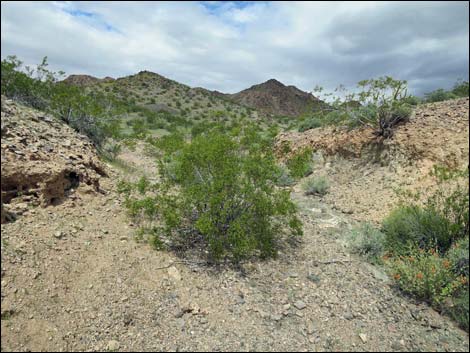
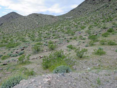
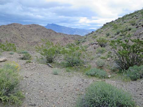
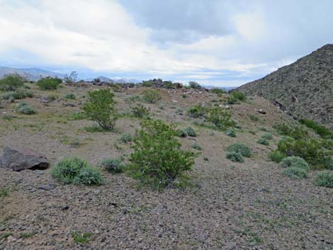
 Starting up the wash (view NNE) |
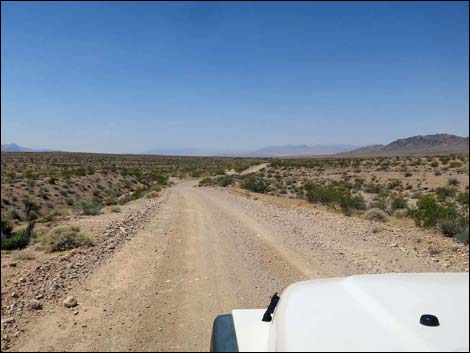
Getting to the Trailhead Black Ridge Mine is located on the south side of Black Ridge out in Gold Butte National Monument, about 1.5 hours northeast of Las Vegas in a wild, remote, and scenic area. From Las Vegas, drive out towards Gold Butte National Monument. From Highway 170 at Gold Butte Road, drive south for 14.3 miles to Fisherman's Cove Road. While driving, Gold Butte Road passes the Gold Butte boundary sign at 12.1 miles out; Fisherman's Cove Road is about 2 miles farther. At Fisherman's Cove Road, turn right and drive southwest 2.9 miles. The road heads southwest down the bajada, but then runs up over an odd highpoint on the otherwise flat desert landscape, and then descends to cross a broad wash. If flash floods are unlikely, park in the wash; this is the trailhead. |
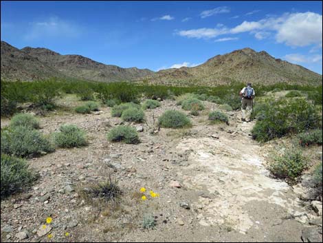
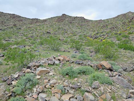
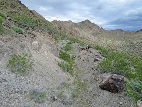
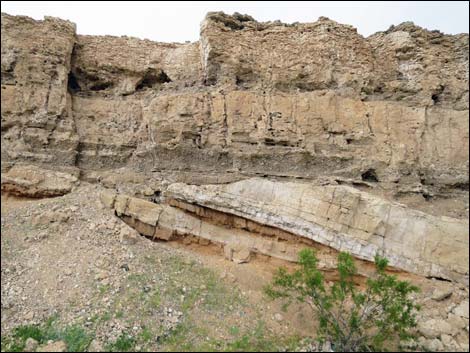 Interesting geology along the wash (view E) |
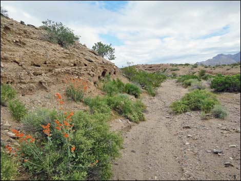
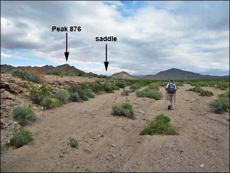
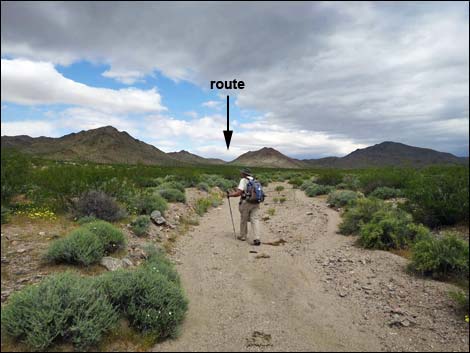
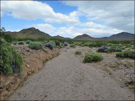
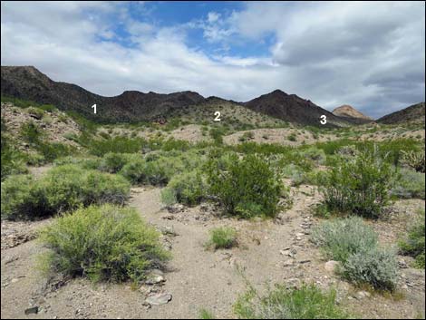
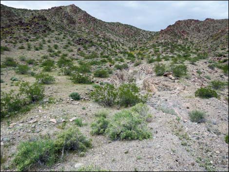
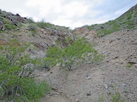
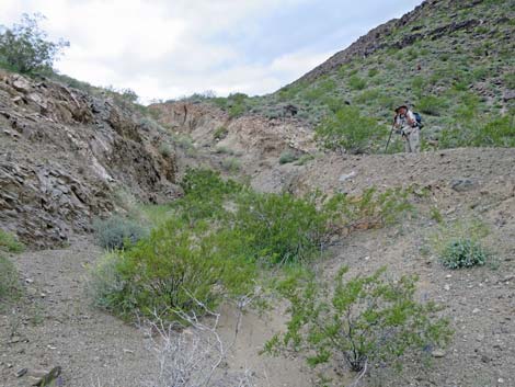
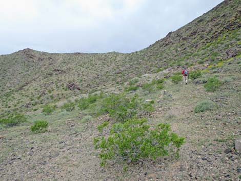
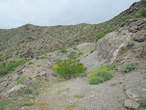
The Hike From the trailhead (Table 1, Waypoint 01), the route runs up the broad wash between low cliffs. These cliffs, with interesting geology, can be seen from many places up the route and make a good landmark for the return. Take note of the cliffs and reflect on them during the hike to keep this landmark in mind when returning across the featureless landscape. It is also useful at this point to look ahead and locate the saddle east of Peak 962. The saddle, on the ridgeline above Black Ridge Mine, is a good landmark going forward. On this broad open country, it would be easy to follow the main wash too far to the northeast (right). Continuing generally north up the gentle wash, it is useful to turn out of the main wash (Wpt. 02) into a narrower side wash to the left. This wash narrows until it is better to step right out of the wash (Wpt. 03) and just walk on the desert flats heading more northwest into the canyon that separates the two major hills that now lie ahead. At about 1.1 miles out, the route drops into a major wash (Wpt. 04) that follows the base of the hills on the left. This wash fans out to blend into the desert flats below, so this is not a good wash to find from below. |
 Hiker in broad, main wash (view NNE) |
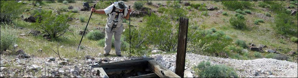
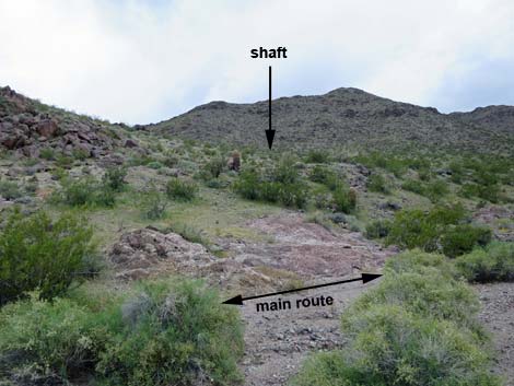
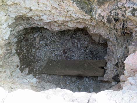
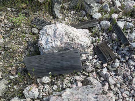
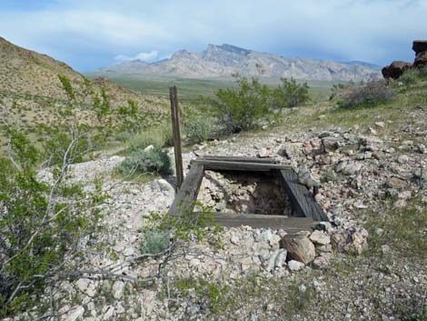
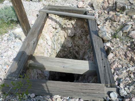
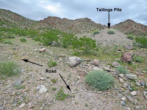
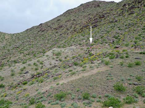
Continuing, the route up the major wash is easier to follow. Passing the East Ridge of Peak 876 (on the left; 1.3 miles out), a minor wash flowing east off the north side of the ridge joins the main wash (Wpt. 05), and sharp-eyed hikers may see a stone cairn on the little ridge between the two washes. For hikers interested in seeing the mine shaft, follow the little ridge between the two washes, passing a large stone cairn, southeast to the mine shaft (Wpt. 06). Watch for the white tailings pile on the hillside. This mine shaft is 20-ft-deep and not in any way remarkable, but it is interesting to see the site and consider the hard lives of the people who worked this land looking for mining riches. The wooden collar makes a fairly safe edge when looking down the shaft. The wooden upright attached to the collar is matched by another down in the shaft and probably held a pulley for hauling buckets of ore and debris up from the bottom. A small collection of wooden boards on the ground likely was a dynamite box. Please be sure to leave objects of historic interest in place. |
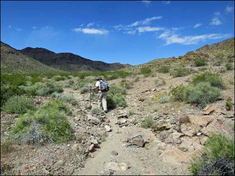
 Hiker in narrower wash (view N) |
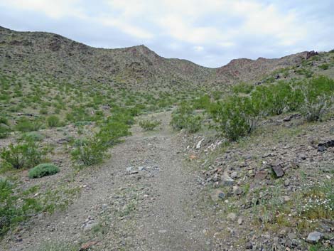
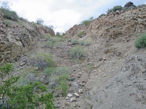
Returning to the wash (Wpt. 05), the route continues northwest up the wash and into the narrowing canyon. At about 1.8 miles out, the wash forks (Wpt. 07) three ways. The main fork goes right, a major fork goes left, and the route goes into the middle fork. Shortly, it becomes evident that an old mine road (Wpt. 08) heads up the middle fork and onto the hillside above. Following the old road northwest and straight up the hill, hikers approach a tailings pile on the right, and then the road turns hard to the left (Wpt. 09). Detouring onto the tailings pile, it soon becomes apparent that this is a pile of debris dug out of a 80-ft trench that runs farther up the hill. It is interesting to see the fractured "bedrock" and the many white veins running through it. Back in the old road (Wpt. 09), the road now runs up across the hillside heading southwest at a more gentle angle. Shortly, the road bends more due south and runs up a shallow gully that is the start of the main prospecting area. |
 |
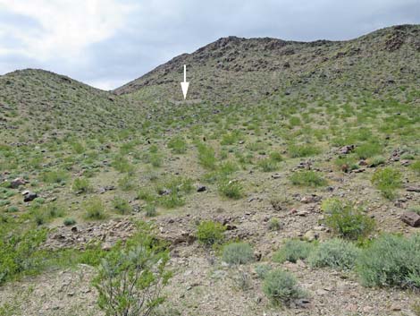
A tailings pile makes a flat area in the gully, and from there a 200-ft trench (Wpt. 10) runs south up the gully to the crest of a low ridge. This seems like the main prospect on the site, and again it is interesting to see the fractured bedrock and the many white veins running through it. Off to the right (west) a 170-ft trench cuts across the hillside leaving a V-shaped trench rather than a rectangular trench. Following the main trench onto the ridgetop (Wpt. 12), a considerable amount of desert was pushed around as if they were scraping away the top of the hill. A road-like trench continues southwest across the hillside and ends (Wpt. 13), and another road-like trench heads down the steep hillside. From this area, hikers can take any of several routes back, including climbing over Peak 962, but following the road and the washes back to the trailhead (Wpt. 01) definitely is easier. |
 |
 |
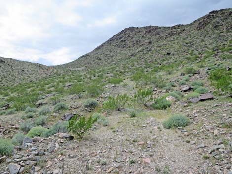
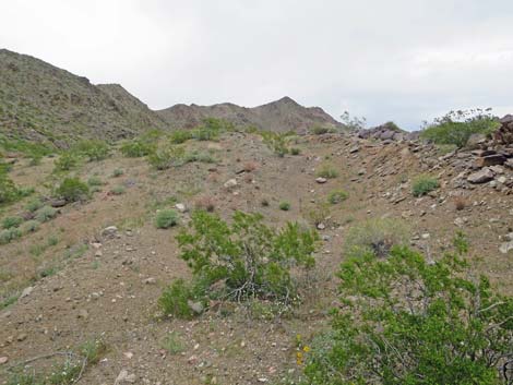
 It becomes easier to leave the wash to the right (view NW) |
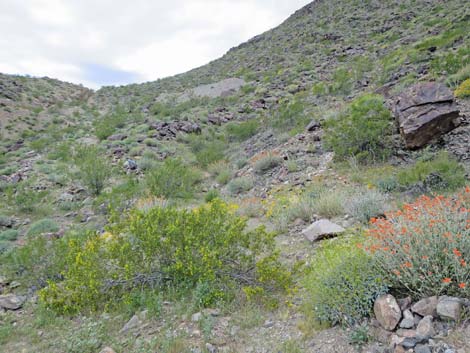
 From this broad wash, hikers can detour to the mine shaft (view W) |
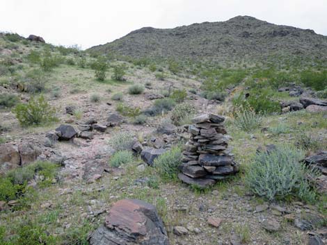 Large stone mining-claim cairn (view SW) |
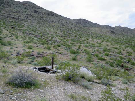 Approaching the mine shaft (view SW) |
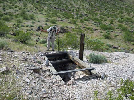 Hiker peering down the mine shaft (view SW) |
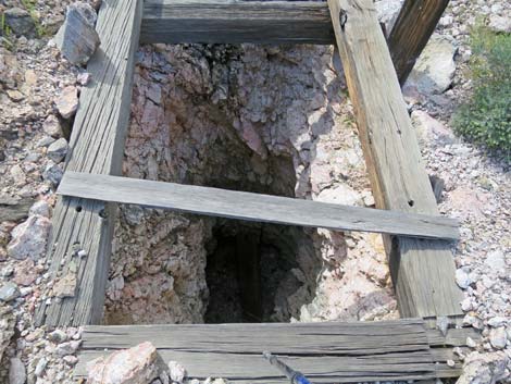 Looking into the shaft (view SW) |
 Looking down the shaft |
 Parts of a dynamite box |
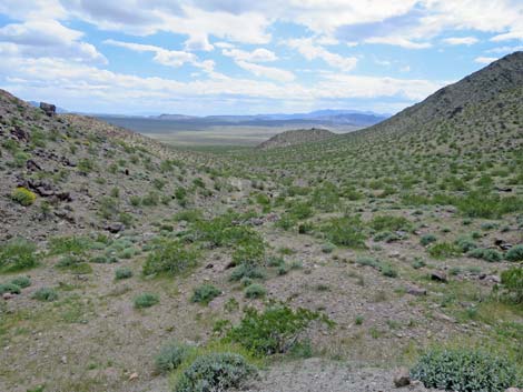
 Grand view from the mine (view NE towards Virgin Peak) |
 Mine shaft collar |
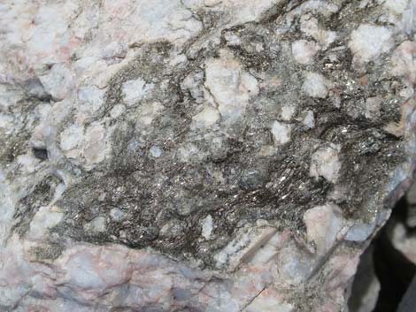 Granite pegmatite crystals with mica |
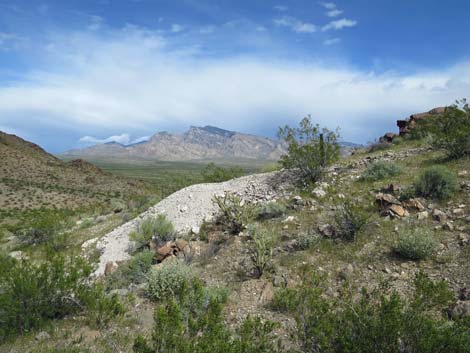 White tailings pile with a grand view (view NE towards Virgin Peak) |
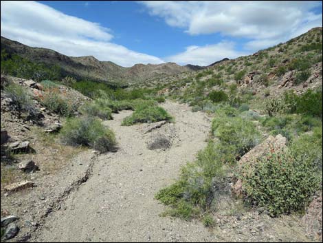 Back in the main wash in the canyon (view NW) |
 The wash forks three ways (view N) |
 Starting up the middle of the three washes (view N) |
 A road appears from nowhere (view NW) |
 The route follows the old road (view NW) |
 Mine tailings can be seen across the hillside (view NW) |
 The road curves below the first trench (view N) |
 Mine trench (view N) |
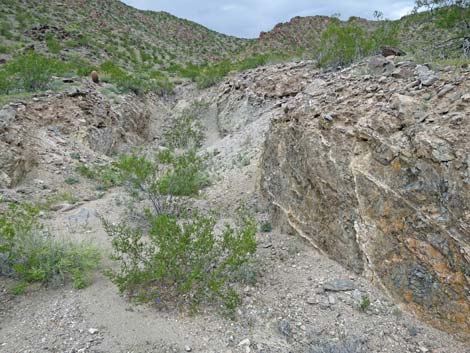 Interesting walls in the mine trench (view N) |
 From tailings pile, grand view down canyon (view SE) |
 From tailings pile, route returns to old road (view SW) |
 Possible tent site? (view N) |
 Old road continues towards main mine site (view SW) |
 Road leads to trenches near low saddle (view SW) |
 Tailings pile below main trench (view SE) |
 Main trench runs up the gully (view SW) |
 Hiker above main trench (view SW) |
 Main trench (view SW) |
 V-shaped trench on hillside (view NE) |
 Top of ridgeline with bulldozed flat area (view SW) |
 Looking back towards top of main trench (view NE) |
 Hiker continuing towards last trench (view SW) |
 Hiker at last trench (view SW) |
 Last trench (view SW) |
Table 1. Hiking Coordinates and Distances based on GPS Data (NAD27; UTM Zone 11S). Download Hiking GPS waypoints (gpx) file.
| Wpt. | Location | UTM Easting | UTM Northing | Elevation (ft) | Point-to-Point Distance (mi) | Cumulative Distance (mi) |
|---|---|---|---|---|---|---|
| 01 | Trailhead | 746777 | 4049636 | 2,083 | 0.00 | 0.00 |
| 02 | Turn Out of Main Wash | 746803 | 4050261 | 2,041 | 0.42 | 0.42 |
| 03 | Step Out of Wash | 746792 | 4050595 | 2,071 | 0.22 | 0.64 |
| 04 | Enter Broad Wash | 746397 | 4051103 | 2,179 | 0.43 | 1.07 |
| 05 | Detour to Mine Shaft | 746228 | 4051412 | 1,498 | 0.23 | 1.30 |
| 06 | Mine Shaft | 746135 | 4051363 | 2,434 | 0.08 | 1.38 |
| 05 | Detour to Mine Shaft | 746228 | 4051412 | 1,498 | 0.08 | 1.46 |
| 07 | Wash Forks Three Ways | 745989 | 4051808 | 2,331 | 0.32 | 1.78 |
| 08 | Start Old Road | 746006 | 4051846 | 2,339 | 0.03 | 1.81 |
| 09 | Spur to East Trench | 745823 | 4052013 | 2,443 | 0.17 | 1.98 |
| 10 | Mine Area | 745697 | 4051811 | 1,795 | 0.30 | 2.28 |
| 11 | Upper Trench | 745667 | 4051804 | 1,824 | 0.03 | 2.31 |
| 12 | Central Trench | 745673 | 4051752 | 1,836 | 0.05 | 2.36 |
| 13 | West Trench | 745603 | 4051669 | 1,838 | 0.12 | 2.48 |
| 09 | Spur to East Trench | 745812 | 4052006 | 2,443 | 0.42 | 2.90 |
| 05 | Detour to Mine Shaft | 746228 | 4051412 | 1,498 | 0.52 | 3.42 |
| 01 | Trailhead | 746777 | 4049636 | 2,083 | 1.30 | 4.72 |
Happy Hiking! All distances, elevations, and other facts are approximate.
![]() ; Last updated 240325
; Last updated 240325
| Hiking Around Gold Butte | Hiking Around Las Vegas | Glossary | Copyright, Conditions, Disclaimer | Home |