Slate Canyon to Agate Canyon
Hiking Around Las Vegas, Grand Canyon National Park
Overview | Previous Segment | Next Segment
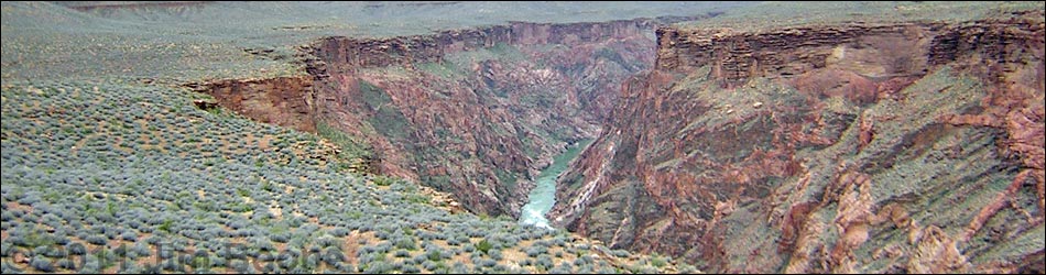
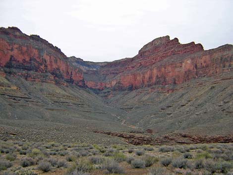
 Crossing in Slate Canyon (view SE) |
Overview This description of the Tonto West Trail is divided into two parts: (1) an overview of the entire trail, trailheads, and other general information, and (2) individual canyon-to-canyon segments. From the wash in Slate Canyon, it is about 4.7 miles and 2.5 hours to the wash in Agate Canyon. Water is available from a spring below the trail in Slate Canyon; seasonal water may be available at Slate Wash. Expect no water at Agate Wash. This segment of the trail runs northeast to the edge of the Inner Gorge, runs west under the toe of Geikie Peak (on the ridge below Pollux Temple), and then turns south and runs back into Agate Canyon. The trail is always faint, and hikers should expect to spend some time off-route and looking for the trail. This segment of trail is in Backcountry Use Zone BO9 (at-large camping). Link to map of this segment. Watch Out Other than the standard warnings about hiking in the desert, ...be sure to read the Watch Out section on the Tonto West Overview page, which discusses things such as cell phones and signal mirrors. While hiking, please respect the land and the other people out there, and please try to Leave No Trace of your passage. |
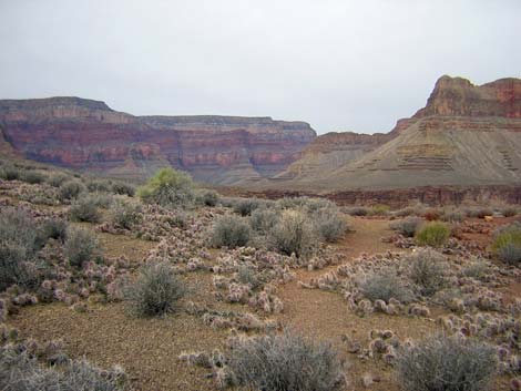
 Slate Canyon (view SW) |
Getting to the Trailhead Trailhead information is presented on the Tonto West Overview page. The Hike 11. Slate Canyon to Agate Canyon -- 4.7 miles and 2.5 hours The Tonto Trail crosses Slate Canyon atop a pour-over at the edge of the Tapeats Sandstone (Table 11, Waypoint 055). From the wash crossing, the trail runs out on the contour following easy ledges across cliffs that overlook the canyon. Less than 1 minute west of the crossing, a step over a chasm while ducking to avoid a catclaw acacia, makes for an airy step with a full pack. The trail runs along the edge of the cliffs for about 10 minutes to a corner, where it turns into a side canyon (Wpt 56). The trail runs straight up the wash for about 100 to 150 feet before cutting steeply up the bank on the right side; the trail then turns and runs out on the contour again. |
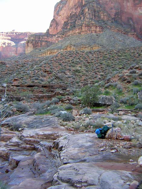
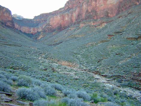
 Campsite below Scylla Butte (view NE) |
On the contour, the trail runs easily, but there are some cliffy spots where the trail crosses a rocky hillside and it's a long way down to bottom of Slate Canyon. You can look down from these cliffs and see water running in the canyon below the spring. Passing the cliffy sections, the trail moves away from the edge of the cliffs and runs up to a low saddle with a nice campsite overlooking Slate Canyon (Wpt. 057). This is the first campsite west of Slate Wash. From the low saddle, the trail gently runs out past the south face of Scylla Butte and climbs to a low saddle with a campsite on the northwest corner of Slate Canyon (Wpt. 058). |
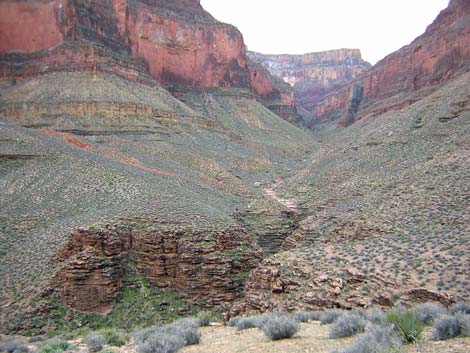
 Trail in cactus (view NW) |
From the low saddle, a fairly clear and easy, but cactus-choked trail runs west towards Agate Canyon. This part of the trail generally is easy, easy to follow, and generally follows the contour, although it drops a fair way into the side canyon northeast of Geikie Peak. There are nice campsites on several of the high points (Wpts. 058-063). There is a particularly nice site on a saddle overlooking the river about 10 minutes west of the turn out of Slate Canyon (Wpt. 060). There are nice views from the edge of the Inner Gorge, and there are places where you can hear the rapids. At the turn into Agate Canyon, there is one section where it is easy to lose the trail. I lost the trail here, stayed too high, and had a difficult time hiking into Agate. Heading west before the turn into Agate Canyon, a good trail crosses a steep hillside in a shallow side canyon (Wpt. 063). As the trail runs west out of this side canyon, the terrain levels out, and the trail becomes faint and blends with the bushes (Wpt. 064). |
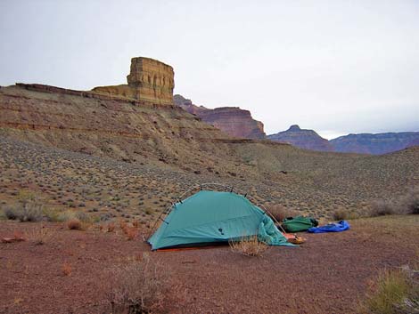
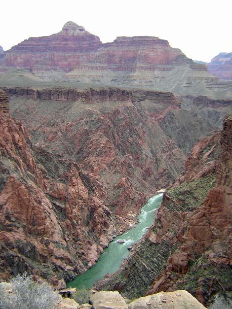 Colorado River (view NE from trail) |
When you lose the trail, and assuming that it follows the contour, you would think that the trail curves south on the contour and starts into Agate Canyon; it does not. Instead, the faint trail stays right on the edge of the Inner Gorge (even over the edge) until it gets to the northern-most point on the corner of Agate Canyon (Wpt. 065). The trail stays between a band of low white cliffs to the south and the cliffs overlooking the river to the north. When the trail does turn into Agate Canyon, it still is difficult to follow, but if you stay on it here, the trail into Agate is fairly easy. From the point on the northeast corner of Agate Canyon (Wpt. 065), the faint trail runs south for about 1 minute (60 yards) to a large cairn (Wpt. 066) set atop a short band of rocks (breakdown rubble, not cliffs). If you don't find the cairn within about 1 minute of the point, hunt around and find it. From the large cairn (Wpt. 066), it is important to follow the cairn-route as there is no evidence of a regular trail anywhere. The cairn-route runs straight down the slope along the south side of a shallow gully. From the large cairn at the top (Wpt. 066), hike down the gully for about 90 yards to the large catclaw acacia (Wpt. 067) and find the cairn a few feet south of the acacia (there are a few small cairns between the band of rocks and the acacia). From the acacia, follow the cairn-route down the gully towards the edge of cliffs, and then follow the cairns and the trail along the edge of cliffs all the way into the back of Agate canyon. |
 Agate Canyon (view SW) |
The hike into Agate is easy if you stay on the cairns, and in general, the trail runs closer to the edge of the cliffs than you would expect. This section is well cairned, so if you don't see cairns, you are off route. There is another problem area in the major side canyon near the back of Agate Canyon. Two major gullies come down this side canyon. The trail leads naturally into the bottom of the first gully (Wpt. 068). From there, the trail runs down the south edge of the gully and cuts around the corner into the next gully, staying more-or-less on the contour but trending downhill. An off-route trail goes up and over the ridge, and you can follow cairns that way, but go down the ridge -- not up. The goal is to follow the contour of the hillside from this gully into the next, not to climb over the ridge between them. The trail is easier to find when hiking east out of Agate: as you start into the major side canyon, aim for what looks like an agave-roasting pit (an odd pile of small stones on the hillside) on the far side of the northern gully. |
 Agate Canyon (view SW) |
Continuing west from the second gully (Wpt. 069), an easy trail runs around the hillside and down into the bottom of Agate Canyon, trending downhill but generally staying on the contour (Wpt. 070). There are no obvious campsites and no water at Agate, although there is a seasonal seep where you can suck water and grit from the ground. |
Table 11. Hiking Coordinates Based on GPS Data (NAD27; UTM Zone 12). Download Entire Route Waypoint (gpx) file.
| Wpt. | Location | Time | Easting | Northing | Elevation (ft) | Verified |
|---|---|---|---|---|---|---|
| 055 | Slate Wash (31) | 1252 | 385765 | 3998279 | 3,120 | GPS |
| 056 | Base of rocky gully (32) | 1303 | 386078 | 3998572 | 3,149 | GPS |
| 057 | Camp on saddle (33) | 1320 | 386529 | 3998914 | 3,348 | GPS |
| 058 | Exit Slate drainage, camp (34) | 1339 | 387136 | 3999411 | 3,446 | GPS |
| 059 | Saddle with camp (35) | 1343 | 387187 | 3999575 | 3,420 | GPS |
| 060 | Flats with big camp (36) | 1351 | 386922 | 3999857 | 3,415 | GPS |
| 061 | Saddle with camp (37) | 1412 | 386099 | 4000114 | 3,411 | GPS |
| 062 | Flat saddle with camp (38) | 1428 | 385746 | 4000119 | 3,405 | GPS |
| 063 | Steep hillside with good trail (39) | -- | 385615 | 4000030 | 3,360 | Map |
| 064 | Saddle (40) | 1440 | 385377 | 4000127 | 3,350 | GPS |
| 065 | Point on the edge of Agate (40.5) | -- | 385062 | 4000181 | 3,260 | Map |
| 066 | Large cairn at top of gully (93) | 1450 | 385037 | 4000128 | 3,279 | GPS |
| 067 | Acacia with a big cairn (41) | 1451 | 384988 | 4000052 | 3,224 | GPS |
| 068 | First gully in side canyon (42) | 1511 | 384976 | 3999393 | 3,176 | GPS |
| 069 | Second gully in side canyon (42.5) | -- | 384931 | 3999316 | 3,150 | Map |
| 070 | Agate Wash (43) | 1526 | 384408 | 3999196 | 3,120 | GPS |
Happy Hiking! All distances, elevations, and other facts are approximate.
![]() ; Last updated 240326
; Last updated 240326
| Hiking Around Grand Canyon | Hiking Around Las Vegas | Glossary | Copyright, Conditions, Disclaimer | Home |