Salt Creek to Cedar Spring
Hiking Around Las Vegas, Grand Canyon National Park
Overview | Previous Segment | Next Segment
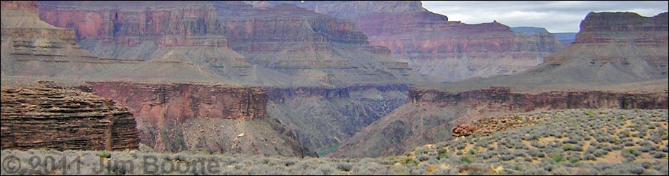
 Salt Canyon (view S) |
Overview This description of the Tonto West Trail is divided into two parts: (1) an overview of the entire trail, trailheads, and other general information, and (2) individual canyon-to-canyon segments. In addition, the Hermits Rest, Monument Creek, Havasupai Garden, Bright Angel Trailhead loop (west to east) is described separately because this is a popular loop, and it is easier to follow descriptions going forward than going backwards. From Salt Creek, it is about 2.1 miles and 1 hour to Cedar Spring, the next water source and camping area to the west. This segment of the trail runs out the west side of Salt Creek and loops around the east arm of the Alligator (one of the ridges below Mohave Point), to Cedar Spring. The trail is fast, wide, and easy (but with a few rocky spots), and the views above and below the trail are truly spectacular. Salt Creek is in Backcountry Use Zone BL5 (camping only in designated campsites), and Cedar Spring is in Zone BL6 (camping only in designated campsites). Link to map of this segment. |
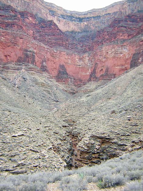
 Trail above cliffs along Salt Canyon (view NW) |
Watch Out Other than the standard warnings about hiking in the desert, ...be sure to read the Watch Out section on the Tonto West Overview page, which discusses things such as cell phones and signal mirrors. While hiking, please respect the land and the other people out there, and please try to Leave No Trace of your passage. Getting to the Trailhead Trailhead information is presented on the Tonto West Overview page. The Hike 3. Cedar Spring to Salt Creek -- 2.1 miles and 1 hour From the Salt Creek Campground trail junction (Table 3, Waypoint 010), the Tonto West Trail runs west to cross a shallow side canyon, then turns north and runs along the edge of the narrow Salt Creek gorge. The trail continues northwest to the point (Wpt. 011), running right along the edge of the Tapeats Sandstone cliffs and providing spectacular views much of the way, including awesome views from the cliff edge straight down into the river. From the point (Wpt. 011), a ridge that comes down from the east arm of the Alligator, the trail turns southwest into a major side canyon with more cliffy sections and grand views. From the back of the side canyon, where the marks of a recent flash flood dramatically show the power of fast-moving water, the trail runs west over a low ridge and into the next little side canyon and Cedar Spring (Wpt. 012). Nothing, not even the tree, is obvious until you come upon the small campground sign. The small tree is down the wash at the top edge of the Tapeats Sandstone cliffs where water runs over the rocks at the edge. There are small campsites just below the trail, and there is a larger campsite on the west side of the wash near the tree. Two use-trails run up the hill above the trail, so there might be campsites up there too. |
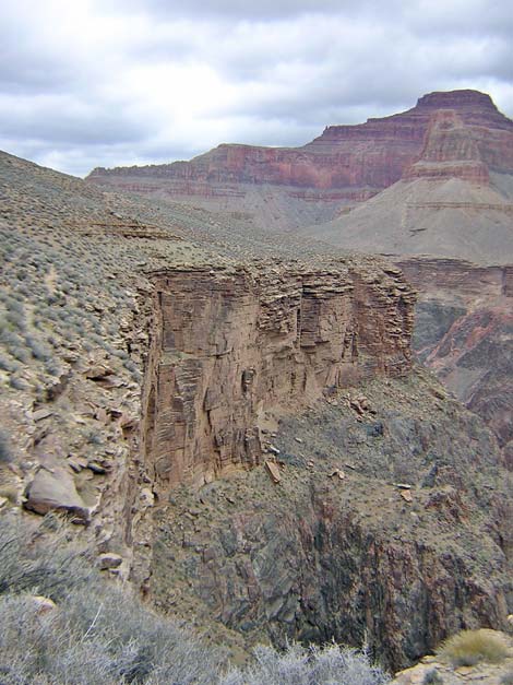
 Inner Gorge and Colorado River (view NE from trail) |
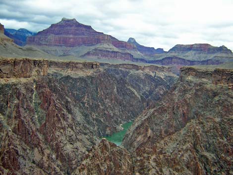
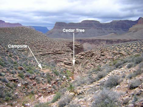 Cedar Spring (view NW from trail). |
Table 3. Hiking Coordinates Based on GPS Data (NAD27; UTM Zone 12). Download Entire Route Waypoint (gpx) file.
| Wpt. | Location | Time | Easting | Northing | Elevation (ft) | Verified |
|---|---|---|---|---|---|---|
| 010 | Salt Creek Wash (B06) | 0828 | 395461 | 3993761 | 3,410 | Map |
| 011 | Point below east arm of the Alligator (B05) | 0801 | 394573 | 3994939 | 3,450 | Map |
| 012 | Cedar Spring Wash (B04) | 0734 | 394001 | 3994233 | 3,360 | Map |
Happy Hiking! All distances, elevations, and other facts are approximate.
![]() ; Last updated 240326
; Last updated 240326
| Hiking Around Grand Canyon | Hiking Around Las Vegas | Glossary | Copyright, Conditions, Disclaimer | Home |