Havasupai Garden Campground to Horn Creek
Hiking Around Las Vegas, Grand Canyon National Park
Overview | Previous Segment | Next Segment
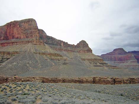
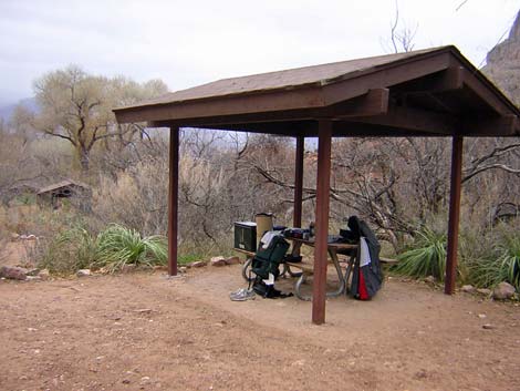 Havasupai Garden Campground (view NE) |
Overview I've organized my description of the Tonto West Trail into two parts: (1) an overview of the entire trail, trailheads, and other general information, and (2) individual canyon-to-canyon segments. Elsewhere I have described the Hermits Rest, Monument Creek, Havasupai Garden, Bright Angel Trailhead loop (west to east) because this is a popular loop, and it is easier to follow descriptions going forward than going backwards. Link to map of this segment. |
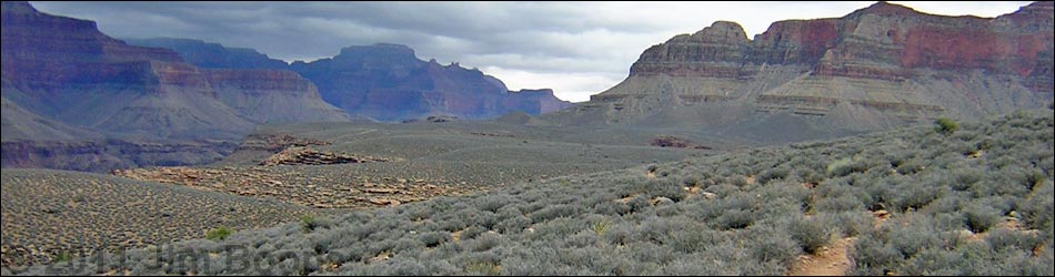
 North of Havasupai Garden Camp. Trail can be seen on hillside at left edge of photo (view N). |
Overview: From Havasupai Garden Campground, it is about 2.5 miles and 1.5 hours to the east horn of Horn Creek, the first legal camping area along the trail. Drinking water is available only at Havasupai Garden Campground. Water flows in Horn Creek, but it is contaminated with uranium from the old mine at the head of the canyon, so don't drink the water. This segment of the Tonto Trail exits Bright Angel Canyon, loops west around the ridge below Maricopa Point, and runs up into Horn Canyon. This segment of the trail is fast, wide, easy, and provides many grand views. Havasupai Garden Campground is in Backcountry Use Zone ICG (camping only in the campground), and Horn Creek is in Zone BL4 (camping only in designated campsites). |
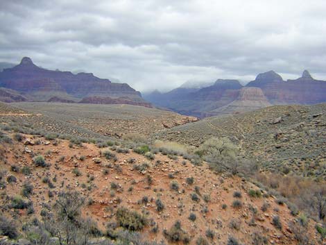
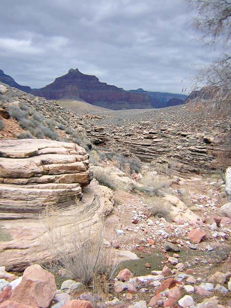
 Tonto Trail (view E) |
Watch Out Other than the standard warnings about hiking in the desert, ...be sure to read the Watch Out section on the Tonto West Overview page, which discusses things such as cell phones and signal mirrors. While hiking, please respect the land and the other people out there, and please try to Leave No Trace of your passage. Getting to the Trailhead Trailhead information is presented on the Tonto West Overview page. |
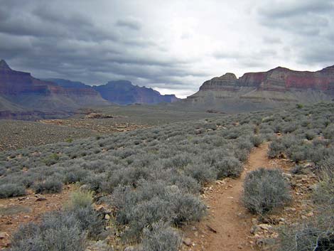
 View across Horn Canyon (view NW from trail) |
The Hike 1. Havasupai Garden Campground to Horn Creek -- 2.5 miles and 1.5 hours From the campground at Havasupai Garden (Wpt. 001), it takes about 15 minutes to get to the start of the Tonto West Trail. Hike north down the Bright Angel Trail to the corral, then cross the creek to the west side of Bright Angel Creek, and continue hiking north along the creek towards Plateau Point. About 10 minutes past the last cottonwood tree, the Tonto West Trail forks off to the west (Wpt. 002). If you have time, it probably is worth the walk out to Plateau Point (Wpt. XX1), although there are many similar views down the trail. |
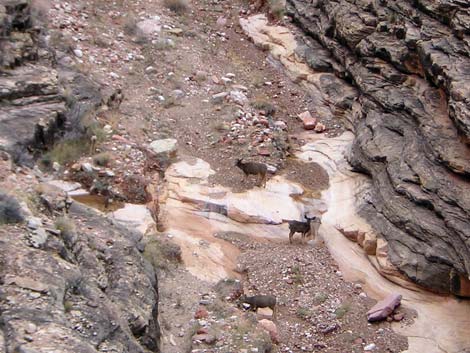 Mule deer in Horn Creek (view SW from trail) |
The Tonto West Trail runs west and up across a gentle slope for about 5 minutes to cross a low ridge and exit the Bright Angel drainage system (Wpt. 003). From the low ridge, the trail gradually descends at an easy grade as it runs west across the blackbrush-covered side-slope below Maricopa Point. This is a good, easy trail with only a few rocky spots. |
 Tonto Trail at east horn of Horn Creek (view N) |
The trail goes over a ridge (Wpt. 004) and turns into the Horn Creek drainage system. The trail runs on the contour, drops down a hillside at fair grade on a rocky trail to the edge of the canyon, and then runs south on the contour towards the back of Horn Canyon. The trail passes a large side canyon with grand views down the cliffs (Wpt. 005) and then a smaller one before reaching the east horn of Horn Canyon (Wpt. 006). There is a nice campsite under a tree on the east edge of the streambed, and there is an outhouse up the hill just west of the creek. From the number of cairns and hand-drawn signs, it seems that people have trouble finding the outhouse. Water runs in the creek about 50 yards up from the trail crossing. I found the water suitable for bathing, but don't drink it. |
Table 1. Hiking Coordinates Based on GPS Data (NAD27; UTM Zone 12). Download Entire Route Waypoint (gpx) file.
| Wpt. | Location | Time | Easting | Northing | Elevation (ft) | Verified |
|---|---|---|---|---|---|---|
| 001 | Havasupai Garden Campground (B13) | 1313 | 398461 | 3992941 | 3,780 | Map |
| 002 | Plateau Point - Tonto West trail junction (B12) | 1248 | 398829 | 3993857 | 3,700 | Map |
| 003 | Turn out of Bright Angel drainage | 1243 | 398363 | 3994211 | 3,805 | Map |
| 004 | Ridge (B11) | 1220 | 398009 | 3994469 | 3,770 | Map |
| 005 | Cliff with view | 1205 | 397567 | 3994179 | 3,630 | Map |
| 006 | East Horn of Horn Canyon (B10) | 1150 | 397077 | 3993717 | 3,520 | Map |
| XX1 | Plateau Point (XX1) | -- | 399550 | 3994640 | 3,765 | Map |
Happy Hiking! All distances, elevations, and other facts are approximate.
![]() ; Last updated 240326
; Last updated 240326
| Hiking Around Grand Canyon | Hiking Around Las Vegas | Glossary | Copyright, Conditions, Disclaimer | Home |