Hiking Around Las Vegas, Grand Canyon National Park
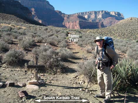
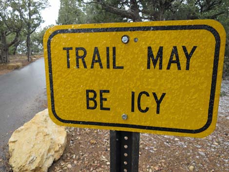 Sign near bus-stop trailhead (view N) |
Overview Hikers seeking an inner-canyon experience with unparalleled panoramic ridgeline views should consider the South Kaibab Trail. But the exhilarating sense of inner-canyon vastness comes at a cost: there is little shade and no water. The South Kaibab Trail descends 7-miles from the South Rim near Yaki Point to Phantom Ranch at the bottom of the Grand Canyon. This trail is steep and airy. This trail provides access to great viewpoints for day hikers (Ooh-Aah Point, Cedar Ridge, and Skeleton Point [3 miles out]), the Tonto East Trail, Tip-Off viewpoint, River Trail, Colorado River, Black Bridge, Bright Angel Campground, and Phantom Ranch. Note: most of this description comes from NPS documents and other sources. I've not hiked this one yet. Link to map. Link to South Kaibab Trail -- Uphill. |
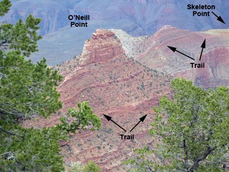 Trail passing O'Neill Butte and heading towards Skeleton Point |
Watch Out Other than the standard warnings about hiking in the desert, ...this is a pretty safe trail if you stay on it, but there are many places where hikers could stumble off the trail. This trail is a very hot and entirely dry. Carry enough water and avoid hiking during midday. While hiking, please respect the land and the other people out there, and try to Leave No Trace of your passage. This is a remote hike, so be sure to bring the 10 Essentials. Pay attention to the direction of wranglers when mule teams pass, as they have the right-of-way. Getting to the Trailhead This hike is located on the South Rim of the Grand Canyon, about 5.5 hours southeast of Las Vegas, and starts off Yaki Point Road, which is accessible on foot (Rim Trail) or by shuttle bus only. Private vehicles are not permitted on Yaki Point Road. |
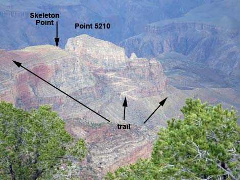 Trail at and beyond Skeleton Point |
The Hike From the bus-stop trailhead (Table 1, Waypoint 01), the paved trail runs north to the edge of the cliffs (Wpt. 02), then immediately begins down a series of tight switchbacks where ice is likely during winter. After the initial switchbacks, the trail levels out following ledges below the first layer of limestone. This west-facing slope can be quite hot during summer afternoons. The ledge is followed north until reaching the top of the Coconino Sandstone and Ooh-Aah Point (Wpt. 03) Oohs and Aahs being the first utterances from people when they first arrive at this grand panoramic view of the canyon. From Ooh-Aah Point, the trail runs down the ridgeline, switchbacking here and there, descending the east and west sides of the ridge before reaching Cedar Ridge (Wpt. 04). There are pit toilets at Cedar Ridge, but no water or emergency phone. |
 Tip-Off Toilets (view E from trail |
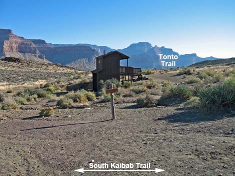
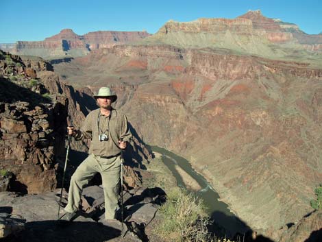
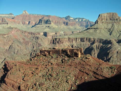
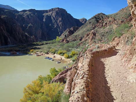
From Cedar Ridge, the South Kaibab Trail runs more-or-less straight down the ridge, contouring down and around O'Neill Butte to Skeleton Point (Wpt. 05). At 3 miles from the rim, Skeleton Point is the maximum distance the NPS recommends for day hikes. From Skeleton Point, the trail drops straight over the edge of the cliffs where the trail was blasted out of the limestone cliffs. In this area, hikers will encounter the most dramatic sense of exposure. The trail drops quickly through 20 switchbacks (depending on what is counted) and eventually begins to contour down and around Peak 5210 and out onto the flats of the Tonto Platform. On these desert flats, the South Kaibab Trail reaches a junction with the Tonto East Trail (Wpt. 06). This trail runs east-west across the Tonto Platform and can be used to connect with the Bright Angel Trail (near Havasupai Garden) to the west or the Grandview Trail to the east. The trail east is hard to see here, but the Tip-Off Toilets (Wpt. 07), ahead on the right, is a good place to find the eastbound Tonto Trail. There are pit toilets and an emergency phone at Tipoff, but no water. |
 Hiker at Tonto East Trail Junction (view W) |
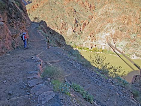
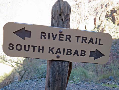
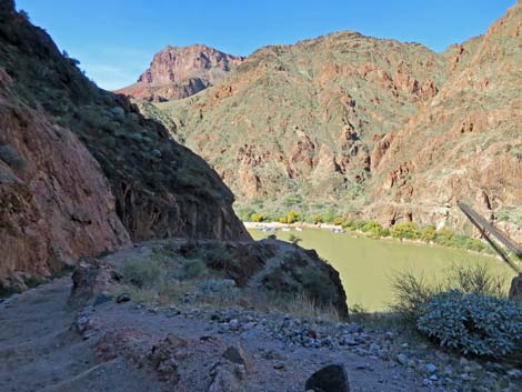
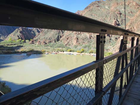
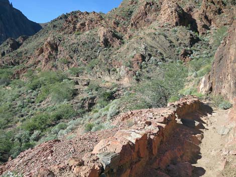
Below the Tonto Trail and Tip-Off Toilets, the South Kaibab Trail continues north to the edge of the next set of cliffs. Here, at the top of the Inner Gorge and the next switchbacks, the Tip-Off (Wpt. 08), where one tips off the edge, hikers get a nice view of the river and the Phantom Ranch area. The trail descends a couple of short switchbacks, then begins contouring down and around ridges while traversing steep hillsides, and here the trail finally gets steep. In this area, the current trail loosely follows the trace of an earlier trail, the Cable Trail, that was built in 1907 to provide access to the old cable-car system that was used to cross the river before construction of the Black Suspension Bridge. Vestiges of this earlier trail can be seen on the way down. The South Kaibab Trail descends steeply toward the Colorado River, but first reaches a junction with the River Trail (Wpt. 30). River Trail runs west to the Silver Suspension Bridge and on to the bottom end of the Bright Angel Trail at Pipe Beach. At the trail junction, the South Kaibab Trail switchbacks to the right and continues steeply downhill, while the River Trail contours around the corner to the left. |
 Hiker at the Tip-Off (view NW) |
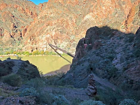
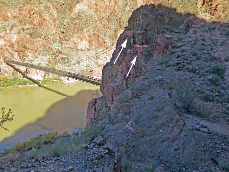
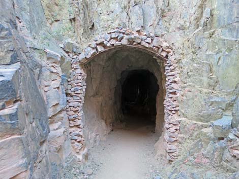
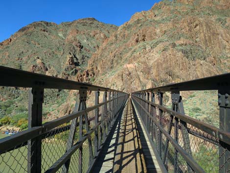
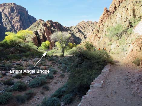
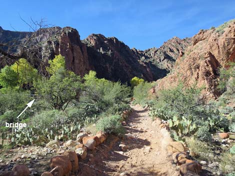
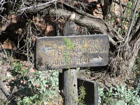
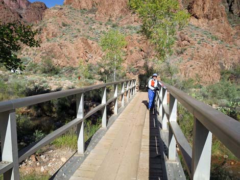
Descending the switchbacks, the trail soon enters a tunnel that was carved out of solid rock to facilitate building the Black Suspension Bridge in 1921. The tunnel is not long, but it bends, so when looking in, hikers can't see the other end. The tunnel opens onto the Black Bridge (Wpt. 29) where mules and hikers cross to the other side (Wpt. 28). The trail makes a little loop upstream and then back down under the bridge to follow cliffs above the river. The trail passes above Boat Beach and the ruins of Bright Angel Pueblo (Wpt. 27), then arrives at the spur trail to Boat Beach (Wpt. 26). A bit father on, the South Kaibab Trail ends at a trail junction with a large information sign (Wpt. 24). Here, the mule trail to Phantom Ranch Lodge continues straight (right), while the North Kaibab Trail turns left to cross a bridge over Bright Angel Creek. Staying right along the other side of the creek and following it upstream, the North Kaibab Trail runs up through Bright Angel Campground and eventually all the way to the North Rim. |
 Trail traversing hillside below the Tip-Off (view NE) |
 Hiker at South Kaibab Trail -- River Trail junction (view NW) |
 South Kaibab Trail -- River Trail junction sign (view NE) |
 Trail switchbacks down towards the Colorado River (view NW) |
 Trail switchbacks down towards the Black Bridge (view N) |
 Concrete structures; part of old cableway? |
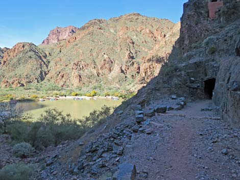 Approaching the Black Bridge Tunnel (view N) |
 Approaching the Black Bridge Tunnel (view N) |
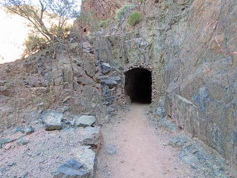
 Entrance to Black Bridge Tunnel (view N) |
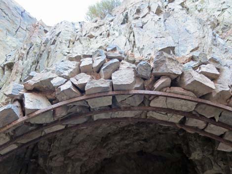 Curious iron and rock work around tunnel entrance |
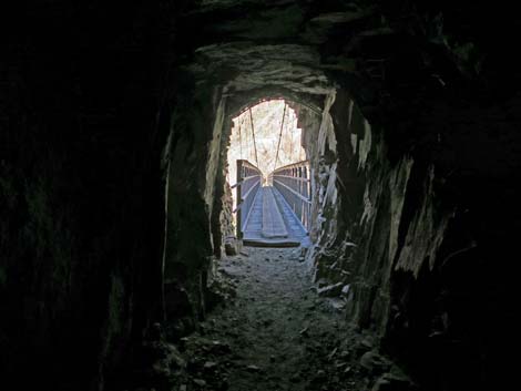 Inside the tunnel looking towards bridge (view NW) |
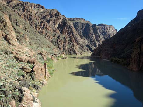
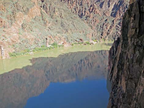 Colorado River upstream (view NE from Black Bridge) |
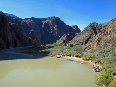
 Boat Beach (view NW from Black Bridge) |
 |
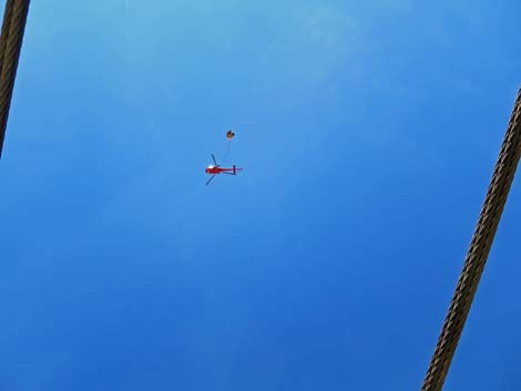 NPS helicopter slinging a load above the bridge |
 Colorado River upstream (view NE from Black Bridge) |
 Boat Beach (view NW from Black Bridge) |
 Trail loops around at N end of bridge (view W) |
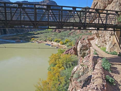 Boat Beach (view W under Black Bridge) |
 Nice rock wall along the trail (view W) |
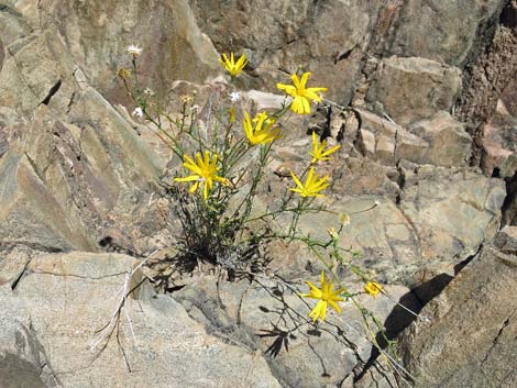 Yellow sunflower blooming on rock wall |
 Approaching ruins of Bright Angel Pueblo (view W) |
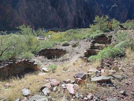 Ruins of Bright Angel Pueblo (view SW) |
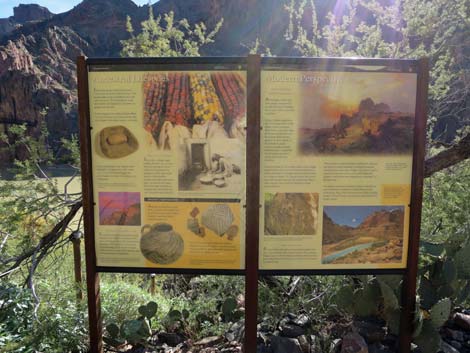 Information sign at ruins of Bright Angel Pueblo (view S) |
 Approaching Phantom Ranch area (view W) |
 Approaching Phantom Ranch area (view W) |
 Sign at trail junction to campground or lodge (view N) |
 Looking back at hiker on bridge over Bright Angel Creek (view N) |
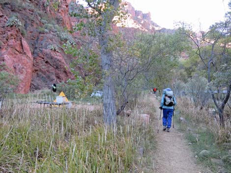 Hiker in Bright Angel Campground (view NW) |
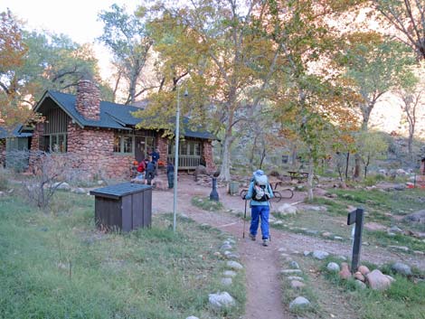 Hiker arriving at Phantom Ranch Cantina (view NE) |
Table 1. Hiking Coordinates and Distances based on GPS Data (NAD27; UTM Zone 11S). Download Hiking GPS Waypoints (gpx) file.
| Wpt. | Location | UTM Easting | UTM Northing | Elevation (ft) | Point-to-Point Distance (mi) | Cumulative Distance (mi) |
|---|---|---|---|---|---|---|
| 01 | South Kaibab Trailhead | 402454 | 3990152 | 7,205 | 0.00 | 0.00 |
| 02 | Edge of the Canyon | 402469 | 3990213 | 7,201 | 0.04 | 0.04 |
| 03 | Ooh-Aah Point | 402163 | 3991104 | 6,400 | 0.86 | 0.90 |
| 04 | Cedar Ridge | 401969 | 3991396 | 6,060 | 0.60 | 1.50 |
| 05 | Skeleton Point | 401925 | 3993313 | 5,200 | 1.50 | 3.00 |
| 06 | Tonto Trail Westbound | 402035 | 3994283 | 4,012 | 1.60 | 4.60 |
| 07 | Tip-Off Toilets | 402089 | 3994317 | 4,005 | 0.05 | 4.65 |
| 08 | Tip-Off Point | 401928 | 3994478 | 3,880 | 0.15 | 4.80 |
| 30 | South Kaibab-River Trail Junction | 402037 | 3995325 | 2,640 | 1.75 | 6.55 |
| 29 | Black Bridge, South End | 402045 | 3995436 | 2,501 | 0.15 | 6.70 |
| 28 | Black Bridge, North End | 401969 | 3995549 | 2,499 | 0.09 | 6.79 |
| 27 | BA Pueblo Ruins | 401861 | 3995537 | 2,487 | 0.10 | 6.89 |
| 25 | Boat Beach Trail Junction | 401740 | 3995412 | 2,502 | 0.11 | 7.00 |
| 24 | North-South Kaibab Trail Junction | 401587 | 3995390 | 2,516 | 0.20 | 7.20 |
| 21 | Bright Angel Campground | 401416 | 3995539 | 2,480 | 0.23 | 7.43 |
| 23 | Phantom Ranch Cantina | 401524 | 3996057 | 2,555 | 0.38 | 7.81 |
Happy Hiking! All distances, elevations, and other facts are approximate.
![]() ; Last updated 240326
; Last updated 240326
| Hiking the Grand Canyon | Hiking Around Las Vegas | Glossary | Copyright, Conditions, Disclaimer | Home |