Hiking Around Las Vegas, Grand Canyon National Park
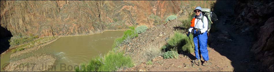
 Technical end of BA Trail: Pipe Creek Beach Trail at River Trail (view N) |
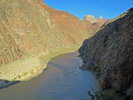
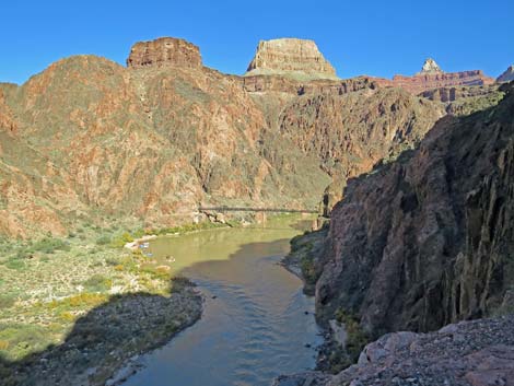
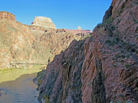
Overview The River Trail is a 1.8-mile connector that runs along the south side of the Colorado River between Pipe Canyon (technically the end of the Bright Angel Trail) on the west end and the South Kaibab Trail on the east end. Parts of the trail were hacked from the cliffs by hand crews many years ago, and as such often follows the path of least resistance, which was not right along the river. The trail is described (NPS webpage) as having "little elevation variation [as it] follows the Colorado River," but this is not entirely accurate, as there is considerable up and down, even if the two ends are roughly at the same elevation. Perhaps the "little elevation variation" comment is relative to starting at the rim and hiking all the way down. The River Trail provides access to the Silver Bridge for hikers traveling between Havasupai Garden and Phantom Ranch, and it makes a nice day-hike loop for visitors staying at Phantom Ranch or Bright Angel Campground. Link to map. Link to River Trail -- Westbound. |
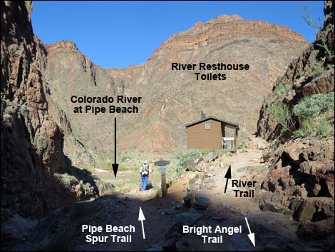
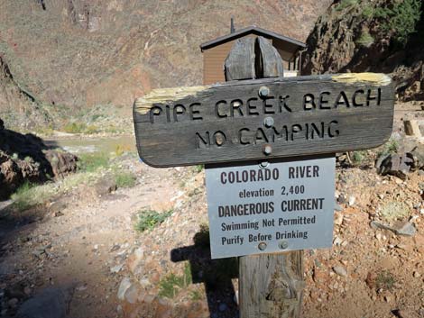 Sign at trail junction for Pipe Creek Beach (view N) |
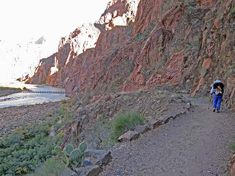
Watch Out Other than the standard warnings about hiking in the desert, ...this is a pretty safe trail if you stay on it, but there are many places where hikers could stumble off the trail and fall a great distance to the river. While hiking, please respect the land and the other people out there, and try to Leave No Trace of your passage. This is a remote hike, so be sure to bring the 10 Essentials. Pay attention to the direction of wranglers when mule teams pass. Getting to the Trailhead This hike is located below the South Rim of the Grand Canyon, at least 8 hours southeast of Las Vegas, and starts from the end of the Bright Angel Trail or from near the end of the South Kaibab Trail. Thus, hikers must hike down to the Colorado River to start from either end of this trail. |
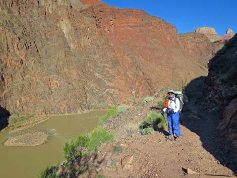
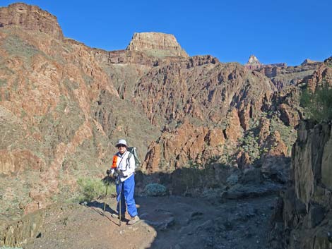
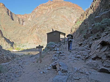 Hiker on River Trail approaching River Resthouse (view N) |
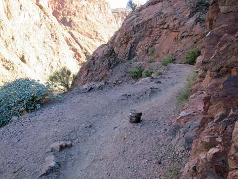
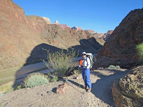
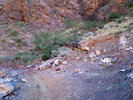
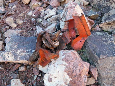
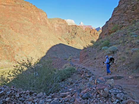
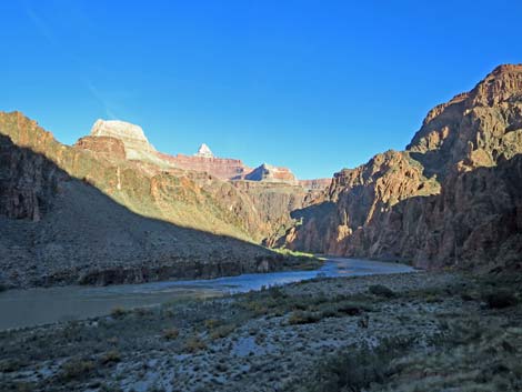
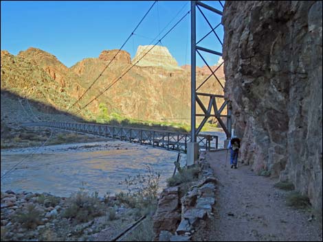
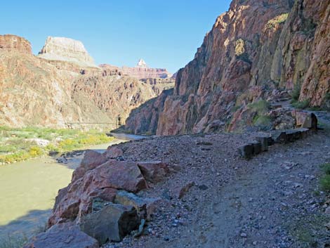
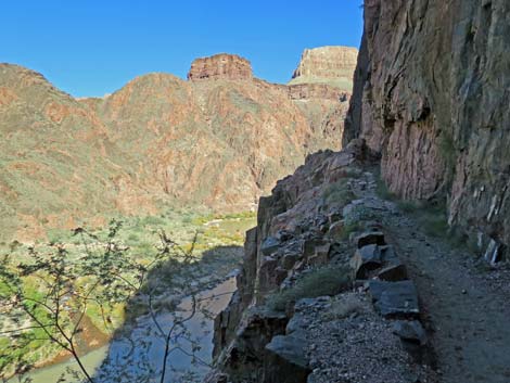
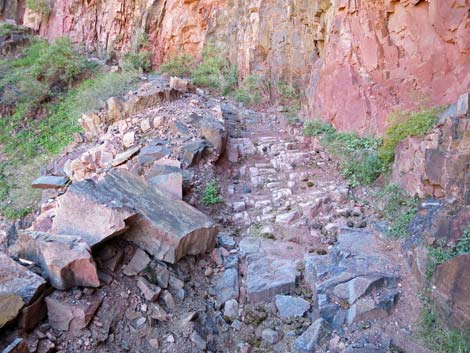
The Hike On the Bright Angel Trail and with the Colorado River in sight at the bottom of Pipe Creek Canyon, the trail forks (Table 1, Waypoint 14). The Bright Angel Trail continues straight (left) to end on Pipe Creek Beach, while the River Trail angles right to pass the River Resthouse composting toilets (a covered picnic table is located a few yards back up Pipe Creek Canyon). The trail continues east along the south side of the river and quickly gains about 200 feet of elevation above the Colorado River. The trail here was blasted out of the cliff, so there are many nice, unobstructed views up and down the river. The trans-canyon water pipe runs under the trail in this area, and exposed pipe and valve-covers can be seen along the way. The trail here generally runs across cliffs above a bend in the Colorado River. When the trail curves inward to pass a broad gully, it passes an old gravel quarry dating from trail construction, and a dilapidated piece of equipment still remains along the trail. |
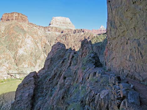
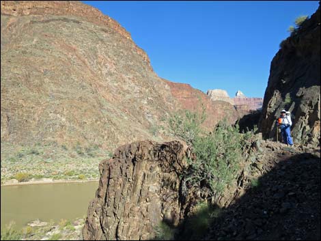 River Trail climbs above the Colorado River (view NE) |
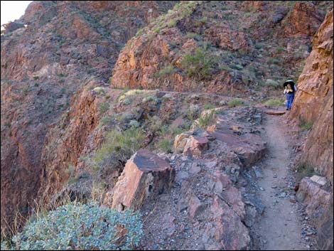
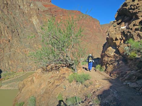
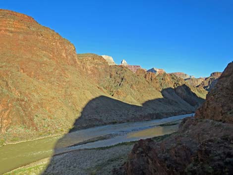
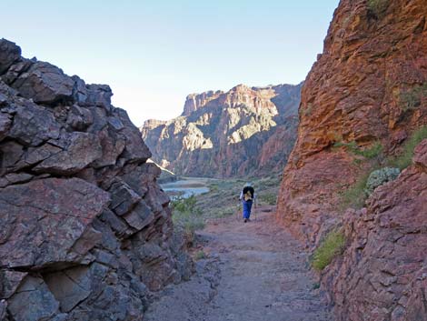
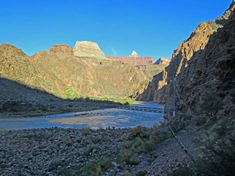
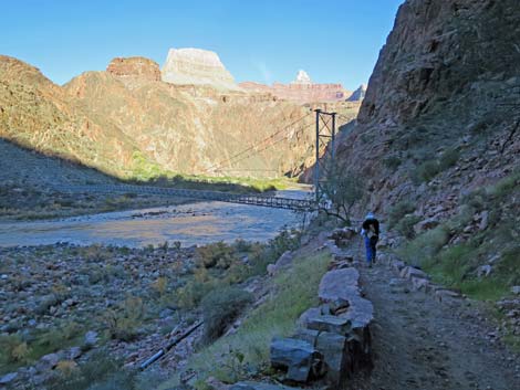
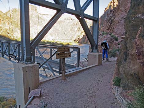
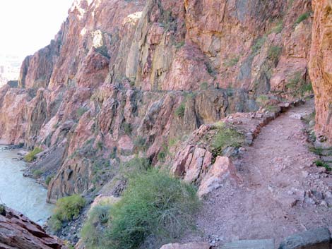
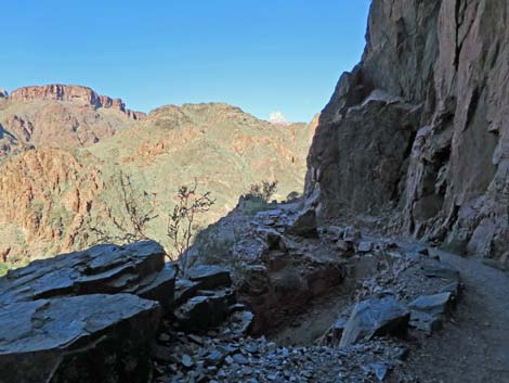
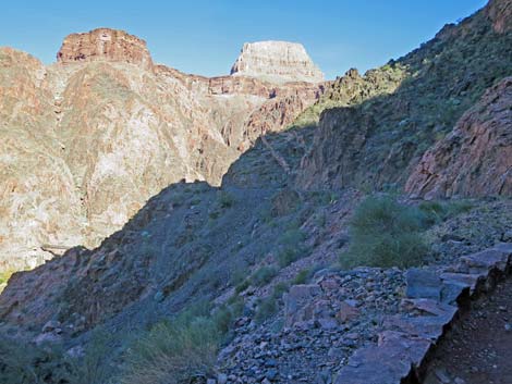
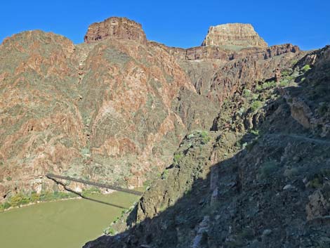
After turning a corner and with some elevation, the trail passes a point with the first view (Wpt. 17) of the Silver Suspension Bridge ahead in the distance. From this corner, the cliffs pull back from the edge of the river and the trail descends to gentler slopes with sandy soils and bunchgrasses, various cactus, and soaptree yucca. After following the River Trail for about 1.1 miles, the trail descends to just above river-level and arrives at the south end of the Silver Suspension Bridge (Wpt. 18). Phantom Ranch, Bright Angel Campground, the North Kaibab Trail, and the North Rim all lie across the bridge. The River Trail continues upstream along the south side of the river and quickly regains considerable elevation above the river. In contrast to the west end of the River Trail where the trail runs around a broad ridge, this end traverses a broad face deeply incised by many gullies. Thus, in addition to being narrow and steep and high, the trail winds in and out of every little gully, but each point brings another grand view. |
 High above the Colorado River (view NE) |
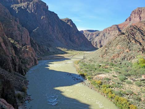
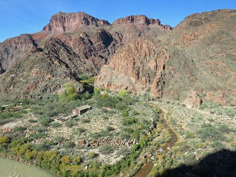
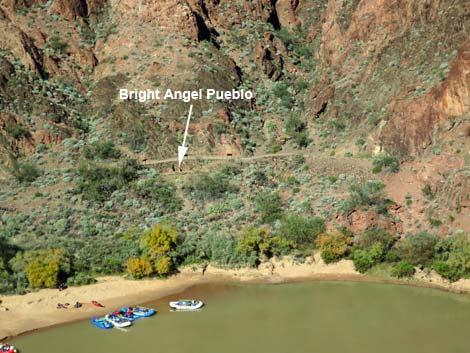
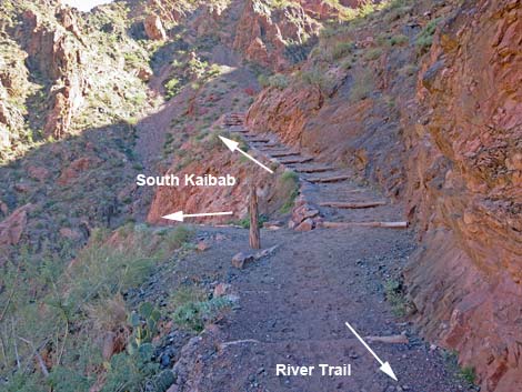
Hikers can look down and see most of the Phantom Ranch area, including the NPS mule corrals, the sewage treatment plant, the lower end of Bright Angel Campground, Bright Angel Creek, Boat Beach where rafters haul out, the ruins of Bright Angel Pueblo, and the Black Suspension Bridge, but not Phantom Ranch, proper, because it is farther up the canyon and around a corner. The River Trail continues upstream winding in and out of little gullies until nearly above Black Bridge. After passing the last scenic point, the trail arrives at a signed trail junction with the South Kaibab Trail (Wpt. 30). Here, the River Trail unceremoniously ends. Hikers can continue down and left on the South Kaibab Trail through the tunnel to Black Bridge (Wpt. 29) and across to Phantom Ranch (Wpt. 23), or they can stay right and hike up the South Kaibab Trail to Yaqui Point on the South Rim about 6-1/2 miles up the hill. |
 River Trail above the river (view NE) |
 Wild ancient rocks and Fluffgrass |
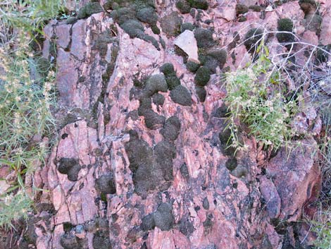 Wild ancient rocks and mosses |
 Trans-canyon water pipe runs under the trail |
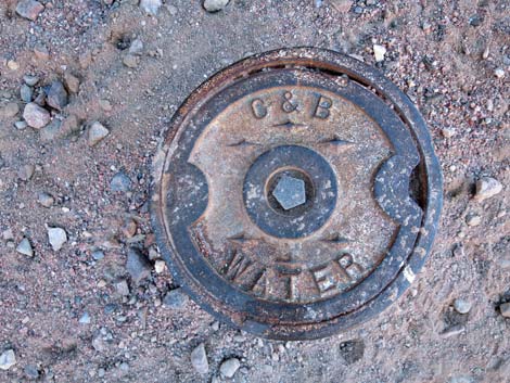 Trans-canyon water pipe valve cover |
 River Trail above the river (view NE) |
 A good spot for a "hero photo" (view NE) |
 Another sunny spot for a "hero photo" (view NE) |
 Grand, upstream views (view E) |
 Approaching old gravel quarry |
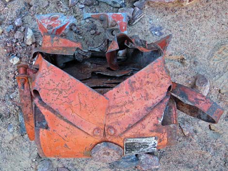 Historic junk? |
 Historic junk? |
 |
 |
 River Trail descending slowly towards the river (view NE) |
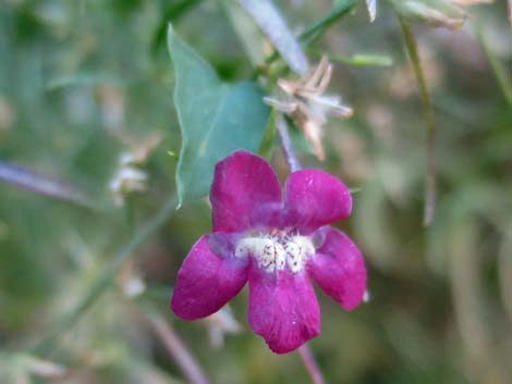
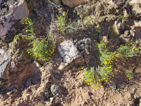 Fiveneedle Pricklyleaf blooming in late fall |
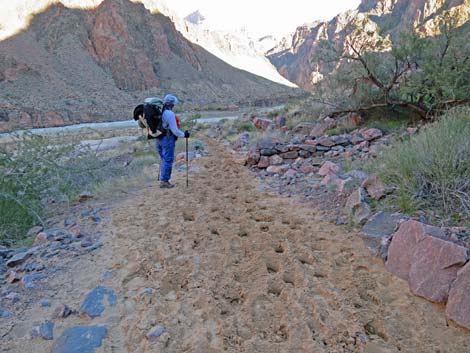 Sandy trail churned up by mules (view NE) |
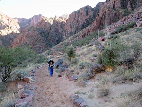 River Trail on sandy flats (view NE) |
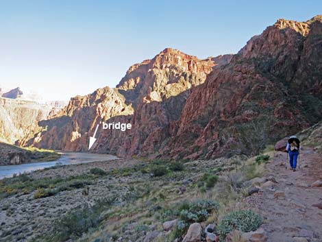 Silver Bridge over the Colorado River comes into view (view NE) |
 More gentle trail and grand views |
 |
 |
 Hiker approaching the Silver Suspension Bridge (view NE) |
 Hiker at the Silver Suspension Bridge (view NE) |
 River Trail at Silver Suspension Bridge; hiker continues (view NE) |
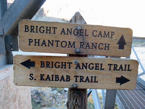 Trail signs at Silver Bridge (view N) |
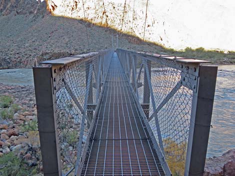 Silver Bridge (view N) |
 The River Trail continues east past the Silver Bridge (view NE) |
 Towering cliffs above the trail Towering cliffs above the trail |
 Narrow trail climbing high above the river |
 Wild ancient rocks with Parry's Lipfern in shady cracks |
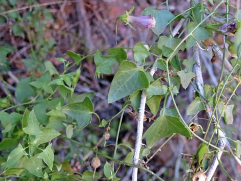 Roving Sailor growing in the cliffs |
 Roving Sailor growing in the cliffs |
 Narrow trail on high cliff |
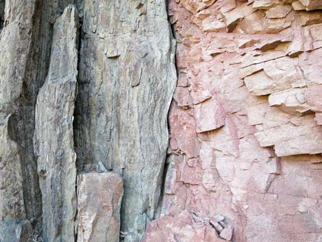 Wild layers of ancient jumbled rock |
 Grand view upstream towards Black Bridge |
 Grand view downstream towards Silver Bridge |
 Grand view across river towards lower Phantom Ranch area |
 |
 |
 Wild ancient rocks with Parry's Lipfern in shady spots |
 River Trail winds along cliffs |
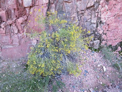 Bush with yellow flowers blooming in late fall |
 River Trail winds along cliffs |
 Fairly level trail runs across shady hillside |
 Rafts pulling up to Boat Beach |
 Fairly level trail runs across shady hillside |
 Hiker at last grand view before descending to the river |
 Trail junction: River Trail ends at South Kaibab Trail (view E) |
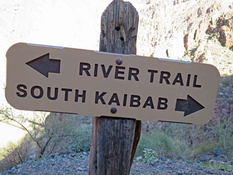 Trail sign: River Trail and South Kaibab Trail (view N) |
Table 1. Hiking Coordinates and Distances based on GPS Data (NAD27; UTM Zone 11S). Download Hiking GPS Waypoints (gpx) file.
| Wpt. | Location | UTM Easting | UTM Northing | Elevation (ft) | Point-to-Point Distance (mi) | Cumulative Distance (mi) |
|---|---|---|---|---|---|---|
| 15 | River Trail Junction | 400024 | 3995242 | 2,382 | 0.00 | 0.00 |
| 17 | View of Silver Bridge | 400718 | 3995367 | 2,520 | 0.56 | 0.56 |
| 18 | Silver Bridge, South End | 401429 | 3995058 | 2,450 | 0.68 | 1.24 |
| 30 | South Kaibab-River Trail Junction | 402037 | 3995325 | 2,640 | 0.60 | 1.84 |
Happy Hiking! All distances, elevations, and other facts are approximate.
![]() ; Last updated 240326
; Last updated 240326
| Hiking the Grand Canyon | Hiking Around Las Vegas | Glossary | Copyright, Conditions, Disclaimer | Home |