Hiking Around Las Vegas, Grand Canyon National Park
 Fence posts at the top of the trail (view SE) |
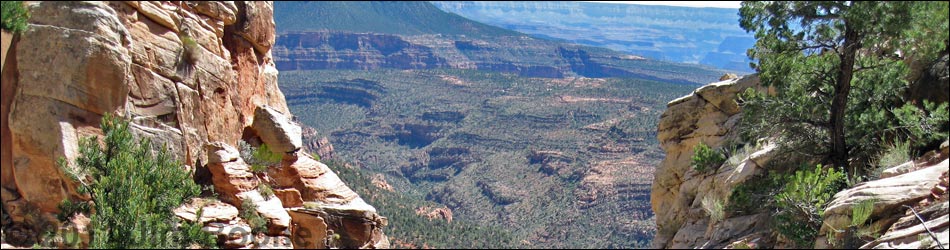
Overview The Old Cattle Trail provides a great hike from the North Rim down to the Esplanade. The trail was built by cattlemen during the early part of the 20th century to graze cows down in the canyon, but it is hard to image driving cattle down this trail. The old trail was recently "rediscovered" and improved a bit, and it is easy to follow the entire way. This trail provides grand views into the Grand Canyon, a bit of history, and a quick and fairly easy way to get from the rim down to the Esplanade. As described here, the route runs from the rim to a small creek below Crazy Jug Spring. Hikers are free to lose themselves among brushy slopes on the Esplanade beyond the creek. The trailhead is not actually in Grand Canyon National Park, rather it is located on the Kaibab National Forest where regulations are less restrictive. For example, access to the area is free and camping is permitted anywhere. However, there are no facilities. Link to trail map or elevation profile. |
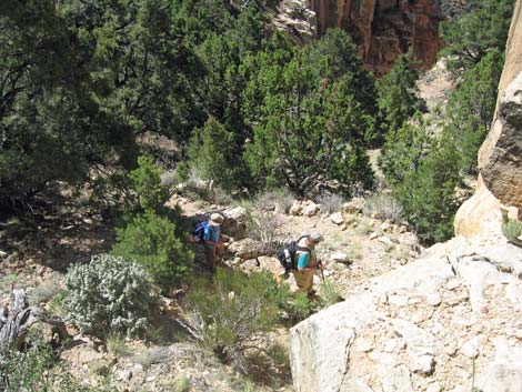
 Dropping to cross a side canyon (view SE) |
Watch Out Other than the standard warnings about hiking in the desert, ...this trail is mostly safe, but in a couple of places, it runs along steep hillsides with precipitous drop-offs and crosses dicey rockslides. While not a dangerous trail, falls from many places would be quite damaging. While hiking, please respect the land and the other people out there, and try to Leave No Trace of your passage. Also, this is a long hike in a remote area, so bring the 10 Essentials. Consider caching water for the hike out. |
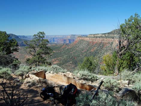 Cement watering tough (view S) |
Getting to the Trailhead
This hike is located on the North Rim of the Grand Canyon, about 7 hours northeast of Las Vegas. From Las Vegas, drive out towards the North Rim of Grand Canyon National Park. From the intersection of Hwy 389 and Hwy Alt 89 in Fredonia, Arizona, turn right onto Hwy Alt 89 and drive east for 1.5 miles to Forest Road (FR) 422 (Table 1, Site# Road 1). Turn right onto FR422 and drive south forever. The road is paved for about 22 miles. At mile 27.2, the gravel road passes Big Springs Ranger Station (Site# Road 2). Piped drinking water is available along the edge of the road by the big pond (outside the fence) just south of the gate into the ranger station area. Continue south for a total of 32.2 miles to FR425 (Site# Road 3). |
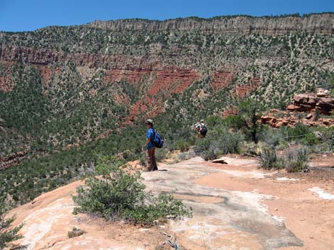
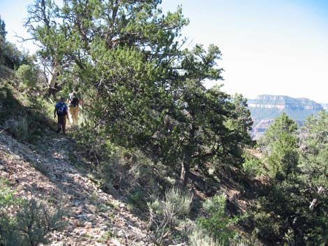 Traversing sideslopes (view SE) |
At FR425, turn right towards Crazy Jug Point and drive west and south for 10.0 miles to FR292 (Site# Road 5). Turn right onto FR292 and continue south for 1.5 miles to FR292B (Site# Road 6). Turn left onto FR292B and drive south for 0.3 miles to the Crazy Jug Point camping area (intersections are well signed for Crazy Jug Point) (Site# Road 7). All of these roads are signed and well maintained for sedans, but rain, snow, and fallen trees can make the roads temporarily impassable. Out at the Crazy Jug Point camping area, you have actually passed the trailhead, but the drive is so long that you will need to camp and do the hike tomorrow any ways. |
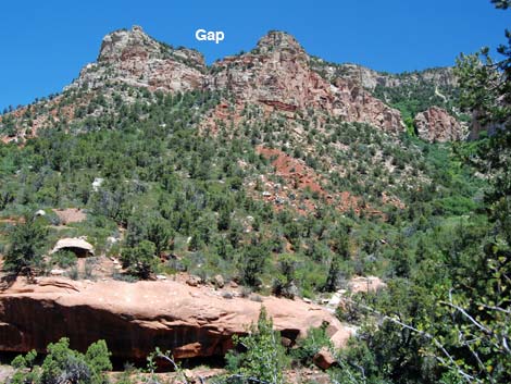
 Descending the gap in the Toroweap and Coconino cliffs (view S) |
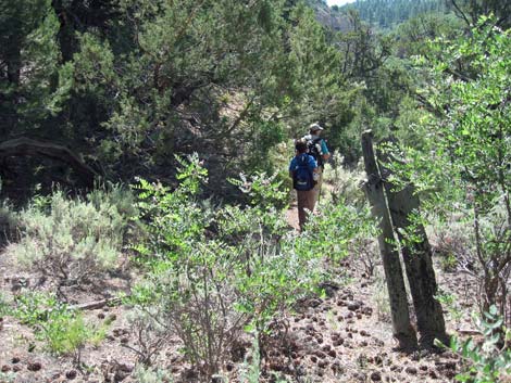
The Hike From Crazy Jug Point, drive back down FR292B to the main road (FR292). Turn right as if exiting the area and drive downhill for 0.64 miles and park on the side of the road (Table 2, Waypoint 1). This is the trailhead. Alternatively, from the camping area, walk north and east along the rim on an old two-track road. Walking from the camp area adds about 1 mile to the round-trip hike. Starting from the main road (Wpt. 1), hike south towards the rim of the Grand Canyon and pick up the old two-track road (Wpt. 2). Turn east and follow the old two-track until it bends sharply away from the rim (Wpt 3). At that point, follow a faint old road east to a long, narrow barbed-wire corral (Wpt 4). Climb over the fences and continue eastward, being careful not to break the old fence posts. Following the rim, the route eventually runs up against another barbed-wire fence at the base of a hill. Turn towards the rim and follow the fence to an old barbed-wire gate (Wpt 5). The gate is open, but the posts are obvious, and the gate is lying on the ground. |
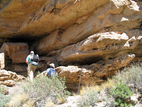 Look for pictographs in the Toroweap |
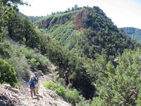
The fence here along the base of the hillside provides an important lesson for following this trail: the cowboys fenced places where they didn't want the cows to go, so when you get to a fenceline, turn and follow along the fence. The trail will again become obvious. Through the gate, the trail drops to cross a side canyon, then continues southeast as it traverses slopes between the Kaibab cliffs above and the Toroweap cliffs below. Before long, the trail passes an old cement watering trough (Wpt 6) that was fed from a spring in the cliffs above the trail. Continuing, the trail traverses to the top of a gap in the cliffs (Wpt 7) where the trail makes a steep descent through the Toroweap Limestone and Coconino Sandstone cliffs to the Hermit Shale layer below (Wpt 8). Below the gap, the trail switchbacks back and forth across the Hermit Shale as it descends quickly until turning and more-or-less running straight down the hillside to meet the Esplanade Trail (Wpt 9), which is marked by a cairn. |
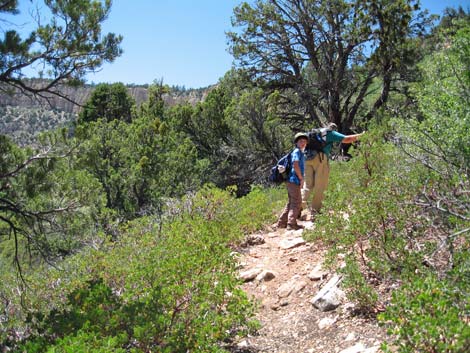
 Descending slopes in the Hermit layer (view SE) |
Following the trail south towards the creek, the trail is obvious and well marked. This is not true for hiking in the other direction (west). After the trail junction, the trail quickly arrives at the creek below Crazy Jug Spring (Wpt 10). When I was there in late June, there was a fair flow of water (plenty to drink), but I would not count on getting water there late in the summer. The top of the cliffs at the creek crossing is a shady and pleasant place to spend some time enjoying the scenery and watching butterfly and other flying insects. After a rest, hike out onto the slickrock of the Esplanade and enjoy the experience and the views. The slickrock is small here, and following the Esplanade Trail is difficult, but it is a pleasant area. When ready, hike back to the trailhead on the Old Cattle Trail or hike across the Esplanade to some other destination. For me, the creek and Esplanade made for a great destination. |
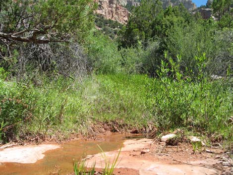 Small steam below Crazy Jug Spring (view NE) |
 Gap in the cliffs (view NE from the creek) |
 Wandering about on the Esplanade (view W) |
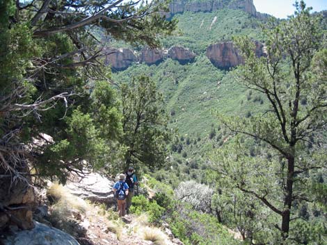
 Heading back up the through the Hermit (view NW) |
Table 1. Highway Coordinates (NAD27, UTM Zone 12S). Note: these are UTM Zone 12 Download GPS Waypoints (*.gpx) file.
| Site # | Location | Latitude (N) | Longitude (W) | UTM Easting | UTM Northing | Elevation (ft) | Verified |
|---|---|---|---|---|---|---|---|
| Road 1 | Alt89 at FR422 | 36.93418 | -112.50358 | 366094 | 4088423 | 4,835 | GPS |
| Road 2 | Big Spring Ranger Station (water) | 36.60269 | -112.34985 | 379267 | 4051445 | 6,925 | GPS |
| Road 3 | FR422 at FR425 | 36.53585 | -112.33684 | 380328 | 4044014 | 7,606 | GPS |
| Road 4 | FR425 at FR232 | 36.46535 | -112.40918 | 373738 | 4036286 | 6,868 | GPS |
| Road 5 | FR425 at FR292 | 36.44634 | -112.39270 | 375184 | 4034156 | 7,046 | GPS |
| Road 6 | FR292 at FR292B | 36.43039 | -112.40291 | 374243 | 4032400 | 7,445 | GPS |
| Road 7 | Crazy Jug Point | 36.42731 | -112.40285 | 374243 | 4032058 | 7,447 | GPS |
| Road 8 | Monument Point Trailhead | 36.43465 | -112.42909 | 371903 | 4032906 | 7,095 | GPS |
| Road 9 | Indian Hollow Trailhead | 36.45904 | -112.48759 | 366701 | 4035691 | 6,261 | GPS |
Table 2. Hiking Coordinates (Waypoints; NAD27; UTM Zone 12S). Note: these are UTM Zone 12. Download GPS Waypoints (*.gpx) file.
| Wpt | Location | Easting | Northing | Elevation (ft) | Point-to-Point Distance (mi) | Cumulative Distance (mi) | Verified |
|---|---|---|---|---|---|---|---|
| 01 | Trailhead on FR292 | 375023 | 4032906 | 7,202 | 0.00 | 0.00 | GPS |
| 02 | Old Two-Track Road | 375101 | 4032729 | 7,204 | 0.14 | 0.14 | GPS |
| 03 | Faint Old Road | 375376 | 4033028 | 7,185 | 0.27 | 0.41 | GPS |
| 04 | Corral | 375443 | 4033025 | 7,210 | 0.04 | 0.45 | GPS |
| 05 | Old Barbed-Wire Gate | 375597 | 4033081 | 7,196 | 0.12 | 0.57 | GPS |
| 06 | Watering Trough | 375940 | 4032598 | 7,016 | 0.45 | 1.02 | GPS |
| 07 | Top of the Cliffs | 376040 | 4032375 | 7,020 | 0.16 | 1.18 | GPS |
| 08 | Bottom of the Cliffs | 376054 | 4032204 | 6,726 | 0.23 | 1.41 | GPS |
| 09 | Esplanade Trail West | 375972 | 4031855 | 6,141 | 0.46 | 1.87 | GPS |
| 10 | Creek | 376032 | 4031798 | 6,066 | 0.06 | 1.93 | GPS |
| 11 | North end of old Fenceline | 375420 | 4033155 | 7,150 | . | . | GPS |
Happy Hiking! All distances, elevations, and other facts are approximate.
![]() ; Last updated 240326
; Last updated 240326
| Hiking the Grand Canyon | Hiking Around Las Vegas | Glossary | Copyright, Conditions, Disclaimer | Home |