Hiking Around Las Vegas, Grand Canyon National Park
Note: As of Aug 27, 2021, Cave of the Domes is closed to humans. This is part of an effort to protect bats from White Nose Syndrome.
 Trail-of-the-Caves Trail at Cave-of-the-Domes turnoff. Turn left at the parallel stones or go farther up the trail and turn down the gully in the background (view NW) |
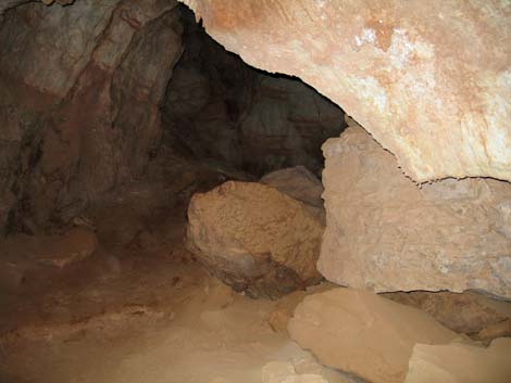
Overview As caves go, Cave of the Domes is a fairly safe and interesting walk-in cave. The cave is located on the edge of Horseshoe Mesa, about 3.5 miles below the South Rim of the Grand Canyon, so it would be a long day to hike down, explore the cave, and return in one day. Everyone would, of course, have at least 3 flashlights, so hiking back to the rim in the dark wouldn't be a problem. The cave is, however, a delightful diversion for backpackers camping on or traversing Horseshoe Mesa. The cave is located on the west side of Horseshoe Mesa, about 20 minutes northwest of the camping area. The trail to the mouth goes down over the edge of the mesa and is quite exposed. Inside the cave, a main passage leads back under the mesa, while many side passages lead off at right angles. The main passages are mostly big enough to walk through, but crawl holes provide tight spots for more adventuresome cavers. Be sure to look up at the underside of the “domes” that form the ceiling. The cave is still dripping and growing, but the floor is dry, so it is fairly easy to backpackers to stay clean. Link to trail map. |
 Looking back at hikers on built-up trail at bottom of gully (view SE) |
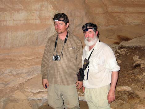
Watch Out Other than the standard warnings about hiking in the desert, ...the use-trail to the cave runs over the edge of the Redwall cliffs and is quite precipitous -- falls would be fatal, but the use-trail should be fine for careful hikers. I wouldn't take a rope, but use your own good judgment. I found no unusual hazards inside the cave, but caves are inherently dangerous places, and rescues are always extremely difficult. While hiking, please respect the land and the other people out there, and try to Leave No Trace of your passage. It is especially important to not touch cave formations because the oil on our hands changes the way minerals precipitate out of solution and could damage the growth of the formations. In addition, please do not add names to the historic inscriptions inside the cave; while records of visitors 100 years ago are interesting, the modern graffiti seems rude. From the rim, this is a long, tough hike, so be sure to bring the 10 Essentials, three sources of light per person, and consider bringing hardhats. |
 Looking back at hikers on precipitous route (view S) |
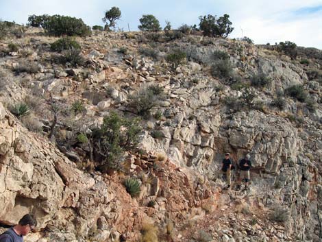
Getting to the Trailhead This hike is located on the South Rim of the Grand Canyon, about 5 hours southeast of Las Vegas. From Las Vegas, drive out to the South Rim of Grand Canyon National Park. From the South Rim Visitor Center (Table 1, Site 811), drive east on South Entrance Road (Hwy 180) to Highway 64 (Site 951), the road to Desert View. Turn left towards Desert View and drive east for about 12 miles to the Grandview Point turnoff (Site 952). Turn left onto the Grandview Point access road and drive north to the parking area at the end of the road (Site 953). Park here; this is the trailhead. The Hike From the trailhead on the rim, the route follows the Grandview Trail for 3.0 miles to Horseshoe Mesa (Wpt. 2), which is the top of the Redwall Limestone and about half-way down to the Colorado River. The trail begins in the Transition (Yellow Pine Forest) Life Zone where the forest is dominated by Ponderosa Pine. Just over the edge of the rim, the trail begins into the Upper Sonoran (Pinyon-Juniper Woodland) Life Zone where the forest is dominated by Two-needle Pinyon Pine and Utah Juniper, with a few Douglas Fir to keep things interesting. The top of Horseshoe Mesa is still in the Upper Sonoran (Pinyon-Juniper Woodland) Life Zone, but the vegetation is dominated by a low-growing forest of Utah Juniper with the distinct flavor of the Mojave Desert (Mojave Desert Scrub). For details of getting down to Horseshoe Mesa, see the Grandview Trail description. The Grandview Trail ends on Horseshoe Mesa at the old stone building (Wpt. 2) that served as the cookhouse for the Last Chance Mine, a copper mining operation that started during the 1890s. All that remains of the building are the walls, chimney, an old cooking pot, some stove pipes, and a few bits of junk. Several mine shafts, some mining equipment, old rusty cans, and other artifacts can be found in the area. Please help protect this historical area by not damaging or removing the things that remain. It is never safe to enter old mines. |
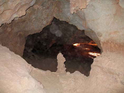
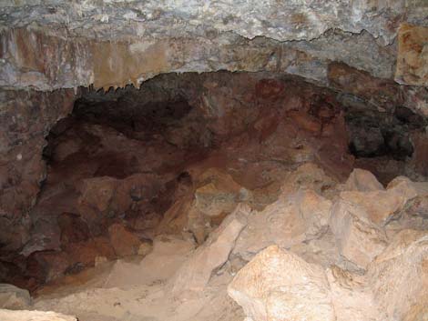
 Cave openings (view N) |
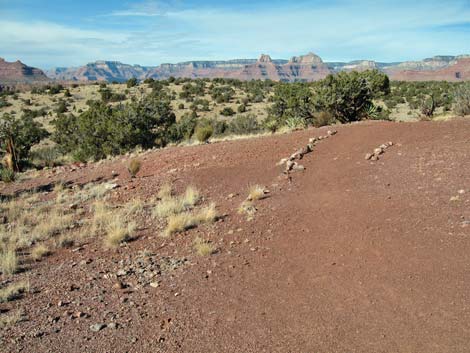
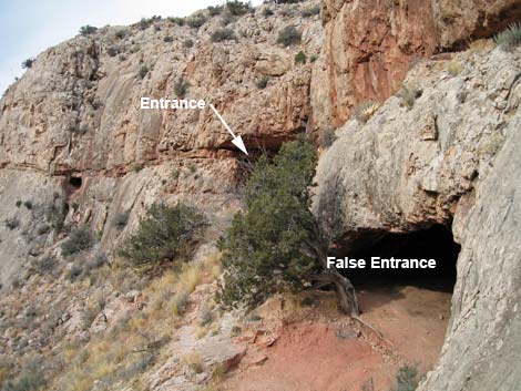
From the old stone building (Table 2, Wpt. 2), the Trail-of-the-Caves Trail continues north along the west edge of Horseshoe Mesa and eventually drops over the edge and runs down to the Tonto East Trail. Continuing north from the stone building for about 100 yards, the trail passes an unmarked junction (Wpt. 3) that bends to the northeast and runs out to the large-group campsites. Staying to the left at the trail junction (Wpt. 3), the Trail-of-the-Caves Trail continues north along the west edge of Horseshoe Mesa, between the edge of the cliffs and the hill that sits atop the mesa. Out at the northwest toe of the hill, the trail crosses some barren, red dirt areas. The trail is obvious, but part of it is bordered by parallel lines of stones (Wpt. 4) that direct hikers on down the trail. It just so happens that the parallel lines of stones also obscure the first of the two use-trails that lead to the cave. One route to the cave leaves the main trail here and shortly becomes a well-defined use-trail that leads northwest and down a rocky slope into a shallow ravine. |
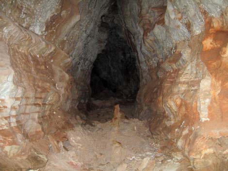
 Cave entrance (view E) |
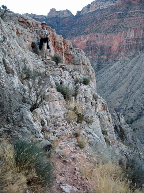
Alternatively, hikers can continue along the Trail-of-the-Caves Trail as it bends to the northeast and contours down at a moderate grade into the head of the shallow ravine (Wpt. 5). The route to the cave leaves the main trail at the wash crossing and runs west down the ravine. Shortly, the route becomes a well-defined use-trail. Both use-trails converge (Wpt. 6) and run down the ravine to the edge of Horseshoe Mesa. The airy use-trail drops off the edge of the cliff (down and left) following stonework that probably dates to the 1890s. The trail descends a short distance (20-30 vertical feet) to an exposed ledge system that is followed north towards a large, obvious cave opening. The first cave opening, however, is not the mouth of the cave; and another airy traverse leads a few more yards to the entrance to the Cave of the Domes (Wpt. 7). The mouth of the Cave of the Domes is large (about 10-feet high and 15-feet wide), but the actual entrance is small, partly because it was walled off with rocks and a wooden door was set in place. The old wooden door has long since fallen off its hinges, and it is now lying on the floor inside the cave. |
 Cave register just beyond the entrance room (view E) |
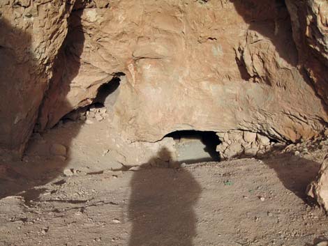
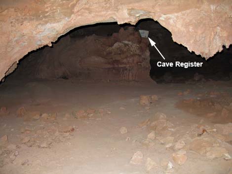
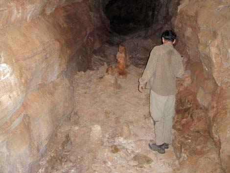
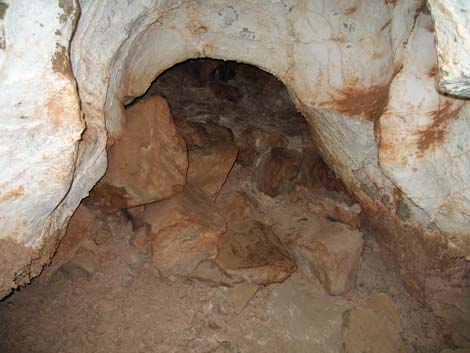
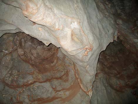
Before entering the cave, ensure that each member of the party has at least three sources of light, extra batteries, and that someone has a first aid kit and all other necessary safety gear (e.g., hardhats and knee pads). There are a few sets of old kneepads inside the cave. Read about risks associated with going into holes in the ground. Inside the cave, the room opens quickly. To the left is a shelf with the visitor register. Please sign the register so the Park Service can collect data the number of people who enter the cave. Use a false name if you don’t want the government tracking your movements, but do sign in. In the entrance room, the main passage leads more or less straight back, while another passage leads back and to the right (south). Following the main passage back under the mesa, side passages lead off at right angles (north and south). Some way back, a fixed rope can be used to climb a slippery slope to a higher level, but it doesn't seem to go anywhere; staying low by the rope leads into the next chamber. |
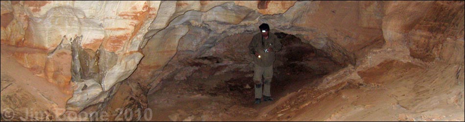
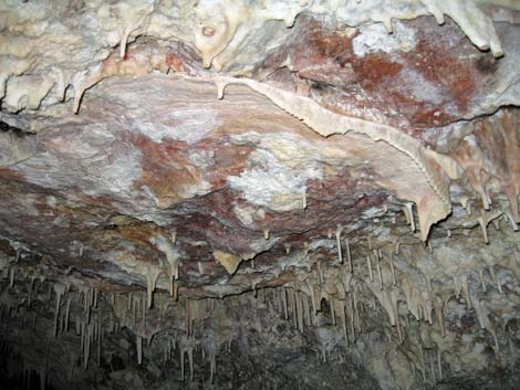
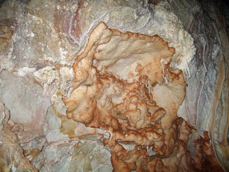
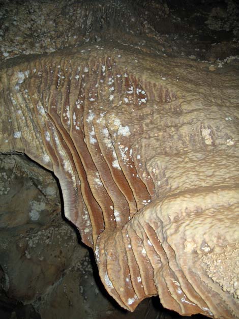
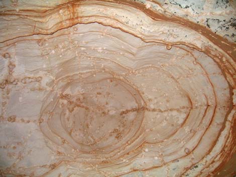 Dome in the ceiling (view straight up) |
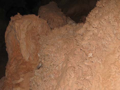
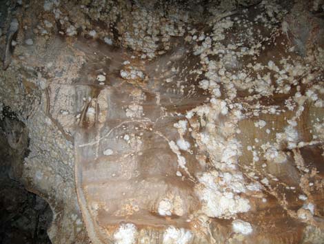
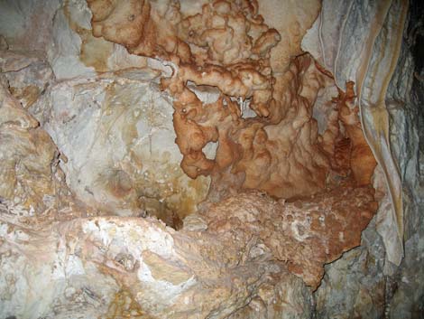
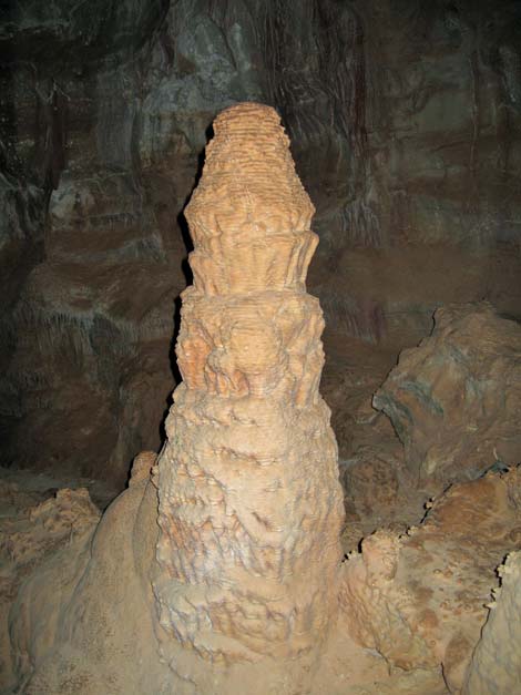
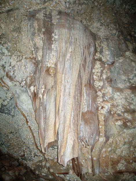
Be sure to watch the ceiling. The place is called “Cave of the Domes” for a reason. Also keep an eye out on the ceiling of the main passage for historical inscriptions dating from early explorers and photographers. Note how the oldest ones were done with care and foresight, while the newer ones just look like scribbled graffiti. Please respect the historical inscriptions and don’t add any more. There are very nice examples of several types of cave formations, including popcorn, flow stone, sheets and sheets of cave bacon, stalactites, stalagmites, columns, cave straws, and even one formation that could pass as a cave shield. Explore the depths of the cave (I have no idea how far the many passageways lead), then try to find your way back to the surface and return to the trailhead by retracing your route. |
 Easy walking in the cave |
 Walking conditions in the cave |
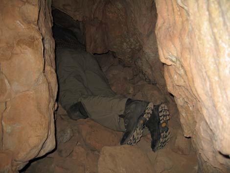 Tight spot in a side tunnel (view S) |
 More easy walking in the cave |
 |
 |
 |
 |
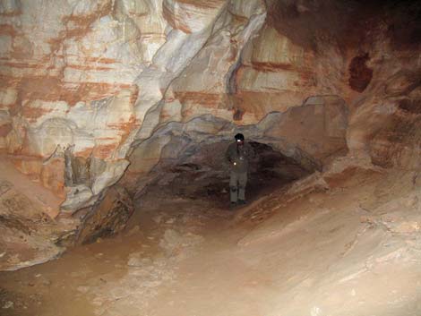
 Conditions in the cave |
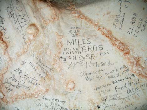 Names of early explorers |
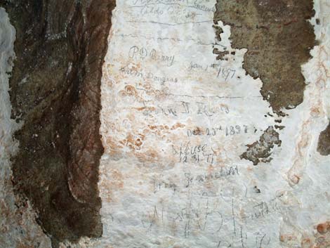 Names of early explorers |
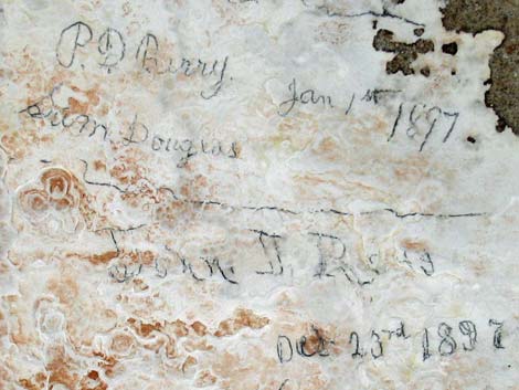 Names of early explorers |
 |
 |
 |
 |
 |
 |
 |
 |
 |
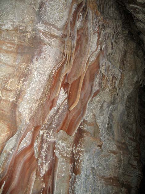 |
Table 1. Highway Coordinates (NAD27, UTM Zone 12S). NOTE: This is UTM Zone 12. Download Highway GPS Waypoints (*.gpx) file.
| Site # | Location | Latitude (°N) | Longitude (°W) | UTM Easting | UTM Northing | Elevation (feet) | Verified |
|---|---|---|---|---|---|---|---|
| 811 | Visitor Center, Canyon View Information Plaza | 36.0590 | 112.1085 | 400166 | 3990857 | 7,092 | Yes |
| 951 | Highway 180 at Highway 64 | 36.0519 | 112.1049 | 400477 | 3990072 | 7,104 | Yes |
| 952 | Highway 64 at Grandview Access Road | 35.9895 | 111.9920 | 410581 | 3983037 | 7,489 | Yes |
| 953 | Grandview Point parking area | 35.9979 | 111.9870 | 411039 | 3983967 | 7,418 | Yes |
Table 2. Hiking Coordinates based on GPS data (NAD27; UTM Zone 12S). Download Hiking GPS Waypoints (*.gpx) file.
| Wpt. | Location | Easting | Northing | Elevation |
|---|---|---|---|---|
| 01 | Grandview Trailhead (1) | 411047 | 3984027 | 7,418 |
| 02 | Stone building (12) | 412122 | 3986440 | 4,865 |
| 03 | Trail to group campsites (66) | 412122 | 3986542 | 4,895 |
| 04 | First use-trail to the cave (67) | 411715 | 3987106 | 4,911 |
| 05 | Second use-trail to the cave (72) | 411755 | 3987202 | 4,872 |
| 06 | Use-trails converge (X1) | 411620 | 3987156 | 4,850 |
| 07 | Cave Of The Domes, entrance (71) | 411499 | 3987150 | 4,793 |
Happy Hiking! All distances, elevations, and other facts are approximate.
![]() ; Last updated 240326
; Last updated 240326
| Hiking the Grand Canyon | Hiking Around Las Vegas | Glossary | Copyright, Conditions, Disclaimer | Home |