Backroads Around Las Vegas, Desert National Wildlife Refuge
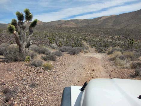
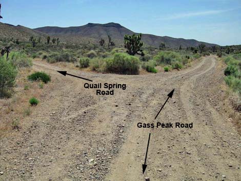 Gass Peak Road at Quail Spring Road (view SE) |
Overview Quail Spring Road is a 1.4-mile spur road that runs northeast from Gass Peak Road and to a trailhead for the Quail Spring Guzzler and Quartzite Mountain routes. The road usually is in reasonable condition, but a steep downhill at the end of the road is most suitable for 4WD vehicles; 2WD vehicles should stop atop the hill. For general information on camping, hiking, regulations, other issues, and the natural history of the Wildlife Refuge, see the Desert National Wildlife Refuge -- Area Overview page. Link to map. |
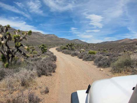
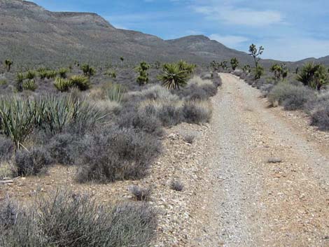 Quail Spring Road (view NE from near Gass Peak Road) |
Watch Out Other than the standard warnings about hiking in the desert... Quail Spring Road generally is a good dirt road, but it runs out into wild and remote country. There are no services or developments of any kind. Cell phones don't work. Bring water and food, a good spare tire, a shovel, tools, a tow rope, bailing wire (I learned the hard way) and anything else that you might need to survive a night stuck out in the desert. While out there, please respect the land and the other people out there, and try to Leave No Trace of your passage. Also, this road leads to remote country, so be sure to bring the 10 Essentials. This is a wildlife refuge, so pay extra attention to respecting the land and stay on the roadway. |
 |
Location Quail Spring Road is located on Desert National Wildlife Refuge and starts about 1.25 hours northwest of Las Vegas. To get there, drive out Corn Creek Road to the Information Kiosk (Table 1, Site 0106) at Corn Creek Field Station. From the kiosk, continue east for another 100 yards to a T-intersection with a large directional sign. Turn right onto Mormon Well Road and follow it south, then east, for 4.3 miles to Gass Peak Road (Site 0884), which branches to the south (right). On Gass Peak Road, drive south then east for about 8.6 miles to a fork (Site 0944). The branch to the left is Quail Spring Road. |
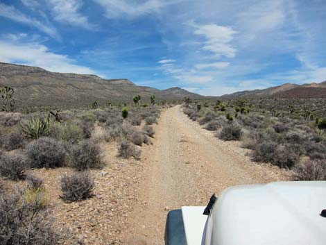 |
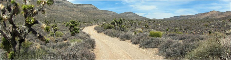
The Road From Gass Peak Road (Site 0944), Quail Spring Road runs northeast up the bajada into a large, north-trending valley in the Las Vegas Range with Quartzite Peak in the background. The road climbs consistently and fairly straight for the first 1.23 miles, then takes a hard turn to the right and descends a steep hillside. If driving a 2WD vehicle, it might be wise to stop atop the hill and walk the last few hundred feet to the trailhead. This place is too remote to risk not being able to climb the hill and get trapped at the end of the road. The road ends, 1.40 miles out, at a parking area (Site 0945). There are no trailhead or other information signs, but the Quail Spring Guzzler and Quartzite Mountain routes continue in line with the road into the wash a few yards out, then bend left to follow the wash uphill. |
 |
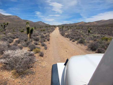 |
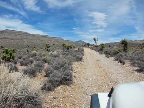
 Easy uphill section (view NE) |
 Steep downhill section; 2WD vehicles park on left (view E) |
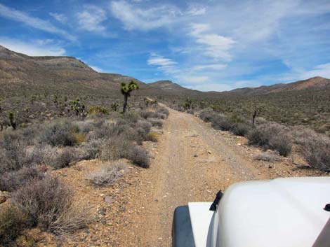
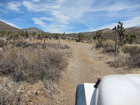 Approaching the end of the road (view NE) |
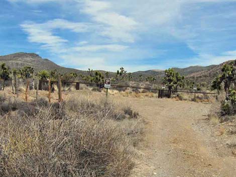 Trailhead parking (view NE) |
Table 1. Highway Coordinates Based on GPS Data (NAD27; UTM Zone 11S). Download Highway GPS Waypoints (*.gpx) file.
| Site # | Location | UTM Easting | UTM Northing | Latitude (N) | Longitude (W) | Elevation (ft) | Verified |
|---|---|---|---|---|---|---|---|
| 0106 | Corn Creek parking area | 647225 | 4033632 | 36.43845 | 115.35745 | 2,814 | Yes |
| 0884 | Mormon Well Rd at Gass Peak Rd | 653761 | 4033896 | 36.43980 | 115.28450 | 3,652 | Yes |
| 0944 | Gass Peak Rd at Quail Spring Rd | 665609 | 4033133 | 36.43095 | 115.15254 | 4,844 | Yes |
| 0945 | Quail Spring Trailhead | 666648 | 4035031 | 36.44787 | 115.14055 | 5,148 | Yes |
Happy Hiking! All distances, elevations, and other facts are approximate.
![]() ; Last updated 240324
; Last updated 240324
| Hiking Around DNWR | Hiking Around Las Vegas | Glossary | Copyright, Conditions, Disclaimer | Home |