Backroads Around Las Vegas, Desert National Wildlife Refuge
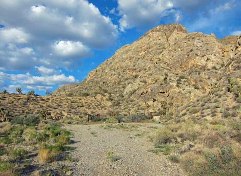
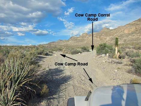 Cow Camp Road at Cow Camp Corral Road (view NE) |
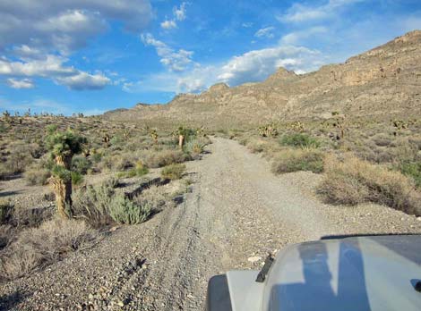
Overview Cow Camp Corral Road is a short side road off Cow Camp Road that runs up into a box canyon the base of the Sheep Range. This road provides access to an historical corral and camping opportunities, plus hiker access to Cow Camp Spring and destinations beyond. The 0.6-mile road is fairly smooth and is fine for 2WD high-clearance vehicles in good weather. The road is a bit sandy, but it has a firm base. For general information on camping, hiking, regulations, other issues, and natural history of the Wildlife Refuge, see the Desert National Wildlife Refuge -- Area Overview page. Link to map. |
 Cow Camp Corral Road |
Watch Out Other than the standard warnings about the desert ... Cow Camp Corral Road generally is a good dirt road, but it runs out into wild and remote country. There are no services or developments of any kind. Cell phones don't work. Bring water and food, a good spare tire, a shovel, tools, a tow rope, bailing wire (I learned the hard way) and anything else that you might need to survive a night stuck out in the desert. While out there, please respect the land and the other people out there, and try to Leave No Trace of your passage. Also, this road leads to remote country, so be sure to bring the 10 Essentials. This is a wildlife refuge, so pay extra attention to respecting the land. |
 Cow Camp Corral Road |
Location Cow Camp Corral Road is located on the Desert National Wildlife Refuge and starts about 1-3/4 hours northwest of Las Vegas. To get there, drive out Corn Creek Road to the Information Kiosk (Table 1, Site 106) at Corn Creek Field Station. Continue east on Corn Creek Road for about 100 yards to a T-intersection with a large directional sign (Site 0731). Note that the sign incorrectly states the distance to Cow Camp Road is 12 miles. Turn left onto Alamo Road and drive north for 8.7 miles to the signed intersection with Cow Camp Road (Site 0992). For details of Alamo Road, including road conditions, see the Alamo Road page. Turn right onto Cow Camp Road (Site 0992) and drive northeast towards the mountains. Pass through a gap in the Black Hills and continue past a fenced camping area to a fork in the road (Site 0993) where Cow Camp Corral Road angles right. |
 Cow Camp Corral Road |
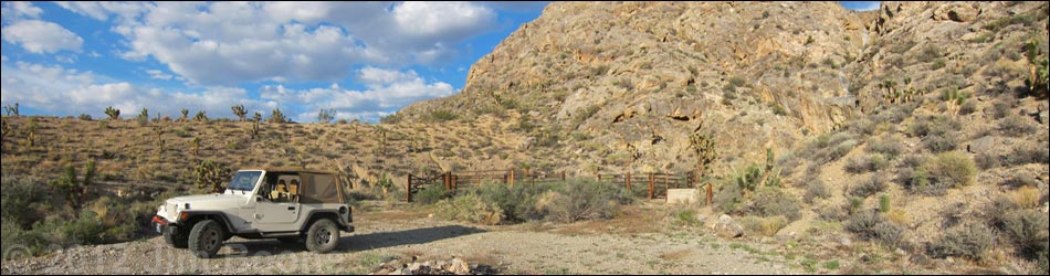
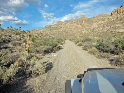
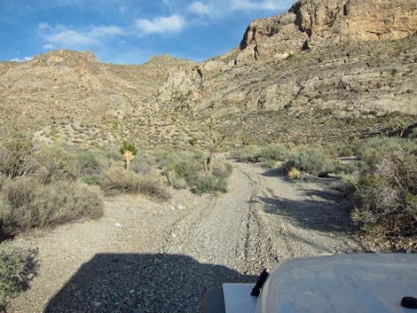
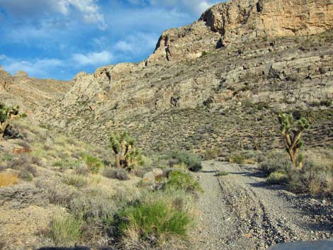
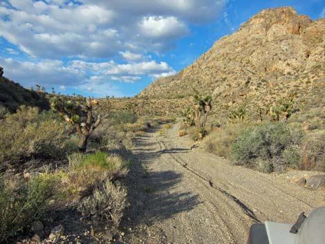
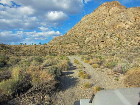
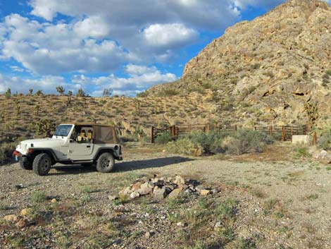
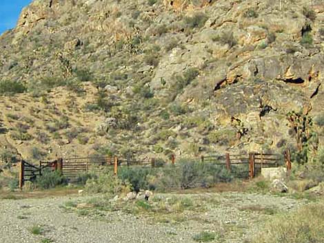
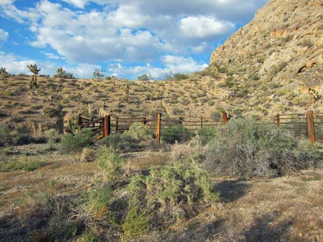
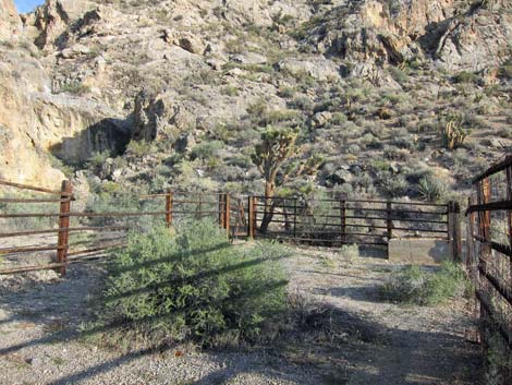
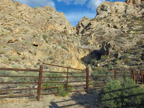
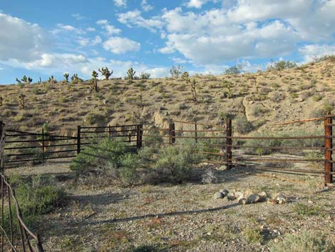
The Road Cow Camp Corral Road (Site 0993) departs Cow Camp Road to the right in a gravel wash with a firm base. Cow Camp Corral Road runs to the east-northeast, then enters a box canyon and angles more to the north, arriving shortly at a turn-about at the end of the road (Site 0994) and adjacent to the historical corral. The area is quiet and secluded as it sits in the bottom of a shallow canyon at the base of the Sheep Range, which juts abruptly out of the desert floor. The old corral remains in fairly good condition, and the watering troughs reveal the presence of a spring nearby. The pour-over in the cleft behind the corral normally is dry, but a stout route leads up the cliffs to Cow Camp Spring. |
 Cow Camp Corral Road |
 Entering the box canyon (view N) |
 Corral in the distance (view N) |
 Turn-about at the end of the road (view N) |
 Parked by Cow Camp Corral (view N) |
 Cow Camp Corral and campfire ring |
 Cow Camp Corral |
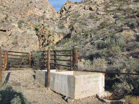 Watering trough; thoughtful cattlemen included a wildlife drinker |
 |
 |
 |
 |
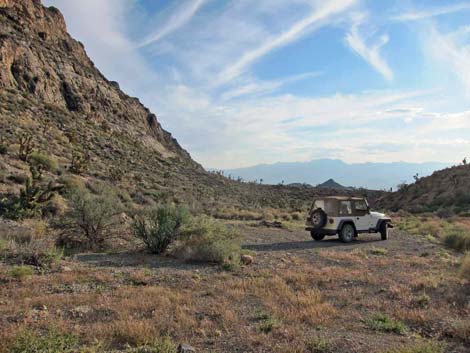 View down box canyon towards Spring Mountains |
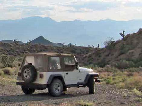 Jeep at Cow Camp Corral campsite |
Table 1. Highway Coordinates Based in GPS Data (NAD27; UTM Zone 11S). Download Highway GPS Waypoints (*.gpx) file.
| Site | Location | UTM Easting | UTM Northing | Latitude (N) | Longitude (W) | Elevation (ft) | Verified |
|---|---|---|---|---|---|---|---|
| 0106 | Corn Creek parking area | 647225 | 4033632 | 36.43844 | 115.35745 | 2,814 | Yes |
| 0731 | Corn Creek Rd at Mormon-Alamo Rd | 647307 | 4033624 | 36.43836 | 115.35654 | 2,814 | Yes |
| 0992 | Alamo Rd at Cow Camp Rd | 643589 | 4046289 | 36.55306 | 115.39564 | 3,547 | Yes |
| 0993 | Cow Camp Rd at Fork | 650517 | 4049638 | 36.58217 | 115.31761 | 5,128 | Yes |
| 0994 | Cow Camp Corral Parking | 651250 | 4049944 | 36.58481 | 115.30937 | 5,239 | Yes |
| 1339 | Rock Shelter Camp | 649381 | 4049292 | 36.57923 | 115.33038 | 4,814 | GPS |
| 1340 | Cow Camp North Fork End | 651215 | 4050587 | 36.59062 | 115.30963 | 5,412 | GPS |
Happy Hiking! All distances, elevations, and other facts are approximate.
![]() ; Last updated 240324
; Last updated 240324
| Backroads Around DNWR | Hiking Around Las Vegas | Glossary | Copyright, Conditions, Disclaimer | Home |