Hiking Around Las Vegas, Desert National Wildlife Refuge
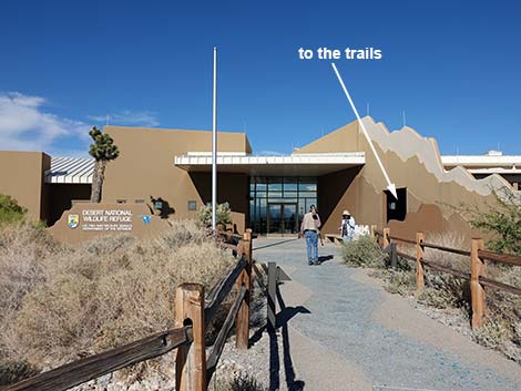 Visitor Center and walkway to the trails (view NE) |
Overview Corn Creek is a tiny spot of green in a vast sea of desert-dry Mojave Desert Scrub. Springs provide water that supports trees, lush vegetation, desert wildlife, and even humans over the last several thousands of years. The ancients left their marks on the land, but most evidence of human use derives from pioneer and more recent times. White settlers farmed the area, and their orchard still produces fruit. A cabin, built with railroad ties, links the area to the rise and fall of local mining and industrialization. Bootleggers are said to have used the area too. Currently, the area is managed by the U.S. Fish and Wildlife Service as the Desert National Wildlife Refuge, the largest wildlife refuge in the lower 48 States. This area has been a birdwatching destination for decades, and now the 0.4-mile Birdsong Trail opens a bit of riparian habitat to the north of the traditional birding area. |
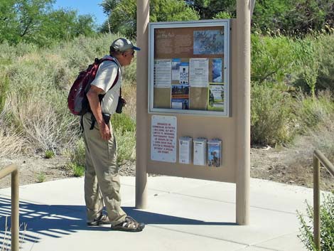 Information kiosk behind visitor center (view NE) |
Most of the habitat immediately surrounding Corn Creek is low-elevation Mojave Desert Scrub dominated by creosote bush, white bursage, fourwing saltbush, and a few Mojave yucca). This area is in the rain shadow of the Spring Mountains, so it gets less rain than usual, even for a desert, and as a result the vegetation is sparse and stunted. Springs at Corn Creek provide water for a desert oasis that supports honey mesquite, cottonwood trees, cattails, and many other wetland plant species. Water from two of the springs was used by late-1800s homesteaders to support a farm, and these two springs still water a pond and the trees, grass, and orchards that remain. |
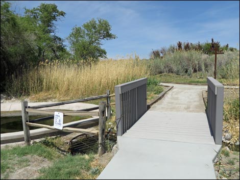 Bridge over Corn Creek (view N) |
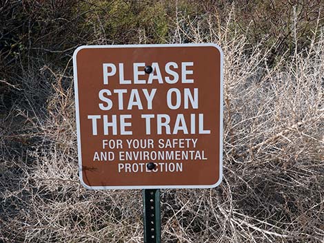
Watch Out Other than the standard warnings about hiking in the desert, ... this is a fairly safe hike without unusual hazards if hikers stay on the trails as is requested by refuge management. While hiking, please respect the land and the other people out there, and try to Leave No Trace of your passage. Even though this hike is short, bring what you need of the 10 Essentials. Also, this is a wildlife refuge, so pay extra attention to respecting the land and wildlife. |
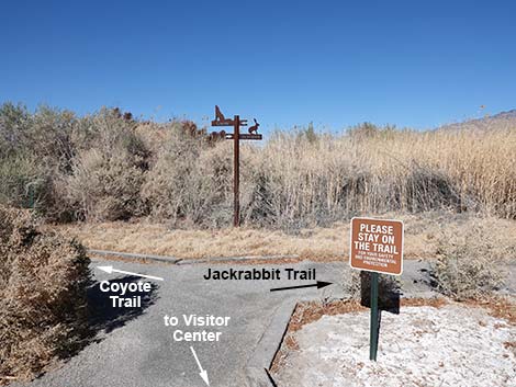 Trail junction: stay left on Coyote Trail (view N) |
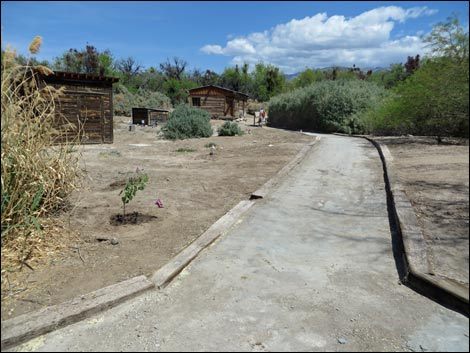
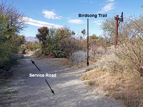
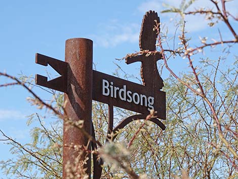
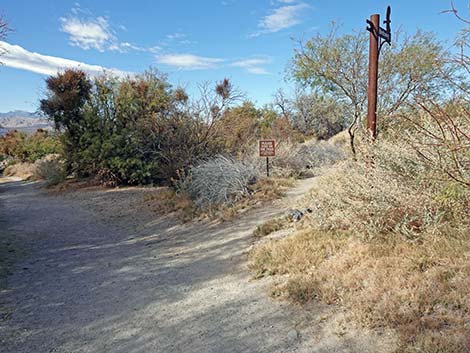
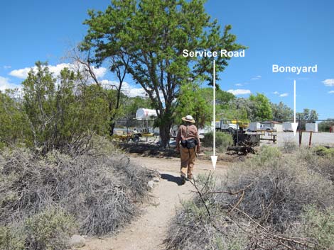
Getting to the Trailhead The Birdsong Trail is located northwest of Las Vegas on the Desert National Wildlife Refuge, about 30 minutes northwest of downtown Las Vegas, at the Corn Creek Visitor Center. From the Visitor Center, the Birdsong Trail is located out past the northwest part of the developed area. To get there, exit the back of the visitor center 15 yards to the kiosk sign at a 4-way trail intersection. Continue northwest across the bridge over Corn Creek, proper, then stay left at the signed trail junction. Continue northwest along the edge of the Cement Pond. Just past the pond, stay right at the trail junction watched by the bronze coyote. This trail leads northwest to yet another trail junction where the Railroad Tie Cabin can be seen to the right. Stay right to the cabin, then continue left onto a service road 65 yards to the beginning of the Birdsong Trail, which departs the road to the right. |
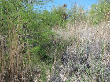
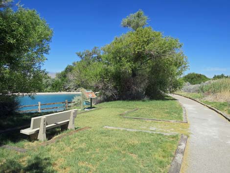 Trail passing the Cement Pond (view NW) |
The Hike From the Birdsong Trailhead (Wpt. 05), the unsigned trail runs northwest into the desert scrub. The trail is lined with rocks and sticks well enough to tell where it goes through the bushes. Heading northwest, the low shrubs mostly are fourwing saltbush, and the taller thicket trees are Russian olive and honey mesquite. The olive produces fruits eaten by many species of birds, and the mesquite supports large growths of mesquite mistletoe, the berries of which feed lots of Phainopepla. This is also a good area to watch for Crissal Thrashers, Verdins, Blue-gray Gnatcatchers, and Black-tailed Gnatcatchers. Continuing, the trail passes through an old fence (Wpt. 06). In the 1950s and 1960s, these fences were part of the pens in which wildlife managers maintained a herd of bighorn sheep. Fortunately for the sheep, they get to live in the mountains these days. |
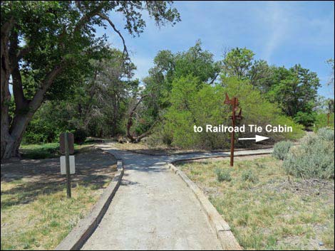 Trail junction towards Railroad Tie Cabin (view (WNW) |
Just past the fence, the trail passes the first of several wet areas. The spring is overgrown with common reed grass and some native wetland species, but the water brings in birds and other wildlife. The trail continues northwest for a short way farther, then turns to the southwest and runs out along a barren patch of white soils. This soil is a "spring deposit," the result of water flowing out of an aquifer and depositing minerals over the centuries. The damp soil also catches wind-blown dust, so the resulting white soil is a combination of mineral deposits and dust. This would be mud if it were wet, so this might not be the best trail in wet weather. The trail runs out a ridge of spring deposit soils to a highpoint (Wpt. 07). It is hard to tell if the landscape here is entirely natural or if people modified it during the last 130 years, but the berm-like highpoint provides an elevated position to look out on the landscape and scan for birds. Be sure to look up for Red-tailed Hawks, Northern Rough-winged Swallows, Common Raven, Turkey Vultures, and other soaring birds. |
 Another trail junction (view N towards Railroad Tie Cabin) |
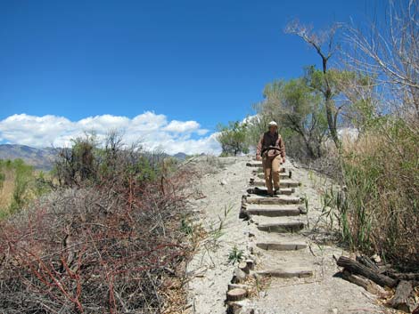
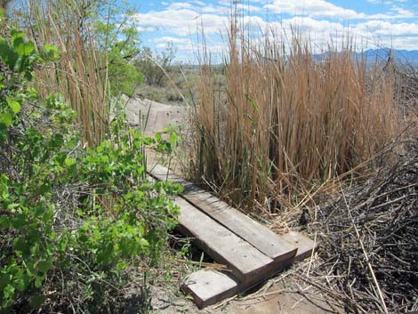
The ditch below the highpoint carries water, as does a spring hidden in the mesquite just south of the highpoint. Water supports wetland vegetation, mesquite thickets, cottonwood trees, and other shrubs. Watch for Wilson's Warblers, Marsh Wrens, and Red-winged Blackbirds in the cattails; Yellow Warblers, Lucy's Warblers, and Western Tanagers in the trees; Western Kingbirds, Ash-throated Flycatchers, and Olive-sided Flycatchers on various perches around the area, and even look for nesting Black-chinned Hummingbirds in the mesquite thickets. Check the trees and the logs on the ground for Yellow-backed Spiny Lizards. Continuing, the trail runs down stairs on the west end of the spring deposit ridge, crossing a short bridge (Wpt. 08) over an outflow stream (trickle) from a spring, and heads down into more typical desert vegetation (Wpt. 09). Here, creosote bush and white bursage, species characteristic of the Mojave Desert, are common. Be sure to watch the rocks lining the trail for basking side-blotched lizards. |
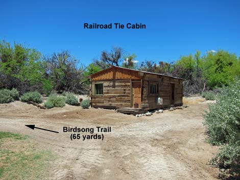 Railroad Tie Cabin; stay left onto service road (view N) |
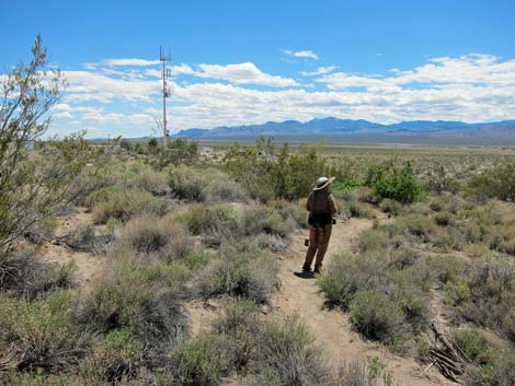
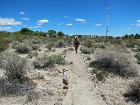
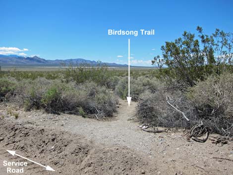
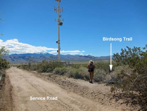
The Birdsong Trail, proper, ends when it returns to the service road (Wpt. 10), this time adjacent to the chain-link fence surrounding the boneyard (the maintenance yard). Turning to the left and heading northeast on the service road, the road can be followed back towards the Railroad Tie Cabin, retracing the trail back to the trailhead. Alternatively, consider following the road back for about 500 feet (Wpt. 11), and then turn right onto a trail that runs south. This trail crosses a bridge, runs easterly past the pasture, orchard, and stream back to the cement pond (Wpt. 03). All of these are good birding areas. The route then runs back around the cement pond to the trailhead (Wpt. 01). On the way back, consider walking up to the two springs (Wpt. 20) that feed the pond. |
 Service Road at Birdsong Trail (view NW) |
 Birdsong Trail sign (view WNW) |
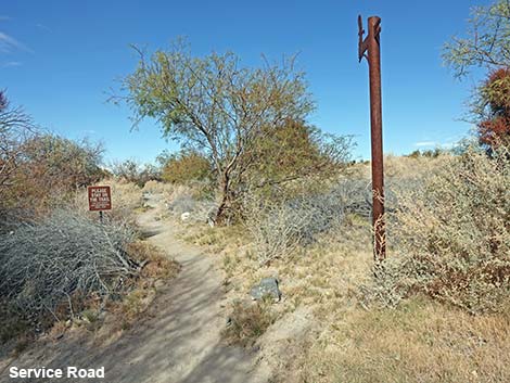
 Service Road at Birdsong Trail (view NW) |
 Birdsong Trail (view NW from Service Road) |
 Starting out on the Birdsong Trail (view NW) |
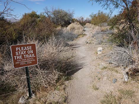
 Please protect the Birdsong Trail habitat and stay on trail (view NW) |
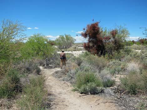
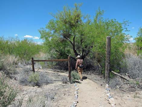 Passing through the fence (view N) |
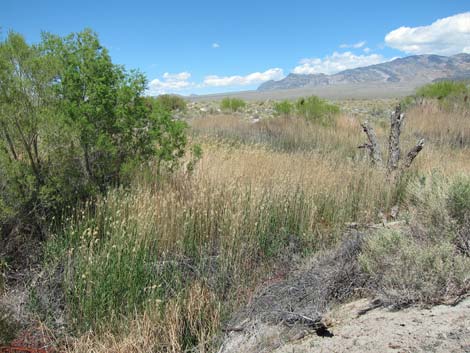
 Small wet area (view NW) |
 Birdsong trail (view NW) |
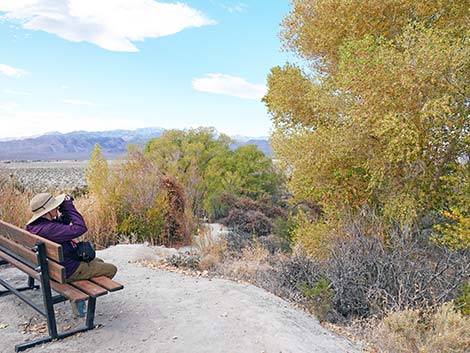
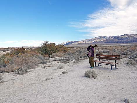 Bench with a view (view NE) |
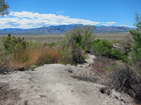
 Trail on spring deposit soils (view W) |
 Highpoint (view W) |
 Another bench with a view (view W) |
 Wet area below highpoint (view N) |
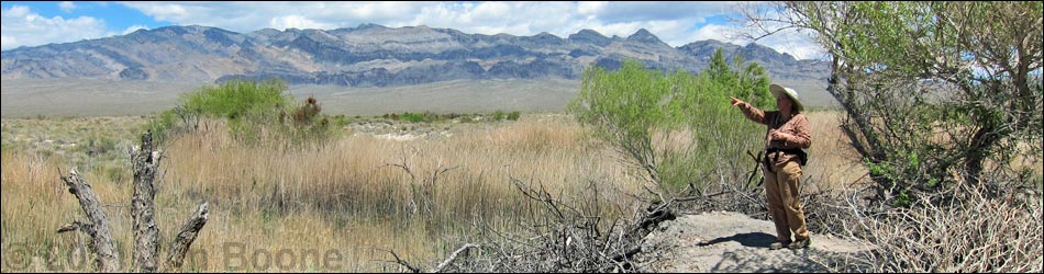
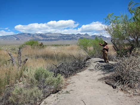 Birdwatching at the highpoint (view E) |
 Looking back at hiker descending the toe of the ridge (view E) |
 Bridge (view SW) |
 Returning to desert scrub vegetation (view S) |
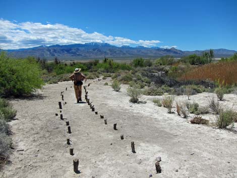
 Trail on desert flats (view S) |
 Birder at end of Birdsong Trail (view S) |
 End of Birdsong Trail (view N) |
 End of Birdsong Trail (view NW) |
Table 1. Hiking Coordinates Based on GPS Data (NAD27, UTM Zone 11S). Download Hiking GPS Waypoints (*.gpx) file.
| Wpt. | Location | UTM Easting | UTM Northing | Elevation (ft) | Point-to-Point Distance (mi) | Cumulative Distance (mi) | Verified |
|---|---|---|---|---|---|---|---|
| 01 | Trailhead | 647224 | 4033636 | 2,936 | 0.00 | 0.00 | GPS |
| 02 | Spur to Spring | 647209 | 4033670 | 2,940 | 0.02 | 0.02 | GPS |
| 03 | Trail Junction | 647117 | 4033704 | 2,940 | 0.07 | 0.09 | GPS |
| 04 | Railroad Tie Cabin | 647056 | 4033768 | 2,935 | 0.06 | 0.15 | GPS |
| 05 | Trail Junction | 647000 | 4033753 | 2,927 | 0.03 | 0.18 | GPS |
| 06 | Fence | 646959 | 4033821 | 2,929 | 0.06 | 0.24 | GPS |
| 07 | High Point | 646831 | 4033881 | 2,928 | 0.12 | 0.36 | GPS |
| 08 | Bridges | 646782 | 4033862 | 2,920 | 0.03 | 0.39 | GPS |
| 09 | Bottom of Slope | 646709 | 4033793 | 2,905 | 0.08 | 0.47 | GPS |
| 10 | Roadway | 646848 | 4033710 | 2,908 | 0.10 | 0.57 | GPS |
| 03 | Trail Junction | 647117 | 4033704 | 2,940 | 0.19 | 0.76 | GPS |
| 02 | Spur to Spring | 647209 | 4033670 | 2,940 | 0.07 | 0.83 | GPS |
| 01 | Trailhead | 647224 | 4033636 | 2,936 | 0.03 | 0.86 | GPS |
| 20 | Springs | 647274 | 4033717 | 2,919 | . | . | GPS |
Happy Hiking! All distances, elevations, and other facts are approximate.
![]() ; Last updated 240324
; Last updated 240324
| Hiking Around DNWR | Hiking Around Las Vegas | Glossary | Copyright, Conditions, Disclaimer | Home |