Hiking Around Las Vegas, Desert National Wildlife Refuge
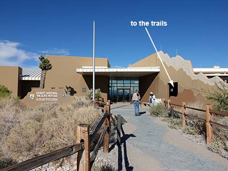 Visitor Center (view NE) |
Overview The Bighorn Loop Trail is a 0.6-mile ADA compliant trail that loops through upland portions of the Corn Creek area. Corn Creek has been a birdwatching destination for decades, and now the Bighorn Trail opens a bit of this area to persons in wheelchairs or with other walking issues, plus families with children in strollers. The trail has interpretive signs describing the ecology and human history of the area. Corn Creek is a tiny spot of green in a vast sea of desert-dry Mojave Desert Scrub. Springs provide water that supports trees, lush vegetation, desert wildlife, and even humans over the last few thousands of years. The ancients left their marks on the land, but most evidence of human use derives from pioneer and more recent times. Link to Trail Map. |
 Trail around Visitor Center (view E) |
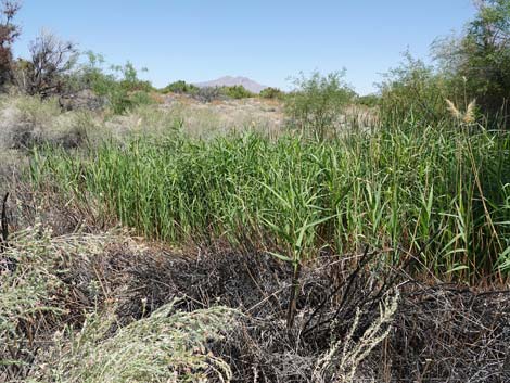
Most of the habitat immediately surrounding Corn Creek is low-elevation Mojave Desert Scrub dominated by creosote bush, white bursage, fourwing saltbush, and a few Mojave yucca). This area is in the rain shadow of the Spring Mountains, so it gets less rain than usual, even for a desert, and as a result, the vegetation is sparse and stunted. Springs at Corn Creek provide water for a desert oasis supporting honey mesquite, cottonwood trees, and many other wetland plant species. Water from two of the springs was used by late-1800s homesteaders to support a farm, and these two springs still water the cement pond and the trees, grass, and orchards that remain. |
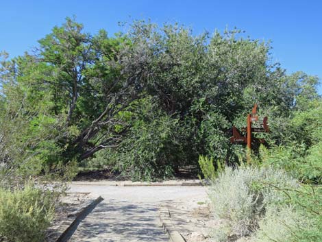
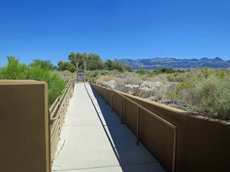 Trail starts behind Visitor Center (view NE) |
Watch Out Other than the standard warnings about hiking in the desert, ... this is a safe hike if hikers stay on the trails as requested by refuge management. The Bighorn Loop Trail is fairly level, although the first half generally is uphill, and the second half generally is downhill. The surfacing is smooth and looks like frozen mud, making one feel unsure about the footing on cold winter mornings. There are several benches where people can stop and rest: about 50 yards out, about 1/3 of the way around the loop (with shade), about the half-way mark (Whispering Ben Trail junction), and most of the way around (overlooking the cement pond). While hiking, please respect the land and the other people out there, and try to Leave No Trace of your passage. Even though this trail is short, bring what you need of the 10 Essentials. Also, this is a wildlife refuge, so pay extra attention to respecting the land and wildlife. |
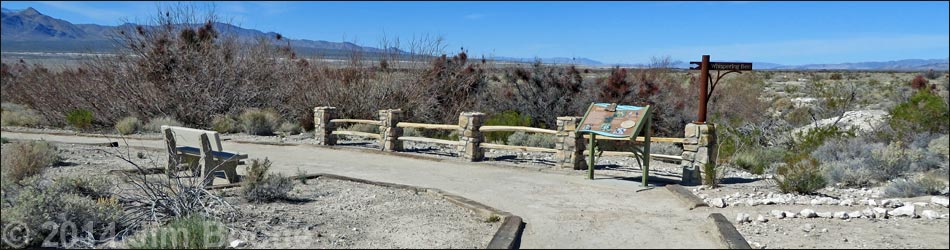
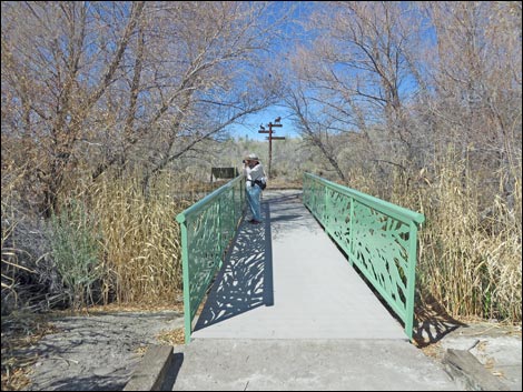
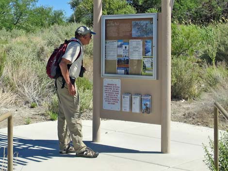 Birder reading information sign at trail junction (view NE) |
Getting to the Trailhead The Bighorn Trail is located northwest of Las Vegas on the Desert National Wildlife Refuge, about 30 minutes northwest of downtown Las Vegas, at the Corn Creek Visitor Center. |
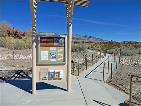 Information kiosk; stay right (view E) |
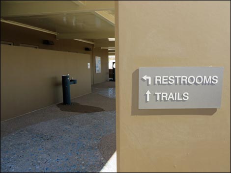
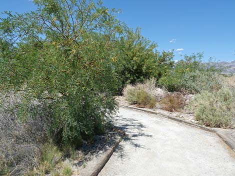
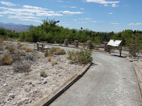
The Hike From the trailhead (Table 1, Waypoint 01), hikers can walk through the Visitor Center and out the back of the building, or they can walk around outside the Visitor Center (through the doorway leading to the rest rooms and drinking water) to the northeast (far) corner of the building. A few steps beyond the building, the concrete trail arrives at a trail junction with an information sign. Here, the outbound trail (technically the Jackrabbit Trail) turns right and runs up along the creek towards the springs, while the inbound trail returns from the left along the edge of the cement pond. Continuing to the right, the trail passes the official start of the trail (through entrance pillars). Passing through the entrance, the trail crosses the outflow creek from the springs, which are located upstream to the right. Notice the small fish, dragonflies, and birds in the trees along the stream. |
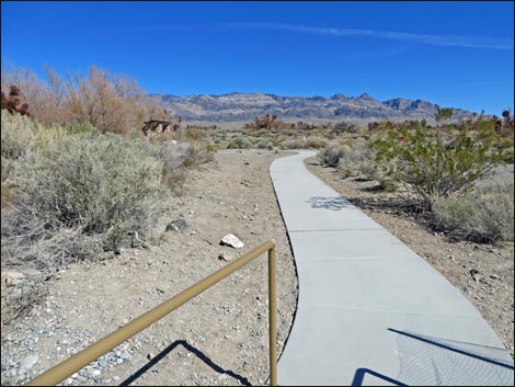 |
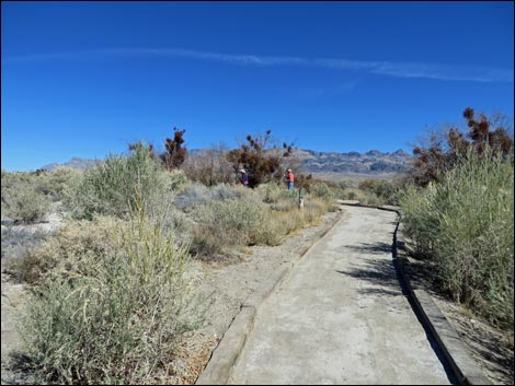
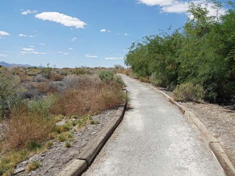
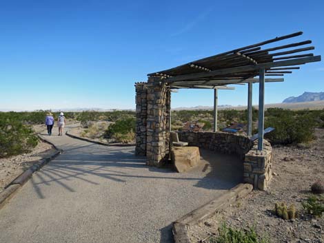
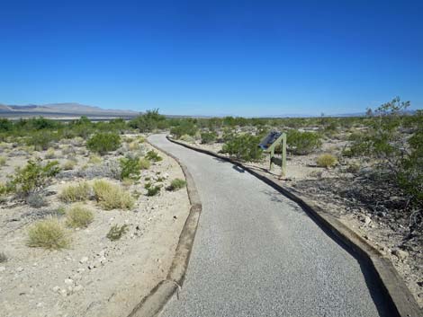
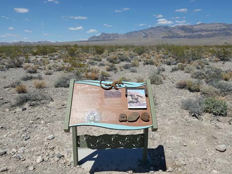
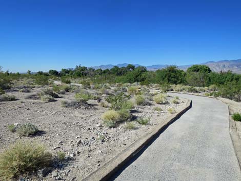
Across the bridge, the trail reaches a T-intersection. Hikers can turn left on the Jackrabbit Trail to short-cut the Bighorn Loop and return to the Visitor Center via the cement pond, or turn right and continue on the Bighorn Trail. Staying to the right, the Bighorn Loop Trail runs up along the stream, then bends left and generally runs northwest out into the desert climbing at a gentle grade. In this area, there are grand views in all directions. To the west (left) are the Spring Mountains (Mt. Charleston) and to the east (right) is the Sheep Range. The trail passes an information sign about native people, then arrives at a shade structure with benches (Wpt. 21). This is a nice place to sit and contemplate the banded geology of the Sheep Range that towers above the desert flats. |
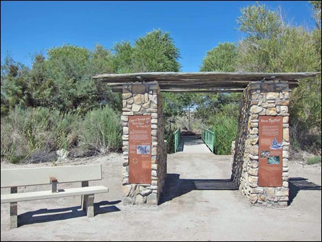 Formal start of the trail system (view N) |
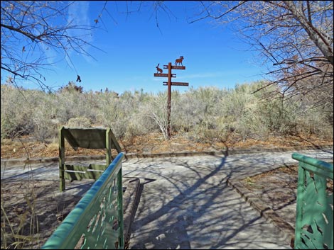
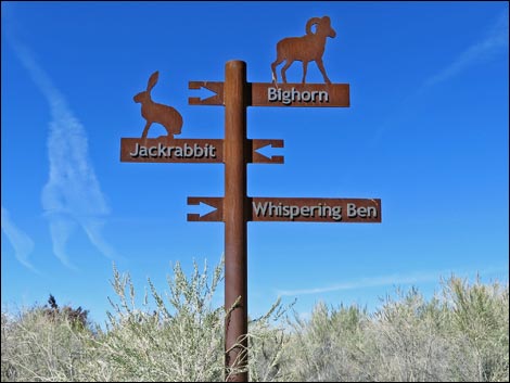
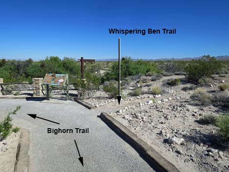
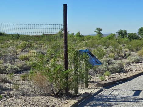
In another 110 yards, the Bighorn Loop Trail arrives at a junction (Wpt. 22) with the Whispering Ben Trail, and then a bench (Wpt. 24) a few steps farther. For those inclined, the narrow, unsurfaced Whispering Ben Trail runs out about 150 yards to an unusual archeological artifact (Wpt. 24): a boulder used like a bedrock mortar for grinding mesquite beans. Native peoples used this stone for so long that one of the holes got so deep that it broke through the bottom of the boulder! Back at the bench on the Bighorn Loop Trail (Wpt. 24), the trail begins to loop back and runs downhill at a gentle grade. The trail passes through an historic fence that was part of a pen used by refuge managers in the 1950s and 1960s to corral a herd of Desert Bighorn Sheep. This was useful at the time for scientists studying the sheep, but fortunately, they now roam free in the mountains. Continuing downhill, the Bighorn Loop Trail arrives at an intersection (Wpt. 25) with the Coyote Loop Trail. For hikers inclined, the restored Railroad Tie Cabin and Pahrump Poolfish Refuge lie to the right, but the Bighorn Trail turns left. |
 Bridge over spring outflow creek |
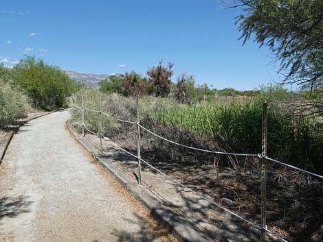
Turning left at the junction (Wpt. 25), the Bighorn Loop Trail quickly reaches another trail junction (Wpt. 03). Here, the trail to the right (Coyote Loop Trail) wanders among old trees past the orchard, but the Bighorn Loop Trail turns left. Following the Bighorn Loop Trail, the trail runs along the cement pond. There is a nice bench on the right (but no shade) overlooking the pond. This can be a peaceful place to sit and watch birds flying among the trees or coming in for water. Continuing on the Bighorn Loop Trail, the trail reaches yet another trail junction (Wpt. 02) with the Jackrabbit Trail. The Jackrabbit Trail turns left, while the Bighorn Loop Trail continues straight. The trail crosses another bridge over the spring outflow creek, and in a few yards farther, arrives at the information sign behind the Visitor Center. |
 Trail junction (view north from bridge) |
 Trail sign: Bighorn trail turns right (view N) |
 Trail runs east through thickets, then bends north (view E) |
 Bighorn trail approaching the spring (view E) |
 Bighorn trail at the overgrown spring (view E) |
 Bighorn trail bends left past the spring (view E) |
 Trail runs along a mesquite thicket (view N) |
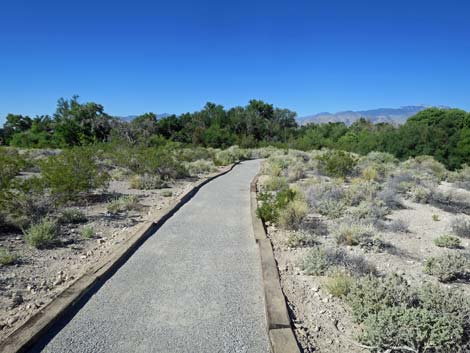
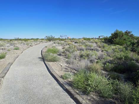 Trail runs out into the open desert (view NW) |
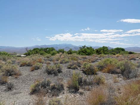 Grand view west towards the Spring Mountains (view W) |
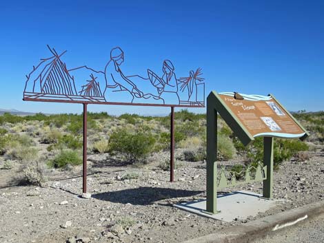 Exhibit: native people and traditional ways of life (view NW) |
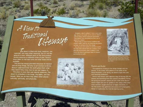 Information sign: A View to Traditional Lifeways (view W) |
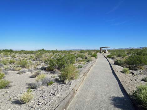 Trail runs out to a shade structure (view N) |
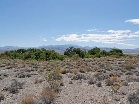 Grand view west towards the Spring Mountains (view W) |
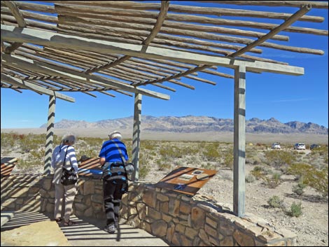 Hikers under the shade structure (view N) |
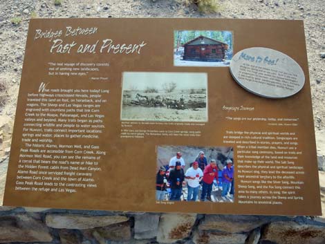 Information sign: Bridges between Past and Present |
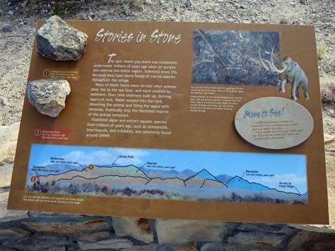 Information sign: Stories in Stone |
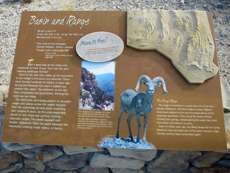 Information sign: Basin and Range |
 Hikers departing the shade structure (view N) |
 Approaching another information sign (view N) |
 Information sign and grand view of the Sheep Range (view E) |
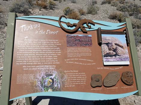 Information sign: Thriving in the Desert |
 Approaching Whispering Ben Trail junction (view N) |
 Approaching another information sign (view N) |
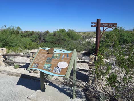 Information sign at the trail junction (view N) |
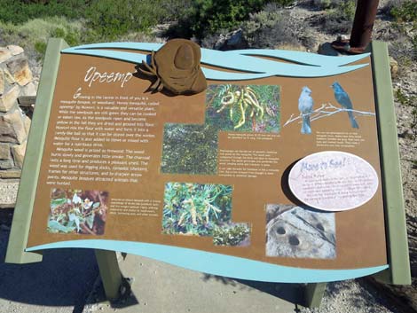 Information sign: Opeemp' (honey mesquite) |
 The trail bends left to head back towards the trailhead (view SW) |
 Fence that was part of Desert Bighorn Sheep pen (view S) |
 Approaching another information sign (view S) |
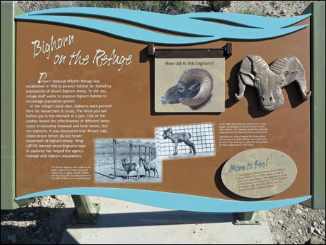 Information sign: Bighorn on the Refuge (view E) |
 Trail runs back towards the trees (view SW) |
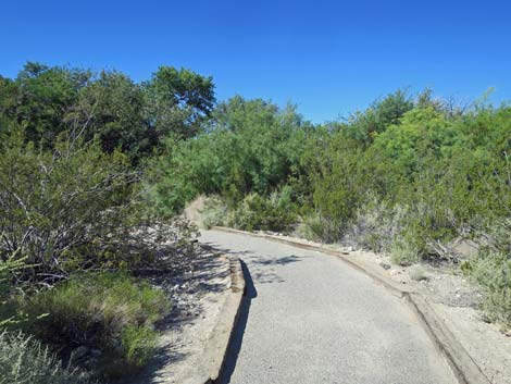 Winding into the thickets (view W) |
 Bighorn Trail at T-intersection with Coyote Trail (view W) |
Table 1. Hiking Coordinates Based on GPS Data (NAD27, UTM Zone 11S). Download Hiking GPS Waypoints (*.gpx) file.
| Wpt. | Location | UTM Easting | UTM Northing | Elevation (ft) | Point-to-Point Distance (mi) | Cumulative Distance (mi) | Verified |
|---|---|---|---|---|---|---|---|
| 01 | Trailhead | 647214 | 4033652 | 2,956 | 0.00 | 0.00 | Yes |
| 02 | Trail Junction | 647208 | 4033672 | 2,940 | 0.01 | 0.01 | GPS |
| 20 | Springs | 647274 | 4033717 | 2,919 | 0.05 | 0.07 | GPS |
| 21 | Shelter | 647217 | 4033826 | 2,946 | 0.09 | 0.16 | GPS |
| 22 | Trail Junction | 647145 | 4033881 | 2,950 | 0.06 | 0.22 | GPS |
| 23 | Grinding Stone | 647143 | 4033954 | 2,953 | 0.08 | 0.30 | GPS |
| 22 | Trail Junction | 647145 | 4033881 | 2,950 | 0.08 | 0.38 | GPS |
| 24 | Bench | 647142 | 4033878 | 2,946 | 0.00 | 0.38 | GPS |
| 25 | Trail Junction | 647084 | 4033730 | 2,932 | 0.11 | 0.49 | GPS |
| 03 | Trail Junction | 647116 | 4033705 | 2,940 | 0.04 | 0.53 | GPS |
| 02 | Trail Junction | 647208 | 4033672 | 2,940 | 0.06 | 0.59 | GPS |
| 01 | Trailhead | 647214 | 4033652 | 2,956 | 0.01 | 0.60 | Yes |
Happy Hiking! All distances, elevations, and other facts are approximate.
![]() ; Last updated 240324
; Last updated 240324
| Hiking Around DNWR | Hiking Around Las Vegas | Glossary | Copyright, Conditions, Disclaimer | Home |