Hiking Around Las Vegas, Desert National Wildlife Refuge
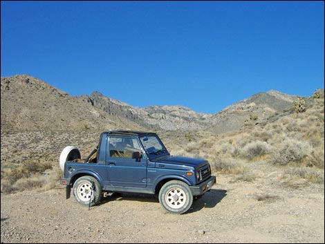
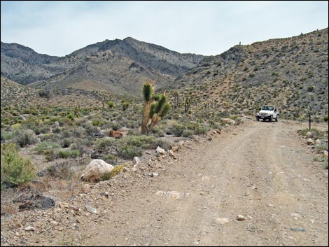 Jeep at the trailhead (view E) |
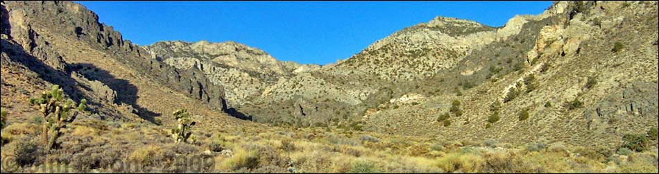
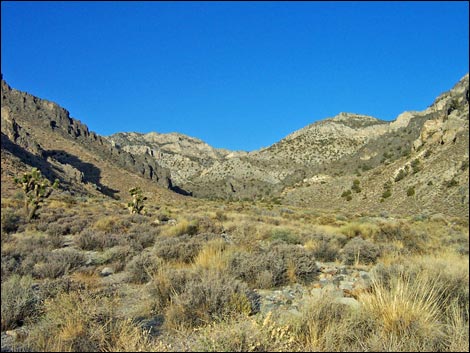
Overview This strenuous route follows a wash and runs straight up Black Gate Canyon to the crest of the Sheep Range with about 2,500 ft elevation gain. Until you top out, you won't feel certain that the route will go, but it only takes a few 3-class moves to pass the cliffs. From the crest, there are several options for getting back down, but retracing the route likely is the easiest. This is a great off-trail hike, and views from the crest are spectacular. For general information on camping, regulations, other issues, and the natural history of the Wildlife Refuge, see the Desert National Wildlife Refuge -- Area Overview page. Link to map. |
 Black Gate Canyon Trailhead (view east). |
Watch Out Other than the standard warnings about hiking in the desert, ...a slip from a few places high in the canyon could result in serious injury, and there is considerable loose scree along the route. This is not a good route for young children. While hiking, please respect the land and the other people out there, and try to Leave No Trace of your passage. Also, this hike is long, so be sure to bring the 10 Essentials. This is a wildlife refuge, so pay extra attention to respecting the land. Please, don't bother the bighorn sheep; they have a hard enough time making a living in these desert lands. |
 |
Getting to the Trailhead This hike is located on the Desert National Wildlife Refuge, about 1.5 hours north of town. From town, drive out Corn Creek Road to Corn Creek Field Station. Continue east 100 yards to a T-intersection with a large directional sign. Turn left onto Alamo Road and drive north for 3.1 miles to Joe May Road. Turn right onto Joe May Road and drive east for about 4 miles to the end of the road or as far as you can get. The last few hundred yards may require a 4WD vehicle; park early if necessary. Park here; this is the trailhead. |
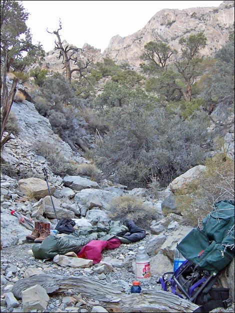 Camp in the wash (typical wash conditions; view east) |
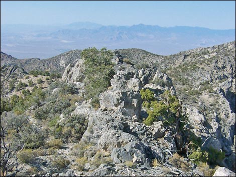
The Hike From the trailhead (Table 2, Waypoint 01), the route drops into the wash and heads straight up the canyon. The hike initially seems more difficult than it should be because there is no good place to walk. There are a few places to walk in the wash, and for the most part, hikers must just pick their way through the shrubs and across boulder fields. At the Black Gate (Wpt. 02), a gap in the long black cliffs that traverse most of the southwestern face of the Sheep Range, it becomes easier to walk in the wash. Black Gate is also at the edge of the Pinyon-Juniper Woodland zone, so there are trees and some shade. From Black Gate (Wpt. 02), the route continues up the main wash, never deviating to the north or south into other drainages. Higher up, the canyon gets narrower and steeper, but the route continues on, heading straight up the canyon. At one point, the wash forks at an odd T-intersection (Wpt. 03). The route stays in the south (right) fork, continuing more-or-less straight up the canyon. Approaching the crest, the summit cliffs appear steeper and more imposing, but the route continues on straight up the canyon. Depending on the exact route chosen through the cliffs, there may be a few 3rd-class moves, but the route is almost entirely 2nd-class. Eventually, the route breaks out onto the crest of the Sheep Range (Wpt. 04) through a gap in the cliffs. Views from the crest are spectacular, extending far to the west, south, and east. The view north up the spine of the Sheep Range suggests some interesting hiking. While enjoying the view, hikers may notice other ways through the cliffs, but it would be difficult to pick a better route from below. From the crest, hikers will find several options for getting back to the trailhead, but the easiest is to retrace your footprints back down the canyon. |
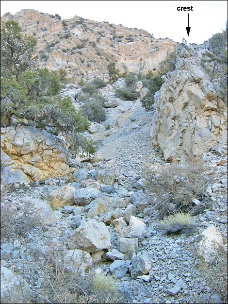 The route through the headwall runs up this gully (view east). |
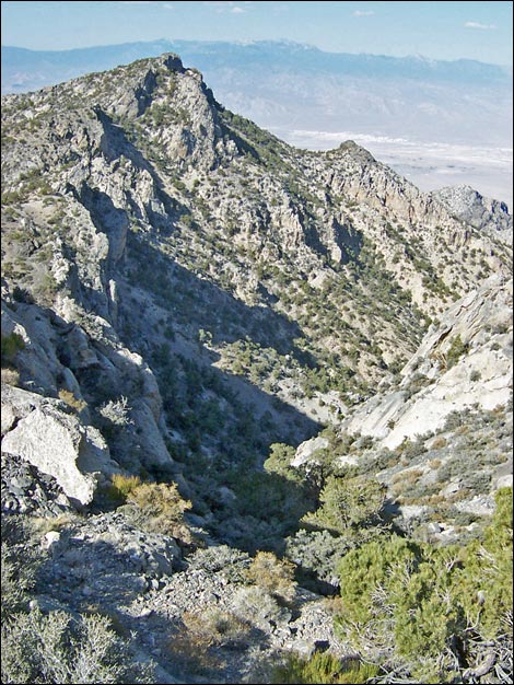 Black Gate Canyon from the crest of the Sheep Range (view W) |
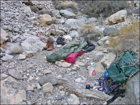 Camp in the wash (view E) |
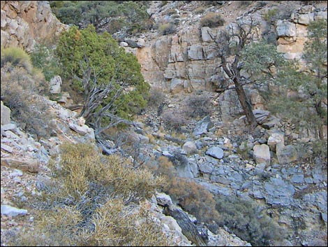 Steep conditions in the canyon (view E) |
 Las Vegas and Mt. Potosi (view SW from the crest) |
 More to come ... |
Table 1. Hiking Coordinates Based on GPS Data (NAD27, UTM Zone 11S). Download Hiking GPS Waypoints (*.gpx) file.
| Wpt. | Location | Easting | Northing | Elevation (ft) | Verified |
|---|---|---|---|---|---|
| 01 | Trailhead | 651960 | 4041577 | 5,096 | GPS |
| 02 | Black Gate | 654103 | 4042081 | 6,105 | GPS |
| 03 | Wash forks at a T-intersection | 655040 | 4042045 | 6,700 | map |
| 04 | Crest of the Sheep Range | 655696 | 4042092 | 7,756 | GPS |
Happy Hiking! All distances, elevations, and other facts are approximate.
![]() ; Last updated 240324
; Last updated 240324
| Hiking Around DNWR | Hiking Around Las Vegas | Glossary | Copyright, Conditions, Disclaimer | Home |