Hiking Around Las Vegas, Death Valley National Park
 |
Overview Ubehebe Lead Mine is an interesting, but dangerous, mining area located just northwest of the Racetrack Playa. The area was a LEAD mine, so there is a lot of toxic lead and other heavy metals in the soil, and therefore camping in prohibited here. Keep this in mind if you hike here and don't stir up the dust too much. The mine area is not in wilderness, but the surrounding lands are included in the Death Valley Wilderness Area Link to map. |
 |
Watch Out Other than the standard warnings about hiking in the desert, ...this is a dangerous mining area. There are lots of scary holes in the ground that are fun to look at, but not safe to enter. While hiking, please respect the land and the other people out there, and please try to Leave No Trace of your passage. Also, this is a remote area, so be sure to bring the 10 Essentials. |
 |
Getting to the Trailhead Racetrack Playa is located in Death Valley National Park, about 5-6 hours northwest of Las Vegas. From town, drive out to Death Valley. From the Furnace Creek Visitor Center (Table 1, Site 0712), drive north on Highway 190 for 17.4 miles to Scotty's Castle Road (Site 0763). Turn right onto Scotty's Castle Road and drive north for about 33 miles to Ubehebe Crater Road (Site 754), which is just past the Grapevine Entrance Station. Turn left (west) onto Ubehebe Crater Road and drive northwest for 5.7 miles to Racetrack Road (Site 0756), which cuts off to the right (west) just before the Ubehebe Crater parking area. This is the start of the Racetrack Road, details of which are on the Racetrack Road webpage. |
 |
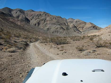
Turn right (west) onto Racetrack Road and drive about 19.5 miles to Teakettle Junction (Site 0757), which has a well-adorned road sign. From Teakettle Junction, continue southwest on the main road for 2.1 miles to Ubehebe Mine Road, which continues straight when Racetrack Road bends to the left. Drive onto a low saddle about 0.2 miles out. In a 2WD vehicle, consider stopping here and walking to the trailhead. Otherwise drive another 0.5 miles to the Ubehebe Lead Mine area (Site 1058). Park here; this is the trailhead. |
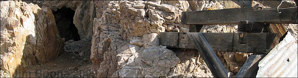
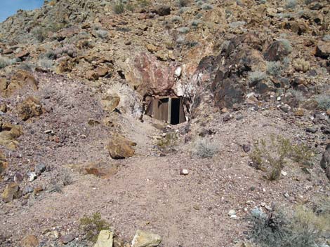
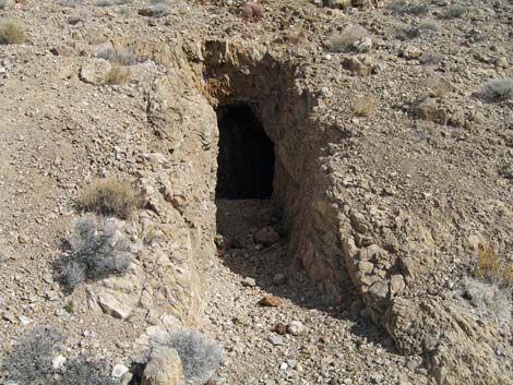
 Old mine entrance |
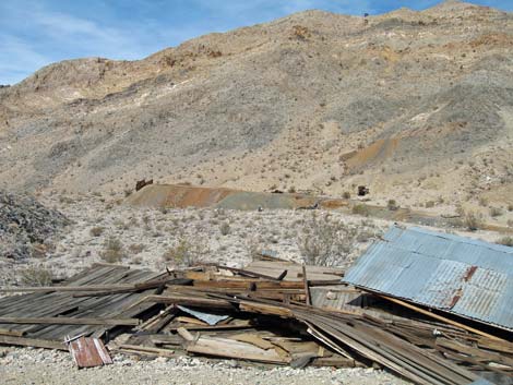
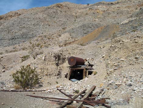
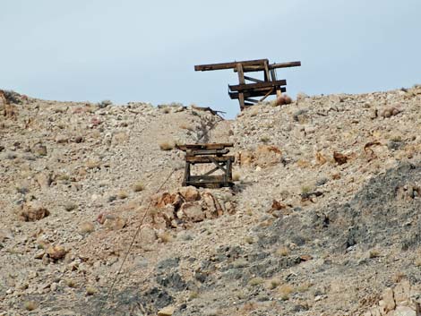
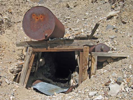
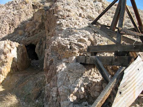
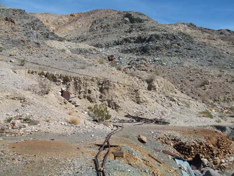
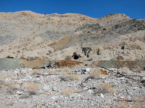
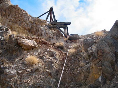
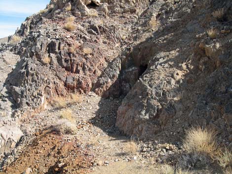
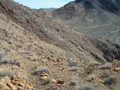
The Hike This is an interesting area with lots of holes in the ground, mining structures, the remains of a tramway, and even an old truck body. Much of what remains can be seen from the end of the road. Mining trails lead to all of the mine opening and to the top of the tramway, but I'll leave it up to the adventuresome to find things and explore the area, but the easier trail to top starts at Waypoint 01. When here, remember: there is toxic lead in the soil, and some of the holes in the ground here are the most unsafe I have even seen. I would not be surprised if the top of the mountain were to cave in. |
 |
 |
 Old ore car tracks |
 Cable still in place |
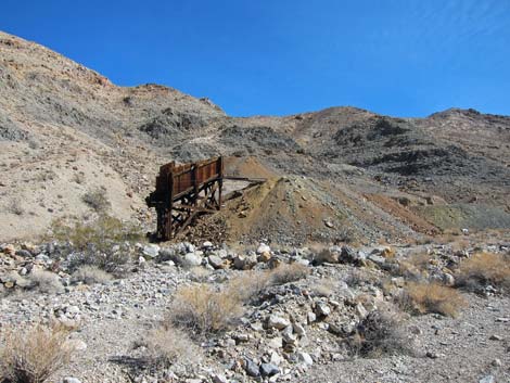 Ore loading structure |
 Ore loading structure |
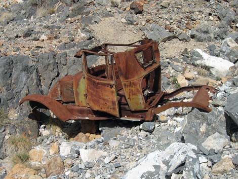 Old truck body |
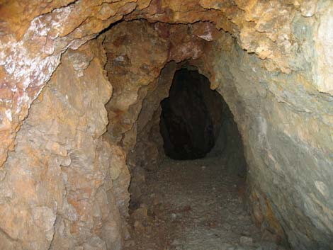
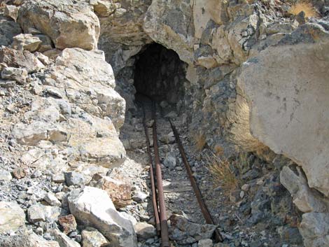 Ore car tracks and pipe leading back into a mine |
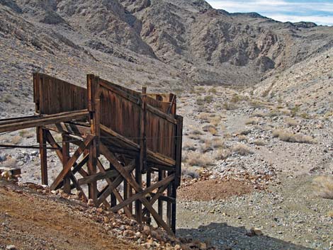
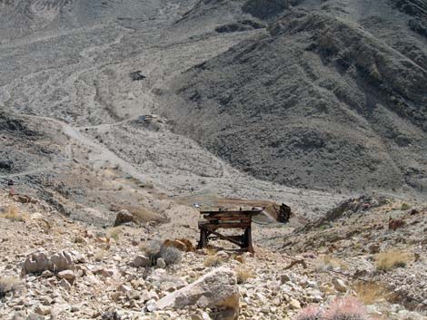 Top of tramway on south side of mountain |
 Top of tramway on north side of mountain |
 Trail to a hole in the ground |
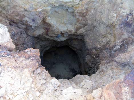
 Scary hole in the ground; note the colors |
 Scary hole in the ground |
 Vertical scary hole in the ground |
 Old miner's trail to the top of the tramway |
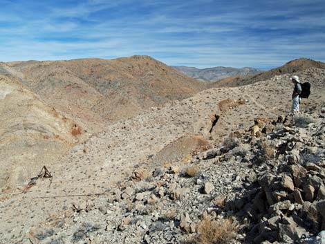 Even with the mining artifacts, the scenery is grand |
Table 1. Highway Coordinates Based on GPS Data (NAD27; UTM Zone 11S). Download Highway GPS Waypoints (*.gpx) file.
| Site # | Location | Latitude (N) | Longitude (W) | Easting | Northing | Elevation (ft) | Verified |
|---|---|---|---|---|---|---|---|
| 0612 | Racetrack at Ube Mine Rd North | 36.74551 | 117.57431 | 448729 | 4066593 | 3,992 | Yes |
| 0613 | Racetrack at Ube Mine Rd South | 36.74408 | 117.57416 | 448741 | 4066435 | 3,973 | Yes |
| 0712 | Furnace Creek Visitor Center | 36.46159 | 116.86574 | 512030 | 4034954 | -186 | Yes |
| 0754 | Scotty's Castle Rd at Ubehebe Rd | 36.99863 | 117.36605 | 467429 | 4094580 | 2,292 | Yes |
| 0756 | Ubehebe Crater Rd at Racetrack Rd | 37.01291 | 117.45699 | 459345 | 4096199 | 2,515 | Yes |
| 0757 | Racetrack Rd at Teakettle Junction | 36.76008 | 117.54142 | 451674 | 4068192 | 4,143 | Yes |
| 0763 | Hwy 190 at Scotty's Castle Rd | 36.63910 | 117.03531 | 496843 | 4054636 | 104 | Yes-2 |
| 1058 | Ubehebe Lead Mine Parking | 36.74868 | 117.58370 | 447893 | 4066950 | 3,925 | GPS |
Table 2. Hiking Coordinates Based on GPS Data (NAD27; UTM Zone 11S). Download Hiking GPS Waypoints (*.gpx) file.
| Wpt. | Location | Easting | Northing | Elevation (ft) | Verified |
|---|---|---|---|---|---|
| 01 | Base of Miner's Trail | 448002 | 4066900 | 3,911 | GPS |
Happy Hiking! All distances, elevations, and other facts are approximate.
![]() ; Last updated 240324
; Last updated 240324
| Death Valley | Hiking Around Las Vegas | Glossary | Copyright, Conditions, Disclaimer | Home |