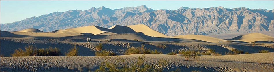
(aka Stovepipe Sand Dunes)
Hiking Around Las Vegas, Death Valley National Park
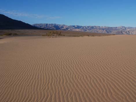
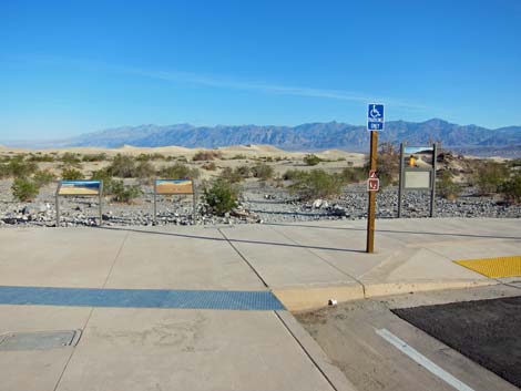 Trailhead parking area (view north) |
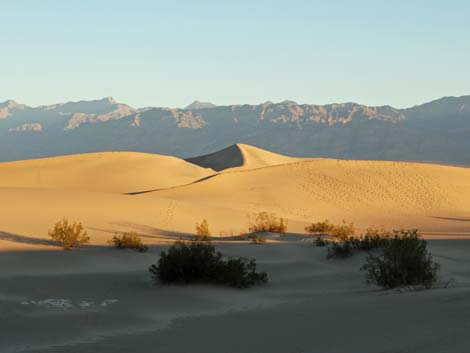
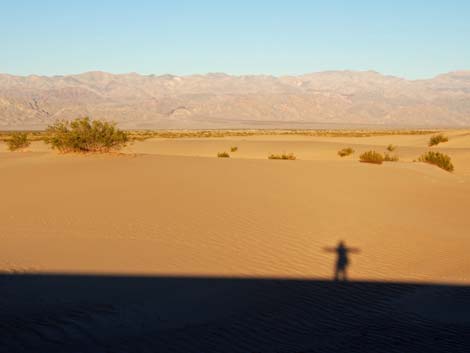
Overview This is a pleasant walk among picturesque sand dunes in the Death Valley Wilderness Area. Beyond the trailhead area, there is no trail; this is just a place to wander about the windswept dunes and enjoy the sights and sounds. If you intend to hike to the top of the dunes, it is farther than it looks -- about 2.3 miles round trip. Link to map. |
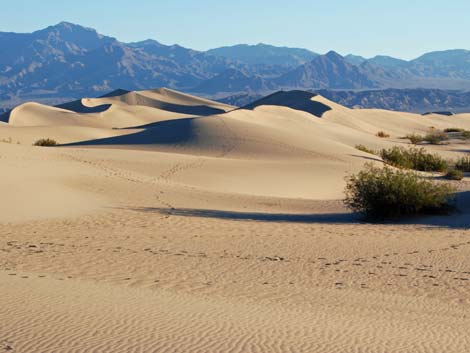
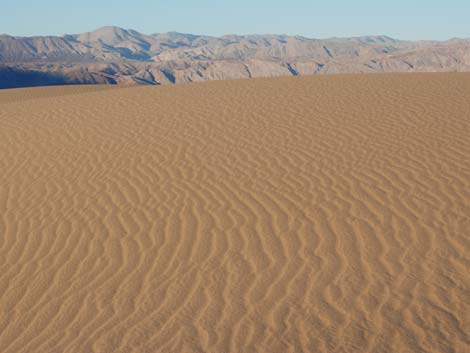
 Sand dunes |
Watch Out Other than the standard warnings about hiking in the desert, ...this is pretty safe area, but watch your eyes and your optical equipment if the sand is blowing. While hiking, please respect the land and the other people out there, and other than footprints in the sand, please try to Leave No Trace of your passage. Also, this is a fairly short hike, so just bring what you need of the 10 Essentials. |
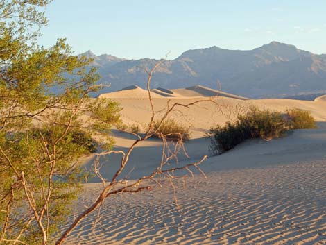
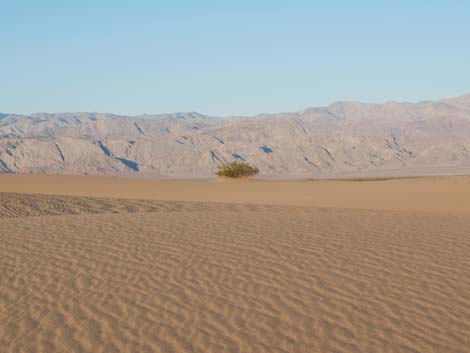
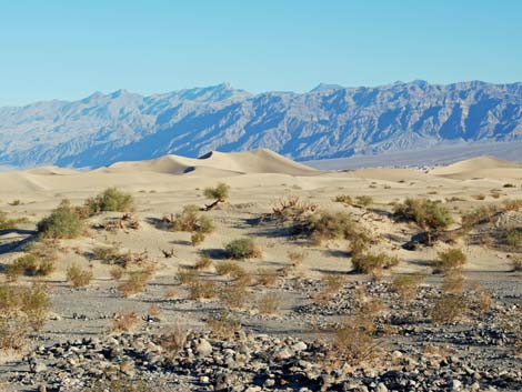
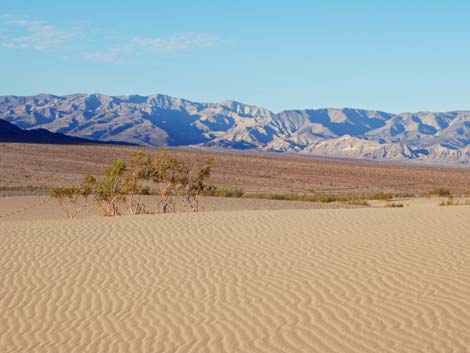
 Mesquite and creosote bush (view north) |
Getting to the Trailhead This hike is located in Death Valley National Park, about 3.5 hours northwest of Las Vegas. From town, drive out to Death Valley. From the Furnace Creek Visitor Center (Table 1, Site 0712), drive north on Highway 190 for 17.4 miles to Scotty's Castle Road (Site 0763). Continue on Highway 190 for another 5 miles to Mesquite Flats Road (Site 0594). Turn right and drive north into the Mesquite Dunes parking area (Site 0748), which is a large, paved parking area with restrooms north of the highway. The parking area is 2 miles before (east of) Stovepipe Wells (Site 0751). If you intend to hike to the top of the dunes, it might be easier to continue westward (closer to Stovepipe Wells) for another mile or so (about half-way to Stovepipe) and walk out around the west side of the dunes, coming back into the dune field closer to the summit. |
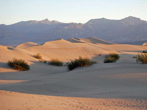
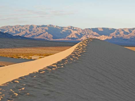
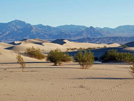
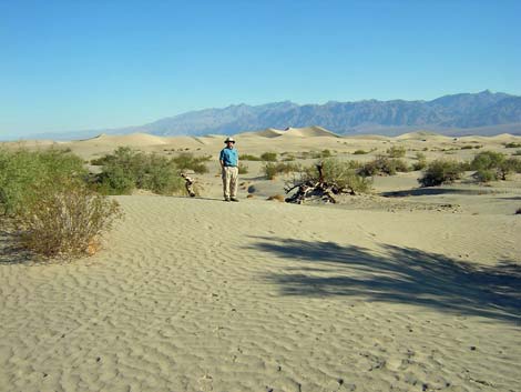
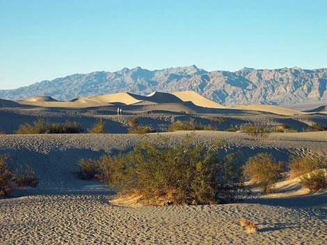 Hikers on the dunes (view north) |
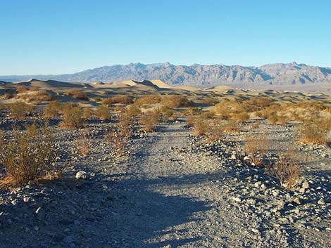
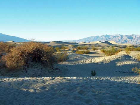
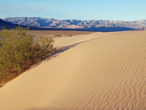
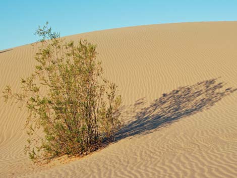
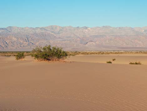
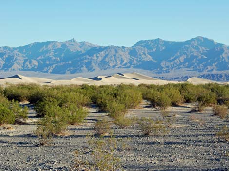
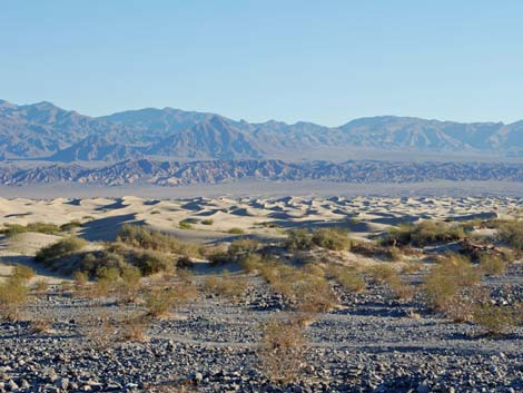
The Hike From the trailhead (Table 2, Waypoint 1), walk north towards the dunes. Initially, the trail runs down from the trailhead on the toe of a gravel alluvial fan (Wpt. 2). The vegetation here is almost exclusively creosote bush, although the creosote acts as a nurse-plant for annual species, the dead stems of which can be seen under the creosote. At the edge of the sand, there is a band of dune hills that seem to have formed around big, old mesquite thickets. These make for a band of hills to walk over before you get out into the dune field (Wpt. 3). Farther into the dunes, you pass the mesquite and get back into creosote bushes that are relatively large and healthy compared to those on the alluvial fan. There is also some saltbush and Russian thistle out in the dunes. |
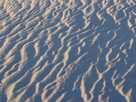
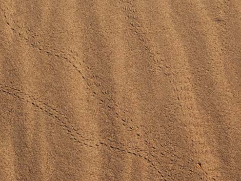
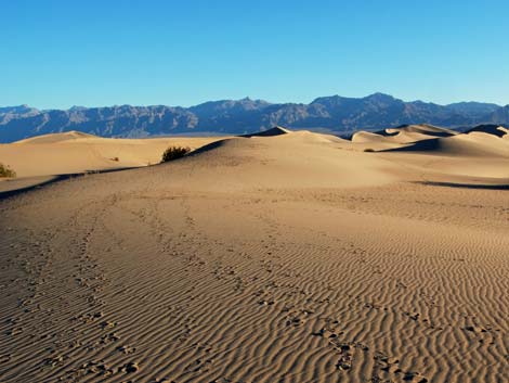
 Patterns and kit fox tracks in the sand (view north) |
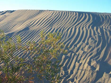
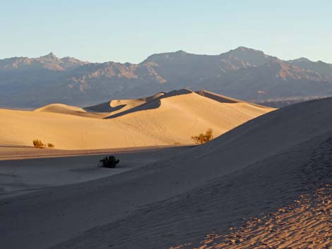
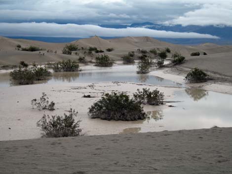
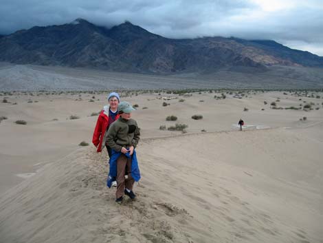
There are no trails or other routes out in the dune field. Most people wander around and play in the sand, but some hike out to the sand dunes summit (Wpt. 4). If your primary goal, however, is simply to climb to the summit, the hiking is easier starting to the west of the trailhead and walking around the dunes to avoid the sand. Then out behind the dune field, make a run at the summit from the northwest side. In the dune swales (the low spaces between the dunes), there are places where rainwater collected and evaporated, leaving crusts of mud. Later, the sand blew away, leaving layers of mud standing slightly above the remaining sand. In places, you can see several layers of mud that have built up over the years. Animals even dig burrows under the mud, using the mud cap as a hard roof. |
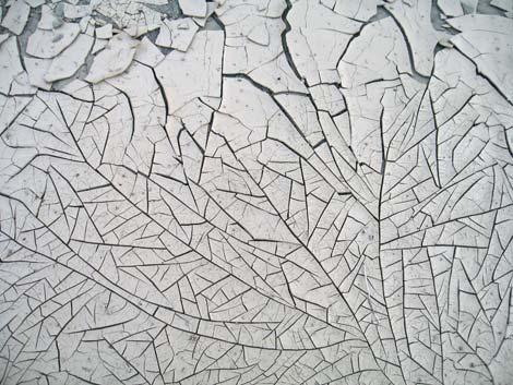
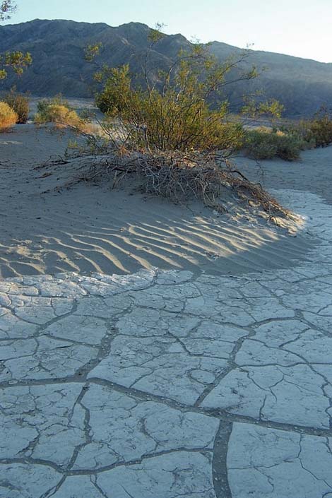 Patterns in the sand and mud (view south) |
Between windstorms, the dunes record the steps of everyone, and everything, that walks across them. In addition to human tracks, look for the tracks of coyote, kit fox, kangaroo rat, rabbit, lizard, and beetles. The coyote and kit fox tracks look like dog tracks, the kit fox being smaller and with a shorter stride than the coyote. Kangaroo rat tracks can be seen most easily near their burrows: watch for 2- to 3-inch-diameter holes under the bushes. These rodents hop on their hind legs like kangaroos, so watch for pairs of little footprints, sometimes with a drag mark from their long narrow tails. Beetle tracks almost look mechanical, so if you can't imagine what made the track, it probably was a beetle. The trailhead can be seen from atop almost every dune, so when you are ready to head back, look south towards the road, find you vehicle, and wander back through the sand. |
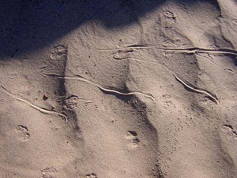 Sidewinder, kangaroo rat, and beetle tracks |
 Mesquite Flat Sand Dunes |
 |
 |
 |
 |
 |
 |
 |
 |
 |
 |
 |
 |
 |
 |
 |
 |
 |
 |
 |
 |
 |
 |
 |
 |
 |
 |
 |
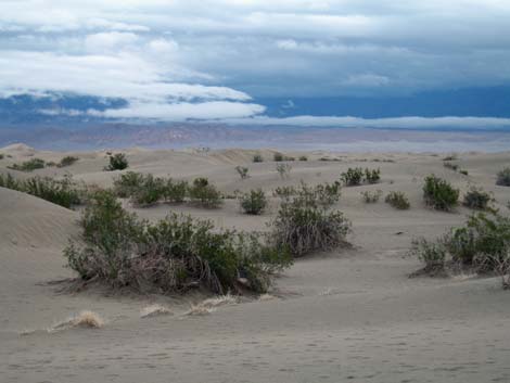 |
Table 1. Highway Coordinates Based on GPS Data (NAD27; UTM Zone 11S). Download Highway GPS Waypoints (*.gpx) file.
| Site # | Location | Easting | Northing | Latitude (N) | Longitude (W) | Elevation (ft) | Verified |
|---|---|---|---|---|---|---|---|
| 0712 | Furnace Creek Visitor Center | 512030 | 4034954 | 36.46159 | 116.86574 | -186 | Yes |
| 0594 | Hwy 190 at Mesquite Flat Dunes Rd | 489907 | 4050930 | 36.60564 | 117.11285 | -5 | GPS |
| 0748 | Mesquite Dunes Trailhead Parking | 489767 | 4050996 | 36.60624 | 117.11442 | -14 | Yes |
| 0751 | Hwy 190 at Stovepipe Wells | 486948 | 4051034 | 36.60654 | 117.14594 | 0 | Yes |
| 0763 | Hwy 190 at Scotty's Castle Rd | 496843 | 4054636 | 36.63910 | 117.03531 | 104 | Yes-2 |
Table 2. Hiking Coordinates Based on GPS Data (NAD27, UTM Zone 11S). Download Hiking GPS Waypoints (*.gpx) file.
| Wpt. | Location | Easting | Northing | Elevation (ft) | Point-to-Point Distance (mi) | Cumulative Distance (mi) | Verified |
|---|---|---|---|---|---|---|---|
| 01 | Trailhead | 489764 | 4051009 | -11 | 0.00 | 0.00 | GPS |
| 02 | Dunes | 489925 | 4051369 | -26 | 0.26 | 0.26 | GPS |
| 03 | Dune Field past Mesquite trees | 490076 | 4051501 | -34 | 0.14 | 0.40 | GPS |
| 04 | Summit | 489946 | 4052508 | 90 | 0.80 | 1.20 | GPS |
| 01 | Trailhead | 489764 | 4051009 | -11 | 1.09 | 2.29 | GPS |
Happy Hiking! All distances, elevations, and other facts are approximate.
![]() ; Last updated 210731
; Last updated 210731
| Death Valley | Hiking Around Las Vegas | Glossary | Copyright, Conditions, Disclaimer | Home |