Hiking Around Las Vegas, Death Valley National Park
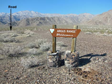 Fittingly, this is the only road sign (view W) |
Overview The Snow Canyon mining area (St. George Mine and Golden Lady Mine), located in the Argus Range Wilderness Area just west of the Death Valley National Park boundary, is part of a much larger mining region. The Snow Canyon area has many old mines, a few younger mines, and tons of old junk lying about. Items of interest include mill sites, tramways, winches, ore hoppers, water pipes, a corral, and mine openings. The area was worked on and off for about 100 years between 1883 and 1980, so some of these historical objects are old, some are interesting, some are junk, and some are alive (wild burros). The miners extracted gold, lead, silver, and copper. |
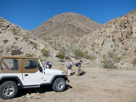 Trailhead parking (view NW; Wpt. 01) |
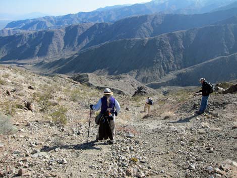
Here I describe the route we took while exploring the area. Other than one key trail junction that makes the difference between a fun day and a not-as-much fun day, I make no statements about whether we saw the best or worst of the area. In addition to what we saw along our route, we saw old mining roads, old mining trails, burro trails, mines, miner camps, and other things in the distance that we did not visit. For hikers who find old mining areas interesting, this is a great place to explore. This route is entirely within a cherry stem area cut out of the Argus Range Wilderness Area (the hike is not in wilderness, but it is close enough to smell) and entirely within the Mojave Desert Scrub habitat type (Upper Sonoran Life Zone). |
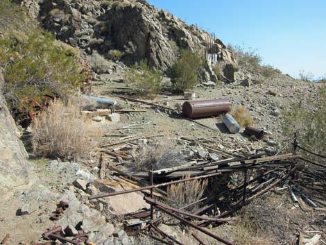
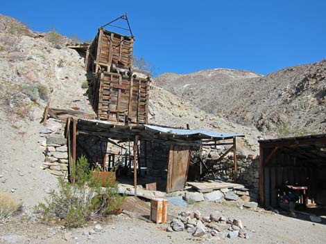 Snow Canyon Mill (view N; Wpt. 02) |
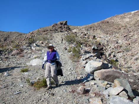
Watch Out Other than the standard warnings about hiking in the desert, ...this route is fairly safe, but many of the mining trails cross very steep hillsides. Be extra careful when high enough to fall and get hurt. Old building should be considered unsafe, and it is never safe to enter holes in the ground -- stay out and stay alive. While hiking, please respect the land and the other people out there, and please try to Leave No Trace of your passage. Also, even though this hike is short, the area is remote, so bring the 10 Essentials. The route runs up into the Argus Range Wilderness Area, so pay particular attention to respecting the land. |
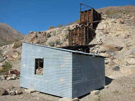 Snow Canyon Mill (view NW; Wpt. 02) |
Getting to the Trailhead This hike is located just west of Death Valley National Park, about 3-1/2 hours northwest of Las Vegas. From town, drive out to Death Valley. From the Furnace Creek Visitor Center (Table 1, Site 0712), drive north (actually west) on Highway 190 for about 52.3 miles to Panamint Valley Road (Site 0485). Turn left onto Panamint Valley Road and drive south for 5.4 miles to Snow Canyon Road (Site 1040), a two-track road on the right. Turn right onto Snow Canyon Road and drive west. Initially the road surface is sandy, but not deep sand that would trap a sedan. Later, the road becomes more rocky, but it still is not a problem in a carefully driven sedan. |
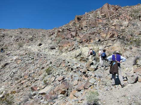
 Key to the route: miner's trail (view E; Wpt. 04) |
At 3.7 miles out, the Snow Canyon Road crosses a north-south road. Continue west ("straight"), passing by a BLM sign announcing the Argus Range Wilderness Area. The road and mining area are cut out of the wilderness, so the road is legal to drive. At 5.5 miles out (Site 1041), hikers in 2WD vehicles will find a wide spot to park just before the relatively good road drops into a wash and deteriorates rapidly. A wash-out on the far side of the wash is not hard to navigate in a 4WD vehicle, but remember the spot on the way back, especially if driving home in the dark, as a moment of inattention could swallow a jeep. If you do remember it, it is a good place to startle your passengers. |
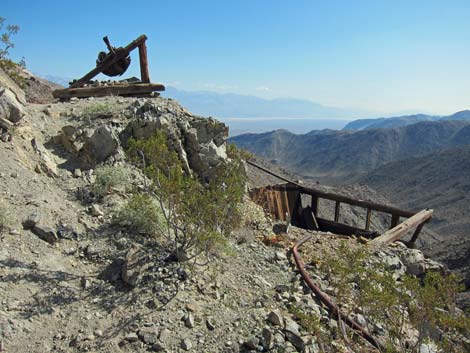
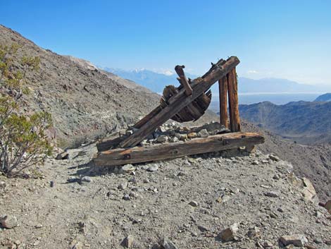
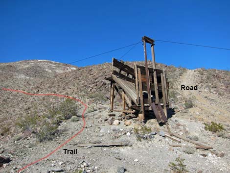 Saddle Mining Co. ore hopper (view NE; Wpt. 05) |
The rough road continues northwest up the canyon, and at 6.9 miles out, passes the mouth of a side canyon with stone cabin foundations used by miners working the Golden Lady Mine. The extreme-steep road in the background is one option for climbing into the upper mining areas and the St. George Mine. Road conditions don't require 4WD until just before the trailhead when the road winds through a rocky narrow spot. When the Snow Canyon Mill comes into view at 7.2 miles out, pull off into a wide, flat area on the left (Site 0548). Park here; this is the trailhead. |
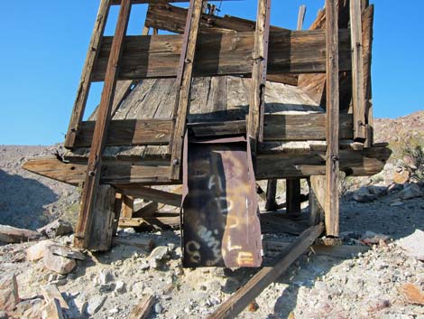 Saddle Mining Co ore hopper (view N; Wpt. 05) |
The Hike From the trailhead (Table 2, Waypoint 01), the route continues up the main canyon on old roads. The Snow Canyon Mill (Wpt. 02) is just ahead on the right side of the canyon. The mill had a two-step wooden and tin hopper that fed a covered mill site. Cement foundations remain, but most of the old equipment is gone. A tin shed stands next to the old mill. Farther up the main canyon (Wpt. 03), a side trip leads to an old wooden ore hopper that stands on stilts against the hillside. Above is an old mine, and between the two is an ore chute made of roofing tin and chicken wire. Next to the hopper, a 55-gallon drum of unusual shape (marked "Associated Oil Company" and dated 7-1922) remains standing after many gun battles -- the drum is so tuff that few of the bullets penetrated. |
 Hikers on miner's trail (view N; near Wpt. 06) |
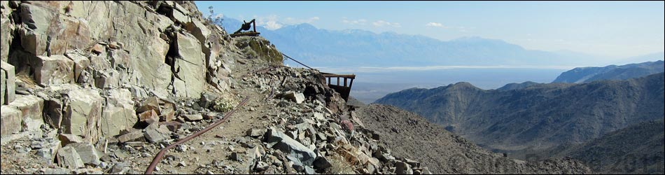
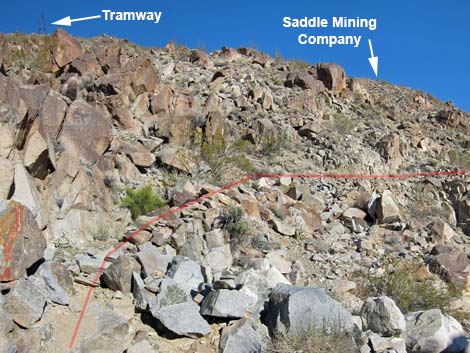
Continuing from the Snow Canyon Mill (Wpt. 02), the route follows an old road up the north-trending side canyon adjacent to the mill. The canyon runs more-or-less straight and slightly east of north to a point where the canyon bends abruptly to run more-or-less straight northwest. At less the 100 feet past the bend, watch for a faint mining trail (Wpt. 04) that switchbacks up the hillside to the east. Note that one otherwise excellent hiking guidebook incorrectly states the distance as 75 yards; it should read 75 feet. If hikers start looking for the miner's trail 75 yards after the bend, they will not find it. This miner's trail, which provides a relatively easy route up the steep hillside, is the key to a fun day -- don't miss it. In the early morning shadows, the trail is hard to see. Facing east, watch the skyline above for a tramway support on the left, and look carefully for the top of the Saddle Mining Company ore hopper peeking over the top of the ridge on the right. The trail is narrow and faint in places, but it provides easy access all the way to the ridgeline above and crests at the Saddle Mining Company ore hopper. |
 |
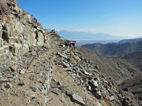
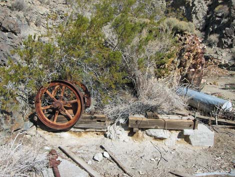
Gaining the ridgeline at the Saddle Mining Co. ore hopper (Wpt. 05), a miner's trail leads out due north from behind the hopper. The trail is relatively broad and gentle, but it is washed out in a few places. The old road to the northeast provides a steep way to the top or a loop for the descent. Various miner's trails fork off from the main trail. At 1/3-miles past the ore hopper, we took a left fork on the low road leading to a wooden ore hopper on the far hillside at about 0.2 miles distant (it look much farther). When we arrived, we found the remains of an old wooden winch that reminded us that the men who worked these hills were some tough old miners. |
 Wooden hand winch (view SE; near Wpt. 07) |
Beyond the wooden hand winch, the now broad trail with water pipes runs around the hillside onto a broad flat area. The area was made flat with mine tailings, and there are the remains of an old mill and settling tanks in the area. On the north side of the flat area, miners dug out a spring that provides a bit of free water, at least during winter. There is a lot of junk, including an old corral made of water pipes, near the spring. Just south of the odd roofing tin ore hopper on the east wall of the flat area, we found mining trails leading up the ridge. Following these, we crossed the "high road" trail we left earlier at Wpt. 06 and continued up the ridge, eventually contouring east on another mining trail that led into a saddle on the ridgeline and an old road (Wpt 08). |
 Trail, winch, and hopper (view SE; near Wpt. 07) |
We started our descent on the old road that quickly became very steep. Little did we know that we were on the easy part, as it got so steep that even the wild burros in the area left the road and made switchbacks on the adjacent hillside. In fact, even the ATVs stopped below the worst of it. We slipped and slid down the steep roadway all the way back to the Saddle Mining Co. ore hopper (Wpt. 05). From there, we choose to hike down the miner's trail (Wpt. 04) to the Snow Canyon Mill (Wpt 02) and the trailhead (Wpt. 01) rather than continue down the steep, and now unpleasant old road (unpleasant because we were tired and tired of slipping and sliding). For more hiking ideas and information on this area, consult the book by Michel Digonnet, Hiking Western Death Valley National Park, Panamint, Saline, and Eureka Valleys. The text and photos are getting dated, but Digonnet provides lots of history. |
 Corral and junk at miner's camp (view SE; Wpt. 07) |
 Mill equipment at miner's camp (view E; Wpt. 07) |
 Top of steep road (view S; below Wpt. 08) |
 Middle of steep road (view S; between Wpt. 08 and Wpt. 05) |
Table 1. Highway Coordinates Based on GPS Data (NAD27; UTM Zone 11S). Download Highway GPS Waypoints (*.gpx) file.
| Site # | Location | Latitude (N) | Longitude (W) | Easting | Northing | Elevation (ft) | Verified |
|---|---|---|---|---|---|---|---|
| 0712 | Furnace Creek Visitor Center | 36.46159 | 116.86574 | 512030 | 4034954 | -186 | Yes |
| 0485 | Hwy 190 at Panamint Valley Rd | 36.33955 | 117.42280 | 462057 | 4021492 | 1,576 | GPS |
| 0548 | Snow Canyon Mine parking | 36.20730 | 117.45335 | 459247 | 4006835 | 3,800 | GPS |
| 1040 | Panamint Rd at Snow Canyon Rd | 36.20447 | 117.33541 | 469848 | 4006478 | 1,578 | GPS |
| 1041 | Snow Canyon Rd, 2WD Parking | 36.19680 | 117.42678 | 461630 | 4005660 | 2,949 | GPS |
Table 2. Hiking Coordinates Based on GPS Data (NAD27, UTM Zone 11S). Download Hiking GPS Waypoints (*.gpx) file.
| Wpt. | Location | Easting | Northing | Elevation (ft) | Point-to-Point Distance (mi) | Cumulative Distance (mi) | Verified |
|---|---|---|---|---|---|---|---|
| 01 | Snow Canyon Trailhead | 459248 | 4006849 | 3,772 | 0.00 | 0.00 | GPS |
| 02 | Snow Canyon Mill | 459137 | 4006910 | 3,834 | 0.07 | 0.07 | GPS |
| 03 | Ore Hopper | 458847 | 4006954 | 3,981 | 0.24 | . | GPS |
| 04 | Base of Mining Trail | 459214 | 4007190 | 4,041 | 0.19 | 0.26 | GPS |
| 05 | Saddle Mining Co Ore Hopper | 459327 | 4007131 | 4,208 | 0.20 | 0.46 | GPS |
| 06 | Fork in Trail | 459211 | 4007537 | 4,469 | 0.33 | 0.79 | GPS |
| 07 | Mine Camp Area | 458852 | 4007634 | 4,598 | 0.27 | 1.06 | GPS |
| 08 | Saddle on Crest | 459286 | 4007838 | 4,874 | 0.43 | 1.49 | GPS |
| 05 | Saddle Mining Co Ore Hopper | 459327 | 4007131 | 4,208 | 0.57 | 2.06 | GPS |
| 04 | Base of Mining Trail | 459214 | 4007190 | 4,041 | 0.20 | 2.26 | GPS |
| 01 | Snow Canyon Trailhead | 459248 | 4006849 | 3,772 | 0.26 | 2.52 | GPS |
Happy Hiking! All distances, elevations, and other facts are approximate.
![]() ; Last updated 240324
; Last updated 240324
| Death Valley | Hiking Around Las Vegas | Glossary | Copyright, Conditions, Disclaimer | Home |