Hiking Around Las Vegas, Death Valley National Park
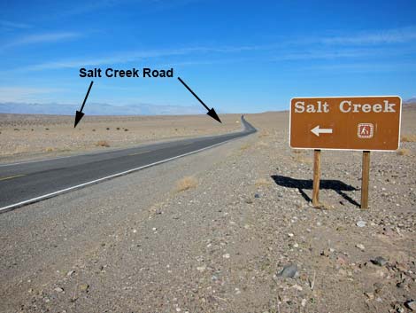 Salt Creek Road at Hwy 190 (view north) |
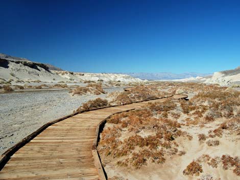
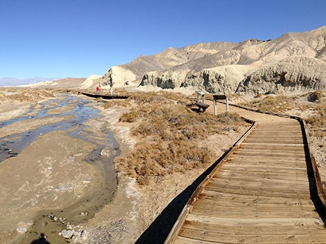
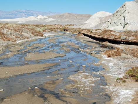
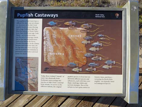
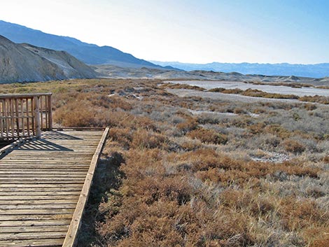
Note: Flashfloods during summer 2022 wiped out the entire boardwalk. The area is closed until funds and personnel or available to rebuild the trail. Overview This pleasant 0.8-mile loop trail runs on a nearly level wooden boardwalk along the lower reaches of Salt Creek and into the Death Valley Wilderness Area. Water from springs at the head of Salt Creek supports a lush saltmarsh meadow with pickleweed, saltgrass, pools, and running water, but no trees. The salty water provides habitat for an endemic fish, the Salt Creek Pupfish, which is found nowhere else. The vegetation provides food and cover for a variety of birds and other animals, and the birding can be quite good during migration because birds from miles around are attracted to the water. From the far end of the loop, a trail runs up Salt Creek that can be followed all the way to Hwy 190 near the east side of the Stovepipe Sand Dunes. Link to map. |
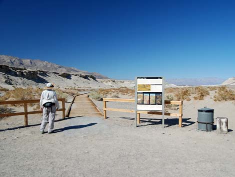 Salt Creek trailhead (view west) |
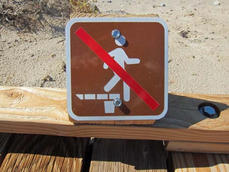
Watch Out Other than the standard warnings about hiking in the desert, ...This is an entirely safe and fully accessible trail, but don't trip and fall off the boardwalk. While hiking, please respect the land and the other people out there, and try to Leave No Trace of your passage. This hike is short, so if you stay on the trail, you don't really need to bring the 10 Essentials. Getting to the Trailhead This hike is located in Death Valley National Park, about 3.5 hours northwest of Las Vegas. From town, drive out to Death Valley. From the Furnace Creek Visitor Center, drive north on Highway 190 for about 13 miles to Salt Creek Road. Follow Salt Creek Road 1.2 mile to the parking lot at the end. Park here; this is the trailhead. |
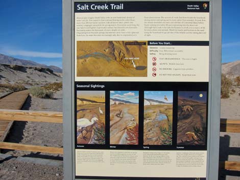 Salt Creek Trailhead sign (view northwest) |
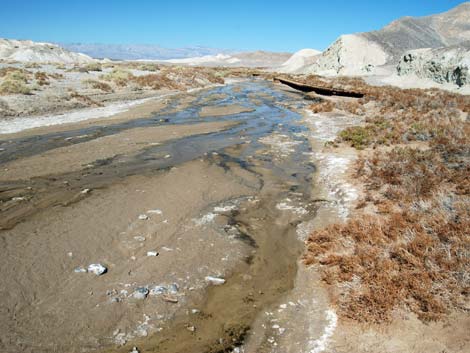
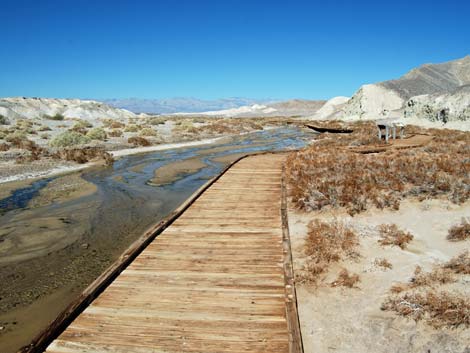
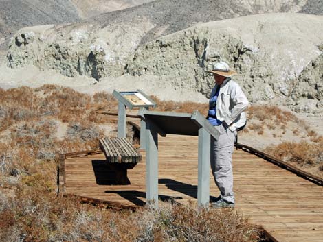
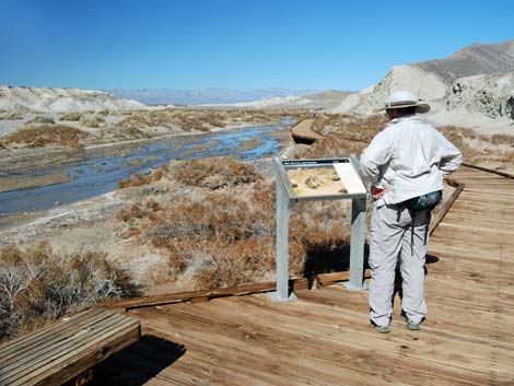
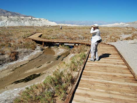
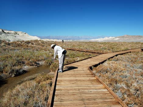
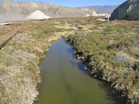
The Hike From the trailhead (Table 1, Waypoint 01) parking area, the boardwalk starts by running through small sand dunes along the east side of Salt Creek. On hot days, this is a good place to watch for zebra-tailed lizards running along the boardwalk and waving their banded tails in the air. This is also a good place to look in the soft sand for the burrows and tracks of desert kangaroo rats. These nocturnal rodents dig burrows (about 3 inches in diameter) in the soft sand. Watch for coyote tracks too. A few minutes out, the trail runs close to Salt Creek. Just before a fork in the trail, there is a reach of stream that usually is good for viewing pupfish. The salty water provides habitat for the endemic Salt Creek Pupfish, a species found nowhere else. Springtime is best for viewing the pupfish; the lower stream is dry during summer, and the fish lie dormant in deep, upstream pools during winter. |
 Stay on the boardwalk! |
The fork in the trail begins a loop (Wpt. 02), so hikers can continue up either side. Heading up the right (east) fork, the trail wanders away from the creek through the saltmarsh to a viewing platform on the edge of a pool. I've don't recall ever seeing fish in the pool, but I'm hopeful and I always check. Continuing on, the trail crosses Salt Creek on a bridge (Wpt. 03). A use-trail runs farther up the northeast side of the creek and across white salt flats heading for the upper springs. I haven't gone all the way, but it is pleasant hike along the creek and wetlands. From the bridge, the trail loops back down along the southwest side of Salt Creek, approaching closely to the mud cliffs that border this part of the creek. Beyond these are sand hills, and there are a few places along here where hikers can walk back into the sandy side-canyons. |
 |
The upper part of the saltmarsh is a good place to watch for wrens and secretive little sparrows. The sparrows are hard to identify because they pop up, flutter low over the pickleweed, and then drop back into the vegetation, never to be seen again. Similarly, the wrens chatter from under the bushes where you can't see them. Say's Phoebes, a kind of flycatcher, are common and more cooperative, and they flutter about in the open catching flies. Watch for these robin-sized birds with salmon-pink belly feathers. Continuing along the boardwalk, hikers shortly return to the fork in the trail, and then the trailhead parking lot (Wpt. 01). |
 |
 |
 |
 |
 |
 |
 |
 |
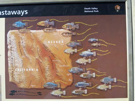
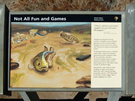 Information about Salt Creek Pupfish making more |
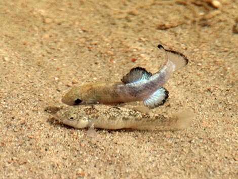 Salt Creek Pupfish working on making more |
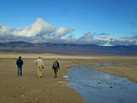
 Looking for birds |
 Trail forks: stay right (view NW) |
 Looking at fish in the stream (view SW) |
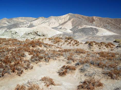 Colorful soils |
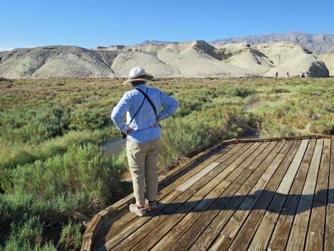 Hiker on Salt Creek boardwalk |
 Farthest point on the boardwalk; start of bridge over Salt Creek |
 On bridge over Salt Creek looking back towards trailhead |
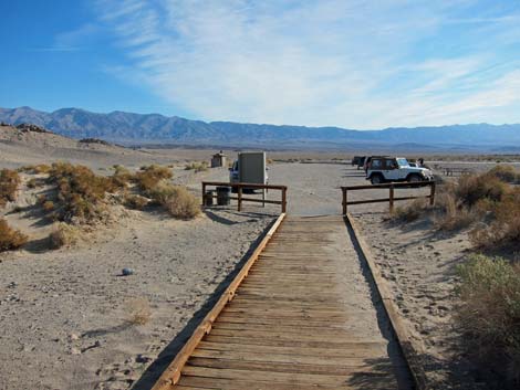 Salt Creek trailhead (view SE) |
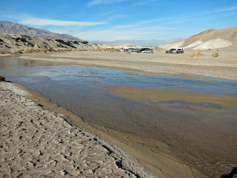
During winter, water flows across the desert below the Salt Creek parking lot
 |
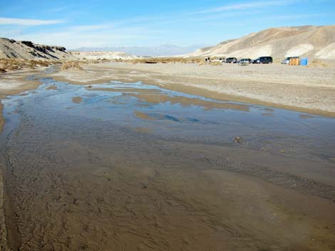 |
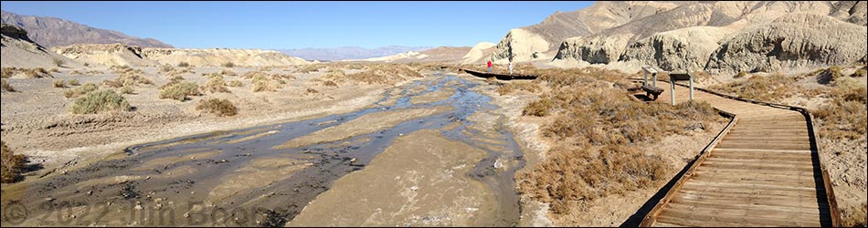
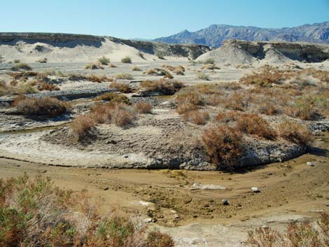
 Below the trail, Salt Creek runs out into the desert |
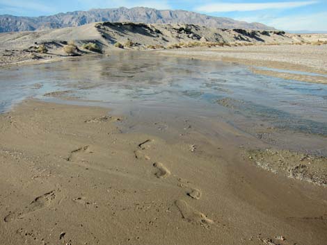 Footprints in damp sand (view W) |
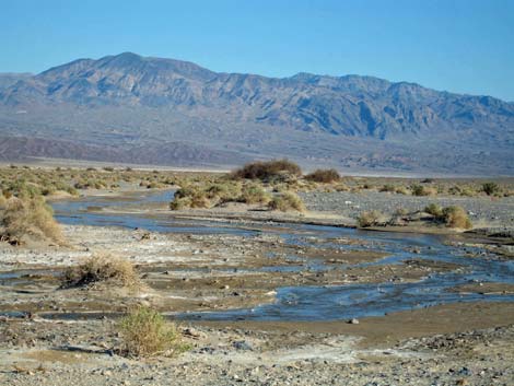 Below the trail, Salt Creek runs out into the desert (view SE) |
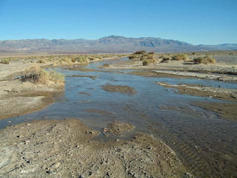
 Some years the stream flows into the desert (view SE) |
Table 1. Hiking Coordinates Based on GPS Data (NAD27; UTM Zone 11S). Download Hiking GPS Waypoints (*.gpx) file.
| Wpt. | Location | Easting | Northing | Elevation (ft) | Verified |
|---|---|---|---|---|---|
| 01 | Salt Creek trailhead | 500928 | 4049257 | -201 | Yes |
| 02 | Beginning of the loop | 500617 | 4049374 | -187 | GPS |
| 03 | Bridge over Salt Creek | 500381 | 4049395 | -180 | GPS |
Happy Hiking! All distances, elevations, and other facts are approximate.
![]() ; Last updated 240324
; Last updated 240324
| Death Valley | Hiking Around Las Vegas | Glossary | Copyright, Conditions, Disclaimer | Home |