Backroads Around Las Vegas, Death Valley National Park
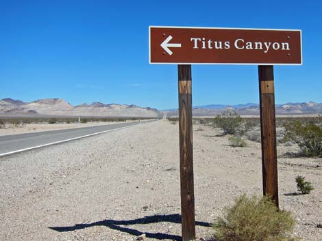 Titus Canyon road sign along Hwy 374 (view NE) |
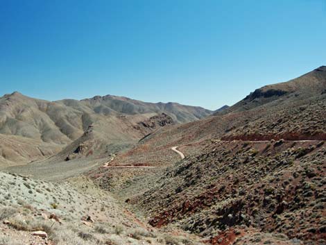
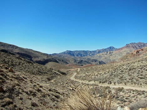
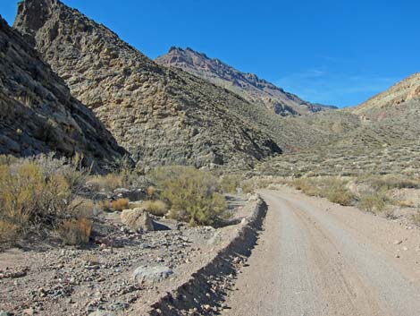
Overview Titus Canyon Road is a one-way, dirt road normally suitable for 2WD-HC vehicles. The road starts outside the National Park on Daylight Pass Road near Beatty, Nevada. Running west into the park, the road climbs over two high points in the Grapevine Mountains (including Red Pass at 5,500 ft elevation), drops past the ghost town of Leadfield, and finally descends through the narrow and sinuous canyon for which the road is famous. Finally, the road descends the alluvial fan to Scotty's Castle Road. This road provides sightseers spectacular scenery, views of a mining ghost town, and a petroglyph panel, and it provides hiker access to Titanothere Canyon, Thimble Peak, and Leadfield, and myriad other unnamed destinations. Link to map. |
 Titus Canyon road sign along Hwy 374 (view NE) |
Watch Out Other than the standard warnings about hiking in the desert, ...this road is pretty safe in appropriate vehicles, but be sure that your vehicle is in good working condition, carry plenty of water (radiator and drinking), and pack a lunch. Always drive slowly and carefully; even though the road is one-way, drivers may try to drive out backwards, causing hazards on the narrow blind curves. There are rough and rocky spots, especially crossing Red Pass, but the road generally is in good condition as the Park Service brings in gravel to fill in holes and around rocks. Time changes road conditions, so always use your own good judgment. The road sometimes can be navigated in a carefully driven sedan, but I wouldn't take mine. While out, please respect the land and the other people out there, and try to Leave No Trace of your passage. This road goes into remote areas, so be sure to bring the 10 Essentials. |
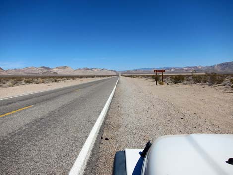
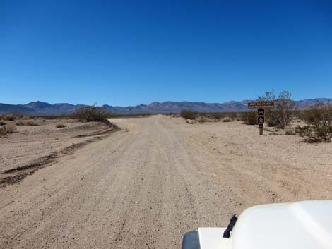
 Titus Canyon turnoff (view NE) |
Getting to the Road Titus Canyon Road is located in the east-central part of Death Valley National Park, about 2 hours northwest of Las Vegas driving directly, or about 1 hours north of the Death Valley Visitor Center at Furnace Creek. From town, drive out to Death Valley. From the Furnace Creek Visitor Center (Table 1, Site 0712), drive north on Highway 190 for 10.9 miles to Beatty Cutoff Road. Turn right, and right again in another 10.0 miles onto Daylight Pass Road. Continue 7.5 miles to the Nevada state line, and another 5.6 miles to Titus Canyon Road (Site 0974), on the left; watch for highway signs. Turn here; this is the roadhead. Directly from Las Vegas, drive north on Highway 95 to Beatty. At the stoplight in Beatty, turn left onto Highway 374. Drive west 6.2 miles to Titus Canyon Road (Site 0974), on the right; watch for highway signs. Turn here; this is the roadhead. |
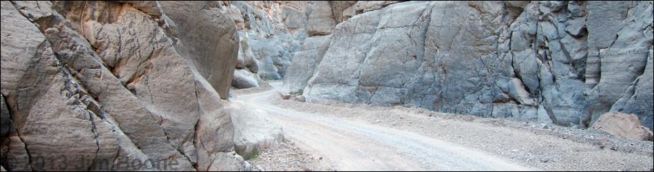
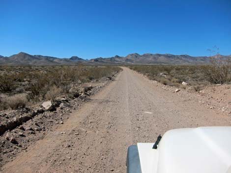
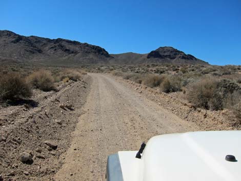
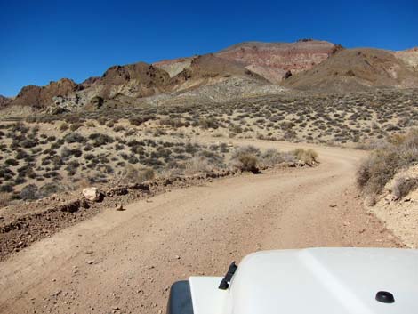
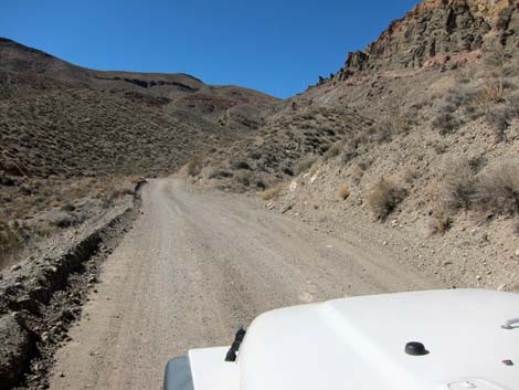
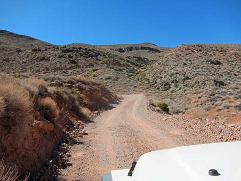
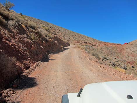
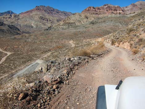
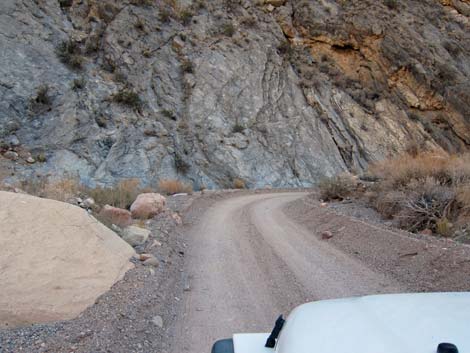
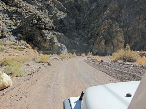
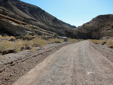
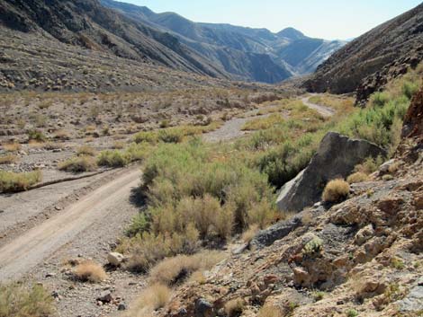
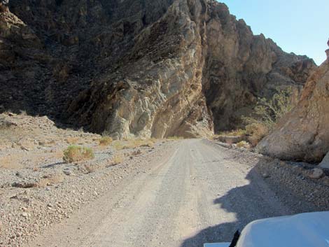
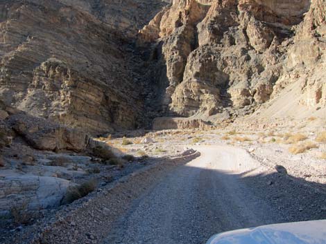
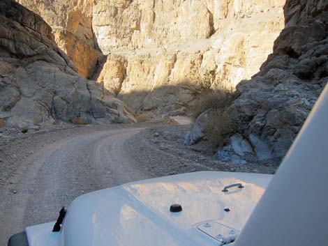
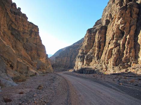
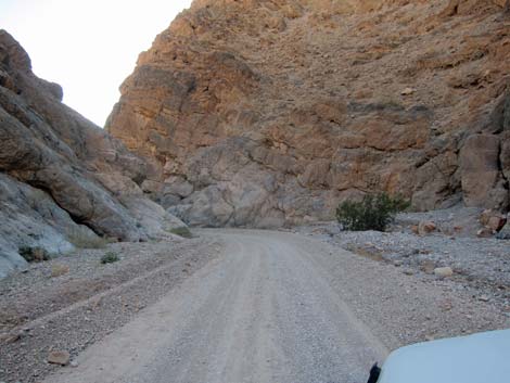
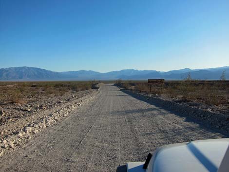
 Beginning of Titus Canyon road (view SW) |
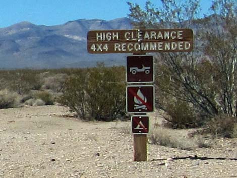
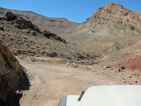
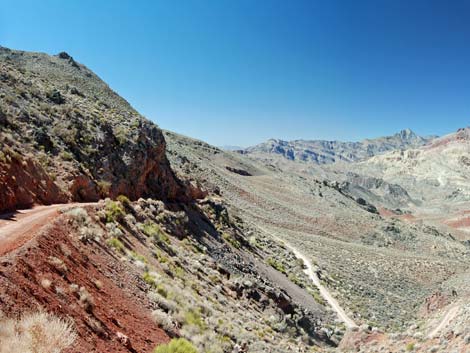
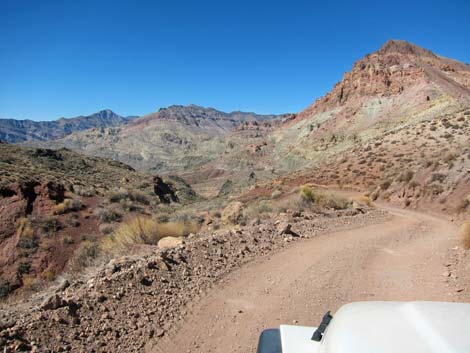
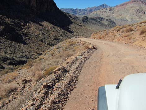
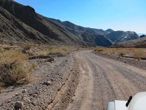
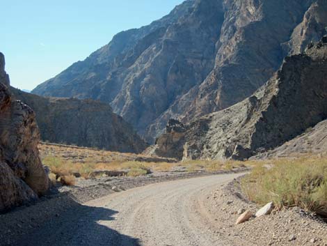
The Road From the pavement (Site 0974), the road runs west-southwest as it gently climbs across the creosote bush covered bajada towards the Grapevine Mountains in the far distance. Near to the pavement, a sign announces "High Clearance 4x4 Recommended. Although 4WD rarely is necessary, sometimes the road is wet, icy, or washed out. When the road is freshly graded and dry, sedans can make it across, but probably with some undercarriage damage. |
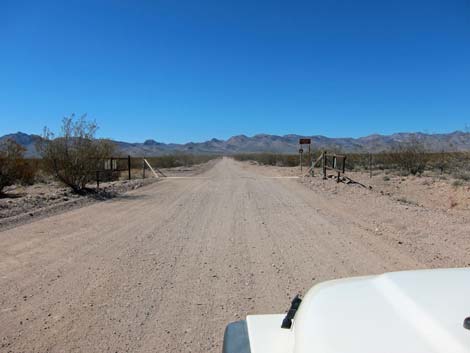
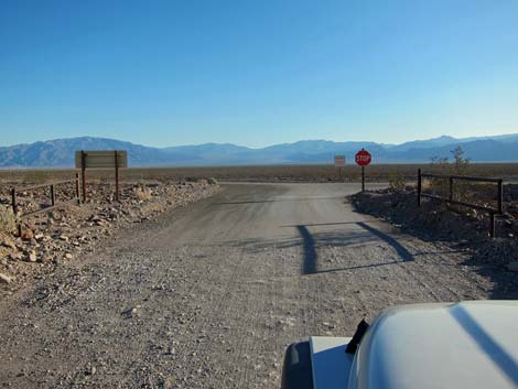
 Caution signs (view SW) |
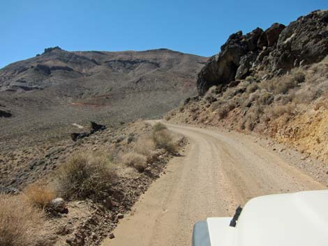
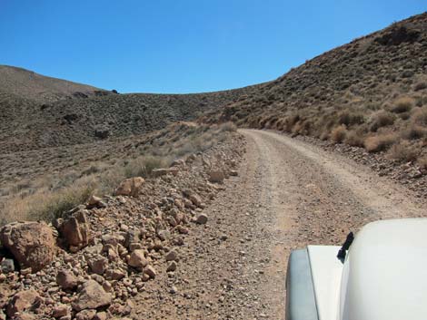
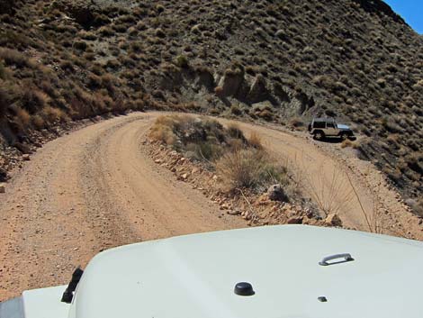
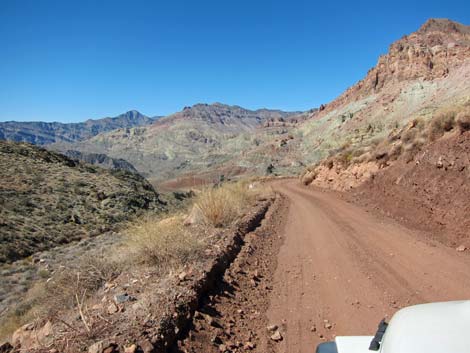
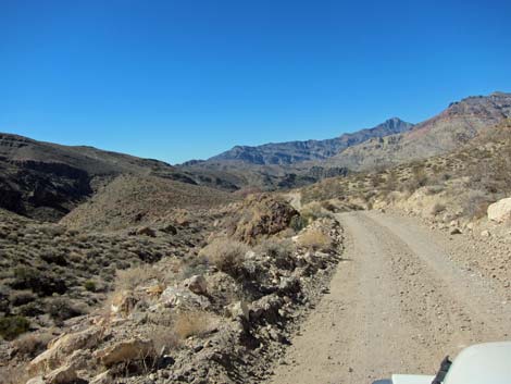
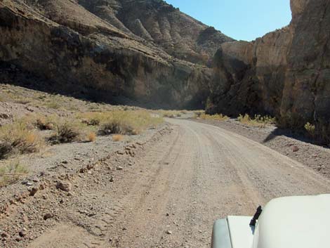
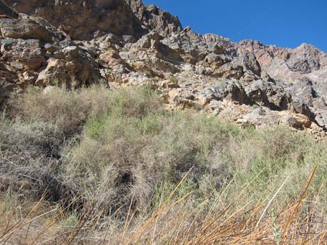
At about 1.9 miles out, the road narrows as it crosses a cattle guard, and signs announce entry into Death Valley National Park. Signs should announce that this is a one-way road, but apparently sometimes they are missing. The one-way road is narrow, often with berms on the side, so drive carefully on blind corners as it is always possible for someone to be driving the wrong way (e.g., someone in a sedan that decided they couldn't make it all the way through). At about 6.2 miles out, the road turns to the south and starts up into a broad canyon. Then, at about 7.0 miles out, the road enters the Death Valley wilderness Area. Actually, from here to the end of the road, the road runs in a 100-ft wide corridor of non-wilderness with designated Wilderness on both sides of the road. |
 Approaching NPS boundary (view SW) |
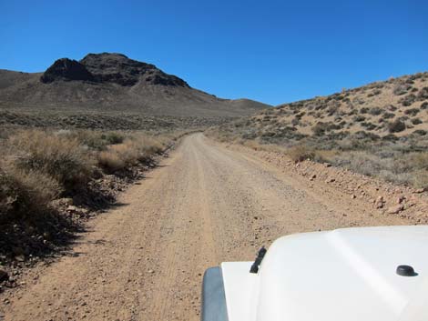
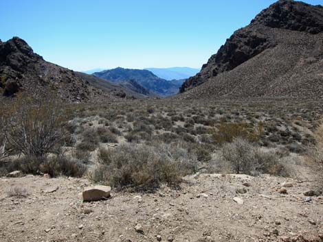
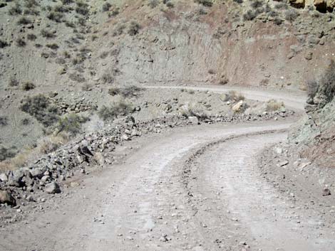
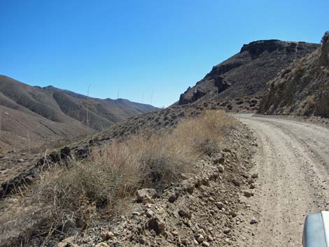
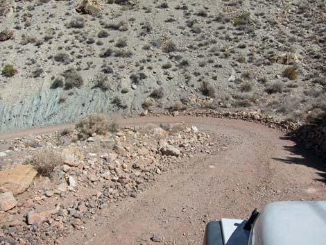
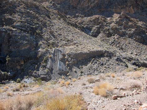
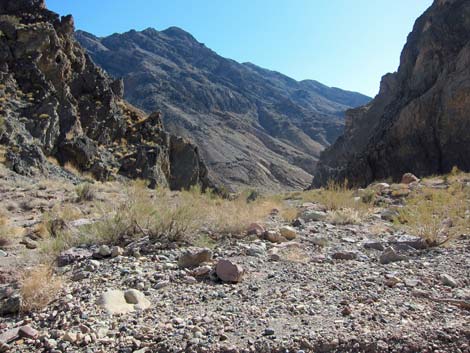
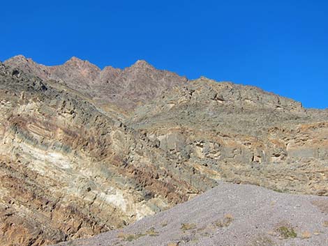
The road climbs, sometimes winding and sometimes tight, to a saddle at about 9.6 miles out. There is a wide spot atop the saddle where drivers can stop and stretch the legs without blocking the road. The view ahead (west) is down into Titanothere Canyon. Titanotheres are extinct mammals that resembled a rhinoceros in size and shape, except with two bulbous and blunt horns, one on each side of the snout. Fossilized bones of these creatures were found in the red-clay layers of strata in this area. The road drops rather steeply into the headwaters of Titanothere Canyon. For hikers, there are two unmarked trailheads for the Titanothere Canyon hike. The first drops into the wash at about 10.2 miles out, and the second drops into another wash at about 11.2 miles out. The first trailhead starts down a canyon said to be more interesting, but both converge in less than a mile. |
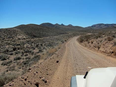
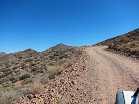
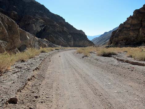
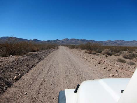 Continuing towards the Grapevine Mountains |
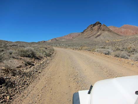
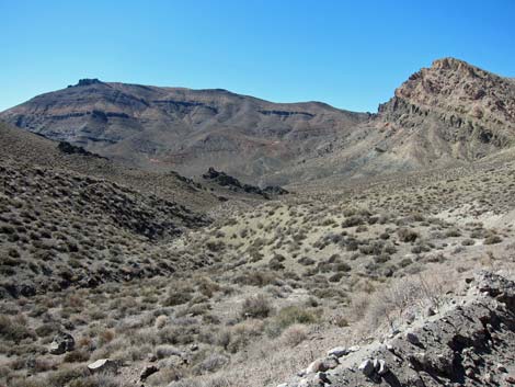
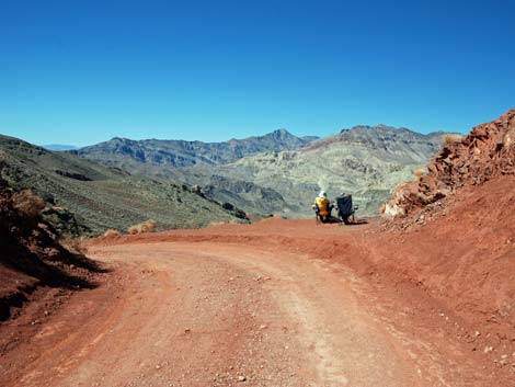
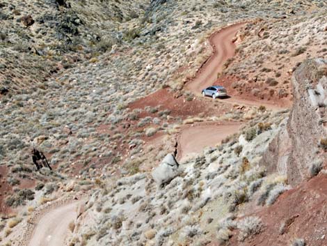
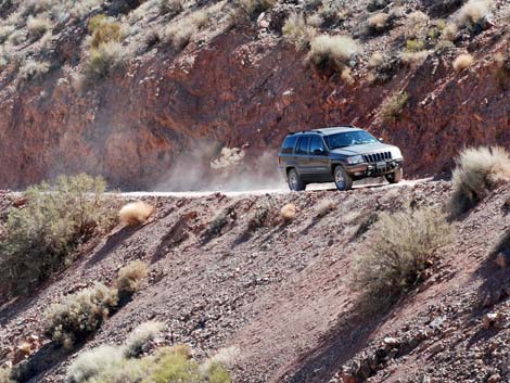
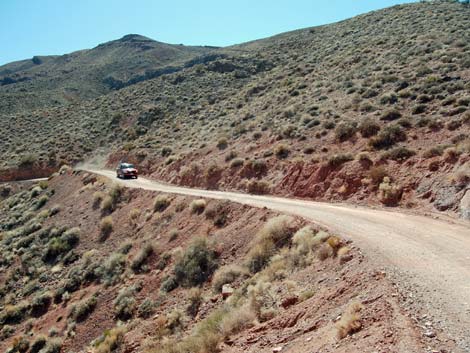
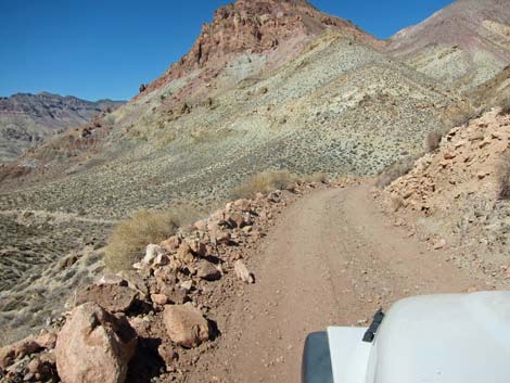
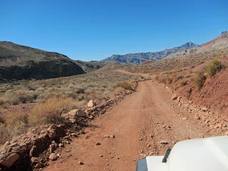
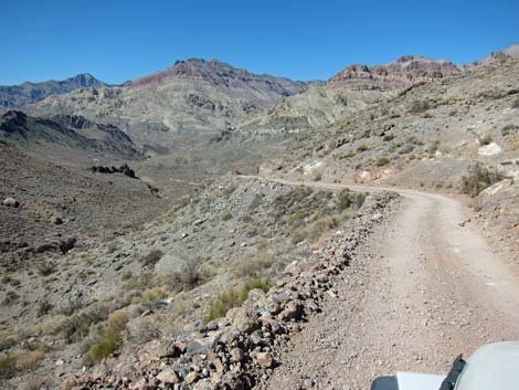
After passing the second trailhead, the road begins to climb somewhat steeply towards Red Pass. The road twists and turns as it hugs the terrain and climbs across steep hillsides where the worst of the rocky spots seem to be on the sharpest and most precipitous curves. Eventually, the grade relaxes somewhat, and at about 12.4 miles out, as the road runs up onto Red Pass (Site 1443). Parking is limited, but there is space for 3-4 vehicles on the south side and parking for another on the north side. Views in both directions are grand, but the view north is worth pulling out the folding chairs and stopping for lunch. This is also the trailhead for Thimble Peak, which lies some 3 miles to the south-southwest along the ridge. |
 Still continuing towards the Grapevine Mountains |
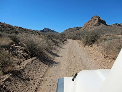
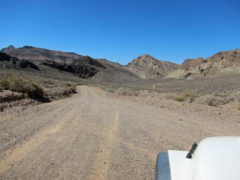
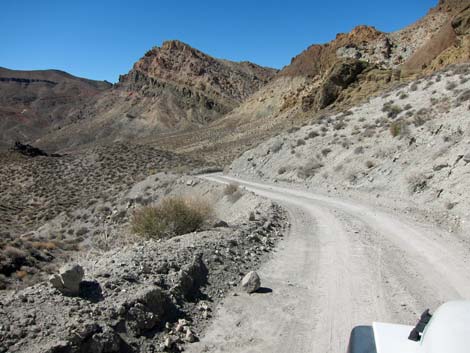
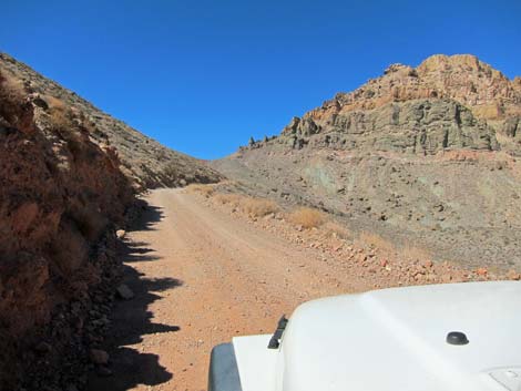
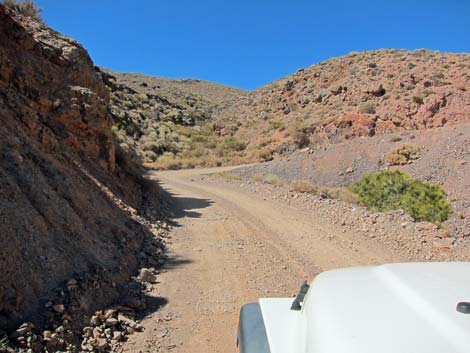
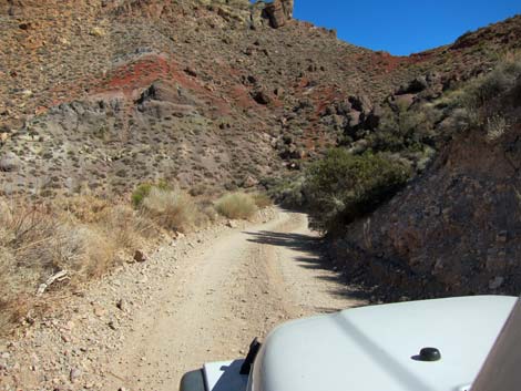
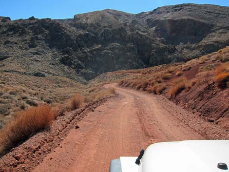
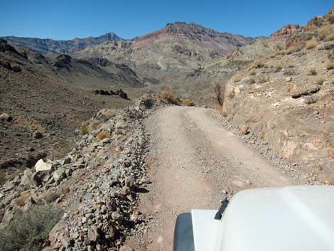
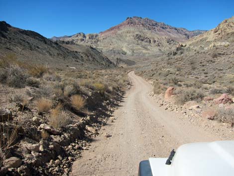
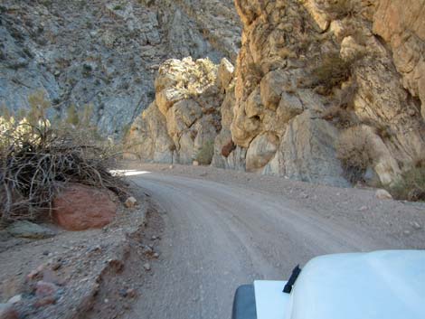
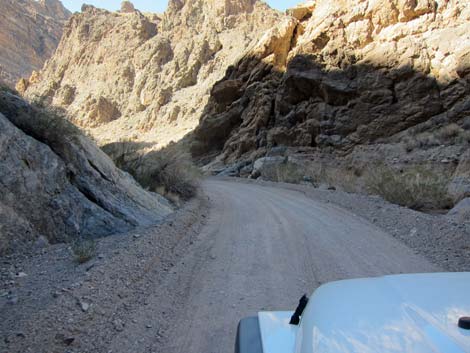
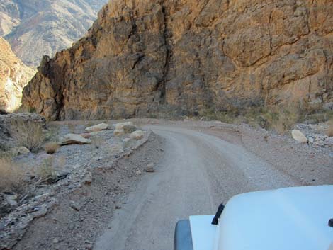
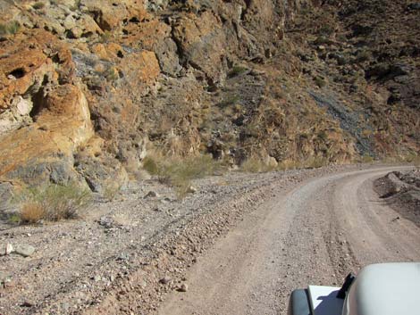
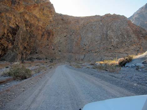
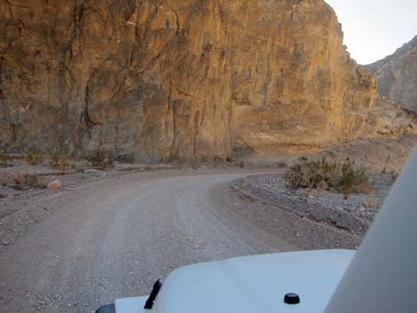
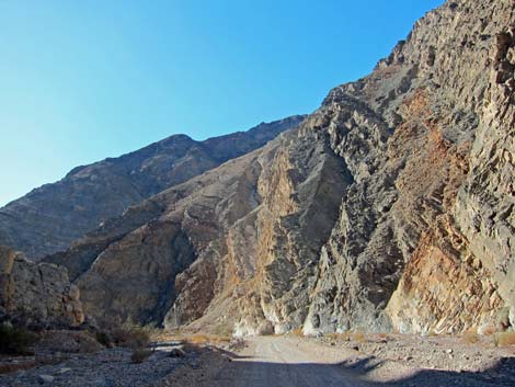
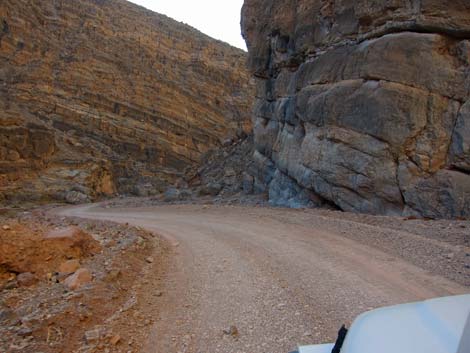
Descending past Red Pass into Leadfield Canyon, the road twists and turns as it hugs the terrain and drops steeply across steep hillsides where the worst of the rocky spots seem to be on the sharpest and most precipitous curves. The first curve past Red Pass, a tight hairpin turn, provides quite a view off the side of the road, and then from below, stonework can be seen holding up the roadway. Note that this is the original mining road, so the hand-placed stones were set in the 1920s. Additional hand-built stone walls hold the road on the cliffs farther along. Approaching Leadfield, at about 13.8 miles out, the road passes a number of prospects below the road. Then, beyond a few more curves, a mine with a large tailings pile can be seen across the canyon. |
 Starting into the hills |
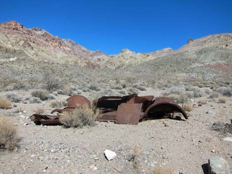
Continuing, the road traverses a steep hillside to make a tight and airy hairpin turn. Driving now south towards another tight turn in the bottom of the canyon, a parking area can be seen that provides access to the mining area up the canyon. On more gentle slopes, the road descends towards rusty metal buildings and mine tailings ahead on the left. The rusted-out hulk of an old car alerts drivers to the approaching parking area (Site 1065; 15.6 miles out) for the ghost town of Leadfield. The town boomed and died in 1926, and old mines, buildings, and other materials serves as silent testament to the efforts of some 300 people. |
 |
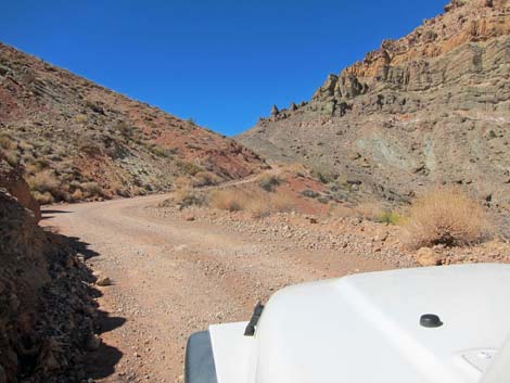
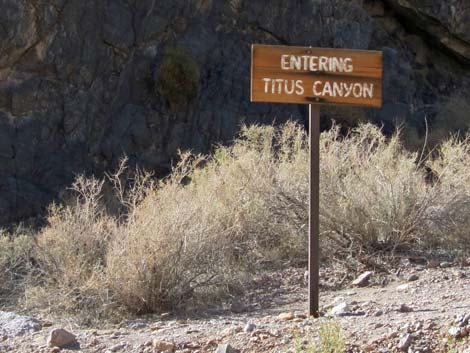
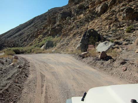
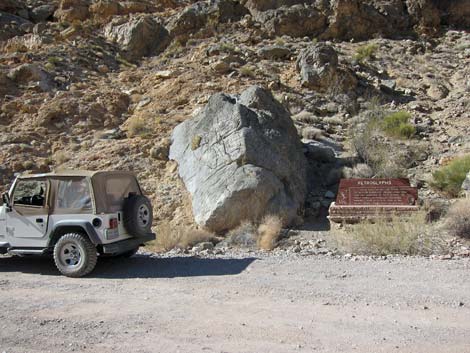
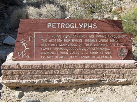
Continuing past Leadfield, the northern-most mine can be seen with another tin building high on the hillside to the left, and then the road curves hard to the left and enters the first of the narrows deeply cut into layered limestone cliffs. This is actually the last of Leadfield Canyon, but shortly the road winds around tightly and passes an "Entering Titus Canyon" sign at the confluence of Leadfield and Titus canyons (16.3 miles out). The canyon feels narrow for about one more mile, but gradually it begins to feel like a deep desert canyon. At about 18.2 miles out, the road arrives at a sign announcing petroglyphs on a large boulder beside the road and only about 100 feet before Klare Spring (Site 1066). |
 |
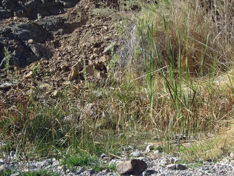
The petroglyph boulder, and an adjacent boulder, have been badly marked by vandals, but the original petroglyphs remain. The boulders are dark, probably dolomite rock, and pecking on the rock leaves a light-colored scar. Native peoples left odd shapes, humanoid forms, and glyphs thought to represent rain and the sun. There is also a nice little bighorn sheep. A few steps down-canyon, Klare Spring wets the hillside and trickles down the side of the road. Here, a dense thicket of Arrowweed, sedges, some cattails, and even a few rushes cover almost all of the free water. Scat indicates that bighorn sheep, coyotes, and birds come in for water. |
 |
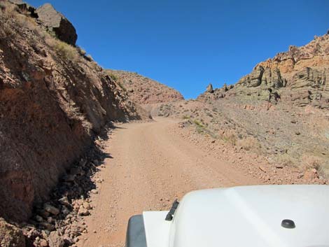
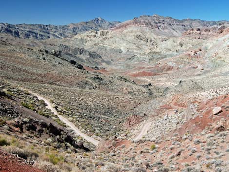
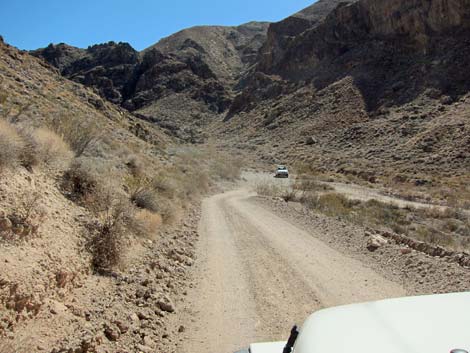
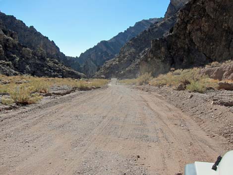
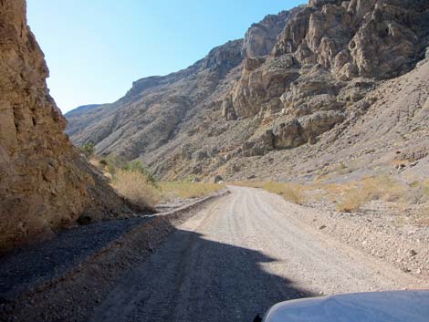
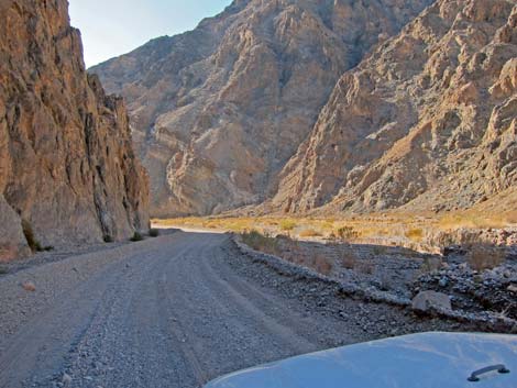
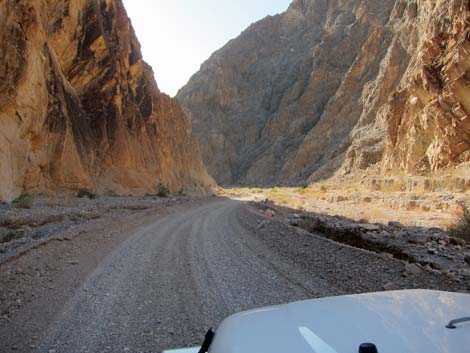
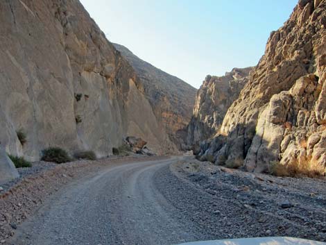
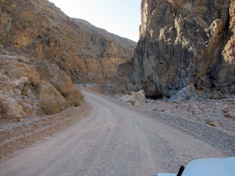
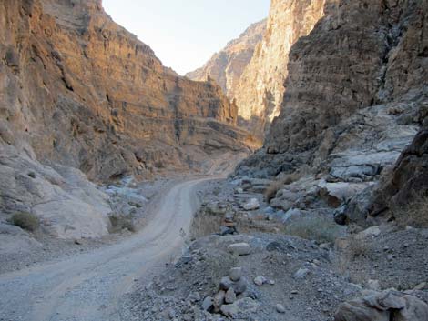
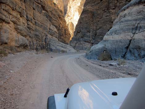
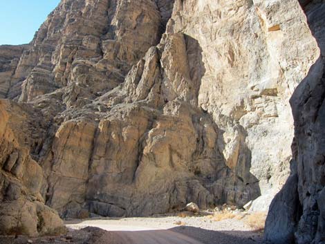
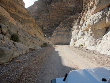
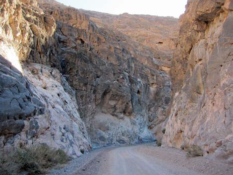
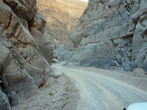
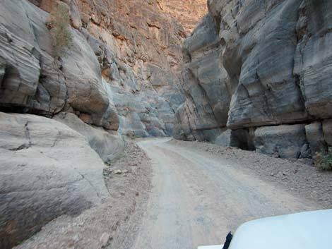
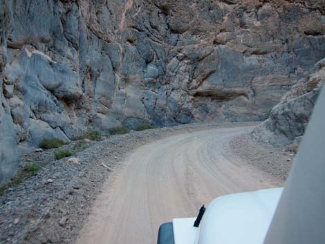
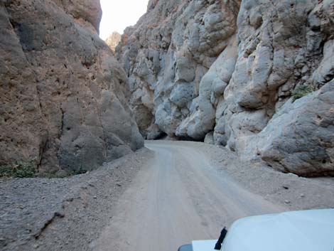
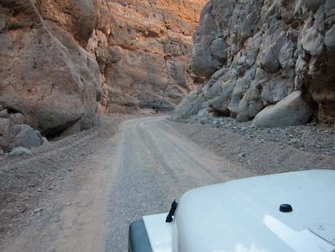
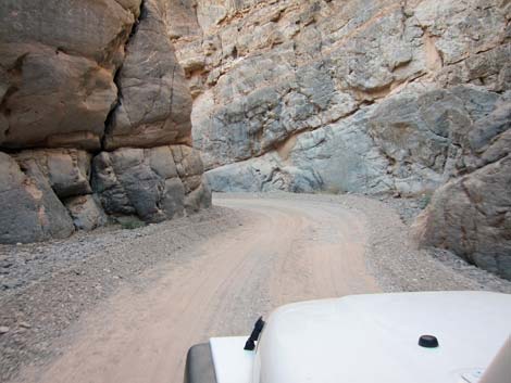
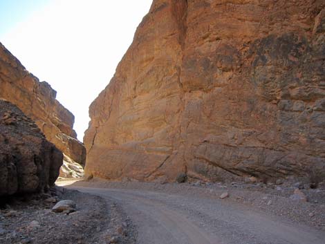
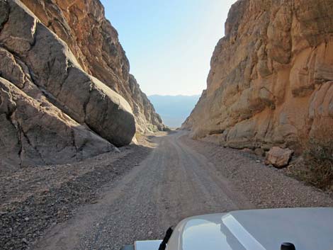
Beyond Klare Spring, the canyon runs wide for a bit more than a mile. Wide is nice for a change because the scenery is grand with layered and colorful mountains and cliffs all around. The road eventually climbs onto a bench above the wash, then drops back into the wash beyond some unseen obstruction in the wash. This point, at 19.6 miles out, marks entry into the lower narrows. The lower narrows are almost entirely narrow, and they continue to get narrower and narrowed farther down the canyon. There is a brief opening at about 21.8 miles out, but after that (22.3 miles out), the narrowest and deepest of the narrows begin. For the next 1.8 miles, the canyon runs deep and narrow. At the narrowest, the canyon walls are barely 15 feet apart - not really enough room for a road! |
 |
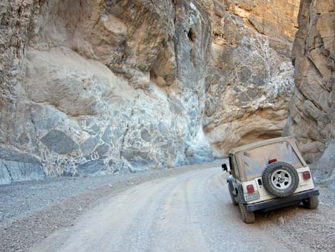
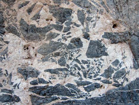
At about mile 23.4, the road passes a section of canyon with a black-and-white mosaic (modern art) plastered on the walls. This is the result of an ancient earthquake deep within the earth that fractured the rock into shards of black stones. Eventually, water percolating through the rock dissolved some of the limestone, then deposited it around the shards in the form of white calcite. Exposed and polished smooth in recent times, we now see a cross-section slice along the fault zone. Beyond the mosaic walls, the road winds through the narrowest of the canyon, but eventually the roads makes a final curve and suddenly the canyon ends and the bright and sunny world of Death Valley opens up again. |
 |
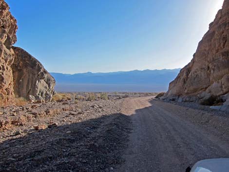
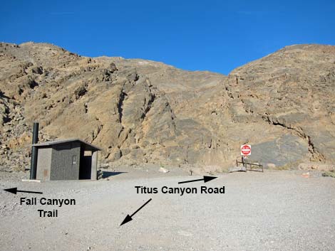
Blinking in the bright sunlight and pulling on sunglasses, drivers exit the canyon, pass a gate and "do not enter" sign, and arrive at the Titus Canyon Hiking Trailhead parking (Site 0760; 24.2 miles out) with a vault toilet. This is where hikers can park and walk up into the Titus Canyon Narrows, or hike north to Fall Canyon. This is also where the traffic becomes two-way. Continuing down across the alluvial fan, the road runs another 2.6 miles to the pavement at Scotty's Castle Road (Site 0761; 26.8 miles out), and thus end, ungraciously, the Titus Canyon adventure. |
 First highpoint (view W into Titanothere watershed) |
 Starting down into the headwaters of Titanothere Canyon |
 Long view down Titanothere Canyon (view SW) |
 Winding along the hillside |
 Road climbing to Red Pass can be seen in the distance (view W) |
 Winding along the hillside |
 |
 |
 Winding along the hillside |
 Second Titanothere trailhead (view SW) |
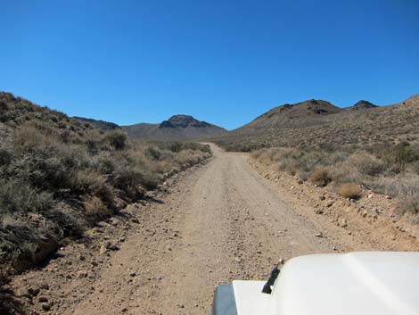
 Starting towards Red Pass |
 Climbing towards Red Pass |
 |
 |
 |
 |
 Tight, steep, narrow, rocky, and precipitous curves |
 Red Pass is in sight |
 Arriving atop Red Pass (view NW) |
 Lunch with a view at Red Pass |
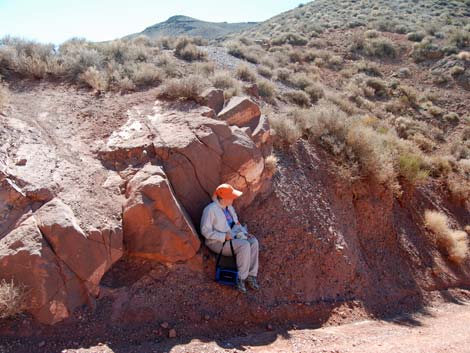 Lunch with a bit of shade at Red Pass |
 Grand view down Leadfield Canyon (view NW) |
 Vehicle descending past Red Pass |
 Looking back down from Red Pass (view SE) |
 Vehicle climbing towards Red Pass (view S) |
 Vehicle arriving at Red Pass (view S) |
 Descending past Red Pass (view NW) |
 Steep, narrow, and precipitous hair-pin curve (view W) |
 1920s hand-built stone wall holding up hair-pin curve (view SE) |
 Descending under Red Pass (view SE) |
 |
 |
 |
 |
 |
 |
 |
 |
 Descending across steep hillsides (view NW) |
 Mine and tailing pile across the canyon (view SW) |
 |
 |
 Approaching another steep and precipitous hair-pin curve (view N) |
 Approaching parking to walk up canyon to mining area (view S) |
 Descending gradually towards Leadfield |
 Carcass of an old car along the road (view NE) |
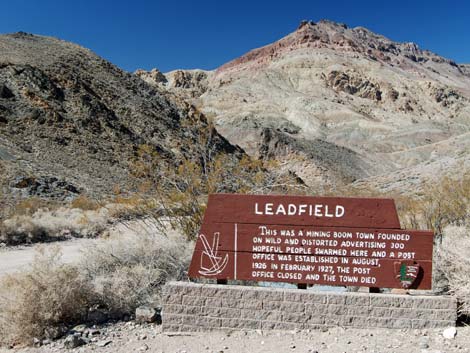 Leadfield sign at parking area (view NW) |
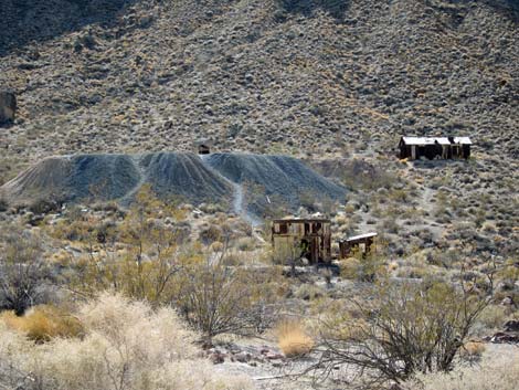 Leadfield ghost town (view SW) |
 Continuing past Leadfield (view NW) |
 Starting into the Leadfield Canyon narrows (view SW) |
 |
 |
 Confluence of Leadfield and Titus canyons (view SW) |
 Sign: Entering Titus Canyon (view SW) |
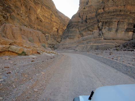
 Many short views |
 Few long views |
 |
 |
 |
 |
 |
 |
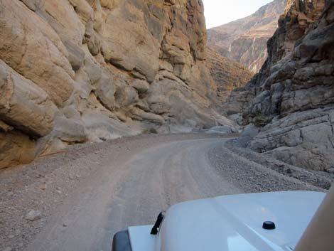
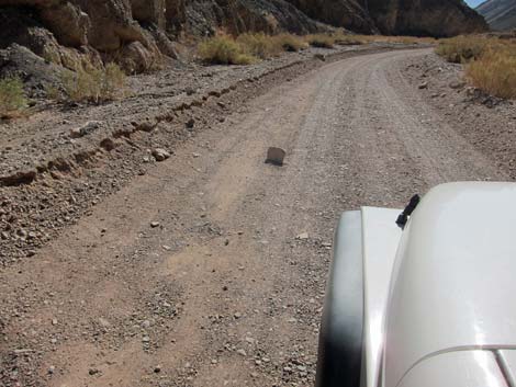 Occasional road hazard, but generally good road |
 Approaching Klare Spring (view W) |
 Arriving at Petroglyphs and Klare Spring (view W) |
 Parking at petroglyph site (view N) |
 Petroglyph sign (view N) |
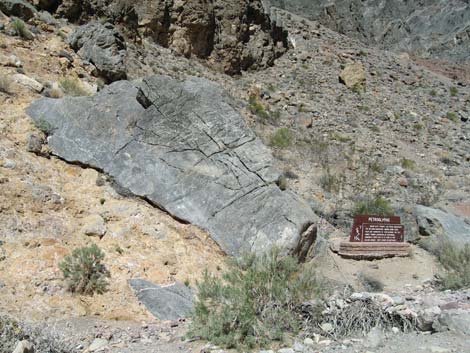 Petroglyphs and sign (view NE) |
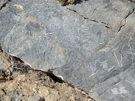 Petroglyphs |
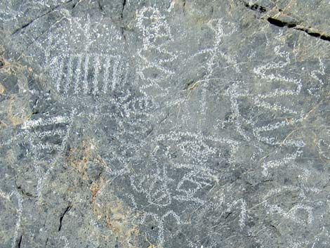 Petroglyphs (close-up) |
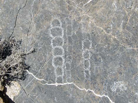 Petroglyphs (close-up) |
 Klare Spring (view SW from above) |
 Klare Spring: a tangle of vegetation on hillside (view N) |
 Klare Spring: a bit of free water along the road edge (view N) |
 |
 |
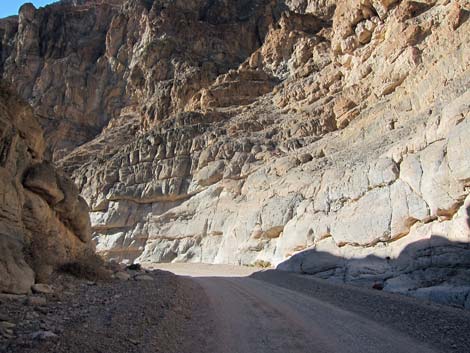
 Many rock walls |
 Pink stones eroding from the mountain tops |
 |
 |
 |
 |
 |
 |
 |
 |
 |
 |
 |
 |
 |
 |
 The narrows begin to narrow (view NW) |
 Narrows (view NW) |
 |
 |
 Narrows (view NW) |
 Mosaic walls in the narrows (view NW) |
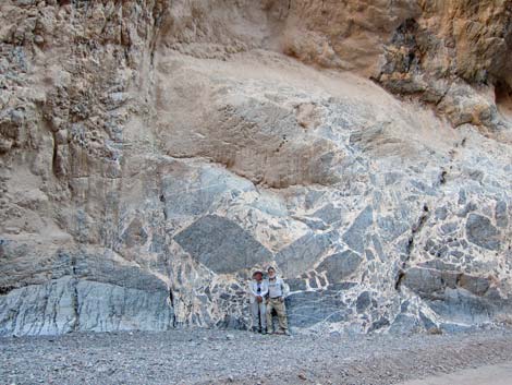 Happy campers at the mosaic wall (view S) |
 mosaic wall details (view S) |
 |
 |
 |
 |
 |
 |
 |
 |
 Approaching the end of the canyon (view SW) |
 Last of the narrows (view SW) |
 Outhouse at Titus Canyon Trailhead parking (view NE) |
 Descending the Titus Canyon alluvial fan (view SW) |
 Approaching Scotty's Castle Road (view SW) |
 Titus Canyon Road at Scotty's Castle Road (view SW) |
Table 1. Highway Coordinates Based on GPS Data (NAD27; UTM Zone 11S). Download Highway GPS Waypoints (*.gpx) file.
| Site | Location | UTM Easting | UTM Northing | Latitude (N) | Longitude (W) | Elevation (ft) | Verified |
|---|---|---|---|---|---|---|---|
| 0760 | Titus Canyon Lower Parking | 484552 | 4074937 | 36.82199 | 117.17321 | 917 | Yes |
| 0761 | Scotty's Rd at Titus Rd | 482992 | 4071148 | 36.78781 | 117.19062 | 169 | Yes |
| 1064 | Hwy 374 at Tutus Canyon Rd | 513806 | 4079060 | 36.85918 | 116.84512 | 3,405 | Yes |
| 1065 | Titus Canyon Rd at Leadfield | 494782 | 4077856 | 36.84842 | 117.05852 | 3,992 | Yes |
| 1066 | Titus Rd at Klare Spring | 491969 | 4077044 | 36.84108 | 117.09007 | 3,094 | Yes |
| 1443 | Titus Canyon Rd at Red Pass | 497194 | 4075671 | 36.82873 | 117.03147 | 5,222 | Yes |
Happy Hiking! All distances, elevations, and other facts are approximate.
![]() ; Last updated 240324
; Last updated 240324
| Hiking Death Valley | Backroads | Hiking Around Las Vegas | Glossary | Copyright, Conditions, Disclaimer | Home |