Backroads Around Las Vegas, Death Valley National Park
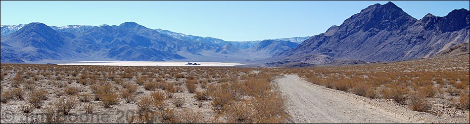
 Ubehebe Road at Racetrack Road (view SW) |
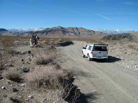
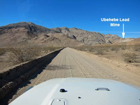
Overview Racetrack Road is a fairly well maintained, graded dirt road. The washboards are pretty bad in places, but assuming good weather conditions, the road is suitable for all but low-rider vehicles. The road generally is fine for standard sedans if you drive slowly and carefully. Expect to spend 1 to 1-1/2 hours driving to Racetrack Playa and the moving rocks. Surrounded by the Death Valley Wilderness Area, driving the Racetrack Road is adventure enough as it winds into the remote heart of Death Valley National Park, but is also provides access to grand scenery and wonderful hiking opportunities such as Racetrack Playa, The Grandstand, Little Ubehebe Peak, Teakettle Junction, Teakettle Camp, Homestake Dry Camp, Ubehebe Lead Mine, Corridor Canyon, and Lippincott Mine. Link to map. |
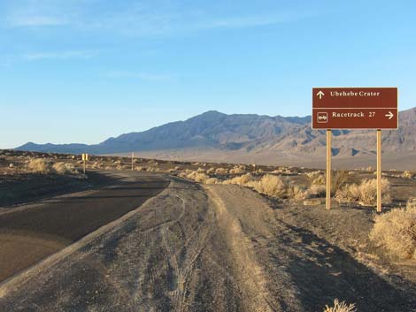
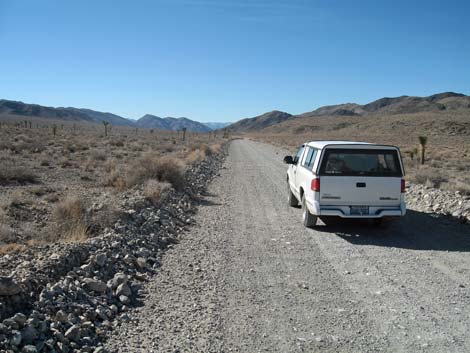
 Turning onto Racetrack Road (view W) |
The road is subject to summer washouts and winter snow, so inquire about current conditions at the Visitor Center or at the Grapevine Ranger Station (often closed; but information signs are posted). The park rangers seem to have been instructed to always say that the road requires a 4WD vehicle, but press them on the details, as this generally is not correct. Before I drove the Racetrack Road for the first time, I asked the rangers at the Visitor Center and at Grapevine about the conditions. They all told me that the road required 4WD, but I wasn't convinced. So I drove out to the turnoff and asked some people coming back from the Racetracks about the road. |
 2.0 miles out and nowhere to pull off and camp |
They told me that there were big rocks in the road and that they needed 4WD. When I pressed them for details, however, they said that there were a couple of fist-sized rocks in the road and that they needed 4WD so they could maintain control on the sharp curves while driving at the posted 35-mph speed limit! They must have been city folks. Needless to say, my little truck and I, and all of the people driving sedans that day, had no trouble on the road. I've seen RV out there too. I've been back several times, and the road always has been fine. For current backcountry road conditions, see the daily report on the Death Valley website. Despite my experience, ask locally, drive carefully, and use your own good judgment. Towing from out there is expensive at best, towing insurance may not cover the cost because the road is not paved, and car rental agreements generally prohibit dirt-road driving. Be sure to check the spare tire on your rental vehicle; one year I had to help some people in a rental 4WD SUV with a flat tire -- because their spare was flat too! |
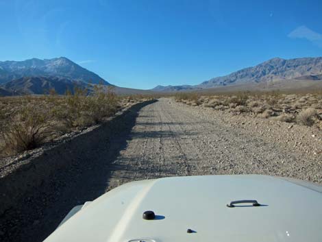
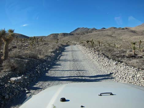
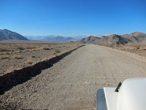
 Typical road quality (view SW) |
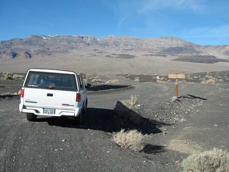
Getting to Racetrack Road Racetrack Road is located towards the north end of Death Valley National Park. It starts about 4 hours northwest of Las Vegas. From town, drive out to Death Valley. From the Furnace Creek Visitor Center (Table 1, Site 0712), drive north on Highway 190 for 17.4 miles to Scotty's Castle Road (Site 0763). Turn right onto Scotty's Castle Road and drive north for about 33 miles to the Grapevine Entrance Station, which is a toll booth in the middle of the road (with water and restrooms at the nearby ranger station). Continue north for 0.2 miles to Ubehebe Crater Road (Site 0754). Turn left (west) onto Ubehebe Crater Road and drive northwest for 5.7 miles to Racetrack Road (Site 0756), which cuts off to the right (west) just before the Ubehebe Crater parking area. This is the start of the Racetrack Road. |
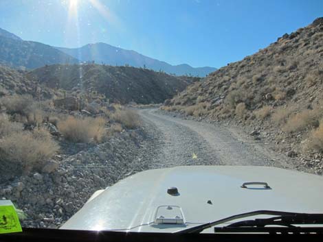
 9.5 miles out |
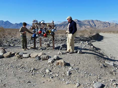
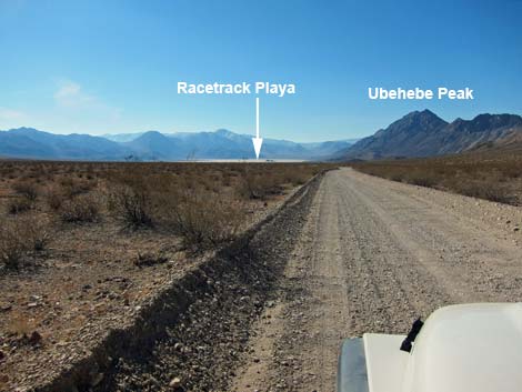
Racetrack Road Turn right (west) onto Racetrack Road and drive 19.5 miles to Teakettle Junction (Site 0757), which has a well-adorned road sign. From Teakettle Junction, continue southwest on the main road for 5.7 miles to the north (near) end of Racetrack Playa, a dry lakebed. There is a wide parking area for the Racetrack Grandstand Trailhead (Site 0758) on the right (west) side of the road and a sign on the left side of the road. Walking out to the Grandstand is a pleasant trip, but there are no moving rocks here. Continue south along the edge of the playa for another 2 miles to reach the south end of the playa, a wide parking area, and a sign on the left (east) side of the road (Site 0759). This is the trailhead for the Racetrack Playa Route, which leads to the moving rocks. |
 10.4 miles out |
The worst thing about the road is the washboards, which can be quite bad in places. Even on these parts, however, you can drive a regular vehicle at 10-15 miles per hour. Driving at a reasonable rate of speed, expect to spend 1 to 1.5 hours driving out to Racetrack Playa. When I've been there, I've seen no sandy, washed out, or rocky spots on the road, although some parts were rougher than others. Drive slowly and carefully -- you'll get there soon enough. |
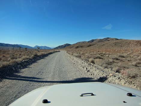 13.1 miles out |
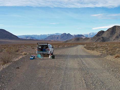
Camping on Racetrack Road The Racetrack Playa is a long way out, so hikers might consider camping out there. Camping is allowed (no fee, no permits) along Racetrack Road starting 1 mile past the pavement and ending at Teakettle Junction. However, you must get off the road to camp, and the graded dirt road lies in a trench almost the entire way. When I was last there, even the 2 or 3 places to get off the road near the 2-mile mark had been blocked off, leaving only wide spots in the road and the pseudo-campground at Teakettle Camp for camping. Beyond Teakettle, camping is permitted at Homestake Dry Camp, about 2.5 miles south of Racetrack Playa. Drive straight south past the playa; don't turn right at an unmarked intersection. The main road ends in a big loop at Homestake with four campsites. The only amenity is an outhouse. A 4WD road continues south past the end of the loop. For current backcountry car-camping regulations, see the park website. |
 17.3 miles out |
 Racetrack Road near Teakettle Junction (view SW) |
 Teakettle Junction; 19.5 miles out (view SW) |
 Teakettle Junction; 19.5 miles out |
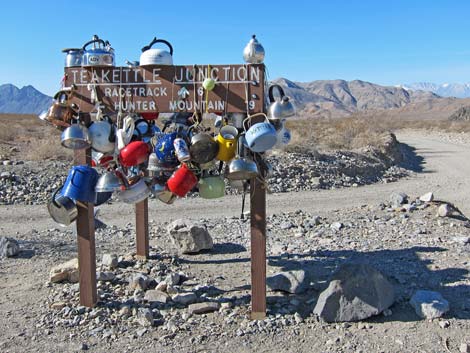 Teakettle Junction (Feb 2011) |
 21.6 miles out |
 22.1 miles out |
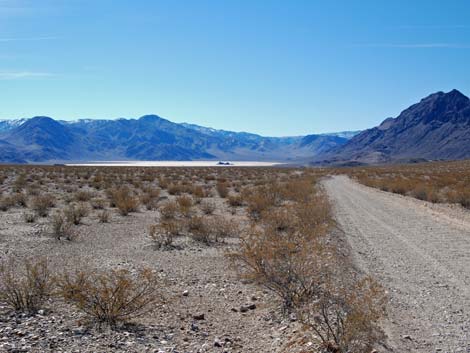 Approaching Racetrack Playa |
A reader comments:
I think you're just a tad too easy on Racetrack Road. I've driven it twice in rental sedans [ed.- this might violate rental contract agreements]. First time was pretty easy, though a long washboard as you note. The second time I found myself driving in deep gravel, trying to keep one wheel on the high center so I would not scrape, having a hard time, and not a whole lot of traction. I was afraid if I stopped I would get stuck, and there was no room to turn around anyway. I figured, and rightly so, that it would be pretty trivial coming down, with gravity on my side. The gravel stretch lasted 2-3 miles.
I've also heard lots of stories of people getting flats on that road. I'm not sure if that's because many people drive it so you hear more stories or if, as you say, they drive too fast.
I'd suggest adding something about conditions being variable depending when the road was last graded and any flooding that may have moved gravel onto the road, and perhaps a tendency for flats so at least make sure you have a good spare.
I went up there on my very first trip to DV with 3-1/2 year old Kaya [ed.- this was near to 1990]. It was a totally amazing day and I realized I was really out in the middle of nowhere. Didn't see anyone else all day. Went out to the Grandstand and then climbed the trail that goes up the ridge toward Ubehebe Peak; got high enough to look down into the multi-colored Saline salt lake. Wow -- I was in awe.
Hiked up Lippincott Road from Saline Valley once and then walked the length of the playa, which was pretty strange.
Table 1. Road Coordinates (NAD27; UTM Zone 11S). Download Highway GPS Waypoints (*.gpx) file.
| Site # | Location | Latitude (N) | Longitude (W) | Easting | Northing | Elevation (ft) | Verified |
|---|---|---|---|---|---|---|---|
| 0561 | Scotty's Castle | 37.03160 | 117.34019 | 469743 | 4098229 | 3,100 | Yes |
| 0562 | Mesquite Spring Camp | 36.96251 | 117.36757 | 467278 | 4090573 | 5,905 | Yes |
| 0612 | Racetrack at Ube Mine Rd North | 36.74551 | 117.57431 | 448729 | 4066593 | 3,992 | Yes |
| 0613 | Racetrack at Ube Mine Rd South | 36.74408 | 117.57416 | 448741 | 4066435 | 3,973 | Yes |
| 0712 | Furnace Creek Visitor Center | 36.46159 | 116.86574 | 512030 | 4034954 | -186 | Yes |
| 0754 | Scotty's Castle Rd at Ubehebe Rd | 36.99863 | 117.36605 | 467429 | 4094580 | 2,292 | Yes |
| 0756 | Ubehebe Crater Rd at Racetrack Rd | 37.01291 | 117.45699 | 459345 | 4096199 | 2,515 | Yes |
| 0757 | Racetrack Rd at Teakettle Junction | 36.76008 | 117.54142 | 451674 | 4068192 | 4,143 | Yes |
| 0758 | Racetrack Rd at Grandstand Trailhead | 36.69430 | 117.57073 | 449015 | 4060911 | 3,719 | Yes-2 |
| 0759 | Racetrack Rd at Racetrack Parking | 36.66562 | 117.56740 | 449293 | 4057727 | 3,716 | Yes |
| 0763 | Hwy 190 at Scotty's Castle Rd | 36.63910 | 117.03531 | 496843 | 4054636 | 104 | Yes-2 |
| 0821 | Homestake Dry Camp | 36.63752 | 117.57326 | 448751 | 4054614 | 3,760 | GPS |
| 0903 | Scotty's Castle Rd at Mesquite camp Rd | 36.99000 | 117.36234 | 467755 | 4093621 | 2,182 | Yes |
| 1047 | Grapevine Entrance Station | 36.99632 | 117.36475 | 467544 | 4094324 | 2,258 | GPS |
| 1048 | Grapevine Ranger Station | 36.99619 | 117.36516 | 467507 | 4094309 | 2,249 | GPS |
| 1049 | Ubehebe Rd at Big Pine Rd | 37.01792 | 117.41055 | 463479 | 4096736 | 2,091 | GPS |
| 1051 | Racetrack Rd at Saline Valley Rd | 36.64157 | 117.57365 | 448719 | 4055062 | 3,803 | GPS |
| 1052 | Teakettle Campground | 36.76039 | 117.54061 | 451747 | 4068226 | 4,153 | GPS |
| 1058 | Ubehebe Lead Mine Parking | 36.74868 | 117.58370 | 447893 | 4066950 | 3,925 | GPS |
Happy Hiking! All distances, elevations, and other facts are approximate.
![]() ; Last updated 240324
; Last updated 240324
| Death Valley | Hiking Around Las Vegas | Glossary | Copyright, Conditions, Disclaimer | Home |