Hiking Around Las Vegas, Death Valley National Park
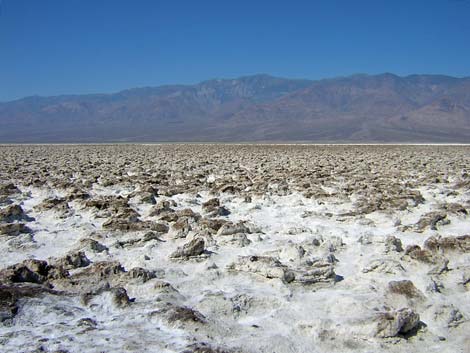 |
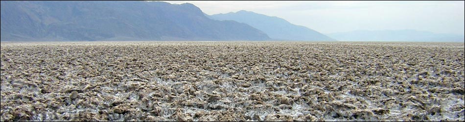
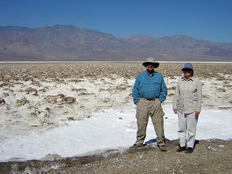
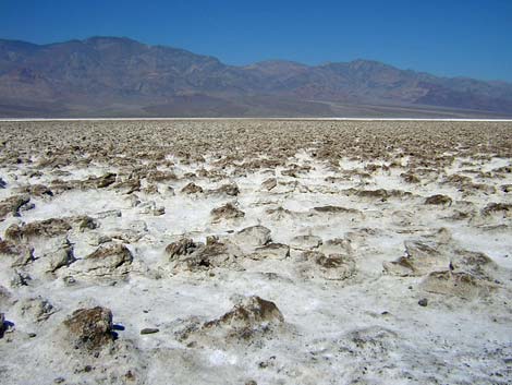
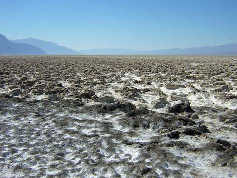
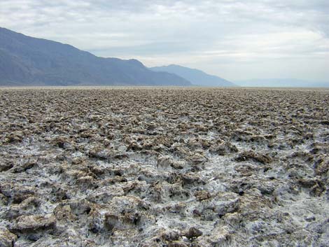
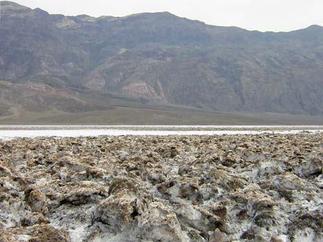
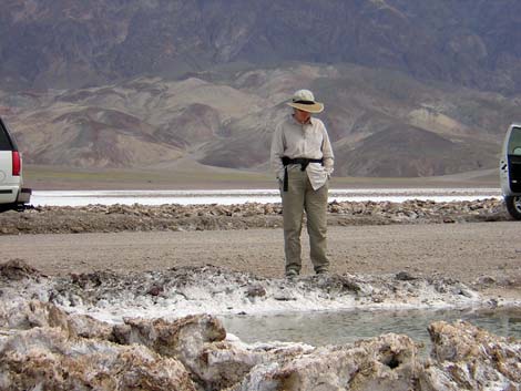
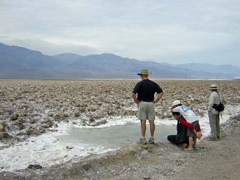
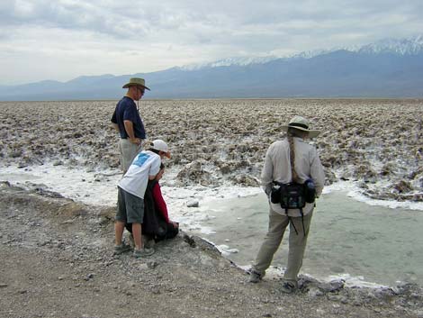
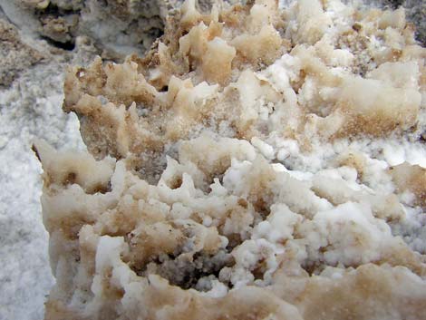
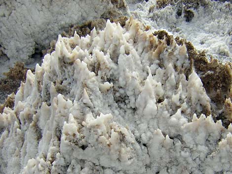
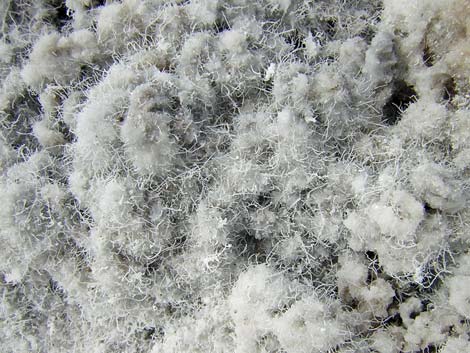
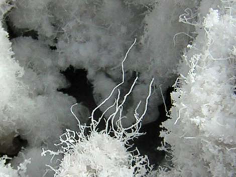
Overview Devils Golf Course is a broad, open area out on a dirty portion of the Death Valley salt pan out near Badwater. I'm not sure about the chemistry, but rainwater and the dirt on the surface seems to facilitate a rock-hard, irregular, crusty, and sharp-edged surface that is very difficult to walk across. While not like the flat, white salt at Badwater (only 10.6 miles south), this site gives visitors the opportunity to get out on the salt pan and experience a land surface seen in few other places. While there, look carefully and notice the irregular salt surface and the odd salt-hairs that "grow" in sheltered places. Link to map. |
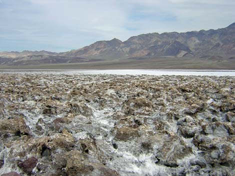 |
Watch Out Other than the standard warnings about hiking in the desert, ... this area is about as safe as it gets if you stay on the road and parking area. Walking on the irregular salt surface is very difficult, slow, and when you fall over, the salt is astonishingly sharp (not to mention that salt in a cut burns like heck). While out, please respect the land and the other people out there, and try to Leave No Trace of your passage. Also, this is a short hike, so just bring what you need of the 10 Essentials. For those who wander beyond the parking area, the walk goes into the Death Valley Wilderness Area, so pay particular attention to respecting the land. |
 |
Getting to Devils Golf Course Devils Golf Course is located along Badwater Road in the south end of Death Valley National Park, about 2 hours northwest of Las Vegas. From town, drive out to Death Valley. From the Furnace Creek Visitor Center (Table 1, Site 0712), drive south on Highway 190 for about 1.25 miles to the Badwater Road (Site 0741). Turn south (right) towards Badwater, and drive for about 11.0 miles to a side road to the right (Site 1432); watch for highway signs. Turn right and drive 1.3 miles to the end of the road (Site 1433). Park here; this is the place. |
 |
 |
 |
 |
 |
 |
 |
 |
 |
 |
 |
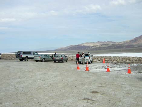 |
Table 1. Highway Coordinates Based on GPS Data (NAD27; UTM Zone 11S). Download Highway GPS Waypoints (*.gpx) file.
| Site | Location | UTM Easting | UTM Northing | Latitude (N) | Longitude (W) | Elevation (ft) | Verified |
|---|---|---|---|---|---|---|---|
| 0712 | Furnace Creek Visitor Center | 512030 | 4034954 | 36.46159 | 116.86574 | -186 | Yes |
| 0714 | Badwater Parking | 520995 | 4009262 | 36.22980 | 116.76638 | -280 | Yes |
| 0741 | Hwy 190 at Badwater Rd | 513271 | 4033494 | 36.44841 | 116.85192 | 4 | Yes |
| 0771 | Hwy 178 at Natural Bridge Rd | 518689 | 4014169 | 36.27409 | 116.79192 | -237 | Yes |
| 1432 | Badwater Rd at Devils Golf Course Road | 516977 | 4016887 | 36.29863 | 116.81092 | -203 | Yes |
| 1433 | Devils Golf Course Parking | 515703 | 4015474 | 36.28591 | 116.82514 | -272 | Yes |
Happy Hiking! All distances, elevations, and other facts are approximate.
![]() ; Last updated 240324
; Last updated 240324
| Death Valley | Hiking Around Las Vegas | Glossary | Copyright, Conditions, Disclaimer | Home |