Hiking Around Las Vegas, Death Valley National Park
 |
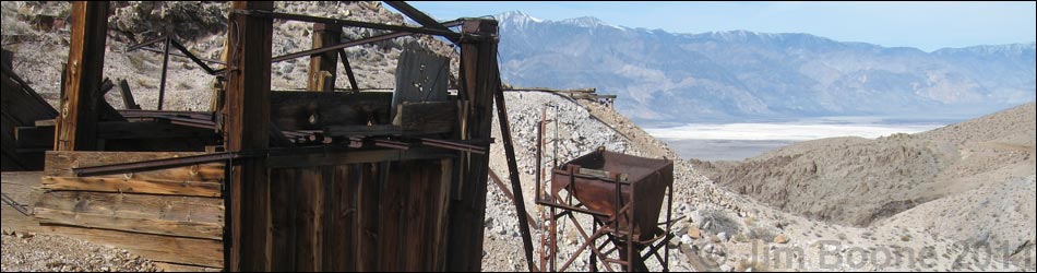
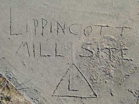
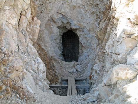
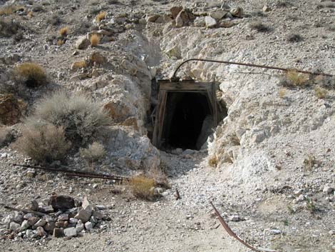
Overview The Lippincott Mine, located deep in the heart of Death Valley National Park and surrounded by the Death Valley Wilderness Area, is a great place to experience history and bask in the grand scenery of this remote area. The hike is fairly short (including all of my wandering around, 2.8 miles) and easy (just follow old roads), and there are plenty of old mine structures to inspect. There are also lots of mine adits and shafts, only some of which are gated, so be careful hiking in the area because the entrance to some of the holes in the ground have collapsed, and the rest are waiting to do the same. The mines were worked from about 1906 to 1952. Link to map. |
 |
Watch Out Other than the standard warnings about hiking in the desert, ... this is a dangerous mining area. There are lots of scary holes in the ground that are fun to look at, but not safe to enter. While hiking, please respect the land and the other people out there, and try to Leave No Trace of your passage. Also, even though this hike is short, the area is wild and remote, so be sure to bring the 10 Essentials. Out on the Racetrack Road, be sure that your spare tire is in good condition, and bring plenty of water. For details of issues associated with the journey, see the Racetrack Road webpage. |
 |
Getting to the Trailhead Lippincott Mine is located along Racetrack Road in the north end of Death Valley National Park, about 5-1/2 hours northwest of Las Vegas. From town, drive out to Death Valley. From the Furnace Creek Visitor Center (Table 1, Site 0712), drive north about 50 miles to the Grapevine Ranger Station, turn left onto Ubehebe Crater Road and drive northwest for 5.7 miles to Racetrack Road (Site 0756). Turn right onto Racetrack Road and drive 19.5 miles to Teakettle Junction (Site 0757), another 8 miles to the Racetrack Playa Trailhead, and then 2.0 more miles to Homestake Dry Camp (Site 0821). Drive to the far end of the campground loop (Site 1060). Park here, this is the trailhead. For details of the journey, see the Racetrack Road webpage. |
 |
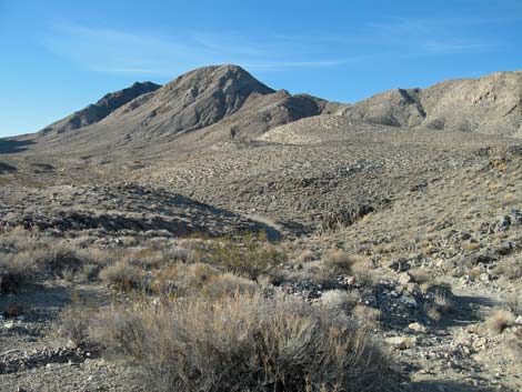
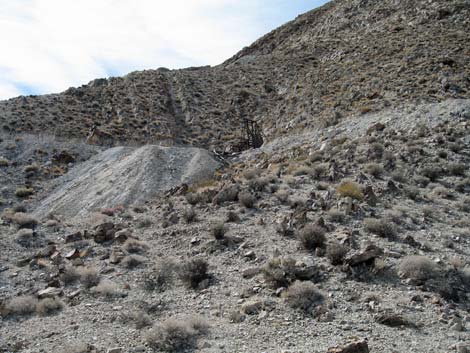
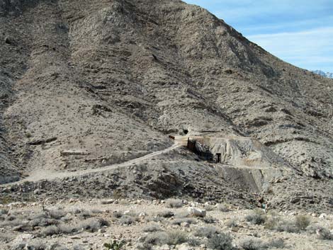
The Hike From the Homestake Dry Camp trailhead (Table 2, Waypoint 01), follow the old road south. It might be possible to drive the road, but I think the Park Service intends for it to be closed. At about 0.4 miles out, the road forks by an old yellow water truck (Wpt. 02) that marks the start of interesting mining stuff. Continuing on the upper road (left fork), the road runs up the hill to the southwest, then bends back to the northwest. There are a number of interesting artifacts along the road, including the top of tramway (Wpt. 03) mine openings, the remains of another old vehicle. This part of the road also provides grand views out to the west with Saline Valley in the foreground and the high Sierra Nevada Mountains in the distance. |
 |
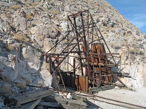
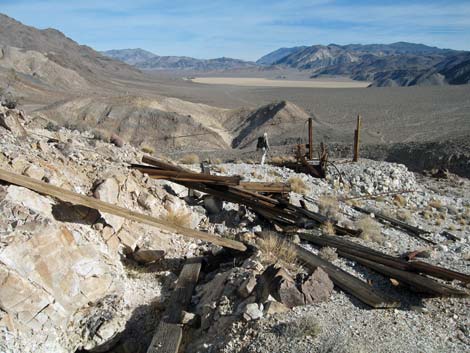
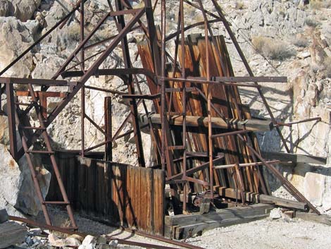
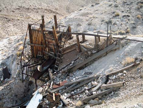
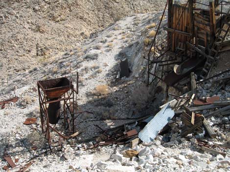
At the end of the old road (Wpt. 04), mine shafts, adits with ore car tracks, metal headgear, an inclined hoist, ore hoppers, and other items of interest are scattered across the landscape. This is a good place to spend some time looking around. From the end of the upper road, wander down the hillside to the lower road, then continue west to the end of the lower road (Wpt. 05) where more holes in the ground and mining equipment can be found. Past the end of the lower road, a miner's trail leads out to yet another hole in the ground. When ready, follow the lower road down into the bottom of the canyon, and then back up to the northeast to the old water truck (Wpt. 02) and the road back to the trailhead (Wpt. 01). For information on history of this area, consult the excellent book by Michel Digonnet, Hiking Death Valley; A Guide to its Natural Wonders and Mining History. |
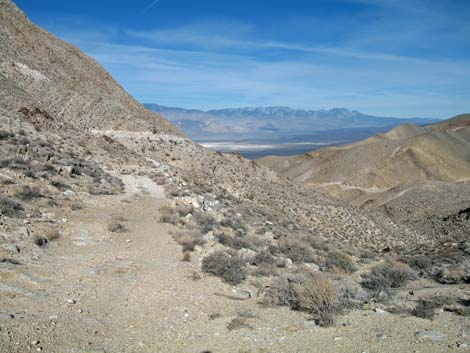
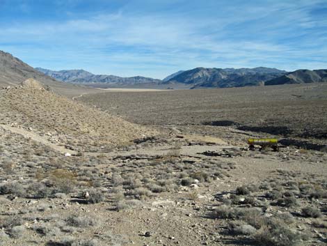 Grand view north towards Racetrack Playa |
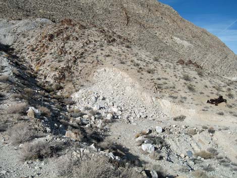
 Artifacts at end of lower road |
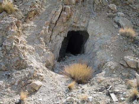
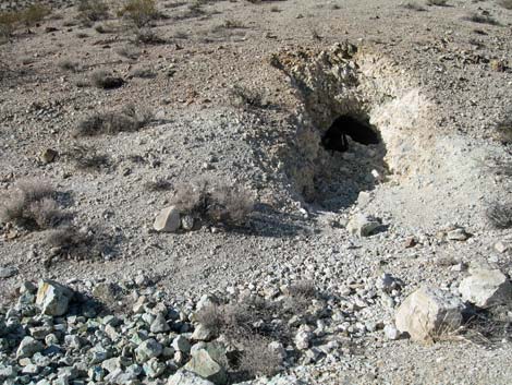 Dangerous hole in the ground |
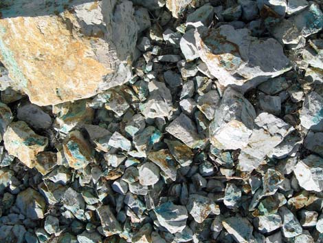 Discarded copper ore |
 |
 |
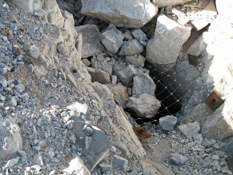 Gated mine shaft with cave-in rocks |
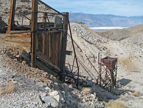
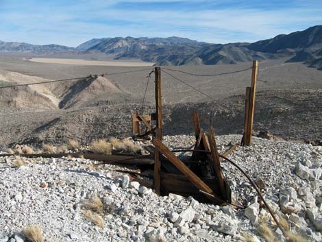 Top of the tramway |
 |
 |
|
 |
 |
 |
 |
 |
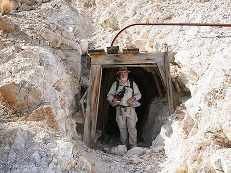
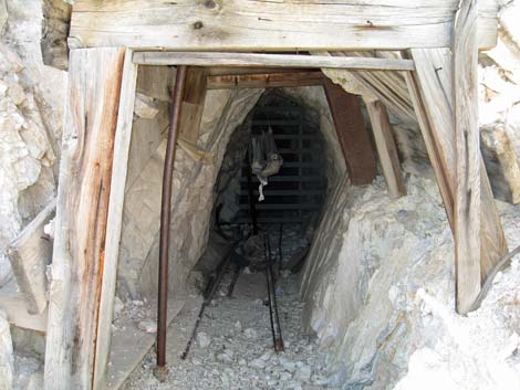
 Shored mine entrance |
 Unstable mine entrance |
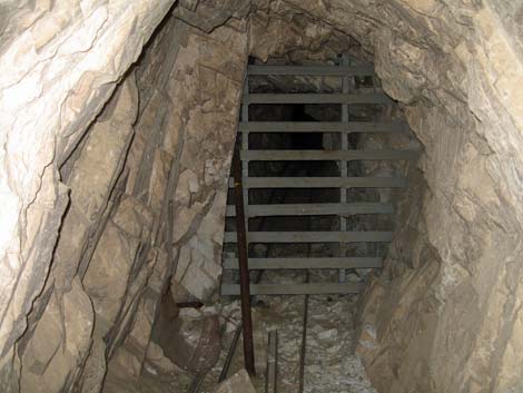 Widely spaced grating allows bats to fly in and out of this adit |
 Old shoring and bat gate |
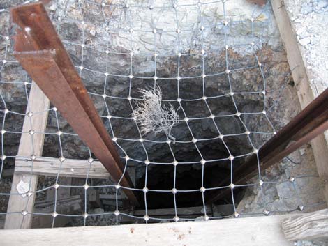 Widely spaced mesh allows bats to fly in and out of the mine shaft |
 End of the lower road (view SW from bottom of canyon |
Table 1. Highway Coordinates (NAD27; UTM Zone 11S). Download Highway GPS Waypoints (*.gpx) file.
| Site # | Location | Latitude (N) | Longitude (W) | UTM Easting | UTM Northing | Elevation (ft) | Verified |
|---|---|---|---|---|---|---|---|
| 0712 | Furnace Creek Visitor Center | 36.46159 | 116.86574 | 512030 | 4034954 | -186 | Yes |
| 0756 | Ubehebe Crater Rd at Racetrack Rd | 37.01291 | 117.45699 | 459345 | 4096199 | 2,515 | Yes |
| 0757 | Racetrack Rd at Teakettle Jct | 36.76008 | 117.54142 | 451674 | 4068192 | 4,143 | Yes |
| 0821 | Homestake Dry Camp | 36.63752 | 117.57326 | 448751 | 4054614 | 3,760 | GPS |
| 1060 | Lippincott Mine TH Parking | 36.63691 | 117.57341 | 448737 | 4054545 | 3,771 | GPS |
Hiking Coordinates Based on GPS Data (NAD27; UTM Zone 11S). Download Hiking GPS Waypoints (*.gpx) file.
| Wpt. | Location | Easting | Northing | Elevation (ft) | Point-to-Point Distance (mi)* | Cumulative Distance (mi) | Verified |
|---|---|---|---|---|---|---|---|
| 01 | Trailhead | 448739 | 4054543 | 3,710 | 0.00 | 0.00 | GPS |
| 02 | Water Truck | 448702 | 4054023 | 3,877 | 0.39 | 0.39 | GPS |
| 03 | Top of Tramway | 448348 | 4053893 | 4,102 | 0.52 | 0.91 | GPS |
| 04 | Shaft and Adits | 448235 | 4054052 | 4,007 | 0.35 | 1.26 | GPS |
| 05 | End of Mining Road | 448076 | 4054314 | 3,769 | 0.40 | 1.66 | GPS |
| 02 | Water Truck | 448702 | 4054023 | 3,877 | 0.80 | 2.46 | GPS |
| 01 | Trailhead | 448739 | 4054543 | 3,710 | 0.35 | 2.81 | GPS |
Happy Hiking! All distances, elevations, and other facts are approximate.
![]() ; Last updated 240324
; Last updated 240324
| Death Valley | Hiking Around Las Vegas | Glossary | Copyright, Conditions, Disclaimer | Home |