Hiking Around Las Vegas, Death Valley National Park
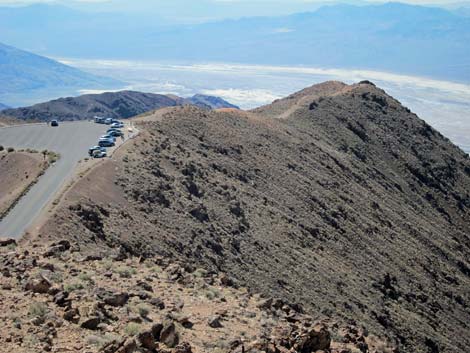
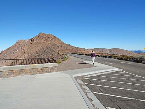 Dante Peak Trailhead (view N) |
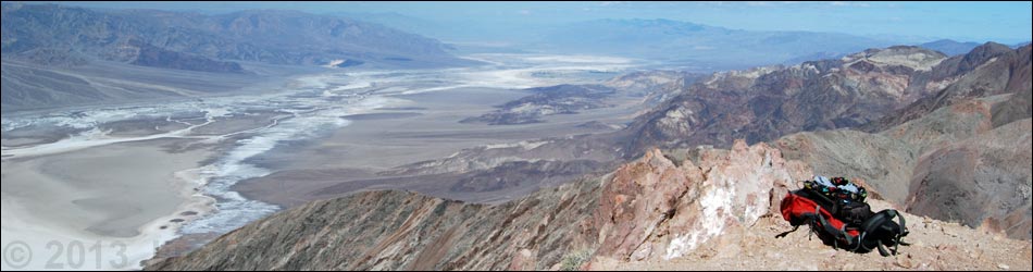
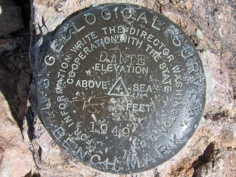
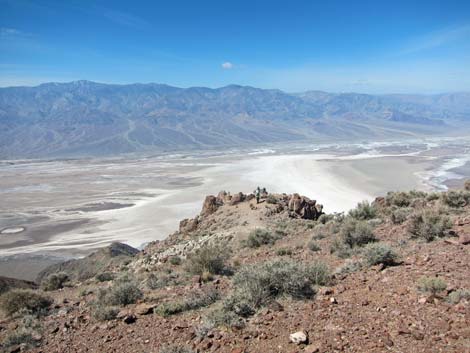
Overview The Dante Peak Trail is an easy 45-minute (0.7 mi) round-trip hike up a ridge to a summit with spectacular views. The summit overlooks Death Valley, and mountain ranges running out to the horizon in all directions can be seen, much of which is included in the Death Valley Wilderness Area. Although it is true that the view from the parking lot is almost as good, this short hike to a quiet summit is worth the effort; plus, hikers likely will have the view all to themselves; that is, not having to share the experience with lots of people and noisy vehicles in the parking lot. Formerly referred to as Dante's Peak in relation to Dante's View, the peak is properly referred to as Dante Peak. The USGS marker on the summit actually reads "Dante." in addition, the use of "Dante's View," as if the view belonged to Dante, is incorrect. This viewpoint is better referred to by the USGS Naming Standard as "Dante View" without the possessive connotation. Link to map. |
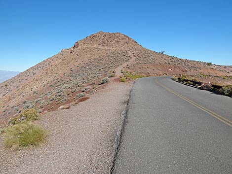 Start of Dante Peak Trail (view N) |
Watch Out Other than the standard warnings about hiking in the desert, ...this hike is pretty safe, but stay off the ridge if lightning threatens, and stay back from the edge of the cliffs -- it's a long way to Badwater from here. While hiking, please respect the land and the other people out there, and try to Leave No Trace of your passage. Also, even though this hike is short, be sure to bring what you need of the 10 Essentials. |
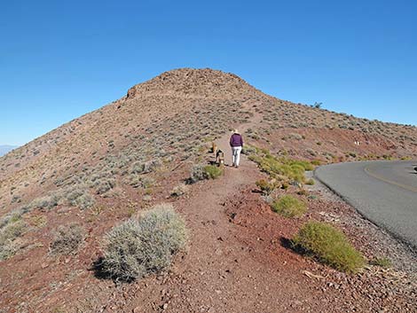 Hiker starting up the Dante Peak Trail (view N) |
Getting to the Trailhead This hike is located in Death Valley National Park, about 3 hours northwest of Las Vegas. From town, drive out to Death Valley. From the Furnace Creek Visitor Center (Table 1, Site 712), drive south on Highway 190 for about 1.25 miles to the Badwater (Highway 178) turnoff (Site 741). Continue east on Highway 190 for about 10.7 miles to the Dantes View turnoff (Site 777). Turn south (right) onto the Dantes View Road, and drive for about 13.2 miles to a parking lot the end of the road (Site 776). Park here; this is the trailhead. The end of the road is steep, narrow, and winding, and trailers are not permitted up there, but there is a paved parking lot 7.5 miles from Highway 190 (Site 752) where you can drop them off. Also, there are no restroom facilities at the end of the road; however, about 0.5 miles before the end, there is a parking area with a restroom on the west (left) side of the road. |
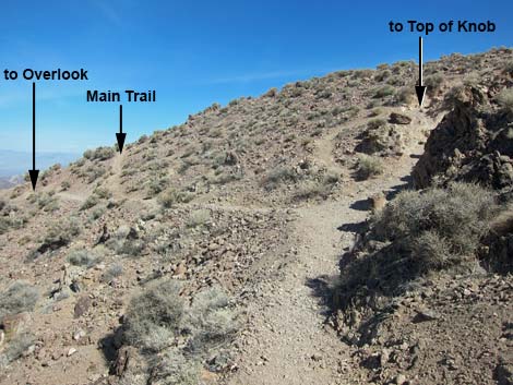
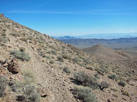
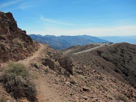
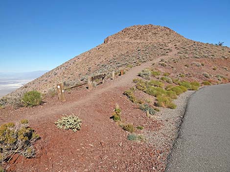 Dante Peak Trail departs the roadway (view N) |
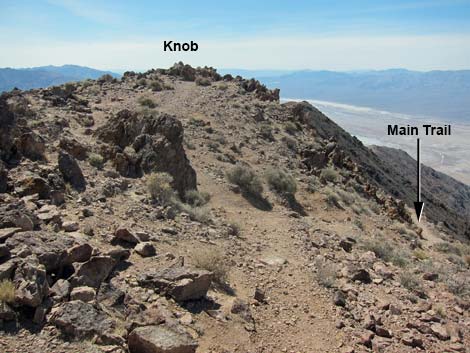
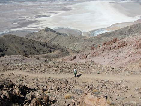
The Hike From the parking area (Table 2, Wpt. 01), the trail runs north on road for about 0.06 miles to the first curve in the road (Wpt. 2) there the trail departs the pavement. From the turn, the unmarked Dantes View Trail runs north and starts up the toe of the ridge. For the first few steps up the ridge, the angle of the slope and the size of the cobbles makes the walking particularly difficult because all of the little rocks in the trail seem to turn under your feet. After a few yards, the trail starts to level out as it cuts up and across the west face of the ridge at a more pleasant grade and the walking is easy. Above the trail, there are low cliffs formed from a pale brown volcanic ash deposit, perhaps a pyroclastic flow, that contains many larger irregular-sized cobbles. The knob at the top of the cliff is a good viewpoint, but it is not on the easiest route to the summit. |
 Steep initial trail up hillside (view N) |
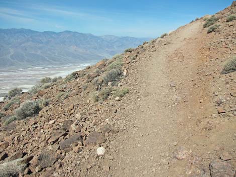
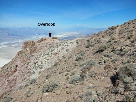
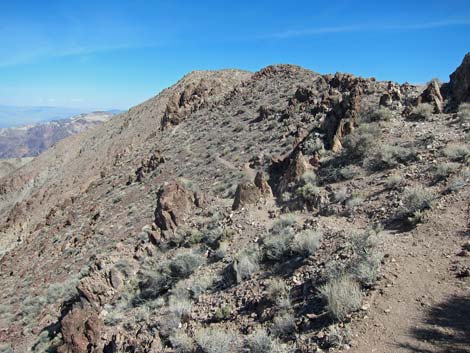
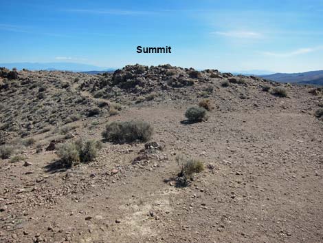
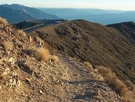
Beyond the low cliffs, the trail forks (Wpt. 03). The west (left) fork runs slightly down and west for about 50 yards to a rocky promontory (Wpt. 04), while the east (right) fork runs steeply up to the top of the ridge. The easiest way to the summit is to take the western fork; be sure to stop on the rocky promontory and enjoy the view. From the rocky promontory (Wpt. 04), the trail runs northeast to a saddle on the crest of the ridge (Wpt. 05). From the saddle, the trail runs along the east side of the ridge to the summit (Wpt. 06). The summit has two little peaklets of almost equal height. The western peaklet has a benchmark that reads "Dante," while the other has a benchmark that reads "Marker #2" and has an arrow pointing back to Dante. Dante is higher by inches. The vegetation here is relatively dense and diverse compared to lower elevations. The visually dominant species is Nevada jointfir (a type of Mormon tea), which is a bit unusual, but there are many other species too (e.g., turpentine broom, California buckwheat, bunchgrasses, desert globemallow, cholla cactus, and others, but no creosote bush). |
 Gentle trail across hillside (view N) |
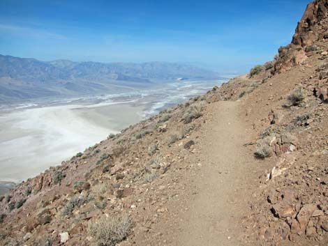
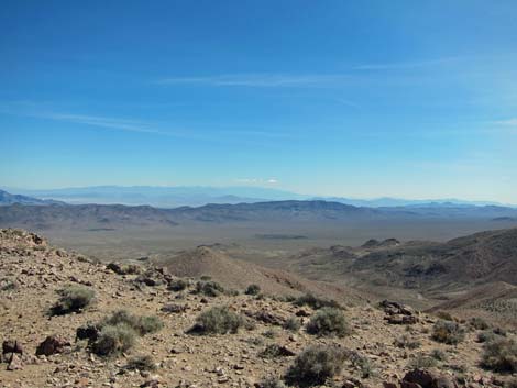
Views from the summit are spectacular, and hikers can see mountain ranges running out to the horizon in all directions. Views include the Sierra Nevada mountains to the northwest, the Grapevine mountains to the north, Mt. Charleston to east, and the mountains around Los Angeles to the southwest. In addition, hikers can see down to the floor of Death Valley and up to the summit of Telescope Peak to the west (a vertical difference of some 12,000 feet!). The summit knobs are set back from the edge of the cliffs by about 50 ft. Hikers should walk out to the rocky outcrop on the edge. All of the mountain ranges are still visible, and there are views down to Badwater and to the tip of the Dantes View parking lot. Before heading down, take a good look at the summit because when you get down and look back from the parking lot, you will see a knob that looks like the summit, but you will realize that it is not the right knob. When ready, head back down the trail following your footprints to the trailhead. As an alternative, walk back to the saddle, then stay on the top of the ridge and visit the southern-most knob on the ridge, which is a good place to wave at people in the parking lot. |
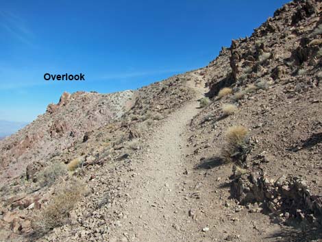 The Overlook comes into view (view N) |
 Fork in the trail (view N) |
 Approaching first overlook (view N) |
 Trail runs across west-facing slope (view N) |
 Trail climbs onto ridgeline (view NE) |
 Trail across east-facing slope (view N) |
 Summit is just a blip on the hill (view E) |
 USGS marker on the summit |
 Mt. Charleston in the distance (view east) |
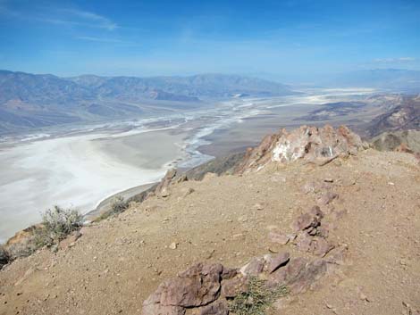 Northern Death Valley (view north from summit) |
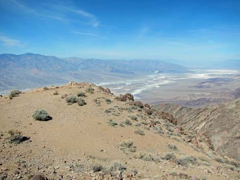 Overlook at summit (view NW from summit) |
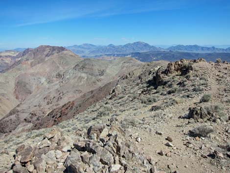 Ridge route to Mt. Perry (view N) |
Returning to the Trailhead
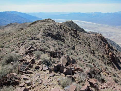 Returning via ridge route (view S) |
 Hikers on First Overlook (view NW from ridgeline) |
 Approaching First Knob on the ridge (view S) |
 Hiker on main trail (view into Badwater Basin) |
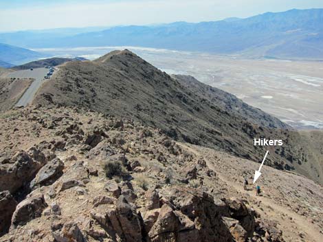 Hikers on main trail below First Knob (view SW) |
 Dante View Trail (view SE from First Knob) |
 Returning on main trail (view S) |
 Returning to the trailhead (view S) |
Table 1. Highway Coordinates (NAD27; UTM Zone 11S). Download Highway GPS Waypoints (*.gpx) file.
| Site | Location | Latitude (N) | Longitude (W) | Easting | Northing | Elevation (ft) |
|---|---|---|---|---|---|---|
| 0712 | Furnace Creek Visitor Center | 36.46159 | 116.86574 | 512030 | 4034954 | -186 |
| 0741 | Hwy 190 at Badwater Rd | 36.44841 | 116.85192 | 513271 | 4033494 | 4 |
| 0752 | Dantes View Rd, trailer parking | 36.26884 | 116.66323 | 530250 | 4013619 | 2,315 |
| 0776 | Dantes View Parking | 36.22083 | 116.72572 | 524652 | 4008276 | 5,450 |
| 0777 | Hwy 190 at Dantes View Rd | 36.36302 | 116.70826 | 526174 | 4024052 | 2,000 |
Table 2. Hiking Coordinates Based on GPS Data (NAD27; UTM Zone 11S). Download Hiking GPS Waypoints (*.gpx) file.
| Wpt. | Location | UTM Easting | UTM Northing | Elevation (ft) | Point-to-Point Distance (mi) | Cumulative Distance (mi) |
|---|---|---|---|---|---|---|
| 01 | Dante View Trailhead Parking | 524663 | 4008292 | 5,385 | 0.00 | 0.00 |
| 02 | Dante Peak Trail Departs Roadway | 524683 | 4008372 | 5,386 | 0.05 | 0.05 |
| 03 | Trail Forks | 524691 | 4008567 | 5,502 | 0.15 | 0.20 |
| 05 | Saddle | 524721 | 4008709 | 5,543 | 0.11 | 0.31 |
| 06 | Dante Peak | 524744 | 4008881 | 5,645 | 0.12 | 0.43 |
| 04 | Rocky Promontory | 524707 | 4008542 | 5,579 | 0.26 | 0.69 |
| 01 | Dante View Trailhead Parking | 524663 | 4008292 | 5,385 | 0.23 | 0.92 |
Happy Hiking! All distances, elevations, and other facts are approximate.
![]() ; Last updated 240324
; Last updated 240324
| Death Valley | Hiking Around Las Vegas | Glossary | Copyright, Conditions, Disclaimer | Home |