Hiking Around Las Vegas, Death Valley National Park, Death Valley Wilderness Area
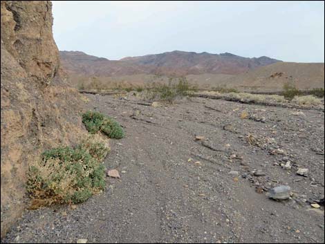
 Trailhead (view SE into the sunrise) |
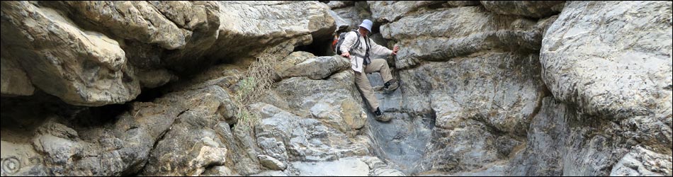
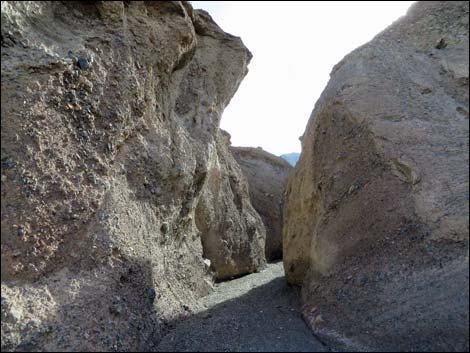
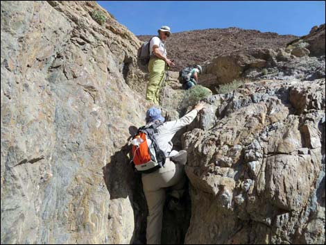
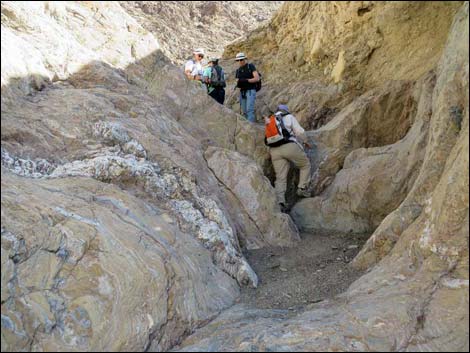
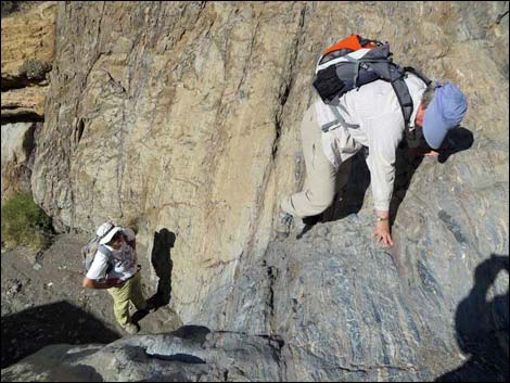
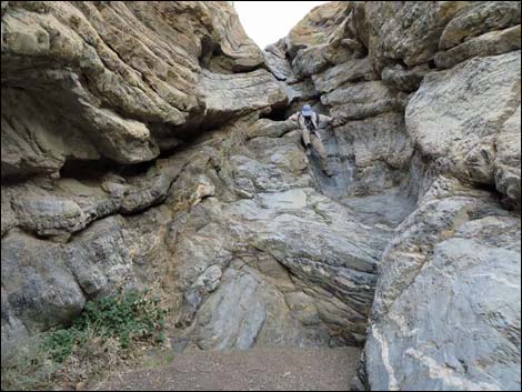
Overview The hike up Black Point Canyon is a somewhat strenuous, but pleasant and geologically interesting, 7-mile round-trip hike in the Death Valley Wilderness Area. The route runs off-trail up Black Point Canyon Wash for about 2 miles to a long series of pour-overs. For much of the next mile, the canyon is chocked full of challenging, but generally safe, pour-overs as the wash cuts through twisted metamorphic rock with many "stretched pebbles" and some unusual sedimentary rocks. Beyond the pour-overs, hikers can continue for as far as anyone would want. Link to trail map. Watch Out Other than the standard warnings about hiking in the desert, ... hiking in the lower canyon is quite safe. Passing the many pour-overs requires good 3rd-Class and 4th-Class rock scrambling skills, but the rock if firm and usually with plenty of hand- and foot-holds. Some hikers may want a belay rope on at least one pour-overs. |
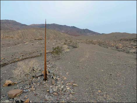 Most of what is left of the historic telegraph line |
While hiking, please respect the land and the other people out there, and try to Leave No Trace of your passage. This hike is in a wild and remote area, so be sure to bring the 10 Essentials. Also, the route is almost entirely within the Death Valley Wilderness Area, so pay particular attention to respecting the land and the historic objects along the route. Getting to the Trailhead This hike is located in Death Valley National Park, about 2-1/2 hours northwest of Las Vegas. Drive west on Highway 190 to a dirt pullout 5 miles west of Stovepipe Wells. Link to Black Point Canyon Trailhead. |
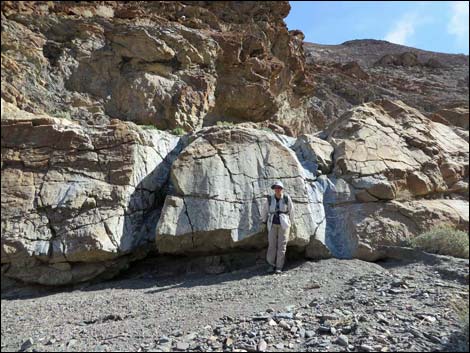
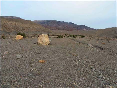 White boulders make a target while hiking up the alluvial fan |
The Hike From the trailhead (Table 1, Waypoint 01), the route runs southeast towards a major canyon that slices into the flanks of Tucki Mountain. Looking into the distance, hikers can see two white boulders that make good targets for hiking towards the canyon. A bit left of straight towards the canyon mouth, hikers can stop and see remnants of the historic Rhyolite-Skidoo telephone line (Wpt. 02) that once ran between Stovepipe Wells and the Skidoo mines farther south. At this spot, a broken pole stands along a wash and the rest of the pole lies nearby. Wires can be found, but not here. Past the telegraph pole, the route passes the white boulders seen from the trailhead, then enters the wash (Wpt. 04), and continues to the mouth of the canyon. The canyon is wide, and it is easier to stay left, but hikers might want to visit an historic dump (Wpt. 04) on the right side of the canyon that probably dates from the early days of Stovepipe Wells. |
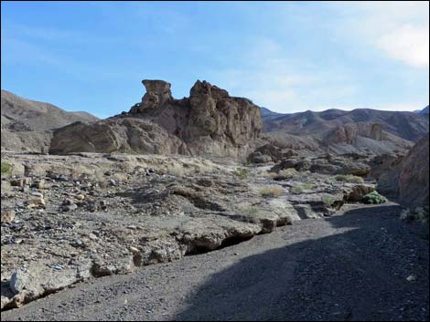
 Passing the mouth of the canyon (view SE) |
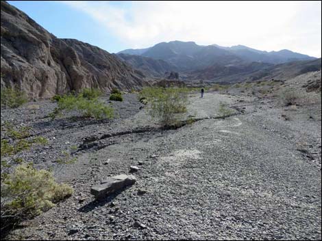
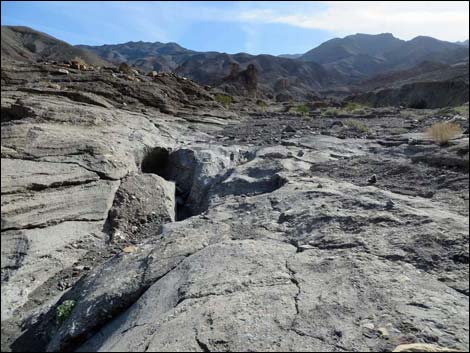
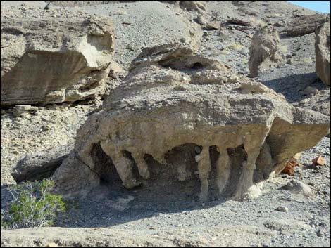
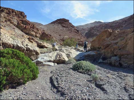
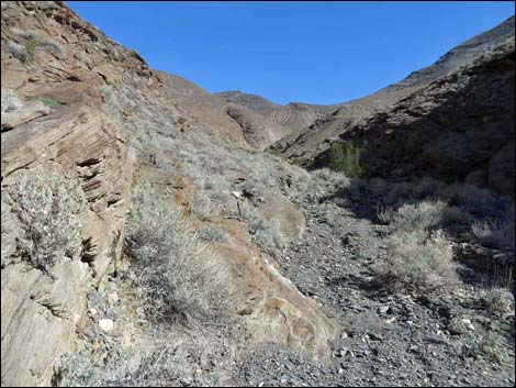
The canyon bends south, then bends again to resume a generally southeast direction. The canyon narrows somewhat, but remains fairly wide, and eventually hikers cross an interesting bit of geology where lighter-colored bedrock, similar to Mosaic Canyon, is carved, water polished, and gives the appearance of a natural mosaic. Shortly beyond the mosaic rocks, and visible from that point ahead on the left, is the Shiprock Formation (Wpt. 05): an outcrop of rock resembling an old-time ocean liner. Opposite Shiprock in the wash, a narrow slot in the wash cuts into conglomerate rock and terminates at an interesting pour-over. Hikers not ready for this challenge can bypass it by walking up the wash closer to Shiprock. Beyond Shiprock, the canyon bends a bit more to the east, then bends sharply south at a curve that announces entry into the Pour-Over Zone (Wpt. 06). Over the next 0.6 miles, the canyon winds about passing several pour-overs before arriving at the confluence of two canyons (Wpt. 07). Here, the main wash comes in from the left side, giving it the appearance of a side canyon. |
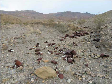 Historic can dump (view SE) |
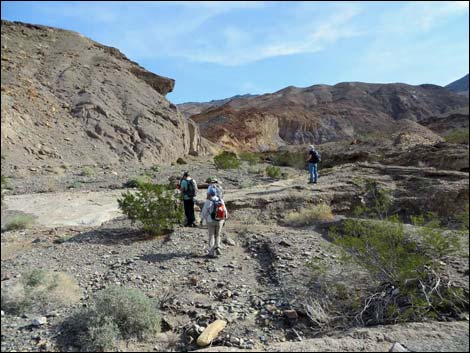
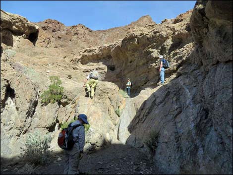
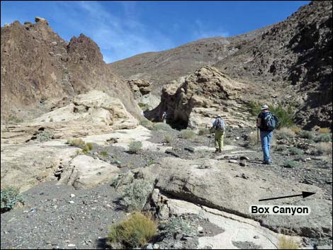
At the confluence (Wpt. 07), the main wash turns left following an unusual rock formation where it looks like a mudflow of volcanic ash roared down the canyon, solidifying in the area of the confluence and slightly down-canyon. The old mudflow is lighter colored than the surrounding bedrock, highlighting the contrast in the two types of rock. If hikers fail to notice the "side canyon," they will continue straight winding up more pour-overs and into what becomes an interesting box canyon (Wpt. 10) worth a visit in any rate. Following the main wash to the left, the wash is blocked by several interesting pour-overs in quick succession. Climbing past about 100 yards of pour-overs, hikers break out into a more open canyon, and with the pour-overs now in the background, hikers can continue up the wash making good progress. About 1/4-miles past the confluence, the wash forks again. Here, the main wash stays right heading southeast. The challenging pour-overs are done, and hikers can wander up the canyon as far as is desired, even to the summit of Tucki Mountain. However, this is a good place to call it a day and head back down, as there are plenty of down-climbing challenges on the way back. |
 Canyon narrows somewhat, but remains fairly wide (view SE) |
 Water-polished natural mosaic rock (view SE) |
 Shiprock (view SE) |
 Slot and pour-over S of Shiprock can be bypassed (view SE) |
 UFO landing craft along the wash (view NE) |
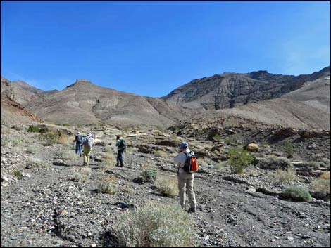
 Hikers in broad wash (view SE) |
 Start of the pour-overs (view E) |
 Canyon begins to narrow (view SE) |
 Pour-over Pour-over |
 Pour-over Pour-over |
 Pour-over |
 Hikers at confluence, heading into final pour-overs (view NE) |
 One of the upper pour-overs |
 Hikers above the last pour-over (view N) |
 The canyon seems to continue forever (view E) |
 A major challenge on the way down |
Table 1. Hiking Coordinates Based on GPS Data (NAD27; UTM Zone 11S). Download Hiking GPS Waypoints (*.gpx) file.
| Wpt. | Location | UTM Easting | UTM Northing | Elevation (ft) | Point-to-Point Distance (mi) | Cumulative Distance (mi) | Verified |
|---|---|---|---|---|---|---|---|
| 01 | Trailhead | 481666 | 4045053 | 981 | 0.00 | 0.00 | GPS |
| 02 | Telegraph Pole | 481908 | 4044969 | 1,052 | 0.19 | 0.19 | GPS |
| 03 | Enter Wash | 482018 | 4044771 | 1,116 | 0.15 | 0.34 | GPS |
| 04 | Old Dump | 482408 | 4044399 | 1,235 | 0.36 | 0.70 | GPS |
| 05 | Shiprock Formation | 483223 | 4043316 | 1,672 | 1.01 | 1.71 | GPS |
| 06 | Begin Pour-Overs | 483852 | 4043107 | 1,946 | 0.47 | 2.18 | GPS |
| 07 | Canyon Forks | 484251 | 4042689 | 2,342 | 0.61 | 2.79 | GPS |
| 08 | Confluence | 484422 | 4042925 | 2,476 | 0.25 | 3.04 | GPS |
| 09 | End of our Route | 484897 | 4042774 | 2,693 | 0.41 | 3.45 | GPS |
| 10 | Box Canyon | 484337 | 4042503 | 2,456 | . | . | GPS |
| 01 | Trailhead | 481666 | 4045053 | 981 | 3.36 | 6.90 | GPS |
Happy Hiking! All distances, elevations, and other facts are approximate.
![]() ; Last updated 240324
; Last updated 240324
| Death Valley | Hiking Around Las Vegas | Glossary | Copyright, Conditions, Disclaimer | Home |