Backroads Around Las Vegas, Basin and Range National Monument
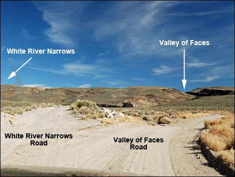
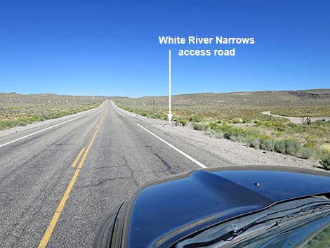 Highway 318 approaching White River Narrows Road (view NE) |
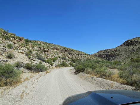
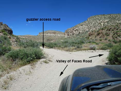
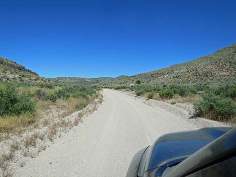
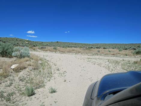
Overview Valley of Faces Road is a maintained dirt road that normally is suitable for 2WD-HC vehicles before the narrows, but it can have deep sand in the narrows where it is hard to turn around or extract a vehicle. The road starts off Highway 318 (north of Hiko) on White River Narrows Road and runs east into the canyon, passing some parts of the White River Narrows Archeological District along the way. Shortly after leaving the pavement, the road forks. White River Narrows Road goes left into the main petroglyph sites, while Valley of Faces Road, the well-maintained road to the right, leads through the surprisingly spectacular Valley of Faces and eastward to connect with ranch roads that can be followed north and back to Highway 318. This road can be sandy, so use caution in 2WD vehicles. |
 White River Narrows Road (view E from Highway 318) |
Watch Out Other than the standard warnings about driving in the desert, ...this road is pretty safe, but it can have deep, soft sand in the narrows. Be sure your vehicle is in good working condition, carry plenty of water (radiator and drinking), and pack a lunch. Always drive carefully; even though the road is maintained, there are occasional hazards such as errant rocks and holes in the roadway. While out, please respect the land and the other people out there, and try to Leave No Trace of your passage. This road goes into remote areas, so be sure to bring the 10 Essentials. Cell phones don't work. |
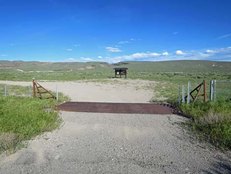 Road crosses cattle guard, passes Information kiosk, and bends left |
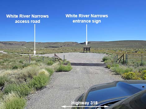
Getting to the Road Valley of Faces Road is located in the southeast part of Basin and Range National Monument, about 2 hours (131 miles) northeast of Las Vegas driving directly, or about 25 minutes (23.8 miles) north of the intersection of Highway 93 and Highway 318. From Las Vegas, drive north on Interstate-15 for 21 miles to Highway 93. Turn left onto Great Basin Highway (Hwy 93) and top off the gas tank if necessary. Drive north past the towns of Alamo (95 miles from Las Vegas) and Ash Springs (102 miles) to the intersection of Highways 93 and 318 (107 miles). Gasoline is available in Alamo, Ash Springs, Rachael, and Lund. Turn left onto Highway 318 and drive west then north on Highway 318 for 23.8 miles to White River Narrows Road on the right. The intersection is marked only by a paved apron and a cattle guard, and past the fence, an information kiosk sign. |
 White River Narrows Road (view E) |
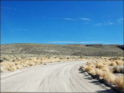
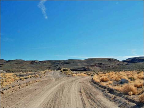
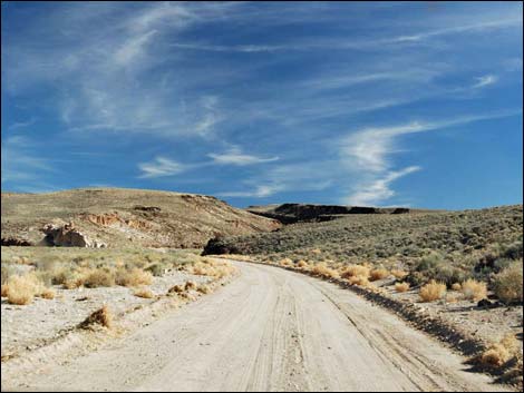
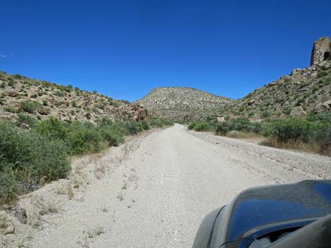
The Road From the pavement (Table 1, Site 1105), Valley of Faces Road (White River Narrows Road at this point) crosses a cattle guard and bends to the left to pass the information kiosk sign. Stop and read the sign for background about the site and a map. Past the kiosk, the road bends back to the right. At about 0.15 miles out, the road forks (Site 1106). Here, White River Narrows Road stays left onto the minor road while Valley of Faces Road, the better road, stays right. Heading east towards the mountains, the road passes close by a rocky outcrop on the right (0.4 miles from the fork). The near end of the outcrop is covered with spectacular lichens of many colors (each color is a different species), but the far end is covered with petroglyphs. This is the Cane Site A petroglyph site. Continuing, at about 0.5 miles from the fork, the road passes an outcrop of white rock on the left. This is the Ash Hill petroglyph site, and the artwork is around the corner on the northwest-facing side of the cliff. |
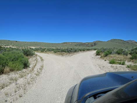
 White River Narrows Road approaching fork (view E) |
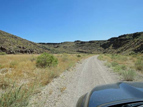
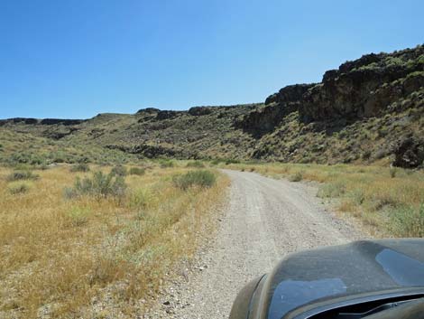
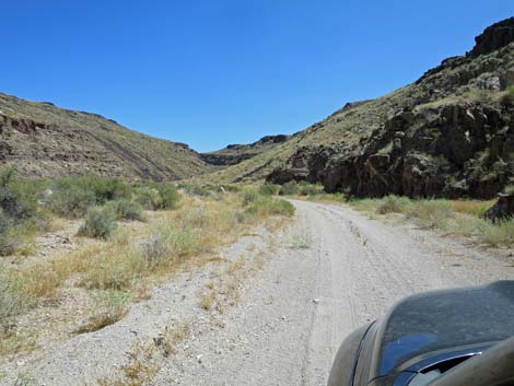
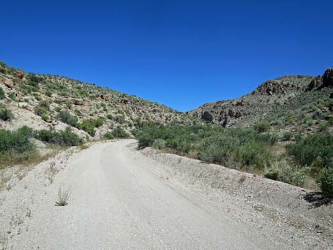
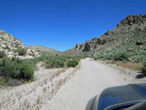
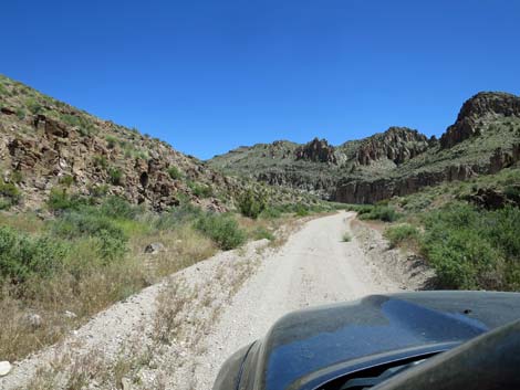
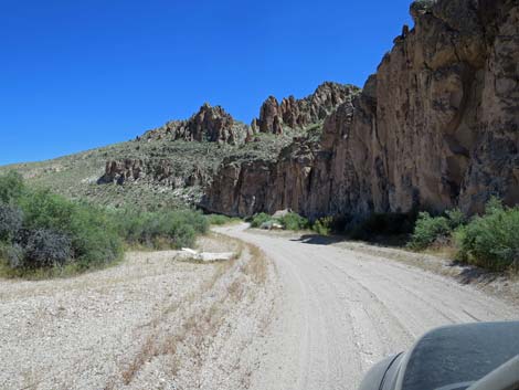
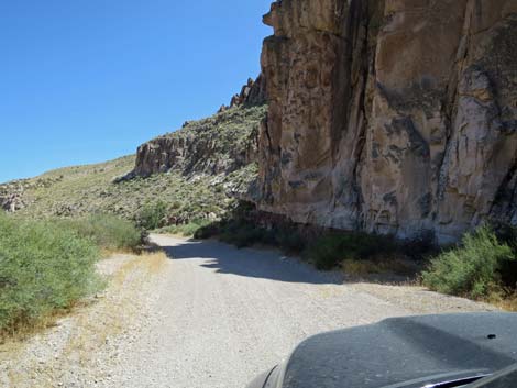
Although washed out, a faint road left (Site 1113) runs north to Old White River Narrows Road. Continuing, the road enters Valley of Faces Canyon at about 0.6 miles out. The road makes for a fun drive, but the more it is used, the more the sand gets stirred up, making it a problem for 2WD vehicles. Use good judgment here. At some times of the year, ranchers put up a gate in the narrows. Be sure to leave it as found (either open or closed), but this is public land, so entry is legal. Valley of Faces Road continues up the canyon through the narrows. Eventually, at about 2.6 miles out, the canyon walls lay back. In the more open canyon, the road passes a corral at about 3.1 miles out, pass a very old corral at about 3.2 miles out, and then ends at a T-intersection 3.4 miles out. Drivers can turn either way and eventually get back to Highway 318, but when turning left, the pavement is only 3.3 miles north. |
 White River Narrows Road stays left at fork (view E) |
 Staying right on Valley of Faces Road (view E) |
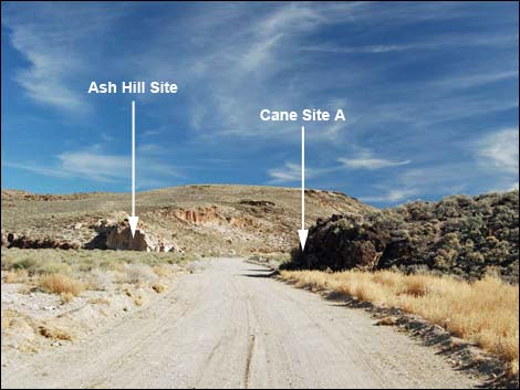 Approaching Ash Hill and Cane Site A petroglyph sites (view E) |
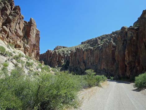
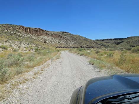 Entering Valley of Faces (view SE) |
 |
 |
 |
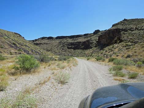 |
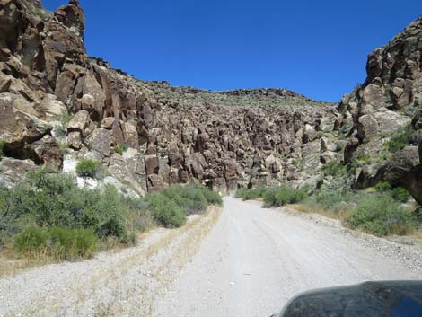
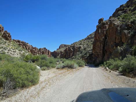
 The canyon bottom begins to narrow (view E) |
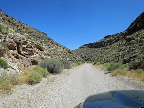
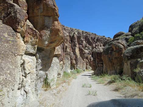
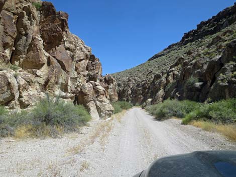 Entering the narrows (view E) |
 |
 |
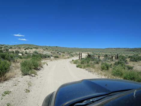
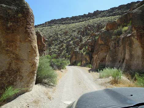 Approaching the cattle gate (view E) |
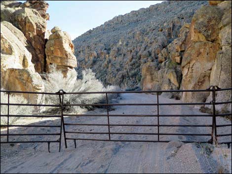 Be sure to leave the gate as found -- either open or closed |
 |
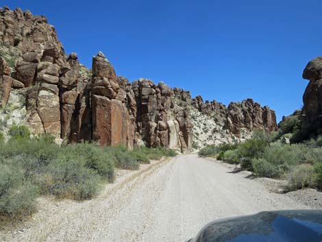 |
 The last grand, sweeping curve (view SE) ... |
 ... before arriving at the Stone Cathedral (view NE) |
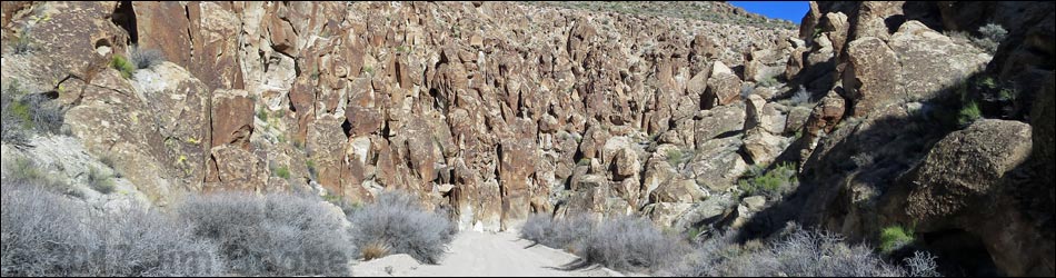
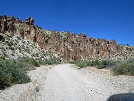
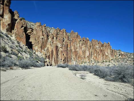 Stone Cathedral |
 Beyond Stone Cathedral (view E) |
 |
 |
 |
 |
 |
 |
 |
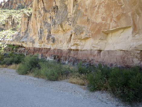 |
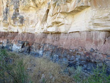 Layers of volcanic rock |
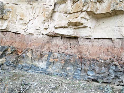 Layers of volcanic rock |
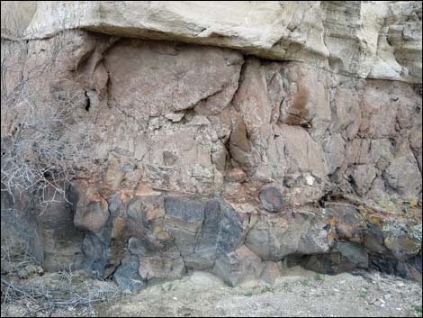 Layers of volcanic rock |
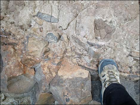 Close-up: Layers of volcanic rock |
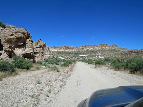 The canyon begins to open (view E) |
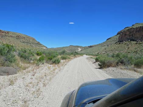 Open canyon (view E) |
 Open canyon (view E) |
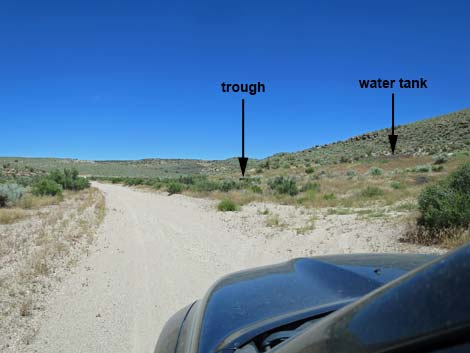 Valley of Faces Road at side loop-road to water tank (view E) |
 Loop-road to water tank (view SE from Valley of Faces Road) |
 Water trough and water tank (view S from Valley of Faces Road) |
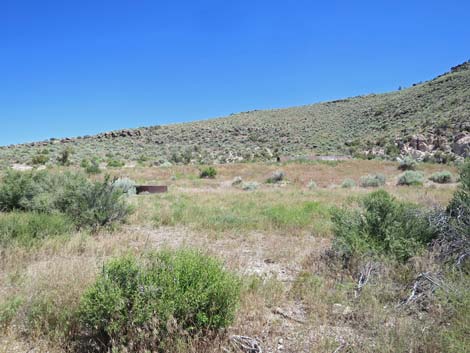
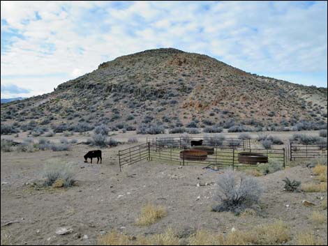 Seasonal corral with watering troughs and cattle |
 Road forks for triangular intersection |
 Left fork: approaching historical corral (view E) |
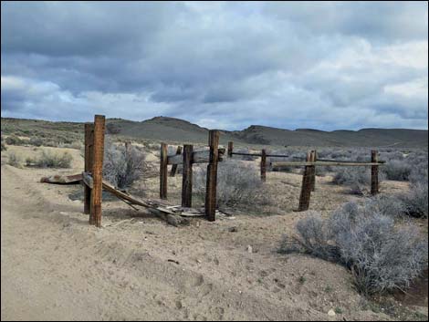 Historical corral (view SE) |
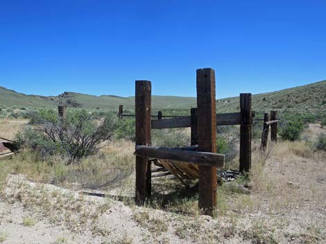 Historical corral (view S) |
 Left fork of triangle intersection; left to Highway 318, right to wilds |
Table 1. Highway Coordinates and Distances based on GPS Data (NAD27). Download highway GPS waypoints (gpx) file.
| Wpt. | Location | Latitude (N) | Longitude (W) | Elevation (ft) | Point-to-Point Distance (mi) | Cumulative Distance (mi) | Verified |
|---|---|---|---|---|---|---|---|
| 1105 | Hwy 93 at Wt River Narrows Rd | 37.81998 | 115.05729 | 4,471 | 0.00 | 0.00 | Yes |
| 1106 | White River Narrows Rd at Valley of Faces Rd | 37.81990 | 115.05482 | 4,440 | 0.15 | 0.15 | Yes |
| 1113 | Valley of Faces Rd at Fork | 37.81687 | 115.04599 | 4,527 | 0.55 | 0.70 | Yes |
| 1595 | Valley of Faces Rd Ends | 37.80504 | 115.00864 | 4,877 | 2.70 | 3.40 | Yes |
Happy Hiking! All distances, elevations, and other facts are approximate.
![]() ; Last updated 240324
; Last updated 240324
| Basin and Range | Backroads | Hiking Around Las Vegas | Glossary | Copyright, Conditions, Disclaimer | Home |