Backroads Around Las Vegas, Basin and Range National Monument
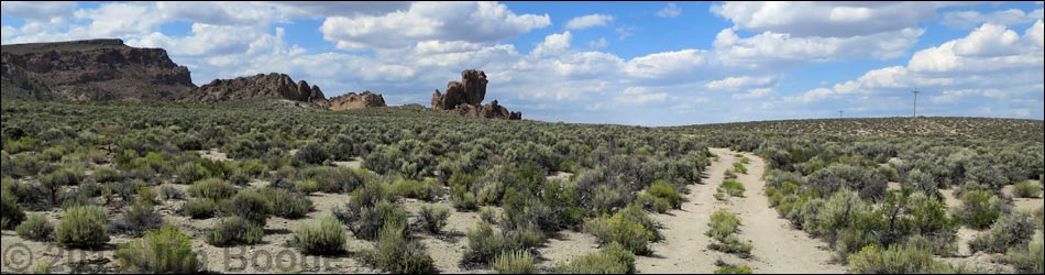
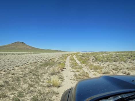
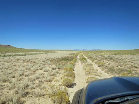
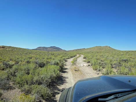
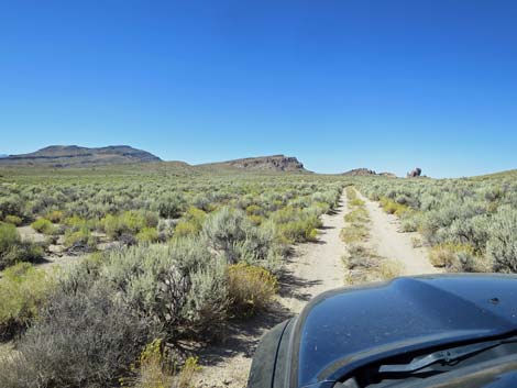
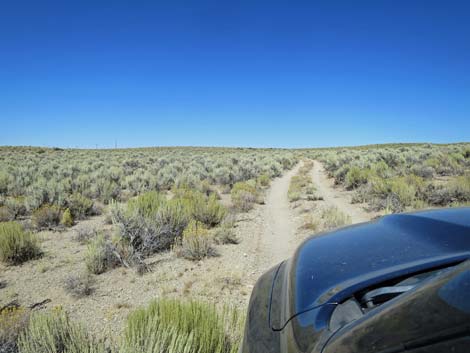
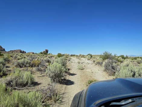
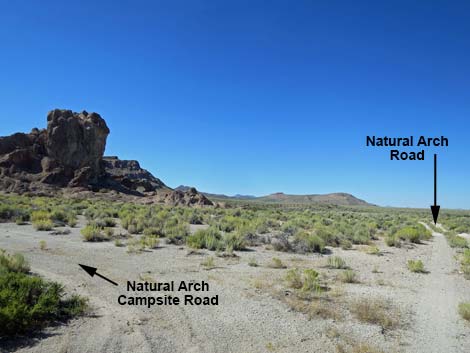
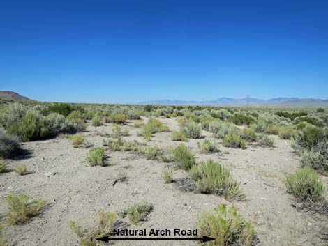
 Coal Valley North Road at Natural Arch Road (view NE) |
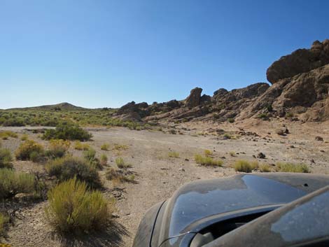
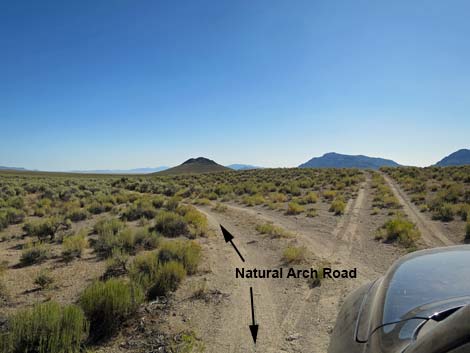
Overview Note: Oct 2021. The road is in reasonable condition and passable in a 2WD-HC pickup. Some ruts are deep. Natural Arch Road is a rarely maintained dirt road that normally is suitable for 2WD-HC vehicles. The road starts from Coal Valley North Road and zig-zags east and west as it runs north about 3 miles to the Natural Arch. This and other roads continue out into the desert. Natural Arch Road starts out rather overgrown with weeds and there are some deep ruts, but the road improves farther out. Towards the Natural Arch, the road crosses some rocky spots, but overall, it remains a 2WD-HC road. For people with unsuitable vehicles, the road makes for a nice, 6-1/2-mile, round-trip hike. This little used road primarily provides access to the Natural Arch. |
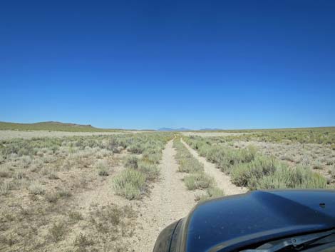
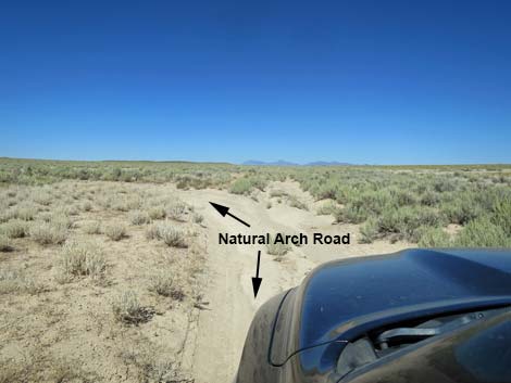
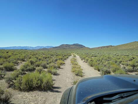
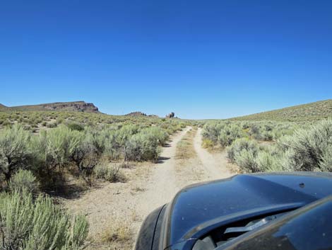
 Starting on Natural Arch Road (view NE) |
Watch Out Other than the standard warnings about driving in the desert, ...this road is pretty safe, but be sure that your vehicle is in good working condition, carry plenty of water (radiator and drinking), and pack a lunch. This road could easily require 4WD after heavy rains. While out, please respect the land and the other people out there, and try to Leave No Trace of your passage. This road goes into a remote area, so be sure to bring the 10 Essentials. Cell phones work along parts of this road. Getting to the Road Natural Arch Road is located in the northeast part of Basin and Range National Monument, about 4-1/2 hours (164 miles) northeast of Las Vegas driving directly via Seaman Wash Road, or about 3 hours (58 miles) north of the intersection of Highway 93 and Highway 318. |
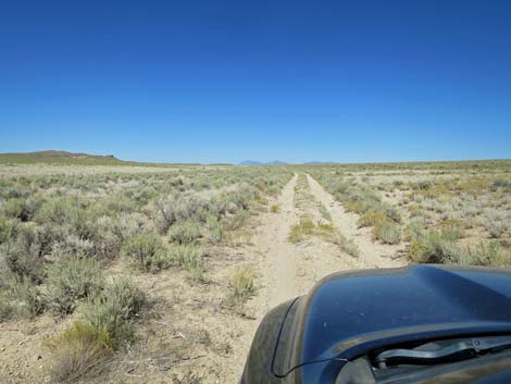
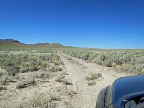
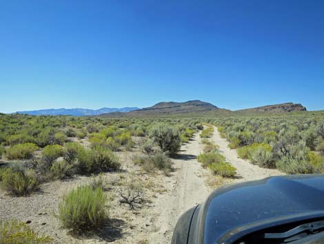
 Natural Arch Road gets overgrown with weeds (view NE) |
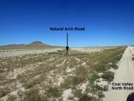
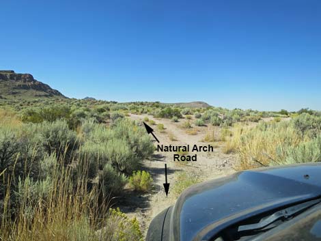
From Las Vegas, drive north on Interstate-15 21 miles to Highway 93. Turn left onto Great Basin Highway (Hwy 93) and drive north past the towns of Alamo (95 miles from Las Vegas) and Ash Springs (102 miles) to the intersection of Highway 93 and Highway 318 (107 miles). Gasoline is available in Alamo, Ash Springs, Rachael, and Lund. Turn left onto Highway 318 and drive west then north for 17.4 miles to Seaman Wash Road on the left. On Seaman Wash Road, drive northwest 26.5 miles to a fork in the road (stay "straight" at all forks and side roads to this point). At this fork, stay right and cross to the other side of Water Gap where the road forks again (this is a big triangular intersection). Stay right onto Timber Pass Road and drive east 0.9 miles to Coal Valley North Road, on the left. Drive north on Coal Valley North Road 9.5 miles to Natural Arch Road, on the left. Watch for a single wooden fence post on the left shortly before the turn. |
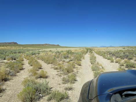
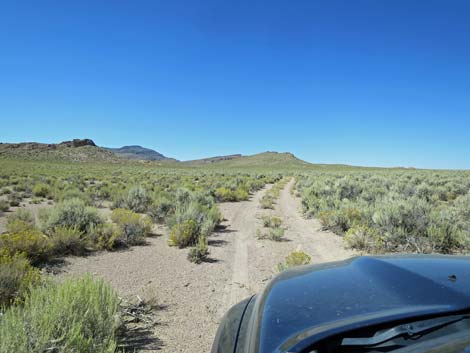
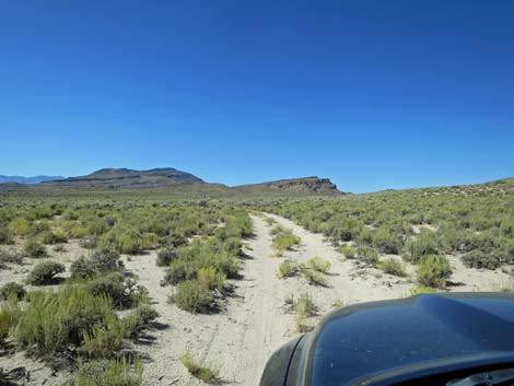
 ... but not so good in others (view NE) |
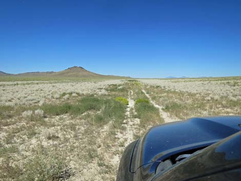
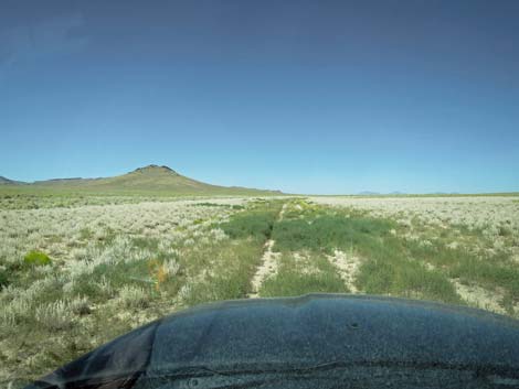
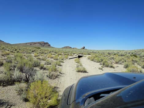
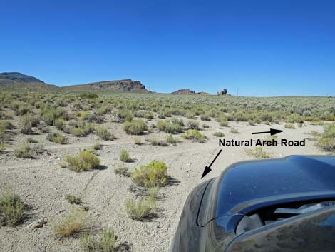
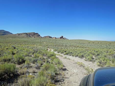
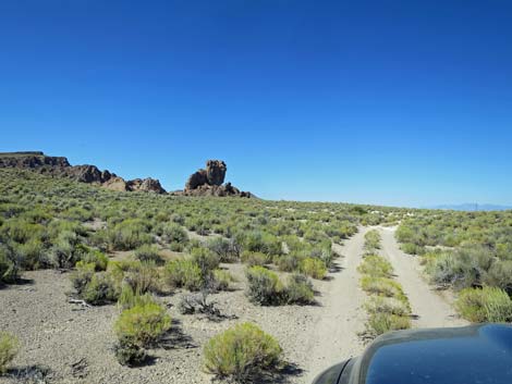
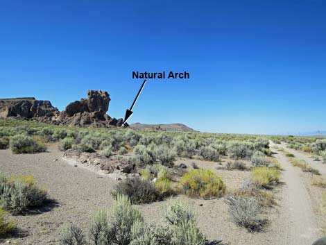
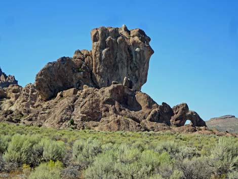
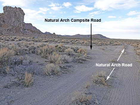
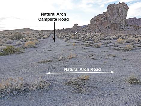
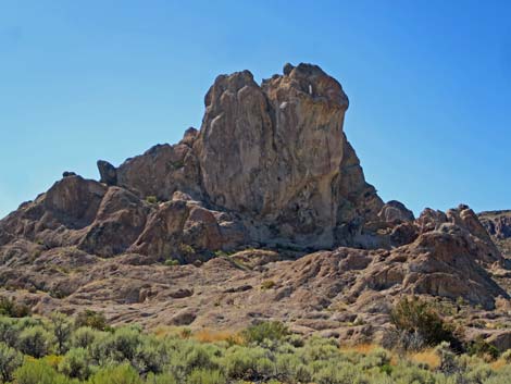
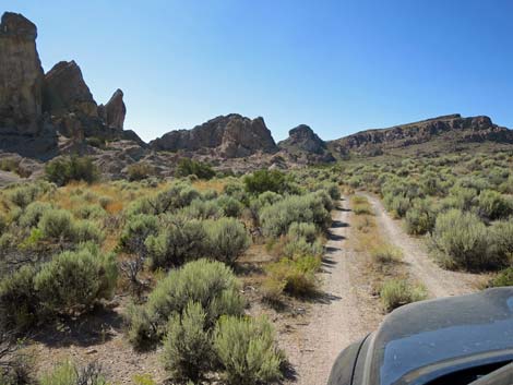
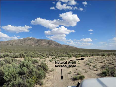
The Road From Coal Valley North Road (Table 1, Site 1613), Natural Arch Road angles left to run northeast through the bottom of Coal Valley. Water runs in the road here, parts are badly rutted, and the road is overgrown with weedy vegetation, making this section tricky without high clearance. This part of the road could easily become 4WD only after rains, but it gets better after a few hundred yards. At about 1.5 miles out, the road forks (Site 1616). Here, Natural Arch Road turns left to run northwest. The road runs up the gentle hillside, winding among tall sagebrush, and climbs onto a low saddle. In this area, a tall, isolated, rocky crag becomes visible ahead in the distance. Natural Arch sits on the northeast corner of this crag. Powerlines also become visible. |
 Road forks; Natural Arch Road turns left (view NE) |
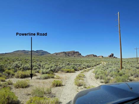
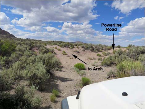
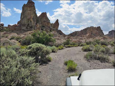
The road eventually curves to the northeast where a faint side road merges from the left (2.4 miles out). Continuing northeast, Natural Arch Road makes a hard bend left (2.6 miles out) to run north and passes a barely noticeable dirt road on the right. Just ahead, at 2.7 miles out, the road passes under the powerlines at yet another dirt road to the left. This side road, the powerline road, seems like it might be a better road for the return; it is not. Natural Arch Road continues north towards the rocky promontory. Approaching the base of the crag (3.2 miles out), the road reaches a T-intersection (Site 1617). Natural Arch Campsite Road turns left and runs west 100 yards to a nice camping area, then continues for no apparent reason to end on a hillside about 0.2 miles out. The campsite is the best place to park when visiting the Natural Arch, especially if there is more than one vehicle in the party. The arch is north of this point, not farther out the useless road to the west. |
 The ruts are deep in places (view NE) |
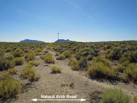
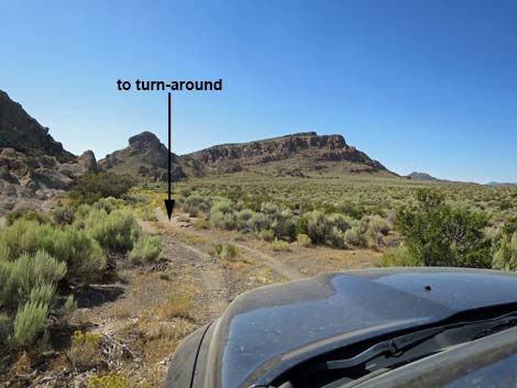
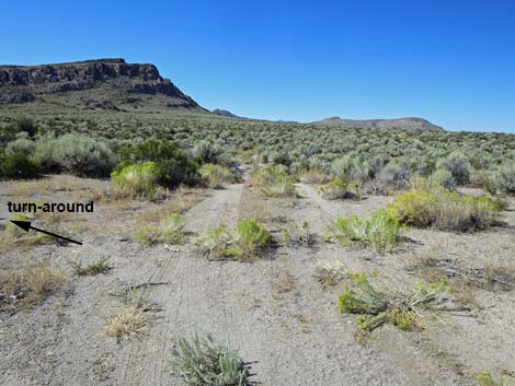
Past the campsite road, Natural Arch Road stays straight (north) to just beyond the crags. At that point, the road dips left to cross a gully packed full of Basin Wildrye Grass (Leymus cinereus), and forks (3.3 miles out). Here, the right fork continues north along the powerlines, while the left runs up along the side of the Natural Arch crags. Staying left along the crags, there is a bush-covered parking area on the right. This is the best place to park for the Natural Arch on this side of the crags. Continuing, the road forks again in another 200 yards. This fork is a good place for a single vehicle to turn around and park. Park in the road, as it is unlikely that anyone else will be using the road. The left fork continues along the crags, and in another 30 yards forks again. Here, the left fork is just a parking place useful for turning around. The right is very lightly used. From anywhere in this area, it is a short walk to the Arch. |
 Minor side-road to somewhere or nowhere (view NE) |
 The rut on the right is deeper than it looks (view NE) |
 Road forks; Natural Arch Road turns left (view NE) |
 Turning out of the bottom lands (view N) |
 Lots of big sagebrush (view NW) |
 Road runs up gentle slopes (view NW) |
 Climbing onto a low saddle (view NW) |
 Crossing over the low saddle (view NW) |
 Easy road (view NW) |
 Arch Rock comes into view (view N) |
 Arch Rock ahead (view N) |
 Road intersection; stay right (view N) |
 Staying right at intersection (view N) |
 Wide open spaces (view NE) |
 Road descends across the hillside (view N) |
 Faint road to the right (view NW) |
 Intersection with rarely used road (view NW) |
 Rarely used road (view SW from Natural Arch Road) |
 The road climbs over a rocky spot (view N) |
 Getting close (view N) |
 Natural Arch comes into view (view N) |
 Arch Rock and the Natural Arch (view NW from the roadway) |
 Natural Arch Road approaching campsite road (view N) |
 Natural Arch Campsite Road (view W from Natural Arch Road) |
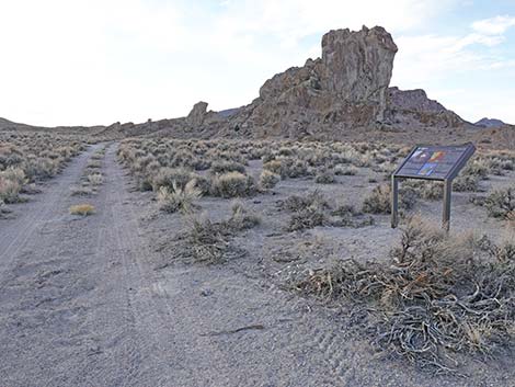 Natural Arch Campsite Road at information sign (view NW) |
 information sign (view NW from Natural Arch Campsite Road) |
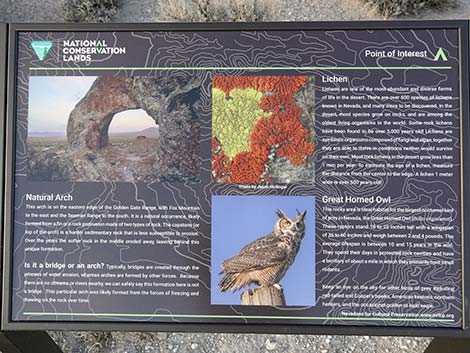 Natural Arch information sign (view NW) |
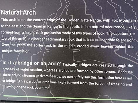 Natural Arch information sign (view NW) |
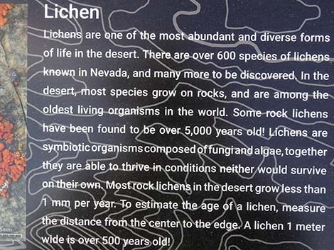 Natural Arch information sign (view NW) |
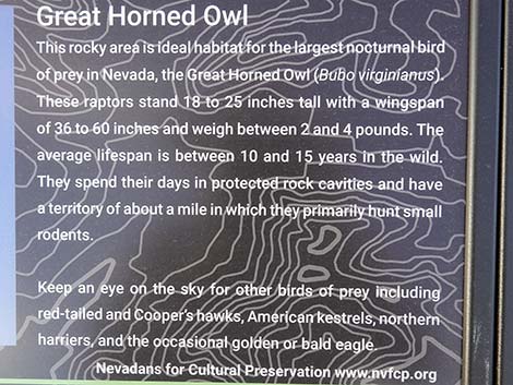 Natural Arch information sign (view NW) |
 Entering Natural Arch Campsite turn-around loop (view W) |
 More to come ... |
Continuing to North Side of Arch Rock
 Continuing on Natural Arch Road (view N) |
 Arch Rock (view W from Natural Arch Road) |
 Natural Arch Road dips to cross a gully (view N) |
 Road forks past gully; stay left to north side of the arch (view NW) |
 Best parking (view NE from Natural Arch Road) |
 Looping around the north side of Arch Rock (view W) |
 Approaching north side of Natural Arch (view W) |
 Faint road forks right (view W) |
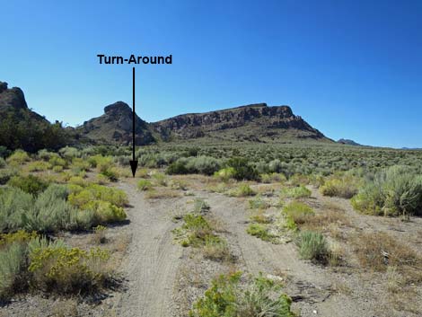 Another faint road forks right; use left spur to turn around (view W) |
 Faint road forks right, but the turn-around is no better (view NW) |
Returning to Coal Valley North Road
 Natural Arch Road stays left at fork (view SW) |
 Natural Arch Road turns right at T-intersection (view SE) |
Table 1. Highway Coordinates and Distances based on GPS Data (NAD27). Download Highway GPS Waypoints (gpx) file.
| Wpt. | Location | Latitude (N) | Longitude (W) | Elevation (ft) | Point-to-Point Distance (mi) | Cumulative Distance (mi) | Verified |
|---|---|---|---|---|---|---|---|
| 1613 | Coal Valley N Rd @ Natural Arch Rd | 38.15707 | 115.26885 | 5,130 | 0.00 | 0.00 | GPS |
| 1616 | Natural Arch Rd at left turn | 38.17446 | 115.25355 | 5,215 | 1.48 | 1.48 | GPS |
| 1617 | Natural Bridge Rd at Natural Bridge | 38.19620 | 115.25805 | 5,406 | 1.73 | 3.21 | GPS |
| 1618 | Natural Bridge Trailhead Parking | 38.19634 | 115.25920 | 5,409 | 0.01 | 3.22 | GPS |
Happy Hiking! All distances, elevations, and other facts are approximate.
![]() ; Last updated 240324
; Last updated 240324
| Basin and Range | Backroads | Hiking Around Las Vegas | Glossary | Copyright, Conditions, Disclaimer | Home |