Backroads Around Las Vegas, Basin and Range National Monument
 |
Overview Garden Valley West Road is a relatively well-maintained dirt road that normally is suitable for 2WD vehicles. The road runs along the base of Worthington Mountains on the southwest side of Garden Valley. Garden Valley West Road runs between Mail Summit Road on the northeast and, eventually, Tikaboo Valley on the southwest. Garden Valley West Road provides rancher access to corrals and watering troughs, but for visitors it mostly is used to connect with Leviathan Cave Road. Link to Map (use back-button to return here). |
 |
Watch Out Other than the standard warnings about driving in the desert, ...this road is pretty safe, but be sure that your vehicle is in good working condition, carry plenty of water (radiator and drinking), and pack a lunch. Always drive carefully; even though the road is well maintained, there are occasional hazards such as errant boulders in the roadway and mud puddles after heavy rains. While out, please respect the land and the other people out there, and try to Leave No Trace of your passage. This road goes into remote areas, so be sure to bring the 10 Essentials. Cell phones don't work. |
 |
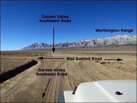
Getting to the Road Garden Valley West Road is located in the west-central part of Basin and Range National Monument, about 3 hours (146 miles) northeast of Las Vegas driving directly, or about 1-1/2 hours (38 miles) north of the intersection of Highway 93 and Highway 318. From Las Vegas, drive north on Interstate-15 21 miles to Highway 93. Turn left onto Hwy 93 and drive north past the towns of Alamo (95 miles from Las Vegas) and Ash Springs (102 miles) to the intersection of Highway 93 and Highway 318 (107 miles). Gasoline is available in Alamo, Ash Springs, Rachael, and Lund. Turn left onto Highway 318 and drive west then north for 9.4 miles to Mail Summit Road on the left. Turn onto Mail Summit Road and drive northwest 29.5 miles to a four-way intersection. At this intersection, Garden Valley West Road turns left while Garden Valley Southeast Road turns right. |
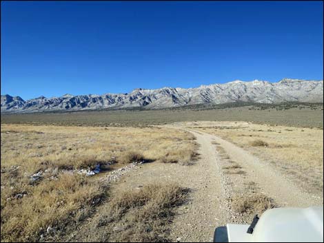 |
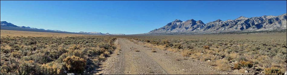
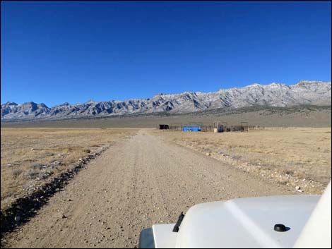
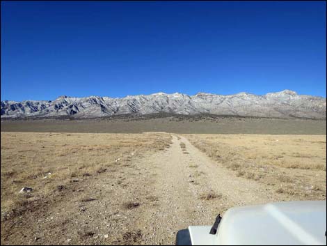
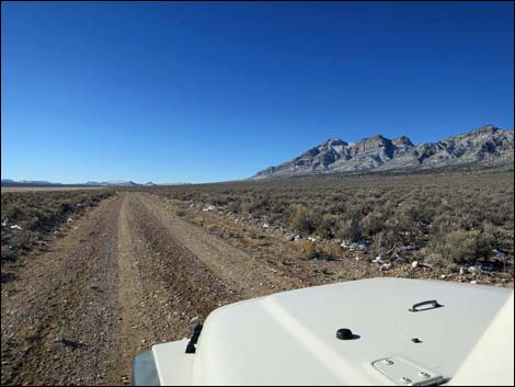
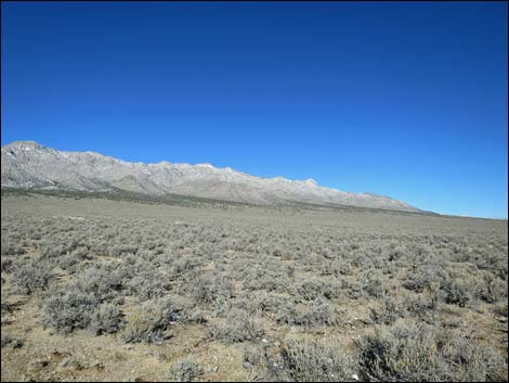
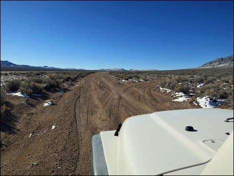
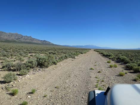
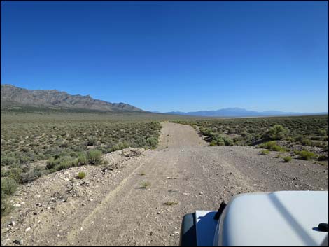
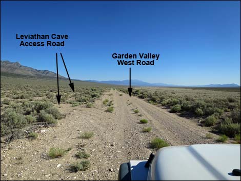
The Road From Mail Summit Road (Table 1, Site 0890), Garden Valley West Road turns left heading southwest towards the Worthington Range, which dominates the view along this road. At 0.7 miles out, the road passes a corral and livestock watering area (Site 1117), then continues towards the base of the mountains. Bending left (1.0 miles out), the road briefly seems to disappear into the bushes, but after the bend, the road continues south as a fine graded road. The road runs south, more-or-less straight, along the base of the Worthington Range. At 4.3 miles out, a side road (Site 0891) forks off to the right (actually a triangle intersection). This is Leviathan Cave Road, which runs 1.5 miles up into the mountains and ends at the Leviathan Cave trailhead. |
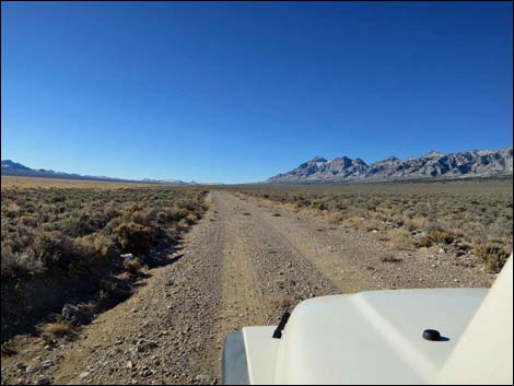 |
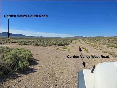
Continuing straight, a side road (Site 1553; 4.8 miles out) forks to the left. This is Garden Valley South Road, which runs east and connects with Mail Summit Road. Continuing straight, Garden Valley West Road runs south and eventually connects with roads that run southwest into Tikaboo Valley and the pavement near the town of Rachael. |
 Garden Valley West Road (view S) |
 Worthington Range (view SW) |
 Worthington Range (view NW) |
 Garden Valley West Road at Leviathan Cave Road (view S) |
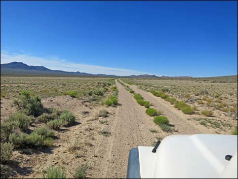 Garden Valley West Road (view S) |
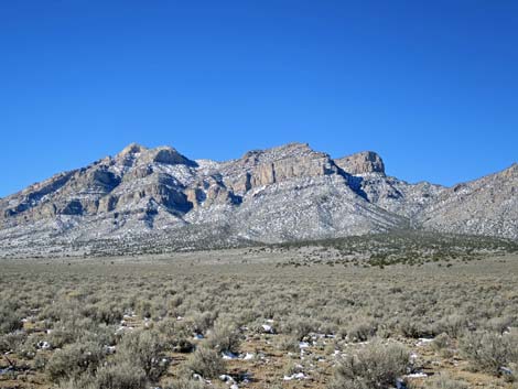 Meeker Peak in the Worthington Range (view SW) |
 Exit left to Mail Summit Road (view S) |
 More to come ... |
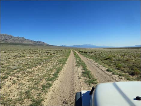
Garden Valley West Road Northbound between Garden Valley South Road and Leviathan Road
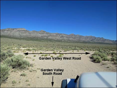 Garden Valley South Road at Garden Valley West Road (view NW) |
 Garden Valley West Road (view N) |
 |
 |
 Garden Valley West Road at Leviathan Cave Road (view N) |
More to come ... |
Table 1. Highway Coordinates and Distances based on GPS Data (NAD27). Download highway GPS waypoints (gpx) file.
| Wpt. | Location | Latitude (N) | Longitude (W) | Elevation (ft) | Point-to-Point Distance (mi) | Cumulative Distance (mi) | Verified |
|---|---|---|---|---|---|---|---|
| 0890 | Mail Summit Rd at Garden Valley W Rd | 37.90409 | 115.53761 | 5,509 | 0.00 | 0.00 | Yes |
| 1117 | Garden Valley W Rd at Water Tank | 37.89706 | 115.54701 | 5,552 | 0.71 | 0.71 | Yes |
| 0891 | Garden Valley W Rd at Leviathan Rd | 37.84915 | 115.55932 | 5,787 | 3.58 | 4.29 | Yes |
| 1553 | Garden Valley W Rd at Garden Valley S Rd | 37.84199 | 115.55887 | 5,781 | 0.50 | 4.79 | Yes |
Happy Hiking! All distances, elevations, and other facts are approximate.
![]() ; Last updated 240324
; Last updated 240324
| Basin and Range | Backroads | Hiking Around Las Vegas | Glossary | Copyright, Conditions, Disclaimer | Home |