Hiking Around Las Vegas, Worthington Mountain Wilderness
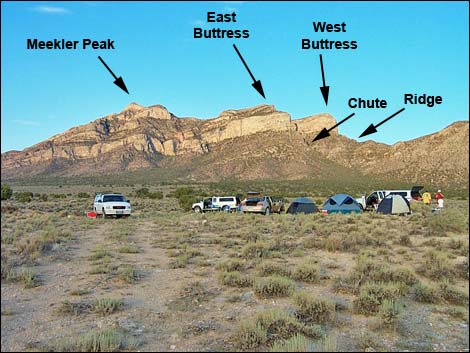 Base camp with landmarks (view SW) |
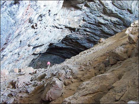
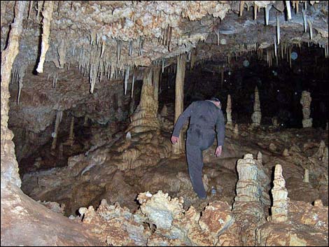
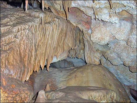
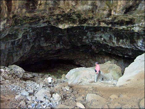
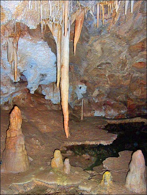
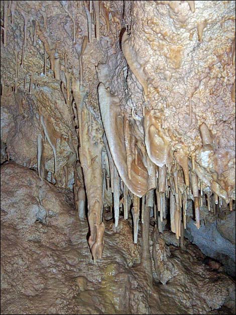
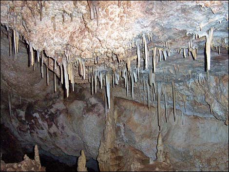
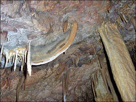
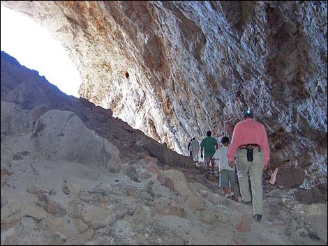
Overview This tough route leads to Leviathan Cave, a huge sinkhole high in the Worthington Range, the namesake for the Worthington Mountain Wilderness Area. The sinkhole is a true leviathan -- an item of unusual size for its kind. The Worthington Range is limestone, and over the millennia, water moving through the mountain dissolved away a long tubular chamber that runs nearly parallel to the steep surface slope. Near the middle of the tubular chamber, the roof collapsed, creating the sinkhole with cave chambers running in opposite directions, uphill on one side and downhill on the other. On the uphill end, cavers slither through a narrow opening into the wet cave. The wet cave is not a leviathan, but it contains nice formations (e.g., stalactite, stalagmite, flow stone, soda straws, and cave shield) and rim pools with water from which bats drink. On the downhill end, the cavern is much larger, but dry, with a flat dirt floor. |
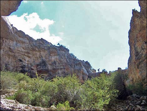
 Main wash (view SW) |
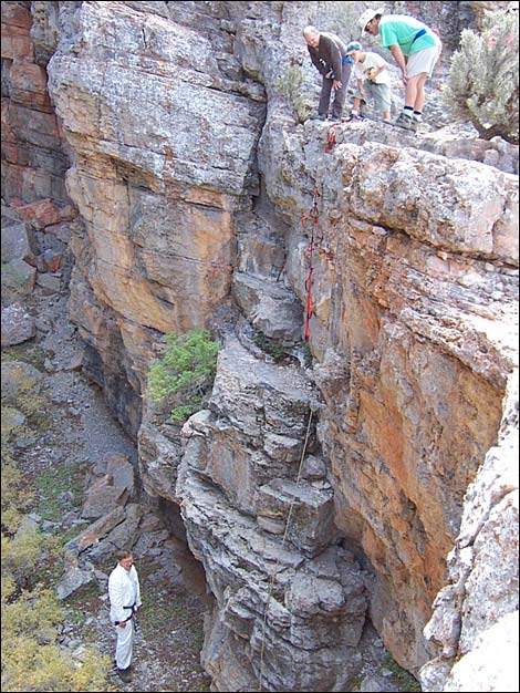
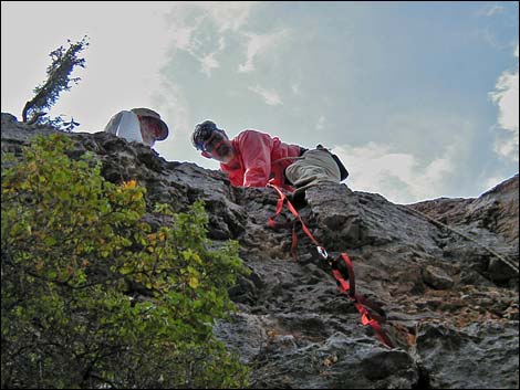
The easiest way into the sinkhole is a 30-foot, 5th-class downclimb. The descent is mostly vertical with a bit of an overhang near the top. The only hard part is right below the lip, but of course, that part is 30 feet up. Take a climbing rope -- use it to rappel into the cave and then to belay or jumar out. Inside the sinkhole, the caving is entirely non-technical. Note: I've learned that there is a route to the cave from the west side of the mountains that might be a longer, but easier, hike. Link to Hiking Route Map. |
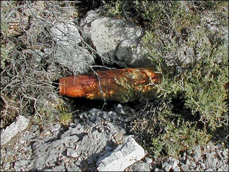
 500-pound bomb -- look, but don't touch! |
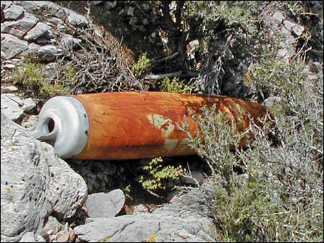
Watch Out Other than the standard warnings about hiking in the desert, especially the section about holes in the ground, ...this is a tough hike with myriad possibilities for injury, and then you get to the cave. There are two regular routes to the cave, both of which are steep and provide a variety of places to fall and get hurt. At the cave, which requires ropes for entry, vertical rock-craft always is dangerous, and cave rescue is a complicated, difficult, and painful endeavor. Inside the wet cave, the floor is slippery and hard things hang down from the ceiling. The approach has an additional, if unusual, danger for hikers: the Air Force dropped two 500-pound bombs on the route that didn't detonate. I've been told that they are dummy bombs and full of concrete, but I still wouldn't investigate too closely. |
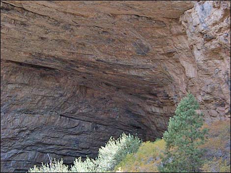
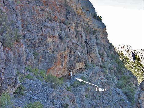 Hiker under red overhang (view W) |
This route requires ropes. If you don't know how to use ropes, go with someone who does, get some training, or visit a walk-in cave. This cave isn't interesting enough to risk getting hurt; if fact, it is hardly interesting enough to be worth the hike. While hiking, please respect the land and the other people out there, and try to Leave No Trace of your passage. This is a long hike in a remote place where rescue would be difficult, so bring the 10 Essentials. Make sure this route of the appropriate difficulty for your skills. Caves are delicate places: don't touch cave formations because the oils on your hand will hinder or change the growth patterns of the cave formations. Don't break any formations; don't bring back any souvenirs from the cave. |
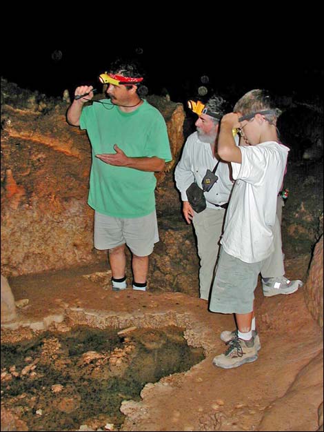
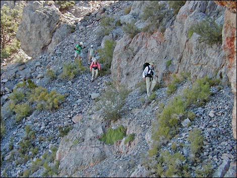 Hikers traversing the ledges (view NE) |
Getting to the Trailhead Leviathan Cave is located in the Worthington Range of Basin and Range National Monument, northwest of Hiko and northeast of Rachael, about 150 miles north of Las Vegas. From Las Vegas, drive north on Interstate-15 for 21 miles to Highway 93 (Exit 64). Exit the interstate and drive north 81 miles to Ash Spring. This is the last gasoline before the trailhead. From Ash Spring, drive north for 2 miles to Highway 318. Turn left onto Highway 318 and drive north 9.4 miles to Mail Summit Road. Drive west on Mail Summit Road over the mountains and into Coal Valley. Heading west, the road runs through Murphy Gap, then bends north and runs over a low pass into Garden Valley. |
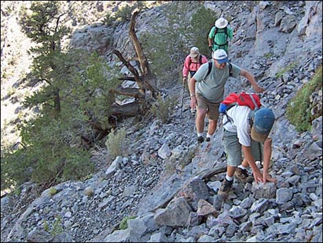 A bad spot; Max (foreground) is about to take a nasty fall (view NE) |
At 25.2 miles from the pavement, the road passes a large rocky outcrop on the right. Stop for a minute to look at the route. The mountains across the valley to the west are the Worthington Range, and the high point on the south end of the range is Meeker Peak (8,768 ft). Leviathan Cave is on the other side of the peak, about 1,000 feet below the summit. There are two large, limestone buttresses on the north side of the peak. One route to the cave goes up the chute between the two buttresses, over the ridge, and down the other side. The other route follows improbable ledges under the face of the western buttress and circles around to the west side. Mail Summit Road continues north 0.3 miles to Garden Valley South Road, a narrow 2-track road. Turn right onto the two-track and drive west 3 miles to a T-intersection with Garden Valley West Road, which runs north-south. Turn right and drive north to the first left turn, which is Leviathan Cave Access Road. Turn left and drive west up Leviathan Cave Access Road to the end. Park here, this is the trailhead. |
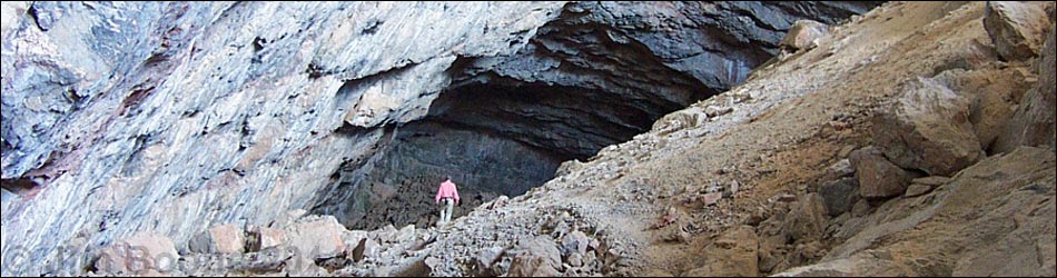
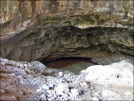
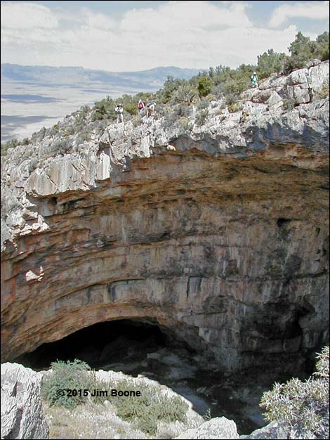 Hikers above Leviathan Cave (view N from entry) |
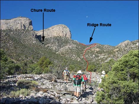
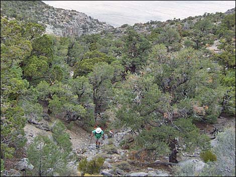
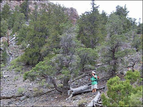
The Hike The trailhead is located in the Pinyon-Juniper Woodland zone where fairly short trees suggest a fire long ago. Among the trees are Sagebrush, Mormon tea, grasses, and few other shrub species. From the trailhead (and from the lower camps), hikers can see Meeker Peak, the two limestone buttresses that guard the north side of the peak, the chute that runs between the two buttresses, and the crest of the range north of the buttresses. There are two ways to get to the cave: (1) straight up the chute and over the ridge, and (2) traversing under the western buttress on improbable ledges and circling around the back. The two routes diverge about 1 hour from the trailhead. From the trailhead (Table 2, Wpt. 01), the route runs southwest along the top of a low ridge towards the major canyon to the west. Ancient peoples used this area; watch the ground for obsidian flakes that they left behind. |
 One down, three aren't sure. My notes say this is 30 feet, but it looks higher (view E) |
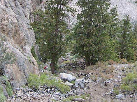
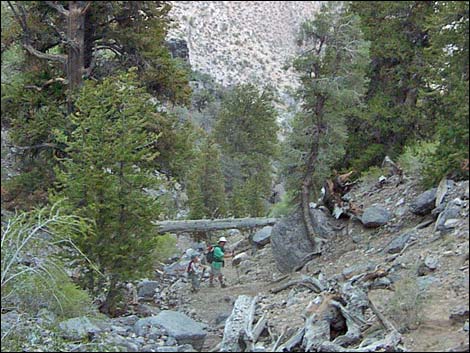
About 20 minutes out, the steep hillside forces the route off the low ridge and into the main wash (Wpt. 02). The route drops into the wash and continues southwest. Parts of the wash are choked with shrubs, and it is sometimes easier to hike on the hillside above the wash. The route runs up the wash for another 40 minutes to the fork in the main wash (Wpt. 03) where the gully from the chute between the buttresses meets the main wash. At this point, decide which way you want to go... around the buttress or up the chute. Route Around the Buttress Continuing up the main wash, hikers might encounter a 500-lb bomb (Wpt. 04) lying in the bottom of the canyon and another with a tail assembly (retarding fins) a short distance farther up the canyon (Wpt. 05). These are said to be dummy bombs, but it isn't worth investigating too closely. |
 Heading into the wet cave (view E) |
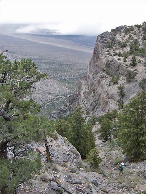
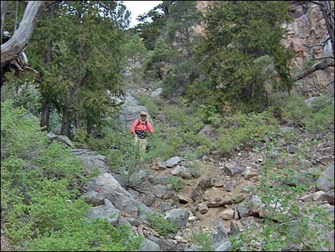
In this vicinity, the route leaves the wash, climbs onto the broad ridge north of the wash, and uses the ridge to gain the crest of the range (Wpt. 06). On the crest, the route turns south to just a few tens of yards short of being able to touch the base of the limestone buttress (Wpt. 07). At this point, hikers can look down the west side or the ridge and see a long, steep scree chute running between the ridge and the north face of the buttress. The route heads down into the rocky, scree-filled chute for about 1 minute (more across than down) to where the route starts out across ledges that run horizontally across the face of the buttress. It doesn't look possible, but the airy route goes. The route heads for the far side of the cliff face, aiming for a notch between the buttress and a knob on the next ridgeline (the knob and notch are visible from the crest of the ridge before starting across the ledges). |
 |
Lightly edited transcript from voice recorder: Traversed highly improbable ledge system beneath the north crag. From the ridgetop (Wpt. 07), cut down and across steep scree slope to a little ledge with an overhang, then follow ledge farther west to a larger overhang with red stains on the rocks (visible from a distance). Continue working across ledges and go under a big slab that broke loose and leans back against the cliff. There are ups and downs, but try to stay at the same elevation while working across the ledges. Lots of exposure here with lots of loose rock and scree. Dangerous place. Max, one of our party, took a fall in a bad spot, and I thought he might be taking the big one. From the notch (Wpt. 08), the route runs south over the next ridge and into the next canyon, staying more-or-less at the same elevation as the notch. The route starts running southwest across the side-slope, then climbs over a low ridge by passing to the west of a band of cliffs (Wpt. 09). Try not to lose more elevation than is necessary to pass the band of cliffs. |
 |
Atop the band of cliffs, the route continues south across the open hillside, crossing over another low ridge (Wpt. 10). From there, the route angles slightly to the east of south. Approaching the cave, hikers will either hit a drop-off or the mouth of Leviathan Cave. If hitting the cliff, hike uphill (east) to the top of the cave opening (Wpt. 11). Arriving at the north edge of the sinkhole, the route traverses southeast across the top of the cave and circles around to the southwest corner (Wpt. 12). The place to get into the sinkhole is located near the bottom of the canyon on the southwest side. Route Up the Chute From the main wash (Wpt. 03), the route runs up the side wash towards the chute. Shortly above the main wash, hikers need to watch for a 500-pound bomb (Wpt. 04); this might be a dummy bomb too, but don't mess with it. |
 |
The route follows a use-trail into the chute between the buttresses (Wpt. 14). It probably is best to stay on the use-trail, which runs along the northwest (right) edge of the chute, all the way up. The scree in the middle and upper portions of the chute is steep and loose, and there are a couple of short, dirty, 3rd-class scramble-ups. Near the top of the chute, the route exits to the northwest and climbs onto the saddle (Wpt. 13). There are a few Bristlecone Pines at the top of the chute. The use-trail crosses the saddle. There are cairns on the saddle, probably leading over the other side and down to the cave. When we came out this way, we started out too far to the south and ended up crossing the ridge far too high (south of the saddle), so we missed the trail. From the saddle, my advice is to follow the use-trail, which runs southwest towards the cave (Wpt. 12). The entry point is located near the bottom of the canyon. Map reading and GPS skills help here. |
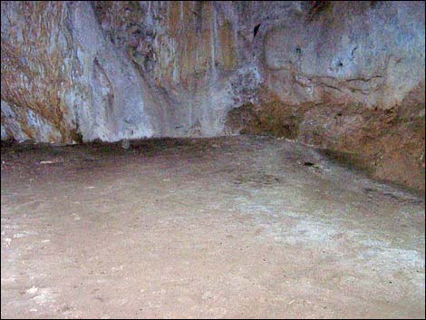
 The dry cave (view W) |
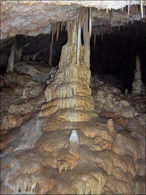
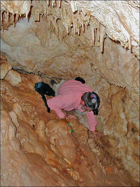
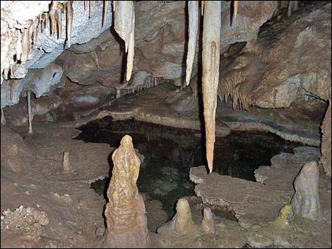
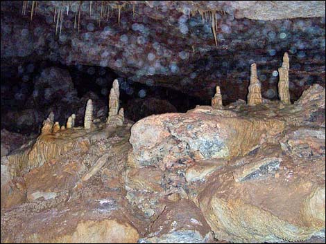
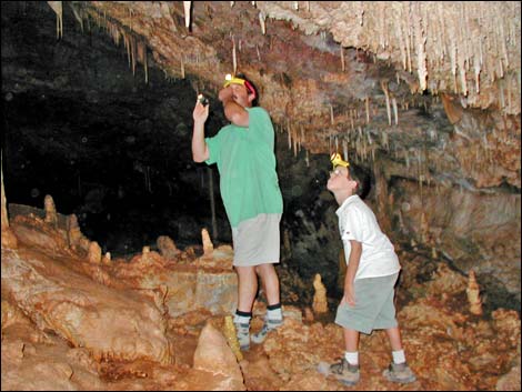
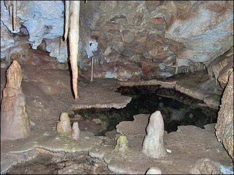
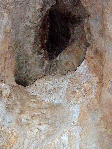
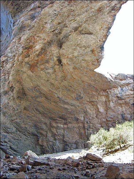
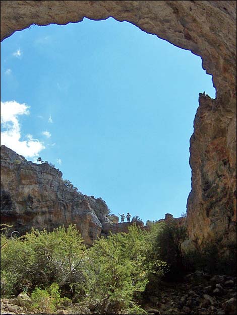
The Cave The sinkhole is entered by rappelling or down-climbing the easy 5th-class route. The drop is about 30-ft; the top 10 feet are slightly overhung, but the bottom 20 feet is just a scramble up a ledge system. Most hikers will want a belay for the top part. Take some webbing to tie off a big boulder for the main anchor. I think we used two 20-ft pieces to tie off the boulder twice. Take another long piece of webbing to tie off a small tree for a backup. Other than a few carabiners, no other hardware is needed. The bottom of the sinkhole is a big open area with lots of brush and a clear view of the sky. From the entrance point, the floor slopes down towards the far side, and then slopes down in both directions from there. There is a campsite, a visitor register, and some old gear on the high point at the far side. |
 The top of the chute (view NE) |
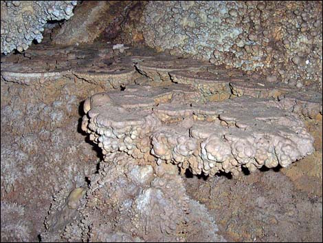
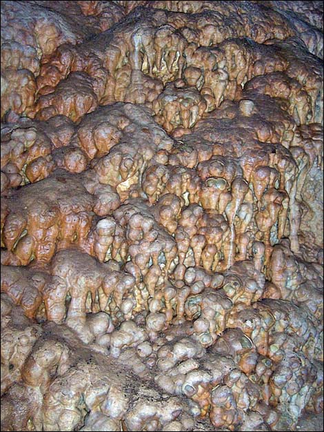
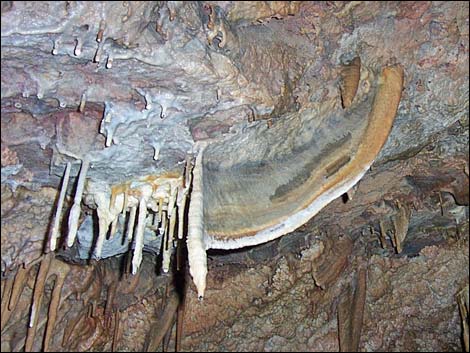
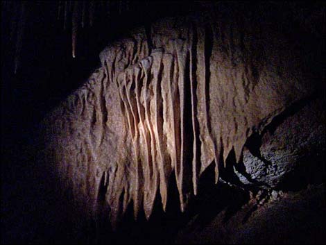
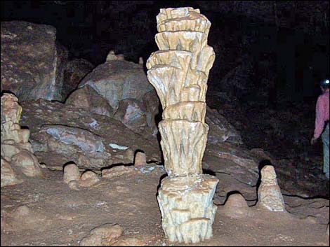
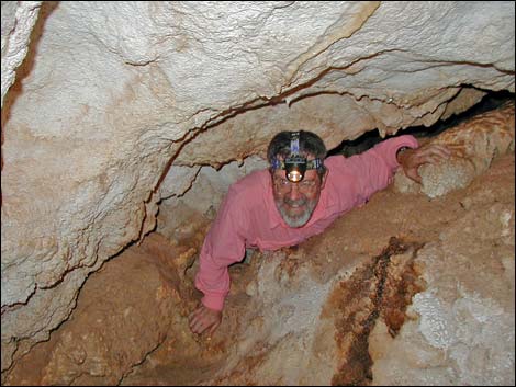
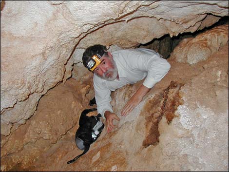
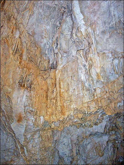
The wet room is in the east arm of the cave. A trail runs at a gentle downhill grade into the east arm. When it gets dark and the ceiling gets low, hikers arrive at a constriction that blocks easy access to the wet room. Squeeze through the diagonal slot into the wet room. Inside the wet room, a passage leads up into an open area with stalagmites, stalactites, columns, cave bacon, and several pools. Considering the size of the entrance, the wet room seems small. Don't touch or break anything in the wet room. Bats use the pools for drinking water. The west arm of the cave is an enormous cavern with a huge chimney that must lead to near the surface. In time, the top is likely to collapse, leaving a deep vertical shaft. A long, steep scree slope leads to a large area with a flat bottom. There are no narrows or side chambers. Some of the walls have ornate flowstone or mud, but there are no cave formations in this area. |
Additional Photos: Wet Cave
 |
 |
 |
 |
 |
 |
 |
 |
 |
 |
 |
 |
 |
 |
 Structures and pools in the wet room |
 Exiting the wet cave. Mike Dornheim -- rest in peace my friend. |
 Goofball in the narrow slot exiting the wet room |
 More to come ... |
Additional Photos: Dry Cave
 |
 |
 |
 |
 |
 |
 |
 |
 Exiting the wet cave |
 Steep exit from the cave |
 Hiker ascending west-side slopes (view downhill) |
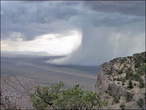 Saddle on crest of the range; storm in Garden Valley (view NE) |
 Hiker descending off the saddle (view uphill) |
 Hikers in steep chute between buttresses (view downhill) |
 Hikers in steep chute between buttresses (view downhill) |
 Hiker in steep chute between buttresses (view uphill) |
 Passing a pesky bomb |
 Passing a pesky bomb tail section |
Table 1. Hiking Coordinates based on GPS data (NAD27; UTM Zone 11S). Download Hiking GPS Waypoints (*.gpx) file.
| Wpt. | Location | UTM Easting | UTM Northing | Elevation (ft) | Point-to-Point Distance (mi) | Cumulative Distance (mi) | Verified |
|---|---|---|---|---|---|---|---|
| 01 | Leviathan Trailhead | 624611 | 4189192 | 6,397 | 0.00 | 0.00 | GPS |
| 02 | Drop into main wash | 624185 | 4188953 | 6,618 | 0.32 | 0.32 | GPS |
| 03 | Base of Chute | 623546 | 4188718 | 6,985 | 0.48 | 0.80 | GPS |
| 04 | 500-pound bomb | 623507 | 4188698 | 6,989 | 0.03 | 0.83 | GPS |
| 05 | 500-pound bomb Tail Assembly* | 623406 | 4188704 | 7,075 | 0.10 | 0.93 | GPS |
| 06 | Crest of the range | 623078 | 4188775 | 7,603 | 0.34 | 1.27 | GPS |
| 07 | Crest of the range | 622979 | 4188469 | 7,825 | 0.23 | 1.50 | GPS |
| 08 | Saddle on northwest ridge | 622716 | 4188337 | 7,792 | 0.39 | 1.89 | GPS |
| 09 | Band of Cliffs | 622583 | 4188170 | 7,755 | 0.17 | 2.06 | GPS |
| 10 | Low Ridge | 622585 | 4188000 | 7,878 | 0.11 | 2.17 | GPS |
| 11 | Top of Leviathan Cave | 622649 | 4187852 | 7,717 | 0.13 | 2.30 | GPS |
| 12 | Mouth of Cave | 622638 | 4187813 | 7,889 | 0.06 | 2.36 | GPS |
| 13 | Saddle at Top of Main Gully | 622958 | 4188083 | 8,277 | 0.34 | 2.70 | GPS |
| 14 | Between Buttresses | 623150 | 4188225 | 7,804 | 0.39 | 3.09 | GPS |
| 03 | Base of Chute | 623546 | 4188718 | 6,985 | 0.60 | 3.69 | GPS |
| 02 | Drop into main wash | 624185 | 4188953 | 6,618 | 0.50 | 4.19 | GPS |
| 01 | Leviathan Trailhead | 624611 | 4189192 | 6,397 | 0.36 | 4.55 | GPS |
Happy Hiking! All distances, elevations, and other facts are approximate.
![]() ; Last updated 240323
; Last updated 240323
| Hiking Around Las Vegas | Glossary | Copyright, Conditions, Disclaimer | Home |